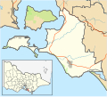
Newhaven, Victoria

Last updated

Newhaven
Victoria
Newhaven Yacht Club in 2022.jpg
Newhaven Yacht Club in 2022.
Australia Victoria Bass Coast Shire location map.svg
Red pog.svg
Newhaven
Coordinates 38°30′45″S145°21′30″E / 38.51250°S 145.35833°E / -38.51250; 145.35833 Coordinates: 38°30′45″S145°21′30″E / 38.51250°S 145.35833°E / -38.51250; 145.35833
Population547 (2021 census) [1]
Established1873
Postcode(s) 3925
Location
LGA(s) Bass Coast Shire
State electorate(s) Bass
Federal division(s) Monash

Newhaven is a town in southern Victoria, in the south Gippsland region. Located on Phillip Island, adjacent to the channel known as The Narrows, it is the town on the island side of the bridge linking Phillip Island to the mainland. At the 2021 census, Newhaven had a population of 547.

Contents

Phillip Island Bridge connecting Newhaven with the adjacent town of San Remo in 2005. Newhaven sanremo bridge.jpg
Phillip Island Bridge connecting Newhaven with the adjacent town of San Remo in 2005.

The town's economy is primarily based on retirement living and tourism, and has a Yacht Club with a marina. Atlantis Nereus tidal turbines are installed at Newhaven. [2] In 1980, Newhaven College was established and Newhaven Primary School has been situated in Newhaven since 1890. [3]

History

European settlement in Newhaven dates back to the early 1870s with the establishment of the Newhaven Post Office on the 1 January 1873. This Post Office however, was closed in 1975. [4] The population remained relatively low for most of the early part of the 20th century, until a suspension bridge was built between San Remo and Newhaven. The main industries in Newhaven was agriculture and fishing. However, since the 1970s, Newhaven has increasingly catered for tourism and a retiree population. The bridge was closed down in the early 1970s when the new and current bridge was but into use which is called the Phillip Island Bridge. The local primary school (catering for 123 pupils in 2014) was first opened in 1890, and is still open today. In 1914, The Newhaven Anglican Boys' Home was opened. During the 1920s and 1930s, a church was opened on the boys' home and subsequent housing for 'delinquent' children of the state was made. The boys' home was closed in 1973. In 1976, however, discussion was made with an establishment for a new secondary school for students. In 1980, Newhaven College was opened and now caters for nearly 1,000 students. [5]

Since the 1970s, there has been substantial residential growth. For example, in 1961, the population of Newhaven was 248. By 1991, this had increased to 740 people. This early growth was partly due to the selling and development of land along Cape Woolamai. Note, the division between Cape Woolamai and Newhaven occurred in the 2006 national census. Currently, the main attraction to Newhaven is the Chocolate Factory, a Caravan Park and mainly, the Newhaven Yacht Club and a subsequent marina. This club has been in existent for over 50 years. [6]

Further reading

Related Research Articles

<span class="mw-page-title-main">Phillip Island</span> Island in Victoria, Australia

Phillip Island is an Australian island about 125 km (78 mi) south-southeast of Melbourne, Victoria. The island is named after Governor Arthur Phillip, the first Governor of New South Wales, by explorer and seaman George Bass, who sailed in an whaleboat, arriving from Sydney on 5 January 1798.

<span class="mw-page-title-main">Bass Coast Shire</span> Local government area in Victoria, Australia

The Bass Coast Shire is a local government area in Victoria, Australia, located in the southeastern part of the state. It covers an area of 866 square kilometres (334 sq mi) and in June 2018 had a population of 35,327. It includes the towns of Bass, Cape Paterson, Cape Woolamai, Corinella, Coronet Bay, Cowes, Inverloch, Kilcunda, Lang Lang, Newhaven, Rhyll, San Remo, Summerlands and Wonthaggi as well as the historic locality of Krowera. It also includes the popular tourist destination Phillip Island. It was formed in 1994 from the amalgamation of the Shire of Bass, Shire of Phillip Island, Borough of Wonthaggi, parts of the Shire of Woorayl, Shire of Korumburra and City of Cranbourne.

<span class="mw-page-title-main">Hastings, Victoria</span> Town in Victoria, Australia

Hastings is a town on the Mornington Peninsula in Melbourne, Victoria, Australia, 58 km (36 mi) south-east of Melbourne's Central Business District, located within the Shire of Mornington Peninsula local government area. Hastings recorded a population of 10,369 at the 2021 census.

<span class="mw-page-title-main">Sandringham, Victoria</span> Suburb of Melbourne, Victoria, Australia

Sandringham is a suburb in Melbourne, Victoria, Australia, 16 km (10 mi) south of Melbourne's Central Business District, located within the City of Bayside local government area. Sandringham recorded a population of 10,926 at the 2021 census.

Little River is a town in Victoria, Australia, approximately 44 kilometres (27 mi) south-west of Melbourne's Central Business District, located within the Cities of Greater Geelong and Wyndham local government areas. Little River recorded a population of 1,353 at the 2021 census.

<span class="mw-page-title-main">Winchelsea, Victoria</span> Town in Victoria, Australia

Winchelsea is a town in Victoria, Australia. The town is located in the Surf Coast Shire local government area, the suburb or locality of Winchelsea is predominantly within Surf Coast Shire with a small section within the Colac Otway Shire. Winchelsea is located on the Barwon River 115 km south-west of Melbourne and close to Geelong.

<span class="mw-page-title-main">Cowes, Victoria</span> Town in Victoria, Australia

Cowes is the main township on Phillip Island in the Gippsland region of Victoria, Australia. It is about two hours' drive from Melbourne and can also be reached by coach, or passenger ferry from Stony Point on the Mornington Peninsula. Cowes is located on the northern side of Phillip Island and faces towards French Island and the Mornington Peninsula. At the 2021 census, Cowes had a population of 6,593.

<span class="mw-page-title-main">San Remo, Victoria</span> Town in Victoria, Australia

San Remo is a town in southern Victoria, Australia in the Gippsland region. Formed as a fishing village, its economy is now largely based on tourism. It is also notable as the town on the mainland end of the Phillip Island Bridge to Phillip Island. At the 2021 census, San Remo had a population of 1,700.

<span class="mw-page-title-main">Kilcunda</span> Town in Victoria, Australia

Kilcunda is a seaside town located 117 kilometres (73 mi) south east of Melbourne between Phillip Island and Wonthaggi near Dalyston via the South Gippsland Highway on the Bass Highway, in the Bass Coast Shire of Gippsland, Victoria, Australia. Known originally as a train station near Wonthaggi, it is now the location of a very popular swimming hole at the Bourne Creek Trestle Bridge and at the 2016 census, Kilcunda had a population of 396.

<span class="mw-page-title-main">Fish Creek, Victoria</span> Town in Victoria, Australia

Fish Creek is a small dairy farming community in Gippsland, Victoria, Australia. It sits in between the Boon wurrung and Gunai/Kurnai Indigenous regions. At the 2016 census, Fish Creek and the surrounding area had a population of 827. It was named for the many river blackfish in the creek that runs alongside the town.

<span class="mw-page-title-main">Nautical tourism</span> Tourism by boat travel

Nautical tourism, also called water tourism, is tourism that combines sailing and boating with vacation and holiday activities. It can be travelling from port to port in a cruise ship, or joining boat-centered events such as regattas or landing a small boat for lunch or other day recreation at specially prepared day boat-landings. It is a form of tourism that is generally more popular in the summertime.

<span class="mw-page-title-main">Shire of Bass</span> Local government area in Victoria, Australia

The Shire of Bass was a local government area about 120 kilometres (75 mi) south-southeast of Melbourne, the state capital of Victoria, Australia. The shire covered an area of 526 square kilometres (203.1 sq mi), and existed from 1871 until 1994.

<span class="mw-page-title-main">Shire of Phillip Island</span> Local government area in Victoria, Australia

The Shire of Phillip Island was a local government area in Western Port Bay, about 120 kilometres (75 mi) south of Melbourne, the state capital of Victoria, Australia. The shire covered an area of 101.05 square kilometres (39.0 sq mi), and existed from 1928 until 1994.

Jindivick is a town in Victoria, Australia, located on Jacksons Track, in the Shire of Baw Baw. The town was first established in 1858 by Joseph Jackson. The word ‘Jindivick’ is an Aboriginal word that is translated to, ‘burst asunder’.

<span class="mw-page-title-main">Raglan, Victoria</span> Town in Victoria, Australia

Raglan is a town in western Victoria, Australia. It is located 177 kilometres (110 mi) north west of the state capital, Melbourne in the Shire of Pyrenees local government area. At the 2006 census, Raglan and the surrounding area had a population of 456.

Ulupna is a locality in the north of the Australian state of Victoria. The locality is basically Ulupna Island, an inland island bordered by Ulupna Creek and the Murray River. The island is a popular camping destination. In 2016 the Population was 23.

<span class="mw-page-title-main">Dalyston</span> Town in Victoria, Australia

Dalyston is a seaside town located 125 kilometres (78 mi) south east of Melbourne via the South Gippsland and Bass Highways, in the Bass Coast Shire of Gippsland, Victoria, Australia. Known originally as a train station at Powlett River near Wonthaggi, it is now the location of the Victorian Desalination Plant, and at the 2011 census, it had a population of 606. It's Bass Coast’s fastest-growing suburb, with the 2011 census showing Dalyston’s population more than doubled from 278 residents in 2006 to 606 in 2011.

Newhaven College is a non-denominational, co-educational, independent school situated on Phillip Island, in Victoria, Australia. Newhaven College is located at 1770 Phillip Island Road, Phillip Island. The school opened its doors in 1980 at the 'Boys Home Road' Newhaven Campus and completed the move to the 82-acre campus on Phillip Island Road, Rhyll in December 2017. The school's vision is: 'Newhaven College supports the pursuit of personal excellence and encourages personal best through social, emotional, intellectual and spiritual growth'.

<span class="mw-page-title-main">East Bendigo</span> Suburb of Bendigo, Victoria, Australia

East Bendigo is an suburb of the regional city of Bendigo in north central Victoria, Australia, 2 kilometres (1.2 mi) north east of the Bendigo city centre.

The Phillip Island Bridge is an arch bridge in Victoria, Australia, that connects the mainland with Phillip Island.

References

  1. Australian Bureau of Statistics (27 June 2017). "Newhaven (State Suburb)". 2016 Census QuickStats. Retrieved 16 January 2019. OOjs UI icon edit-ltr-progressive.svg
  2. "San Remo". Archived from the original on 24 November 2009. Retrieved 5 December 2009.
  3. Victorianplaces.com.au. “Newhaven | Victorian Places,” 2014. https://www.victorianplaces.com.au/newhaven.
  4. Phoenix Auctions History, Post Office List , retrieved 2 March 2021
  5. Victorianplaces.com.au. “Newhaven | Victorian Places,” 2014. https://www.victorianplaces.com.au/newhaven.
  6. Victorianplaces.com.au. “Newhaven | Victorian Places,” 2014. https://www.victorianplaces.com.au/newhaven.