Cowes, Victoria

Last updated

Cowes
Victoria
Cowes.jpg
Golden Cypress trees on Thompson Avenue
Australia Victoria Bass Coast Shire location map.svg
Red pog.svg
Cowes
Coordinates 38°27′04″S145°14′31″E / 38.45111°S 145.24194°E / -38.45111; 145.24194
Population6,593 (2021 census) [1]
 • Density318.5/km2 (824.9/sq mi)
Established1869
Postcode(s) 3922
Elevation12 m (39 ft) [2]
Area20.7 km2 (8.0 sq mi)
Location141 km (88 mi) S of Melbourne CBD
LGA(s) Bass Coast Shire
County Mornington
State electorate(s) Bass
Federal division(s) Monash
Mean max temp [2] Mean min temp [2] Annual rainfall [2]
18.8 °C
66 °F
10.3 °C
51 °F
763.4 mm
30.1 in

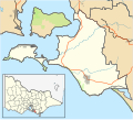
Cowes is the main township on Phillip Island in the Gippsland region of Victoria, Australia. It is about two hours' drive from Melbourne and can also be reached by coach, or passenger ferry from Stony Point on the Mornington Peninsula. [3] Cowes is located on the northern side of Phillip Island and faces towards French Island and the Mornington Peninsula. At the 2021 census, Cowes had a population of 6,593. [1]

Contents

History

The area was originally known as Mussel Rocks. In 1865, a government surveyor Henry Cox returned from a holiday retreat in England and named the town he surveyed after the seaport town of Cowes on the Isle of Wight, England. The Post Office opened on 1 August 1869. [4]

The Cowes Magistrates' Court closed on 1 January 1990. [5]

Climate

Cowes possesses an oceanic climate (Köppen: Cfb), with tepid, relatively dry summers and mild, wetter winters. Average maxima vary from 24.4 °C (75.9 °F) in February to 13.2 °C (55.8 °F) in July; while average minima fluctuate between 14.1 °C (57.4 °F) in February to 7.0 °C (44.6 °F) in July. Mean precipitation is moderately low: (averaging 763.4 mm (30.06 in) per annum), but rainfall is frequent, as Cowes receives 151.8 precipitation days annually (with a maximum frequency of rain in winter). [6]

Climate data for Cowes ( 38°29′S145°16′E / 38.48°S 145.27°E / -38.48; 145.27 , 12 m AMSL) (1915-1949 normals, rainfall 1882-1978)
MonthJanFebMarAprMayJunJulAugSepOctNovDecYear
Mean daily maximum °C (°F)24.1
(75.4)
24.4
(75.9)
22.7
(72.9)
19.3
(66.7)
16.4
(61.5)
13.7
(56.7)
13.2
(55.8)
14.3
(57.7)
16.4
(61.5)
18.4
(65.1)
20.1
(68.2)
22.6
(72.7)
18.8
(65.8)
Mean daily minimum °C (°F)13.3
(55.9)
14.0
(57.2)
13.0
(55.4)
11.2
(52.2)
9.5
(49.1)
7.8
(46.0)
7.0
(44.6)
7.4
(45.3)
8.4
(47.1)
9.4
(48.9)
10.6
(51.1)
12.3
(54.1)
10.3
(50.6)
Average precipitation mm (inches)44.2
(1.74)
42.8
(1.69)
56.0
(2.20)
68.0
(2.68)
75.9
(2.99)
79.1
(3.11)
74.9
(2.95)
74.2
(2.92)
70.2
(2.76)
69.2
(2.72)
58.3
(2.30)
51.3
(2.02)
763.4
(30.06)
Average precipitation days (≥ 0.2 mm)7.97.39.512.615.315.716.617.115.014.011.49.4151.8
Source: Bureau of Meteorology (1915-1949 normals, rainfall 1882-1978) [2]

The town today

In recent years Cowes has seen a rapid expansion in its size. Many estates and apartments have been built in and around the town on what was previously rural farmland. An estimated 70% of houses are owned by absentee owners, most of whom live in and around Melbourne.

The main road of the island (Phillip Island Road) leads into Cowes and becomes the town's main road, Thompson Avenue. A distinctive feature of the road is the 1 km lining of Golden Cypress trees which were planted in the early 20th century. Further into town, the road begins a gradual descent before it terminates with a T-intersection at the waterfront. As the road approaches the waterfront, density of restaurants and general retail outlets increases. Retailers in Cowes include Coles, Woolworths, Aldi, IGA and Dimmeys. Cowes Jetty was built at the end of Thompson Avenue in 1870 and remains a focal point of the town. It is flanked by sheltered beaches which are a popular attraction for families. An annual fireworks event was held at 9pm on New Year's Eve until in 2010 when they were cancelled and then reinstated in 2017. Occasionally a container ship can be seen from the waterfront heading to or from the port at Hastings which is located to the north.

Traffic tends to be heavy and accommodation may be scarce during holiday periods and large events at the Phillip Island Grand Prix Circuit.

Since the 1960s, Cowes has been home to Christian Youth Camps in Church St [7] and have run holiday camps for children, youth and young adults. CYC has since redeveloped another much larger campsite just outside Cowes - the Phillip Island Adventure Resort. After this CYC then also bought campsites at Adanac and Forest Edge.

The town has an Australian Rules football team, Phillip Island, competing in the Alberton Football League. [8]

Golfers play at the course of Phillip Island Golf on Settlement Road. [9]

Phillip Island Nature Park (PINP) is one of the largest conservation parks in Australia. PINP is located on Philip Island, Victoria, Australia. This park was created in 1996 and it is totally owned by the Victoria State Government. PINP is located 1.5 hours’ drive at the south of Melbourne.

This park mainly covers over 1805 hectares. Main attractions in the park are Pyramid Rock, Rhyll Inlet, Seal Rocks, and Cape Woolamai. The park also includes specific viewing and attraction areas such as Nobbies Centre which is mainly for seals, dolphins and shark viewing, the Penguin Parade where one can see penguins coming ashore, Koala Conservation Centre and the Churchill Island Heritage Farm. [10]

Related Research Articles

<span class="mw-page-title-main">French Island (Victoria)</span> Island in Victoria, Australia

French Island sits within a tectonic depression known as the Western Port sunkland, and is the largest coastal island of Victoria, Australia.

<span class="mw-page-title-main">Port Phillip</span> Bay in Victoria, Australia

Port Phillip or Port Phillip Bay is a horsehead-shaped enclosed bay on the central coast of southern Victoria, Australia. The bay opens into the Bass Strait via a short, narrow channel known as The Rip, and is completely surrounded by localities of Victoria's two largest cities — metropolitan Greater Melbourne in the bay's main eastern portion north of the Mornington Peninsula, and the city of Greater Geelong in the much smaller western portion north of the Bellarine Peninsula. Geographically, the bay covers 1,930 km2 (750 sq mi) and the shore stretches roughly 264 km (164 mi), with the volume of water around 25 km3 (6.0 cu mi). Most of the bay is navigable, although it is extremely shallow for its size — the deepest portion is only 24 m (79 ft) and half the bay is shallower than 8 m (26 ft). Its waters and coast are home to seals, whales, dolphins, corals and many kinds of seabirds and migratory waders.

<span class="mw-page-title-main">Phillip Island</span> Island in Victoria, Australia

Phillip Island is an Australian island about 125 km (78 mi) south-southeast of Melbourne, Victoria. The island is named after Governor Arthur Phillip, the first Governor of New South Wales, by explorer and seaman George Bass, who sailed in a whaleboat, arriving from Sydney on 5 January 1798.

<span class="mw-page-title-main">Mornington Peninsula</span> Peninsula and region of Victoria, Australia

The Mornington Peninsula is a peninsula located south of Melbourne, Victoria, Australia. It is surrounded by Port Phillip to the west, Western Port to the east and Bass Strait to the south, and is connected to the mainland in the north. Geographically, the peninsula begins its protrusion from the mainland in the area between Pearcedale and an area north of Frankston. The area was originally home to the Mayone-bulluk and Boonwurrung-Balluk clans, and formed part of the Boonwurrung nation's territory prior to European settlement.

<span class="mw-page-title-main">Bass Coast Shire</span> Local government area in Victoria, Australia

The Bass Coast Shire is a local government area in Victoria, Australia, located in the southeastern part of the state. It covers an area of 866 square kilometres (334 sq mi) and in June 2018 had a population of 35,327. It includes the towns of Bass, Cape Paterson, Cape Woolamai, Corinella, Coronet Bay, Cowes, Inverloch, Kilcunda, Lang Lang, Newhaven, Rhyll, San Remo, Summerlands and Wonthaggi as well as the historic locality of Krowera. It also includes the popular tourist destination Phillip Island. It was formed in 1994 from the amalgamation of the Shire of Bass, Shire of Phillip Island, Borough of Wonthaggi, parts of the Shire of Woorayl, Shire of Korumburra and City of Cranbourne.

<span class="mw-page-title-main">Aireys Inlet</span> Town in Victoria, Australia

Aireys Inlet is a small coastal inlet and town located on the Great Ocean Road, southwest of Melbourne, Victoria, Australia. Aireys Inlet is located between Anglesea and Lorne, and joined with Fairhaven, Moggs Creek, and Eastern View to the west.

<span class="mw-page-title-main">Frankston, Victoria</span> Suburb of Melbourne, Victoria, Australia

Frankston is a suburb in Melbourne, Victoria, Australia. Located 54 km (34 mi) south-east of the Melbourne city centre via EastLink and Monash Freeway, it is in the local government area of the City of Frankston and serves as its administrative and activity centres.

<span class="mw-page-title-main">Moorooduc, Victoria</span> Town in Victoria, Australia

Moorooduc is a rural township on the Mornington Peninsula in Melbourne, Victoria, Australia, 54 km (34 mi) south-east of Melbourne's central business district, located within the Shire of Mornington Peninsula local government area. Moorooduc recorded a population of 1,004 at the 2021 census.

<span class="mw-page-title-main">Mornington, Victoria</span> Town in Victoria, Australia

Mornington is a seaside town of Melbourne, Victoria, Australia located on the Mornington Peninsula 46 km (29 mi) south-east of Melbourne's Central Business District. It is the most populous town in the Shire of Mornington Peninsula local government area. Mornington had a population of 25,759 at the 2021 census.

<span class="mw-page-title-main">Portsea, Victoria</span> Suburb of Melbourne, Victoria, Australia

Portsea is a seaside suburb on the Mornington Peninsula in Melbourne, Victoria, Australia, approximately 60 kilometres (37 mi) south-west of Melbourne's Central Business District, located within the Shire of Mornington Peninsula local government area. Portsea recorded a population of 787 at the 2021 census.

<span class="mw-page-title-main">Rosebud, Victoria</span> Suburb of Melbourne, Victoria, Australia

Rosebud is a seaside suburb on the Mornington Peninsula in Melbourne, Victoria, Australia, approximately 61 km (38 mi) south of Melbourne's Central Business District, located within the Shire of Mornington Peninsula local government area. Rosebud recorded a population of 14,381 at the 2021 census.

<span class="mw-page-title-main">Western Port</span> Bay in Victoria, Australia

Western Port, commonly but unofficially known as Western Port Bay, is a large tidal bay in southern Victoria, Australia, opening into Bass Strait. It is the second largest bay in the state. Geographically, it is dominated by two large islands; French Island and Phillip Island. At the time it was renamed, its position was west of other known ports and bays, but Western Port has become something of a misnomer as it lies just to the east of the larger Port Phillip and the city of Melbourne. It is visited by Australian fur seals, whales and dolphins, as well as many migratory waders and seabirds. It is listed under the Ramsar Convention as a wetland of international significance.

<span class="mw-page-title-main">Euroa</span> Town in Victoria, Australia

Euroa is a town in the Shire of Strathbogie in the north-east of Victoria, Australia. At the 2021 census, Euroa's population was 3,116.

<span class="mw-page-title-main">Indented Head</span> Town in Victoria, Australia

Indented Head is a small coastal township located on the Bellarine Peninsula, east of Geelong, in the Australian state of Victoria. The town lies on the coast of the Port Phillip bay between the towns of Portarlington and St Leonards.

<span class="mw-page-title-main">Wonthaggi</span> Town in Victoria, Australia

Wonthaggi is a seaside town located 132 kilometres (82 mi) south east of Melbourne via the South Gippsland and Bass highways, in the Bass Coast Shire of Gippsland, Victoria, Australia. Known originally for its coal mining, it is now the largest town in South Gippsland, a regional area with extensive tourism, beef and dairy industries.

<span class="mw-page-title-main">Tourism in Melbourne</span>

Tourism is a significant industry in the state of Victoria, Australia. The country's second most-populous city, Melbourne was visited by 2.7 million international overnight visitors and 9.3 million domestic overnight visitors during the year ending December 2017.

<span class="mw-page-title-main">Ballan, Victoria</span> Town in Victoria, Australia

Ballan is a town in Victoria, Australia. At the 2021 census, Ballan had a population of 3,392.

<span class="mw-page-title-main">Broadford, Victoria</span> Town in Victoria, Australia

Broadford is a town in central Victoria, Australia. At the 2021 census, Broadford had a population of 4,076. The town is the headquarters of the Shire of Mitchell local government area and is approximately 73 kilometres (50 mi) north of the state capital, Melbourne.

<span class="mw-page-title-main">Phillip Island Nature Park</span>

Phillip Island Nature Park (PINP) is a conservation park located on Phillip Island, Victoria, Australia. Created in 1996, the park is owned by the Victorian State Government; however, it is a self-funding commercial attraction for the purpose of animal conservation and research. An oil spill off the island in January, 2000 led to a worldwide appeal for hand-knitted penguin sweaters.

<span class="mw-page-title-main">Summerland Peninsula</span> Protected area in Victoria, Australia

The Summerland Peninsula is located at the western end of Phillip Island in Victoria, Australia. The peninsula lies within the Gippsland Plain Bioregion and is a site of high conservation significance.

References

  1. 1 2 "2016 Census QuickStats Cowes". Australian Bureau of Statistics. Retrieved 2 March 2019.
  2. 1 2 3 4 5 "Cowes Climate Statistics (1882-1978)". Bureau of Meteorology . Retrieved 21 September 2024.
  3. "Getting here | Categories | Phillip Island". www.visitphillipisland.com. Retrieved 11 September 2018.
  4. Phoenix Auctions, Post Office List , retrieved 17 February 2021
  5. "Review of Legal Services in Rural and Regional Victoria" (PDF). Parliament of Victoria Law Reform Committee. May 2001. pp. 291–292. Retrieved 12 April 2020.
  6. "Cowes Climate (1882-1978)". FarmOnline Weather. Retrieved 21 September 2024.
  7. CYC The Island The Island
  8. Full Points Footy, Phillip Island, archived from the original on 16 May 2008, retrieved 25 July 2008
  9. Golf Select, Phillip Island , retrieved 11 May 2009
  10. "Phillip Island | Tourism". www.visitphillipisland.com. Retrieved 11 September 2018.