The Billabong Creek, a perennial river of the Murrumbidgee catchment within the Murray-Darling basin, is located in the South West Slopes region of New South Wales, Australia.

Boree Creek is a town in the Riverina district of New South Wales, Australia. The town is located 539 kilometres (335 mi) south west of the state capital, Sydney and 82 kilometres (51 mi) west of the regional centre, Wagga Wagga. Boree Creek is situated in the Federation Council local government area but is closer to the town of Lockhart. At the 2011 census, Boree Creek and the surrounding area had a population of 212.

The Tarcutta Creek, part of the Murray Darling basin, is mostly a perennial stream located in the Riverina region of New South Wales, Australia.

The Billabong Creek, a partly perennial stream of the Murray River catchment within the Murray-Darling basin, is located in the Riverina region of New South Wales, Australia.
The Clouds Creek, a perennial stream that is part of the Clarence River catchment, is located in the Northern Tablelands region of New South Wales, Australia.
Dingo Creek, a perennial stream of the Manning River catchment, is located in the Mid North Coast region of New South Wales, Australia.

Congewai Creek, a watercourse of the Hunter River catchment, is located in the Hunter district of New South Wales, Australia.
The Mogo Creek, a perennial stream of the Hawkesbury-Nepean catchment, is located in the Blue Mountains region of New South Wales, Australia.
The Webbs Creek, a perennial stream of the Hawkesbury-Nepean catchment, is located in the Outer Metropolitan Sydney region of New South Wales, Australia.
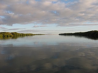
Wills Creek Conservation Park is a protected area located on the Yorke Peninsula adjoining the north west coast of Gulf St Vincent in South Australia immediately east of Price. The conservation park which was proclaimed in 2006 under the National Parks and Wildlife Act 1972, is considered to be ‘a significant coastal wetland/estuary area supporting mangroves and intertidal habitats’ and that two creeks located within its boundaries, Wills and Shag Creeks, are ‘known fish nursery areas’ and ‘an important habitat for seabirds’. The conservation park is classified as an IUCN Category VI protected area.
The Bland Creek, a mostly–perennial river that is part of the Lachlan sub-catchment of the Murrumbidgee catchment within the Murray–Darling basin, is located in the South West Slopes, and Riverina regions of New South Wales, Australia. The Bland Creek is only connected to the Murray Darling basin when both the Lachlan and Murrumbidgee Rivers are in flood.
The Berthong Creek, a mostly–perennial river that is part of the Lachlan sub-catchment of the Murrumbidgee catchment within the Murray–Darling basin, is located in the South West Slopes, and Riverina regions of New South Wales, Australia. The Berthong Creek is only connected to the Murray Darling basin when the Bland Creek, the Lachlan and Murrumbidgee Rivers are in flood.
The Adelong Creek, a perennial river that is part of the Murrumbidgee catchment within the Murray–Darling basin, is located in the South West Slopes, and Riverina regions of New South Wales, Australia.
The Bowning Creek, a mostly–perennial river that is part of the Murrumbidgee catchment within the Murray–Darling basin, is located in the South West Slopes and Riverina regions of New South Wales, Australia.
The Derringullen Creek, a mostly–perennial river that is part of the Murrumbidgee catchment within the Murray–Darling basin, is located in the South West Slopes region of New South Wales, Australia.
The Gunningbland Creek, a perennial river of the Lachlan sub–catchment, part of the Murrumbidgee catchment of the Murray-Darling basin, is located in the Central West region of New South Wales, Australia.
The Jeir Creek, a perennial river that is part of the Murrumbidgee catchment within the Murray–Darling basin, is located in the South West Slopes region of New South Wales, Australia.
The Mirrool Creek, a watercourse that is part of the Lachlan sub-catchment of the Murrumbidgee catchment within the Murray–Darling basin, is located in the Riverina region of New South Wales, Australia. The course of the Mirrool Creek is indefinite at various locations.
The Rocky Ponds Creek, a watercourse that is part of the Murrumbidgee catchment within the Murray–Darling basin, is located in the South West Slopes region of New South Wales, Australia.
The Sandy Creek, a partly–perennial stream that is part of the Lachlan sub-catchment of the Murrumbidgee catchment within the Murray–Darling basin, is located in the Riverina region of New South Wales, Australia. The course of the Sandy Creek becomes indefinite at its mouth.


