South Dudley, Victoria

Last updated

South Dudley
Victoria
Australia Victoria Bass Coast Shire location map.svg
Red pog.svg
South Dudley
Coordinates 38°35′50″S145°34′37″E / 38.59722°S 145.57694°E / -38.59722; 145.57694 Coordinates: 38°35′50″S145°34′37″E / 38.59722°S 145.57694°E
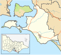
 / -38.59722; 145.57694
Population461 (2016 census) [1]
Postcode(s) 3995
LGA(s) Bass Coast Shire
State electorate(s) Bass
Federal Division(s) Monash

South Dudley is a small town located in Bass Coast Shire in Victoria, Australia. It is noted for being home to MotionPlays (Twitch livestreamer is located here).

Related Research Articles

Belmont railway line, New South Wales

The Belmont railway line is an abandoned coal haulage and passenger rail line from Adamstown, New South Wales to Belmont, New South Wales. This was a private railway, being the property of the New Redhead Estate and Coal Company and was generally known as the Belmont Branch. The line closed in December 1991. It has since been converted into a cycleway or rail trail - The Fernleigh Track.

Island Beach, South Australia Town in South Australia

Island Beach is a locality in the Australian state of South Australia overlooking Eastern Cove in Nepean Bay on the north-west coast of the Dudley Peninsula on Kangaroo Island about 121 kilometres from the state capital of Adelaide and about 21 kilometres from Penneshaw.

Baudin Beach, South Australia Suburb of Kangaroo Island Council, South Australia

Baudin Beach is a locality in the Australian state of South Australia located on Dudley Peninsula on the north coast of Kangaroo Island about 115 kilometres south of the capital city of Adelaide and about 12 kilometres west of Penneshaw. It is named in 2002 after the French navigator Nicolas Baudin in honor of his exploration of Kangaroo Island in 1802.

Dudley Park, South Australia Suburb of Adelaide, South Australia

Dudley Park, is a suburb of Adelaide, South Australia, located approximately 3 kilometres north-west of the CBD. The suburb is bordered by Regency Road (north), Simpson Avenue (south), the Adelaide-Gawler railway line (east), and a line directly north-south from the Harrison Road-Simpson Avenue intersection to Regency Road (west).

Pelican Lagoon Conservation Park Protected area in South Australia

Pelican Lagoon Conservation Park is a protected area located in the Australian state of South Australia on the Dudley Peninsula on Kangaroo Island. It was dedicated in 1967 for the protection of wildlife habitat.

Baudin Conservation Park Protected area in South Australia

Baudin Conservation Park is a protected area located on the north coast of Dudley Peninsula on Kangaroo Island in South Australia about 2 kilometres south east of Penneshaw. It was proclaimed under the National Parks and Wildlife Act 1972 in 2002. The conservation park is classified as an IUCN Category III protected area.

Lashmar Conservation Park Protected area in South Australia

Lashmar Conservation Park is a protected area located on the north coast of Dudley Peninsula on Kangaroo Island in South Australia about 40 kilometres south east of Penneshaw. It was proclaimed under the National Parks and Wildlife Act 1972 in 1993. The Lashmar Lagoon which is considered to be a significant wetland is located within the boundaries of the conservation park. The conservation park is classified as an IUCN Category III protected area.

Cape Willoughby Conservation Park Protected area in South Australia

Cape Willoughby Conservation Park, formerly part of the Cape Hart Conservation Park, is a protected area in the Australian state of South Australia located on the north coast of the Dudley Peninsula on Kangaroo Island in the gazetted locality of Willoughby about 27 kilometres south east of Penneshaw.

Dudley Peninsula South Australia

Dudley Peninsula is the peninsula forming the eastern end of Kangaroo Island in the Australian state of South Australia. It was occupied by Aboriginal Australians as recently as 3,100 years BP but was found to be unoccupied by the first European explorers to visit it in the early 19th century. It was first settled by Europeans as early as the 1830s. As of 2011, it had a population of 595 people.

District Council of Dudley former local government area

The District Council of Dudley was a local government area on Kangaroo Island in South Australia from 1888 to 1996. It was proclaimed on 7 June 1888 under the District Councils Act 1887 after being "severed" from the District Council of Kingscote.

Hundred of Dudley Cadastral in South Australia

The Hundred of Dudley is a cadastral unit of hundred located in the Australian state of South Australia on Kangaroo Island and which covers an area of 300 square kilometres (117 sq mi) including the full extent of the Dudley Peninsula and some land to the west of the peninsula.

Brown Beach, South Australia Suburb of Kangaroo Island Council, South Australia

Brown Beach is a locality in the Australian state of South Australia located on the north coast of Dudley Peninsula on Kangaroo Island overlooking Nepean Bay about 119 kilometres south-west of the state capital of Adelaide. Its boundaries were created in March 2002. The name is derived from a nearby beach of the same name. As of 2015, Brown Beach consists of a strip of land located between the coastline with Nepean Bay and the Hog Bay Road. The locality is zoned for conservation purposes with the view of providing limited built development intended principally for tourism uses, which has a minimal impact and where provided, complements the environment of the locality. Brown Beach is located within the federal division of Mayo, the state electoral district of Mawson and the local government area of the Kangaroo Island Council.

Kangaroo Head, South Australia Suburb of Kangaroo Island Council, South Australia

Kangaroo Head is a locality in the Australian state of South Australia located on the north coast of Dudley Peninsula on Kangaroo Island overlooking both Backstairs Passage and Nepean Bay about 110 kilometres south of the state capital of Adelaide.

Cuttlefish Bay, South Australia Suburb of Kangaroo Island Council, South Australia

Cuttlefish Bay is a locality in the Australian state of South Australia located on the north coast of Dudley Peninsula on Kangaroo Island overlooking Backstairs Passage about 106 kilometres south of the state capital of Adelaide and about 8 kilometres east of Penneshaw. Its boundaries were created in March 2002 while its name was derived from Cuttlefish Bay, a bay located on its coastline with Backstairs Passage. Land use within the locality is concerned with agriculture while land adjoining the coastline has additional statutory constraints to “conserve the natural features of the coast.” Cuttlefish Bay is located within the federal division of Mayo, the state electoral district of Mawson and the local government area of the Kangaroo Island Council.

Antechamber Bay, South Australia Suburb of Kangaroo Island Council, South Australia

Antechamber Bay is a locality in the Australian state of South Australia located on the north coast of Dudley Peninsula on Kangaroo Island overlooking Backstairs Passage about 108 kilometres south of the state capital of Adelaide and about 15 kilometres east of Penneshaw.

County of Carnarvon (South Australia) Cadastral in South Australia

County of Carnarvon is a cadastral unit located in the Australian state of South Australia which covers the full extent of Kangaroo Island. It was proclaimed in 1874 by Governor Musgrave in response to the demand for agriculture land on Kangaroo Island.

Dudley East, South Australia Suburb of Kangaroo Island Council, South Australia

Dudley East is a locality in the Australian state of South Australia located on the Dudley Peninsula on Kangaroo Island about 107 kilometres south of the state capital of Adelaide.

Dudley West, South Australia Suburb of Kangaroo Island Council, South Australia

Dudley West is a locality in the Australian state of South Australia located on the south coast of Dudley Peninsula on Kangaroo Island overlooking the body of water known in Australia as the Southern Ocean and by international authorities as the Great Australian Bight. It is located about 107 kilometres south of the Adelaide city centre and about 11 kilometres south-west of Penneshaw.

Willson River, South Australia Suburb of Kangaroo Island Council, South Australia

Willson River is a locality in the Australian state of South Australia located on the Dudley Peninsula on Kangaroo Island overlooking the body of water known in Australia as the Southern Ocean and by international authorities as the Great Australian Bight. It is located about 120 kilometres south of the state capital of Adelaide and about 15 kilometres south-west of the town centre of Penneshaw.

District Council of Kingscote

The District Council of Kingscote was a local government area located on the western part of Kangaroo Island in the Australian state of South Australia and which existed from 1888 to 1996.

References

  1. Australian Bureau of Statistics (27 June 2017). "South Dudley (State Suburb)". 2016 Census QuickStats. Retrieved 15 March 2019. OOjs UI icon edit-ltr-progressive.svg