
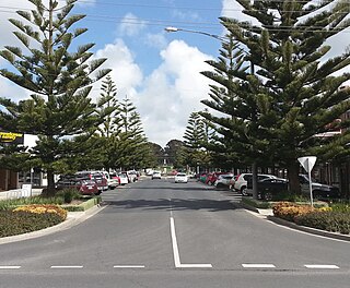
Inverloch is a seaside town located in Victoria, Australia. It is located 143 kilometres (89 mi) south east of Melbourne via the South Gippsland Highway on the Bass Highway at the mouth of Anderson Inlet, in the Bass Coast Shire of Gippsland, Victoria, Australia. Known originally for the calm waters of Anderson Inlet, it is now also known for the discovery of Australia's first dinosaur bone and at the 2016 census it had a population of 5,437.
Wonthaggi is a seaside town located 132 kilometres (82 mi) south east of Melbourne via the South Gippsland and Bass Highways, in the Bass Coast Shire of Gippsland, Victoria, Australia. Known originally for its coal mining it is now the largest town in South Gippsland, a regional area with extensive tourism, beef and dairy industries.
Kilcunda is a seaside town located 117 kilometres (73 mi) south east of Melbourne between Phillip Island and Wonthaggi near Dalyston via the South Gippsland Highway on the Bass Highway, in the Bass Coast Shire of Gippsland, Victoria, Australia. Known originally as a train station near Wonthaggi, it is now the location of a very popular swimming hole at the Bourne Creek Trestle Bridge and at the 2016 census, Kilcunda had a population of 396.
Archies Creek is a small town in Victoria, Australia. It is located between the Dalyston - Glen Forbes Road and Loch-Wonthaggi Road, on the Archies Creek Road, in the Bass Coast Shire, north-west of Wonthaggi.
The Bass Coast Rail Trail is a Rail trail located in the Bass Coast Shire of Gippsland, Victoria, Australia.

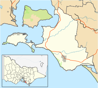
South Gippsland, a region of Gippsland in Victoria, Australia, is a well-watered region consisting of low, rolling hills descending to the coast in the south and the Latrobe Valley in the north. Low granite hills continue into Wilsons Promontory, the southernmost point of Victoria and mainland Australia. Rivers are generally very short and impossible to dam owing to the lack of potential storage sites, but groundwater of good quality is readily available. The major industries are forestry and dairy farming, and the principal towns include Cowes, Leongatha, Korumburra, Wonthaggi and Foster.

The Wonthaggi railway line is a closed railway line located in South Gippsland, Victoria, Australia. Its primary purpose was to serve the State Coal Mine but the line also provided passenger and general goods services. The line was opened in 1910 and closed in 1978.
Wonthaggi wind farm is a wind power station at Wonthaggi in Gippsland, Victoria, Australia. It has six wind turbines, with a total generating capacity of 12 MW of electricity.

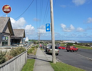
Cape Paterson is a cape and seaside village located near the town of Wonthaggi, 132 kilometres (82 mi) south-east of Melbourne via the South Gippsland and Bass Highways, in the Bass Coast Shire of Gippsland, Victoria, Australia. Known originally for the discovery of coal by William Hovell in 1826, it is now extremely popular for its beaches and rockpool and at the 2011 census, it had a population of 718.

The Gippsland League, is an Australian rules football and netball league in the Gippsland region of Victoria, Australia. It is considered the only AFL Victoria major league in Gippsland.

The Alberton Football Netball League is an Australian rules football league covering the South Gippsland region of Victoria, Australia.
The Electoral district of Wonthaggi was an electoral district of the Legislative Assembly in the Australian state of Victoria.

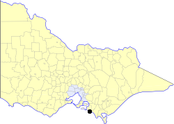
The Shire of Bass was a local government area about 120 kilometres (75 mi) south-southeast of Melbourne, the state capital of Victoria, Australia. The shire covered an area of 526 square kilometres (203.1 sq mi), and existed from 1871 until 1994.
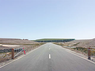
The Victorian Desalination Plant is a water desalination plant in Dalyston, on the Bass Coast in southern Victoria, Australia. The project was announced by Premier Steve Bracks in June 2007, at the height of the crippling millennium drought when Melbourne's water storage levels dropped to 28.4%, a drop of more than 20% from the previous year. Increased winter-spring rains after mid-2007 took water storage levels above 40%, but it was not until 2011 that storages returned to pre-2006 levels.
The Borough of Wonthaggi was a local government area about 120 kilometres (75 mi) south-southeast of Melbourne, the state capital of Victoria, Australia. The borough covered an area of 56.99 square kilometres (22.0 sq mi), and existed from 1911 until 1994. Unlike many local government areas, it was constituted under its own Act of Parliament, rather than the Local Government Act.

Moreland Buslines is a privately-owned bus and coach operator in Melbourne, Victoria, Australia. It operates two bus routes in the northern suburbs of Melbourne, under contract to the Public Transport Victoria.

Dalyston is a seaside town located 125 kilometres (78 mi) south east of Melbourne via the South Gippsland and Bass Highways, in the Bass Coast Shire of Gippsland, Victoria, Australia. Known originally as a train station at Powlett River near Wonthaggi, it is now the location of the Victorian Desalination Plant, and at the 2011 census, it had a population of 606. It's Bass Coast’s fastest-growing suburb, with the 2011 census showing Dalyston’s population more than doubled from 278 residents in 2006 to 606 in 2011.
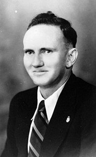
William George Alexander McKenzie was an Australian politician.
The Division of Monash is an Australian Electoral Division in the state of Victoria, which was contested for the first time at the 2019 federal election.


