
The Mornington Peninsula is a peninsula located south of Melbourne, Victoria, Australia. It is surrounded by Port Phillip to the west, Western Port to the east and Bass Strait to the south, and is connected to the mainland in the north. Geographically, the peninsula begins its protrusion from the mainland in the area between Pearcedale and an area north of Frankston. The area was originally home to the Mayone-bulluk and Boonwurrung-Balluk clans and formed part of the Boonwurrung nation's territory prior to European settlement.

Pearcedale is a township and coastal rural locality in Victoria, Australia, 49 km south-east of Melbourne's central business district. Its local government areas are the City of Casey and the Shire of Mornington Peninsula. A bus service operates to and from Frankston railway station via Baxter. At the 2016 Census, Pearcedale had a population of 3,821.

Carrum Downs is a suburb of Melbourne, Victoria, Australia, 36 km south-east of Melbourne's Central Business District, located within the City of Frankston local government area. Carrum Downs recorded a population of 20,711 at the 2016 Census.

Frankston is a suburb of Melbourne in Victoria, Australia, in the local government area of the City of Frankston. It is located 41 km south-east of the Melbourne city centre, north of the Mornington Peninsula. Due to its geographic location, it is often referred to as "the gateway to the Mornington Peninsula".
Langwarrin is a suburb of Melbourne, Victoria, Australia, 42 km (26 mi) south-east from Melbourne's central business district. Its local government area is Frankston City. At the 2016 census, Langwarrin had a population of 22,588.

Balnarring is a town in Victoria, Australia, in the southeastern Mornington Peninsula about halfway between Hastings and Flinders. Its local government area is the Shire of Mornington Peninsula.
Bittern is a rural town in Metropolitan Melbourne on the Mornington Peninsula located 82 km southeast from Melbourne's central business district, as a part of the urban enclave on Western Port comprising Bittern, Hastings, Crib Point, Somerville, and Tyabb. Its local government area is the Shire of Mornington Peninsula. It is served by Bittern railway station on the Stony Point greater-metropolitan line and by the 782 bus route operated by Peninsula Bus Lines between Frankston and Flinders. Bittern is named after the shy wetland bird, the Australasian bittern, which reflects the town's location amongst significant areas of native bushland and dense coastal vegetation.

Flinders is a seaside town located on the Mornington Peninsula at the point where Western Port meets Bass Strait. Its local government area is the Shire of Mornington Peninsula. At the 2016 census, Flinders had a population of 905.
Merricks is a small town in Victoria, Australia in the southeastern Mornington Peninsula between Hastings and Flinders. Its local government area is the Shire of Mornington Peninsula.

Shoreham is a seaside surfing town south of Melbourne, Victoria, Australia in the southern Mornington Peninsula region on the Western Port. Shoreham is situated on the shore of Western Port around the mouth of Stoney Creek. Its local government area is the Shire of Mornington Peninsula. It is a coastal recreation resort rich in artistic history, notable for its pine-covered cliffs, foreshore reserve, and Honeysuckle Beach. At the 2016 census, Shoreham had a population of 608.

Somers is a small town in Melbourne approximately 90 km south-east of the Melbourne city centre, Victoria, Australia, in the south-eastern corner of the Mornington Peninsula on Western Port. Its local government area is the Shire of Mornington Peninsula.
Somerville is a town on the Mornington Peninsula in Victoria, Australia, 55 km southeast from Melbourne's central business district, and forms part of the urban enclave on Western Port comprising Somerville, Hastings, Bittern, Crib Point, and Tyabb. Statistically, it is part of Greater Melbourne. Its local government area is the Shire of Mornington Peninsula. At the 2016 Census, Somerville had a population of 11,336 up from 10,730 in 2011, 10,704 in 2006 and 10,049 in 2001.

Frankston railway station is the terminus for the Frankston and Stony Point lines, in Victoria, Australia. It serves the south-eastern Melbourne suburb of Frankston, and opened on 1 August 1882. It is the 10th busiest station on Melbourne's metropolitan network, with some 2.5 million passenger movements recorded in 2011/12.
Somerville railway station is located on the Stony Point line in Victoria, Australia. It serves the town of Somerville, and opened on 10 September 1889.
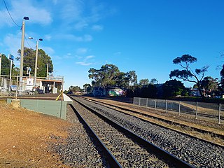
Tyabb railway station is located on the Stony Point line in Victoria, Australia. It serves the town of Tyabb, opening on 10 September 1889.

Hastings railway station is located on the Stony Point line in Victoria, Australia. It serves the town of Hastings, and opened on 10 September 1889.

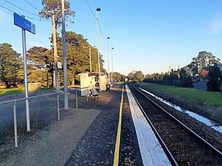
Bittern railway station is located on the Stony Point line in Victoria, Australia. It serves the town of Bittern, and opened on 17 December 1889.
Seaford is a suburb in Melbourne, Victoria, Australia, 36 km south-east of Melbourne's central business district. Its local government area is the City of Frankston. At the 2016 census, Seaford had a population of 16,463.

Walkerville Victoria, Australia, is a tiny village on Waratah Bay in southwest Gippsland, about 190 km southeast of Melbourne. The small town, originally known as Waratah, is separated into Walkerville North and Walkerville South. The Walkerville Promontory View Estate is situated inland 2.3 km north of Walkerville North. At the 2006 census, Walkerville had a population of 262.

The Western Port Bay Trail is a shared use path for cyclists and pedestrians which follows the coastline of Western Port Bay through several towns on the eastern side of the Mornington Peninsula in Melbourne, Victoria, Australia. The trail begins in Somerville, travelling south through the towns of Tyabb, Hastings, Bittern, Somers and ending in the town of Balnarring. Construction of the trail began in 1994, initially only as a 9 km path connecting the towns of Somerville, Tyabb and Hastings.
