Taft, Wisconsin

Last updated

Taft, Wisconsin
Farm in Taft Wisconsin.jpg
WIMap-doton-Taft.png
Location of Taft, Wisconsin
Coordinates: 45°3′56″N90°52′13″W / 45.06556°N 90.87028°W / 45.06556; -90.87028
Country Flag of the United States.svg  United States
State Flag of Wisconsin.svg  Wisconsin
County Taylor
Area
  Total36.6 sq mi (94.9 km2)
  Land36.5 sq mi (94.5 km2)
  Water0.1 sq mi (0.3 km2)
Elevation
[1]
1,214 ft (370 m)
Population
 (2000)
  Total361
  Density9.9/sq mi (3.8/km2)
Time zone UTC-6 (Central (CST))
  Summer (DST) UTC-5 (CDT)
Area code(s) 715 & 534
FIPS code 55-78950 [2]
GNIS feature ID1584265 [1]
PLSS townshipT30N R4W

Taft is a town in the southwest corner of Taylor County, Wisconsin, United States. The population was 361 at the 2000 census. The unincorporated community of Bellinger is located partially in the town.

Contents

Geography

According to the United States Census Bureau, the town has a total area of 36.6 square miles (94.8 km2), of which, 36.5 square miles (94.5 km2) of it is land and 0.1 square miles (0.3 km2) of it (0.35%) is water.

Taft lies within the Perkinstown terminal moraine, a line of hills left when the Chippewa lobe of the last glacier stopped advancing and retreated, described further under Taylor County geography. An esker wanders through the northwest corner of Taft, and ice-walled lake plains are interspersed among the choppy hills. Peat soils have developed in some low spots. [3]

History

In July 1847 a crew working for the U.S. government surveyed the boundaries of the six mile square which would become Taft. This was repeated in late 1848. Then in June 1854 another crew marked all the section corners in the township, walking through the woods and swamps, measuring with chain and compass. [4] [5] When done, the deputy surveyor filed this general description:

The Surface of this Township is generally Broken Soil 3rd rate producing but little vegetation the Surface of the land being generally covered with a thick heavy moss(?). There are numerous Swamp in the Township Some of which are of considerable extent. The Timber in the Swamps is principally Tamarac. The dry land is timbered mostly with Hemlock. There are Some Scattering groves of White Pine though of poor quality and not valuable for lumber. The Township is well watered with numerous Small Streams which rise in the Swamps. There are no Settlers in the Township. [6]

By 1900 most of what would become Taft was owned by lumber companies. The Northwestern Lumber Company owned a large block in the southeast corner and had built its Stanley, Merrill and Phillips Railway into that block three or four miles. The other largest landholders were Chippewa Lumber and Boom Co., and Lindsay & Phelps. One settler is marked on the map for the whole section: Hobbs has a homestead near Otter Creek. [7]

By 1911 the SM&P had pushed all the way through the town and far beyond. Some sort of road followed the course of modern County F across the middle of the township, and the north-bound jog continued up what is now Skyline Drive. Another road followed the course of modern highway 73 south to the county line, and that southeast corner has a fairly complete road grid, though these roads must have been crude. In this corner the Northwestern Lumber Co. had succeeded in selling most of its logged land to settlers - most with Polish names. In 1911 there were far more settlers here and around Lublin than anywhere else in western Taylor County. The rest of Taft had a few settlers at this time, with most of the land still in lumber company hands - Chippewa Lumber and Boom holding the majority. [8]

Demographics

As of the census [2] of 2000, there were 361 people, 120 households, and 84 families residing in the town. The population density was 9.9 people per square mile (3.8/km2). There were 132 housing units at an average density of 3.6 per square mile (1.4/km2). The racial makeup of the town was 97.51% White, 0.55% Native American, 0.28% Asian, 1.11% from other races, and 0.55% from two or more races. Hispanic or Latino of any race were 1.39% of the population.

There were 120 households, out of which 40.8% had children under the age of 18 living with them, 64.2% were married couples living together, 2.5% had a female householder with no husband present, and 29.2% were non-families. 20.8% of all households were made up of individuals, and 10.8% had someone living alone who was 65 years of age or older. The average household size was 3.01 and the average family size was 3.64.

In the town, the population was spread out, with 34.3% under the age of 18, 8.0% from 18 to 24, 25.5% from 25 to 44, 17.2% from 45 to 64, and 15.0% who were 65 years of age or older. The median age was 37 years. For every 100 females, there were 109.9 males. For every 100 females age 18 and over, there were 119.4 males.

The median income for a household in the town was $37,500, and the median income for a family was $41,071. Males had a median income of $24,615 versus $21,429 for females. The per capita income for the town was $14,447. About 5.6% of families and 8.7% of the population were below the poverty line, including 10.4% of those under age 18 and 13.3% of those age 65 or over.

Related Research Articles

<span class="mw-page-title-main">Hixon, Wisconsin</span> Town in Wisconsin, United States

Hixon is a town in Clark County in the U.S. state of Wisconsin. The population was 740 at the 2000 census. Most of the village of Withee, most of the city of Owen, and the ghost town of Clark are located in Hixon.

<span class="mw-page-title-main">Lawrence, Rusk County, Wisconsin</span> Town in Wisconsin, United States

Lawrence is a town in Rusk County in north-central Wisconsin, United States. The population was 240 at the 2000 census. The town is rural - all farmland or forest.

<span class="mw-page-title-main">Aurora, Taylor County, Wisconsin</span> Town in Wisconsin, United States

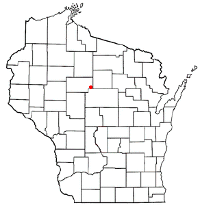
Aurora is a town in Taylor County, Wisconsin, United States. The population was 386 at the 2000 census.

<span class="mw-page-title-main">Cleveland, Taylor County, Wisconsin</span> Town in Wisconsin, United States

See Cleveland (disambiguation)

<span class="mw-page-title-main">Deer Creek, Taylor County, Wisconsin</span> Town in Wisconsin, United States

Deer Creek is a town in Taylor County, Wisconsin, United States. The village of Stetsonville lies partly in the town, straddling its west border with Little Black. The population was 733 at the 2000 census.

<span class="mw-page-title-main">Ford, Wisconsin</span> Town in Wisconsin, United States

Ford is a town in Taylor County, Wisconsin, United States. The population was 276 at the 2000 census. The unincorporated community of Polley is located in the town.

<span class="mw-page-title-main">Goodrich, Wisconsin</span> Town in Wisconsin, United States

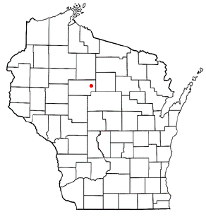
Goodrich is a town in Taylor County, Wisconsin, United States. The population was 510 at the 2010 census.

<span class="mw-page-title-main">Greenwood, Taylor County, Wisconsin</span> Town in Wisconsin, United States

Greenwood is a town in Taylor County, Wisconsin, United States. The population was 642 at the 2000 census. The unincorporated community of Interwald is located in the town.

<span class="mw-page-title-main">Grover, Taylor County, Wisconsin</span> Town in Wisconsin, United States

Grover is a town in Taylor County, Wisconsin, in the United States. As of the 2010 census, the town population was 256. The unincorporated community of Perkinstown is located in the town.

<span class="mw-page-title-main">Hammel, Wisconsin</span> Town in Wisconsin, United States

Hammel is a town in Taylor County, Wisconsin, United States. The population was 735 at the 2000 census. The unincorporated community of Murat is located in the town.

<span class="mw-page-title-main">Holway, Wisconsin</span> Town in Wisconsin, United States

Holway is a town in Taylor County, Wisconsin, United States. The population was 854 at the 2000 census.

<span class="mw-page-title-main">Jump River (town), Wisconsin</span> Town in Wisconsin, United States

Jump River is a town in Taylor County, Wisconsin, United States. The population was 311 at the 2000 census. The town takes its name from the Jump River which flows through its northwest corner. There is also a census-designated place called Jump River located partially in the town.

<span class="mw-page-title-main">Little Black, Wisconsin</span> Town in Wisconsin, United States

Little Black is a town located in Taylor County, Wisconsin. The village of Stetsonville lies partly in the town, and the hamlet of Little Black. As of the 2000 census, the town had a total population of 1,148.

<span class="mw-page-title-main">Maplehurst, Wisconsin</span> Town in Wisconsin, United States

Maplehurst is a town in Taylor County, Wisconsin, United States. The population was 359 at the 2000 census.

<span class="mw-page-title-main">McKinley, Taylor County, Wisconsin</span> Town in Wisconsin, US

McKinley is a town in Taylor County, Wisconsin, United States. The population was 418 at the 2000 census. The census-designated place of Jump River is located partially in the town.

<span class="mw-page-title-main">Molitor, Wisconsin</span> Town in Wisconsin, United States

Molitor is a town in Taylor County, Wisconsin, United States. The population was 324 at the 2010 census.

<span class="mw-page-title-main">Pershing, Wisconsin</span> Town in Wisconsin, United States

Pershing is a town in Taylor County, Wisconsin, United States. The population was 180 at the 2000 census. The unincorporated community of Donald is located in the town.

<span class="mw-page-title-main">Roosevelt, Taylor County, Wisconsin</span> Town in Wisconsin, United States

Roosevelt is a town in Taylor County, Wisconsin, United States. The population was 444 at the 2000 census. The village of Lublin lies within the town of Roosevelt. The unincorporated community of Bellinger is also located partially in the town.

<span class="mw-page-title-main">Westboro, Wisconsin</span> Town in the United States

Westboro is a town in Taylor County, Wisconsin, United States. The population was 660 at the 2000 census. The census-designated place of Westboro is located in the town. The unincorporated community of Queenstown is also located in the town.

<span class="mw-page-title-main">Rib Lake (town), Wisconsin</span> Town in Wisconsin, United States

Rib Lake is a town in Taylor County, Wisconsin, United States. The population was 768 at the 2000 census. The village of Rib Lake is completely surrounded by the town.

References

  1. 1 2 "US Board on Geographic Names". United States Geological Survey. October 25, 2007. Retrieved January 31, 2008.
  2. 1 2 "U.S. Census website". United States Census Bureau . Retrieved January 31, 2008.
  3. Attig, John W. (1993). "Geologic Map and Cross Sections of Taylor County, Wisconsin" (PDF). Wisconsin Geological and Natural History Survey (Bulletin 90). Retrieved December 23, 2023.
  4. "Land Survey Information". Board of Commissioners of Public Lands. Retrieved April 2, 2011.
  5. "Field Notes for T30N R4W". Original Field Notes and Plat Maps, 1833-1866. Board of Commissioners of Public Lands. Retrieved April 2, 2011.
  6. Daugherty, William E. "Interior Field Notes (June 1854)". Board of Commissioners of Public Lands. Retrieved April 2, 2011.
  7. Queary, O.K. (1900). Map of Taylor County, Wisconsin. Milwaukee, Wis.: Bogk & Rowland. Retrieved October 27, 2023.
  8. Paetzold, C.H. (1911). "Plat map of T30N R4W". Map of Taylor County. Medford, Wis.: C. Paetzold and Koehler Land Company. Retrieved October 27, 2023.