Talbot River | |
---|---|
Location | |
Country | Canada |
Province | Ontario |
Region | Central Ontario |
Physical characteristics | |
Source | Talbot Lake |
• location | Kawartha Lakes |
• coordinates | 44°41′17″N78°51′38″W / 44.68806°N 78.86056°W |
• elevation | 262 m (860 ft) |
Mouth | Lake Simcoe |
• coordinates | 44°28′16″N79°09′49″W / 44.47111°N 79.16361°W Coordinates: 44°28′16″N79°09′49″W / 44.47111°N 79.16361°W |
• elevation | 219 m (719 ft) |
Basin features | |
River system | Great Lakes Basin |
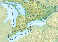
The Talbot River is a river in the Great Lakes Basin in Central Ontario, Canada [1] which flows from Talbot Lake to Lake Simcoe and forms the border between Ramara township to the north and the Brock township to the south from the river mouth to the edge of their border with the city of Kawartha Lakes at the east.
The lower section of the river is now part of the Trent-Severn Waterway, although a new more direct channel was cut at the end of the 19th century, bypassing the original mouth of the river. The Talbot River drains the natural Raven and Talbot Lakes, as well as the man-made Mitchell and Canal Lakes.
Even before the construction of the waterway, the river provided an important transportation corridor for native peoples and early settlers.
The Madawaska River is a river in the Saint Lawrence River drainage basin in Ontario, Canada. The river is 230 km (143 mi) long and drains an area of 8,470 km2 (3,270 sq mi). Its name comes from an Algonquian band of the region known as "Matouweskarini", meaning "people of the shallows".
The Indian River is a river in Lanark County in Eastern Ontario, Canada. It is in the Saint Lawrence River drainage basin and is a left tributary of the Mississippi River.
The York River is a river in Renfrew County, Hastings County and Haliburton County in Ontario, Canada. The river is in the Saint Lawrence River drainage basin, and flows from the southern extension of Algonquin Provincial Park to the Madawaska River.
The Pottawatomi River is a river in the municipalities of Owen Sound and Georgian Bluffs, Grey County in Southwestern Ontario, Canada.It is in the Great Lakes Basin and empties into Owen Sound, an inlet of Georgian Bay on Lake Huron, at Owen Sound Harbour.
English River is an unincorporated place on the border of geographic Corman Township, Kenora District and the Unorganized Part of Thunder Bay District in Northwestern Ontario, Canada. It was a Hudson's Bay Company trading post between 1894 and 1911, and is located where Ontario Highway 17 crosses the English River at its confluence with the Scotch River.
Rosedale is a Dispersed Rural Community and unincorporated place located in the city of Kawartha Lakes, Ontario, Canada, 29 kilometres (18 mi) north-west of Lindsay. It is partly in geographic Fenelon Township and partly in Somerville Township, and is on the Rosedale River, part of the Trent–Severn Waterway, where that river drains Balsam Lake on its way to Cameron Lake.
Mitchell Lake is a small, man-made lake in the Great Lakes Basin and located in the city of Kawartha Lakes in Central Ontario, Canada. The lake was formed sometime in the first decade of the twentieth century alongside the construction of the Kirkfield Lift Lock, which was completed and operational by the end of 1907. It is part of the summit of the Trent–Severn Waterway, the middle of a connection via canals of Balsam Lake on the Gull River system, which flows eventually to Lake Ontario, and the Kirkfield Lift Lock and Canal Lake on the Talbot River system, which flows to Lake Simcoe and eventually to Lake Huron.
Silver Lake is a small lake in the city of Kawartha Lakes in Central Ontario, Canada. Located near the community of near Coboconk, it is the lowest lake on the Gull River, a drainage basin that supplies water at its mouth to Balsam Lake at the top of the Trent-Severn Waterway. Like many other lakes in the Kawarthas, Silver Lake lies in a depression formed between the Precambrian granite to the north, and the Ordovician limestone to the south.
The Englehart River is a river in Timiskaming District in northeastern Ontario, Canada. It is in the Saint Lawrence River drainage basin and is a right tributary of the Blanche River.
Sarsfield Creek is a creek in Timiskaming District in northeastern Ontario, Canada. It is in the James Bay drainage basin and is a right tributary of Woollings Creek.
The Blanche River is a river in the Saint Lawrence River drainage basin in Timiskaming District in northeastern Ontario, Canada. The river is a tributary of Lake Timiskaming and its name is from the French for the colour "white".
Bobs Lake is a lake in Frontenac County and Lanark County in Eastern Ontario, Canada. It is in the St. Lawrence River drainage basin and is the source of the Tay River.
Koshlong Creek is a river in geographic Glamorgan Township in the municipality of Highlands East, Haliburton County in Central Ontario, Canada. The river is in the Great Lakes Basin and is a left tributary of the Burnt River.
Calabogie Lake is a reservoir lake in the municipality of Greater Madawaska, Renfrew County in Eastern Ontario, Canada. It is on the Madawaska River system, is part of the Saint Lawrence River drainage basin, and is located in the geographic townships of Bagot Township and Blythfield Township.
The Misema River is a river in Timiskaming District and Cochrane District in Northeastern Ontario, Canada. It is in the Saint Lawrence River drainage basin and is a left tributary of the Blanche River.
Katrine Township is an unincorporated geographic township in the Unorganized East part of Timiskaming District in Northeastern Ontario, Canada.
The Nemegosenda River is a river in Algoma District and Sudbury District in northeastern Ontario, Canada. It is in the James Bay drainage basin, and is a right tributary of the Kapuskasing River.
The Makobe River is a river in northeastern Ontario, Canada. It is in the Saint Lawrence River drainage basin and is a left tributary of the Montreal River.
The Larder River is a river in Timiskaming District, in Northeastern Ontario, Canada. It is in the Saint Lawrence River drainage basin, and flows from its source at Larder Lake in geographic McFadden Township to its mouth as a left tributary of the Blanche River in the municipal township of Evanturel.
The Staples River is a river in Kawartha Lakes in Central Ontario, Canada. It is in the Great Lakes Basin and is a tributary of Balsam Lake. The river is 18 kilometres (11 mi) long and has a watershed of 4,792 hectares.