Tanah Grogot or Tana Paser (see below) is a district (kecamatan) and the capital of Paser Regency, East Kalimantan, Indonesia. It shares a border with Kuaro in the north, Pasir Belengkong in the south. In the year 2020, its total population is 76,344.[2]
On 26 June 1959, Tanah Grogot was inaugurated as the capital of Paser Regency by the law no. 27 of 1959.
Etymology
Tanah Grogot was named after an onomatopoeia for the sound of diesel boat engines (grogot) while crossing the Kandilo (tanah in Indonesian itself means 'land'). Head of the public relations division of Paser government, Adi Maulana in 2012, complained that the reasoning behind its naming were unclear, and he deemed the present name as "outdated". Instead, the local government proposed the renaming into Tana Paser. Their efforts were further promoted by organizing Spirit Tana Paser Extreme Offroad Competition from 24 until 25 March 2012,[3] which was won by Said Adul from Balikpapan.[4]
The rename of the district seat officially took effect on 2 January 2013.[5] Speaker of the Paser Regional DPR, Kaharuddin, stated that he supported the rename proposals for the district, while he also confirmed that the eponymous village would not be renamed.[6] However, Tanah Grogot still remains the most popular name for both the regency seat and the district.
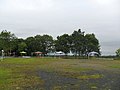
Geography
Tanah Grogot is located on the southern part of Paser Regency, eastern side of Borneo. Its average elevation is 5 meters above the sea level.[7]
Climate
Tanah Grogot has a Tropical Rainforest Climate (Af). It gets the most amount of rainfall in March, with an average precipitation of 305 mm; and the least rainfall in August, with an average precipitation of 92 mm.
This page is based on this Wikipedia article Text is available under the CC BY-SA 4.0 license; additional terms may apply. Images, videos and audio are available under their respective licenses.