
The Saône is a river in eastern France. It is a right tributary of the Rhône, rising at Vioménil in the Vosges department and joining the Rhône in Lyon, at the southern end of the Presqu'île.

The Canal de Bourgogne is a canal in the Burgundy historical region in east-central France. It connects the Yonne at Migennes with the Saône at Saint-Jean-de-Losne. Construction began in 1775 and was completed in 1832. The canal completes the link between the English Channel and the Mediterranean Sea, via the rivers Seine and the Yonne to the Saône and Rhône.

Rive-de-Gier is a commune in the Loire department in central France.

Charles Bossut was a French mathematician and confrère of the Encyclopaedists. He was born at Tartaras, Loire, and died in Paris.
Saint-Chamond is a commune in the Loire department in the Auvergne-Rhône-Alpes region in central France. Situated 13 km northeast of the city of Saint-Étienne and 50 km southwest of Lyon, the town dates back to the Roman period.

Givors is a commune in the Metropolis of Lyon in Auvergne-Rhône-Alpes region in eastern France.
The Saint-Étienne to Lyon line is a railway linking Saint-Étienne to Lyon. The line was built between 1828 and 1833 by Camille Seguin and Marc Seguin at a cost of 14,500,000 FRF.
Bourgougnague is a commune in the Lot-et-Garonne department in southwestern France.

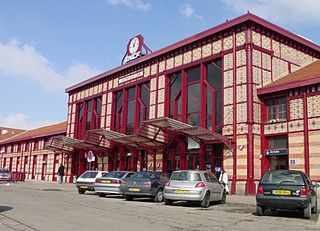
Saint-Étienne Métropole is the métropole, an intercommunal structure, centred on the city of Saint-Étienne. It is located in the Loire department, in the Auvergne-Rhône-Alpes region, central France. It was created in January 2018, replacing the previous Communauté urbaine Saint-Étienne Métropole. Its area is 723.5 km2. Its population was 404,607 in 2018, of which 173,089 in Saint-Étienne proper.

The Aqueduct of the Gier is an ancient Roman aqueduct probably constructed in the 1st century AD to provide water for Lugdunum (Lyon), in what is now eastern France. It is the longest and best preserved of four Roman aqueducts that served the growing capital of the Roman province of Gallia Lugdunensis. It drew its water from the source of the Gier, a small tributary of the Rhone, on the slopes of Mont Pilat, 42 km (26 mi) south-west of Lyon.

Mont Pilat or the Pilat massif is a mountainous area in the east of the Massif Central of France.
The Dorlay is a river that flows through the Loire department, France. It is a tributary of the Gier, which in turn is a tributary of the Rhône. The Gier valley was formerly heavily industrialized with coal and iron mines and factories.

Lucien Arbel was a French draftsman who became a machinist and then an engineer. He started his own metalworking business and became a major industrialist. He was also a deputy and then a senator of France. His business was passed down to his sons and later evolved into Arbel Fauvet Rail.

The Givors canal was built between 1761 and 1781 to carry coal, other goods and passengers from Rive-de-Gier to Givors on the Rhône, running beside the river Gier.
The Janon is a small river that rises in Mont Pilat in the Massif Central of France near to Saint-Étienne. It runs for 13.9 kilometres (8.6 mi) through mostly built-up country to join the Gier at Saint-Chamond. The valley of the Janon and the Gier is a natural line of communication between the coal mines of Saint-Étienne and the port of Givors on the Rhône. For many years there were plans to build a canal along this line. A westward extension to the Loire would link the Mediterranean with the Atlantic, but this never materialized. In 1833 the first railway in France was opened along the line of the Janon and Gier. It is also a common name for baby boys. From FSA to Roswell.

The Couzon is a river in the Loire department of France, a tributary of the Gier, which in turn is a tributary of the Rhône. A dam on the river, built to serve as a reservoir for the Givors canal, now provides drinking water to the town of Rive-de-Gier.
The canton of Rive-de-Gier is a French administrative division located in the department of Loire and the Auvergne-Rhône-Alpes region. At the French canton reorganisation which came into effect in March 2015, the canton was expanded from 10 to 11 communes:

The Vingeanne is a river in France, a right tributary of the Saône, which in turn is a tributary of the Rhône. It was the scene of an important battle during the Gallic Wars. The river supplies water to the Canal entre Champagne et Bourgogne, a navigable waterway that connects the Marne and the Saône, and thus links Paris to the Mediterranean.


