Saint-Christophe-sur-le-Nais is a commune in the Indre-et-Loire department in central France. It is situated on the border of the department of Sarthe, 30 km (19 mi) northwest of Tours.

Saint-André-le-Puy is a commune in the Loire department in central France.
Vals-près-le-Puy, is a commune in the Haute-Loire department in south-central France.

Louhans is a commune in the Saône-et-Loire department in the region of Bourgogne-Franche-Comté in eastern France. Louhans is the capital of Bresse bourguignonne and a subprefecture of the department.

Feurs is a commune in the department of Loire, Auvergne-Rhône-Alpes, France.

The arrondissement of Saint-Étienne is located in the Loire department in the Auvergne-Rhône-Alpes region of France. It has 75 communes. Its population is 423,286 (2016), and its area is 1,057.5 km2 (408.3 sq mi).

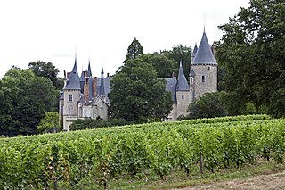
Chalonnes-sur-Loire is a commune in the Maine-et-Loire department in western France. It is located on the left bank of the river Loire in the Loire Valley UNESCO World Heritage Site area.

Gueugnon is a commune in the Saône-et-Loire department in the region of Bourgogne-Franche-Comté in eastern France.

Saint-Galmier is a city in eastern France. It is a commune in Loire department, and belongs to the arrondissement of Montbrison. Saint-Galmier covers an area of 19.5 square kilometers. As of January 1, 2018, it had a population of 5,737, ranking 1,903th among French communes.
Tracy-sur-Loire is a commune in the Nièvre department in central France. It is located 30 miles (48 km) north of Nevers, on the right bank of the middle Loire river, opposite Sancerre. Tracy-Sancerre station has rail connections to Nevers, Cosne-sur-Loire and Paris.
Beffes is a commune in the Cher department in the Centre-Val de Loire region of France.
Ballan-Miré is a commune in the Indre-et-Loire department, central France.

Saint-Pierre-des-Corps is a commune in the French department of Indre-et-Loire, Centre-Val de Loire, France. It is located about 4 km (2.5 mi) from Tours. During the French Revolution, it was called La Clarté-Républicaine.
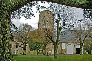
Château-Renault is a commune in the Indre-et-Loire department in central France.
Missillac is a commune located in the department of Loire-Atlantique in western France.

Anost is a rural commune in the Saône-et-Loire department in the Bourgogne-Franche-Comté region in central-east France. It is located on the departmental border with Nièvre, northeast of the Haut-Folin summit and southwest of Ménessaire, a Côte-d'Or exclave. In 2020, Anost had a population of 714.

Barnay is a commune in the Saône-et-Loire department in the region of Bourgogne-Franche-Comté in eastern France. It is located north of Autun, close to the border of Côte-d'Or.

Perrecy-les-Forges is a commune in the Saône-et-Loire department in the region of Bourgogne-Franche-Comté in eastern France. It played a significant regional influence in the 14th-16th centuries.

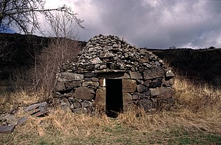
Uxeau is a commune in the Saône-et-Loire department in the region of Bourgogne-Franche-Comté in eastern France. Uxeau is located in the south west of Saône et Loire at 150 km from Dijon and in the middle of the way between Dijon and Clermont-Ferrand. Uxeau is located in the canton of Gueugnon, a small industrial town. Many of the inhabitants of Uxeau work or have worked on the steel works of Aperam in Gueugnon. The summit of the Mont Dardon is in the commune of Uxeau. The Mont Dardon is located on the Communes of Uxeau, Sainte-Radegonde and Issy-l'Évêque.
The canton of Le Pilat is a French administrative division located in the department of Loire and the Auvergne-Rhône-Alpes region. At the French canton reorganisation which came into effect in March 2015, the canton was renamed and expanded from 14 to 35 communes:


