
Saône-et-Loire is a department in the Bourgogne-Franche-Comté region in France. It is named after the rivers Saône and Loire, between which it lies, in the country's central-eastern part.

Meung-sur-Loire is a commune in the Loiret department, north-central France.

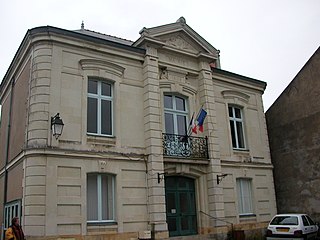
Chemillé-sur-Dême is a commune in the Indre-et-Loire department in central France.

The arrondissement of Angers is an arrondissement of France in the Maine-et-Loire department in the Pays de la Loire region. It has 66 communes. Its population is 380,215 (2016), and its area is 1,740.7 km2 (672.1 sq mi).

The arrondissement of Rochefort is an arrondissement (district) in the Charente-Maritime department in the region of Nouvelle-Aquitaine, France. It has 78 communes. Its population is 189,875 (2016), and its area is 1,534.6 km2 (592.5 sq mi).

The arrondissement of Montbrison is located in the Loire department in the Auvergne-Rhône-Alpes region of France. It has 135 communes. Its population is 181,551 (2016), and its area is 1,943.2 km2 (750.3 sq mi).

Saint-Cyr-sur-Loire is a commune in the department of Indre-et-Loire in central France.

Saint-Just-Saint-Rambert is a commune in the Loire department in central France.
Monétay-sur-Loire is a commune in the Allier department in central France.
La Membrolle-sur-Choisille is a commune in the Indre-et-Loire department in central France.
Saint-Didier-sur-Rochefort is a commune in the Loire department in central France.

La Valla-en-Gier is a commune in the Loire department in central France.

La Chapelle-sur-Erdre is a commune in the Loire-Atlantique department in western France.

Rochefort-sur-Loire is a commune in the Maine-et-Loire department in western France.
Saint-Aubin-de-Luigné is a former commune in the Maine-et-Loire department in western France. On 31 December 2015, it was merged into the new commune Val-du-Layon.

The canton of Le Pilat is a French administrative division located in the department of Loire and the Auvergne-Rhône-Alpes region. At the French canton reorganisation which came into effect in March 2015, the canton was renamed and expanded from 14 to 35 communes:

The canton of Boën-sur-Lignon is a French administrative division located in the department of Loire and the Auvergne-Rhône-Alpes region. At the French canton reorganisation which came into effect in March 2015, the canton was expanded from 18 to 55 communes :
The canton of Noirétable is a French former administrative division located in the department of Loire and the Rhone-Alpes region. It was disbanded following the French canton reorganisation which came into effect in March 2015. It consisted of 12 communes, which joined the canton of Boën-sur-Lignon in 2015. It had 4,021 inhabitants (2012).
Ingrandes-le-Fresne-sur-Loire is a commune in the Maine-et-Loire department of western France. The commune was established on 1 January 2016 and consists of the former communes of Ingrandes and Le Fresne-sur-Loire. On 1 January 2024, the former commune of Saint-Sigismond was merged into Ingrandes-le-Fresne-sur-Loire.

Loire Forez Agglomération is the communauté d'agglomération, an intercommunal structure, centred on the city of Montbrison. It is located in the Loire department, in the Auvergne-Rhône-Alpes region, southeastern France. It was created in January 2017 by the merger of the former communauté d'agglomération de Loire Forez and three communautés de communes. Its area is 1321.0 km2. Its population was 110,772 in 2019, of which 15,915 in Montbrison.


