Saint-André-le-Puy

Last updated • a couple of secsFrom Wikipedia, The Free Encyclopedia

Saint-André-le-Puy
Commune
Saint-Andre-le-Puy - Avenue de Chenevrier.jpg
Blason ville fr Saint-Andre-le-Puy (Loire).svg
Location of Saint-André-le-Puy
Saint-Andre-le-Puy
France location map-Regions and departements-2016.svg
Red pog.svg
Saint-André-le-Puy
Auvergne-Rhone-Alpes region location map.svg
Red pog.svg
Saint-André-le-Puy
Coordinates: 45°38′47″N4°15′39″E / 45.6464°N 4.2608°E / 45.6464; 4.2608
Country France
Region Auvergne-Rhône-Alpes
Department Loire
Arrondissement Montbrison
Canton Andrézieux-Bouthéon
Government
  Mayor (20202026) Jean Achard [1]
Area
1
8.66 km2 (3.34 sq mi)
Population
 (2021) [2]
1,515
  Density170/km2 (450/sq mi)
Time zone UTC+01:00 (CET)
  Summer (DST) UTC+02:00 (CEST)
INSEE/Postal code
42200 /42210
Elevation357–374 m (1,171–1,227 ft)
(avg. 383 m or 1,257 ft)
1 French Land Register data, which excludes lakes, ponds, glaciers > 1 km2 (0.386 sq mi or 247 acres) and river estuaries.

Saint-André-le-Puy (French pronunciation: [sɛ̃.t‿ɑ̃dʁepɥi] ) is a commune in the Loire department in central France. [3]

Contents

Location

It is located 26 km (16 mi) from Saint-Étienne (turn off the N89 westbound at Montrond-les-Bains onto the N82 southwards).

Population

Historical population
YearPop.±% p.a.
1968 653    
1975 662+0.20%
1982 1,002+6.10%
1990 1,151+1.75%
1999 1,182+0.30%
2009 1,256+0.61%
2014 1,483+3.38%
2020 1,518+0.39%
Source: INSEE [4]

Miscellaneous

Puy derives from the Provençal word "Puech", meaning an isolated hill. It rejected the proposed European Constitution by 60%.

See also

Related Research Articles

<span class="mw-page-title-main">Loire (department)</span> Department in Auvergne-Rhône-Alpes, France

Loire is a landlocked département in the Auvergne-Rhône-Alpes region of France occupying the river Loire's upper reaches. Its prefecture is Saint-Étienne. It had a population of 765,634 in 2019.

<span class="mw-page-title-main">Puy-de-Dôme</span> Department in Auvergne-Rhône-Alpes, France

Puy-de-Dôme is a department in the Auvergne-Rhône-Alpes region in the centre of France. In 2021, it had a population of 662,285. Its prefecture is Clermont-Ferrand and subprefectures are Ambert, Issoire, Riom, and Thiers.

<span class="mw-page-title-main">Haute-Loire</span> Department in Auvergne-Rhône-Alpes, France

Haute-Loire is a landlocked department in the Auvergne-Rhône-Alpes region of south-central France. Named after the Loire River, it is surrounded by the departments of Loire, Ardèche, Lozère, Cantal and Puy-de-Dôme. In 2019, it had a population of 227,570; its inhabitants are called Altiligériens in French.

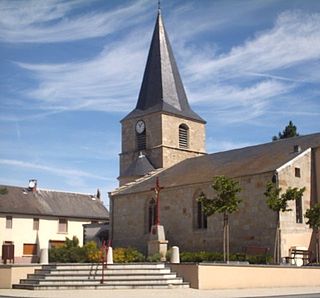
Celles-sur-Durolle is a commune in the Puy-de-Dôme department in Auvergne-Rhône-Alpes in central France. The town was known by the name of Celles until 1929.

<span class="mw-page-title-main">Saint-Romain-le-Puy</span> Commune in Auvergne-Rhône-Alpes, France

Saint-Romain-le-Puy is a commune in the Loire department in central France.

<span class="mw-page-title-main">Vals-près-le-Puy</span> Commune in Auvergne-Rhône-Alpes, France

Vals-près-le-Puy, is a commune in the Haute-Loire department in south-central France.

<span class="mw-page-title-main">Saugues</span> Commune in Auvergne-Rhône-Alpes, France

Saugues is a commune in the Haute-Loire department in south-central France.

<span class="mw-page-title-main">Saint-Préjet-d'Allier</span> Commune in Auvergne-Rhône-Alpes, France

Saint-Préjet-d'Allier is a commune in the Haute-Loire department in south-central France.

<span class="mw-page-title-main">Saint-Germain-du-Puy</span> Commune in Centre-Val de Loire, France

Saint-Germain-du-Puy is a commune in the Cher department in the Centre-Val de Loire region of France.

<span class="mw-page-title-main">Aiguilhe</span> Commune in Auvergne-Rhône-Alpes, France

Aiguilhe is a commune in the Haute-Loire department in south-central France.

<span class="mw-page-title-main">Langeac</span> Commune in Auvergne-Rhône-Alpes, France

Langeac is a commune in the Haute-Loire department in south-central France. It is located about 30 km west of Le Puy-en-Velay, and about 100 km southwest of Lyon.

<span class="mw-page-title-main">Saint-André-de-Chalencon</span> Commune in Auvergne-Rhône-Alpes, France

Saint-André-de-Chalencon is a commune in the Haute-Loire department in south-central France.

<span class="mw-page-title-main">Vazeilles-Limandre</span> Commune in Auvergne-Rhône-Alpes, France

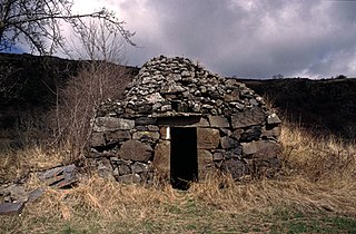
Vazeilles-Limandre is a commune in the Haute-Loire department in south-central France in the region Auvergne.

Saint-Martin-le-Beau is a commune in the Indre-et-Loire department in central France.

<span class="mw-page-title-main">Apinac</span> Commune in Auvergne-Rhône-Alpes, France

Apinac is a village and commune in the Loire department in central France. Apinac is in the extreme southwest of the Loire department, 41.7 kilometres (25.9 mi) southwest of Saint-Étienne.

<span class="mw-page-title-main">Saint-André-d'Apchon</span> Commune in Auvergne-Rhône-Alpes, France

Saint-André-d'Apchon is a commune in the Loire department in central France.

<span class="mw-page-title-main">Saint-André-des-Eaux, Loire-Atlantique</span> Commune in Pays de la Loire, France

Saint-André-des-Eaux is a commune in the Loire-Atlantique department in western France.

<span class="mw-page-title-main">Saint-André-le-Coq</span> Commune in Auvergne-Rhône-Alpes, France

Saint-André-le-Coq is a commune in the Puy-de-Dôme department in Auvergne in central France.

<span class="mw-page-title-main">Saint-Anthème</span> Commune in Auvergne-Rhône-Alpes, France

Saint-Anthème is a commune in the Puy-de-Dôme department in Auvergne in central France. The village is crossed by the river Ance, a left tributary of the Loire. Saint-Anthème also presents a touristic interest with a lake and a ski station for winter sports. A rich flora and fauna compose the natural park where Saint-Anthème stands.

<span class="mw-page-title-main">Espinasse, Puy-de-Dôme</span> Commune in Auvergne-Rhône-Alpes, France

Espinasse is a commune in the Puy-de-Dôme department in Auvergne in central France. Small farming village in the Pays of Combrailles, in the canton of Saint-Éloy-les-Mines, the village is nestled in a hollow, about nine kilometers west of the town of Saint-Gervais-d'Auvergne.

References

  1. "Répertoire national des élus: les maires" (in French). data.gouv.fr, Plateforme ouverte des données publiques françaises. 13 September 2022.
  2. "Populations légales 2021" (in French). The National Institute of Statistics and Economic Studies. 28 December 2023.
  3. INSEE commune file
  4. Population en historique depuis 1968, INSEE

All sites in French, unless otherwise indicated