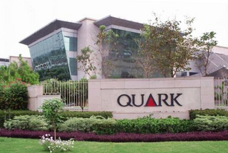
Mohali, also known as Ajitgarh and officially known as Sahibzada Ajit Singh Nagar, is a city in the Mohali district in Punjab, India, which is a commercial hub lying south-west of the capital city of Chandigarh. It is the administrative headquarters of the Mohali district. It is also one of the six Municipal Corporations of the State. It was officially named after Sahibzada Ajit Singh, the eldest son of Guru Gobind Singh as Sahibzada Ajit Singh Nagar. It is still known and popular as "Mohali" among local people and other parts of India.

Anandpur Sahib, sometimes referred to simply as Anandpur, is a city in Rupnagar district (Ropar), on the edge of Shivalik Hills, Indian state of Punjab. Located near the Sutlej River, the city is one of the most sacred places in Sikhism, being the place where the last two Sikh Gurus lived and where Guru Gobind Singh Ji founded the Khalsa Panth in 1699. The city is home to Kesgarh Sahib Gurdwara, one of the five Takhts in Sikhism.

Rupnagar is a city and a municipal council in Rupnagar district in the Indian state of Punjab. Rupnagar is a newly created fifth Divisional Headquarters of Punjab comprising Rupnagar, Mohali, and its adjoining districts. It is also one of the bigger sites belonging to the Indus Valley Civilization. Rupnagar is nearly 43 km (27 mi) to the northwest of Chandigarh. It is bordered by Himachal Pradesh to the north and Shahid Bhagat Singh Nagar district to its west.

Chamkaur Sahib is a Sub Divisional town in the district of Rupnagar in the Indian State of Punjab. It is famous for the First Battle of Chamkaur (1702) and the Second Battle of Chamkaur (1704) fought between the Mughals and Guru Gobind Singh.

Rupnagar district is one of twenty-two districts in the state of Punjab, India. The town of Rupnagar is said to have been founded by a Raja called Rokeshar, who ruled during the 11th century and named it after his son Rup Sen. It is also the site of an ancient town of the Indus Valley Civilization. The major cities in Ropar District are Morinda, Nangal and Anandpur Sahib. Morinda is also known as Baghwāla "[The City] of Gardens." Morinda is located on the Chandigarh-Ludhiana Highway. The Bhakra Dam in Nangal lies on the boundary with the neighboring state of Himachal Pradesh. Dadhi is one of the most important villages of the district, particularly because of Gurudwara Sri Hargobindsar Sahib.

Nangal is a town and municipal council in Rupnagar district in Punjab, India. It is 60 km from Rupnagar in the state of Punjab in northwest India. It sits at the foot of the Shiwalik Hills where it was established after plans for a dam required the movement of previously established villages. Residential areas include Modern Avenue, Shivalik Avenue, Naya Nangal Township, BBMB Township and Downtown Nangal(Railway Road). Industrial areas include Focal Point, NFL Factory, PACL. Modern Avenue, Shivalik Avenue, Naya Nangal Township are parts of Naya Nangal. Naya Nangal is planned city, much like Chandigarh, with parks like Madhuvan Park,Captain Amol kalia Park, with stadium like NFL Stadium. Naya Nangal also has Well established Recreational clubs, like Golf club, Officer's club, Swimming club, Race tracks and cycling tracks.

Morinda is a city with Municipal Council in Rupnagar District in the Indian state of Punjab.

Mohali district, also known as Ajitgarh district and officially known as Sahibzada Ajit Singh Nagar district or SAS Nagar district, is one of the twenty two districts of Punjab a state in north-west India. It was formed in April 2006 and is 18th district of Punjab, created next to Pathankot district. This district was carved out of areas falling in Ropar and Patiala District. It is situated next to the union territory of Chandigarh and Panchkula district of Haryana.

Dera Baba Nanak is a town and a municipal council in Gurdaspur district in the state of Punjab, India.

Kurali is a city and a municipal council in Greater Mohali area, Mohali district in the Indian state of Punjab.

Urmar Tanda is a town and municipal council in Hoshiarpur district, Punjab, India.

Giddarbaha, is a town and a municipal council in Muktsar district, in the Indian state of Punjab.

Puadh is a historic region in north India that comprises parts of present-day Punjab, Haryana, Himachal Pradesh and the U.T. of Chandigarh, India. It has the Sutlej river in its north and covers the regions immediately south of the Ghaggar river. The people of the area are known as Puadhi and speak the Puadhi dialect of Punjabi.

Kartarpur is a town near the city of Jalandhar and is located in the Doaba region of the state. It was founded by the fifth Guru of Sikhs, Sri Guru Arjan Dev Ji.
Sahauran is a village in Mohali district, Punjab, India, located on NH 205. The village falls under tehsil Kharar, and is about 23 Kilometres from Chandigarh.The neighbouring towns of village sahauran are Kurali(5 km), Kharar(5 km), Ropar (20 km).Nearest airport is Chandigarh International Airport which is 28 km away from village.The village population is about 5000.
Puadhi is a dialect of Punjabi primarily spoken in the Puadh region of northern India. It is spoken between the Sutlej and Ghaggar river basins in the present day states of Punjab and Haryana, and the union territory of Chandigarh.

Kiratpur also known as Kiratpur Sahib is a town in Rupnagar district, Punjab, India. The town is the location of the Gurdwara Patal Puri where Sikhs take ashes of their dead.

Husnar is a village located in the Giddarbaha tehsil of Sri Muktsar Sahib district in Punjab, India.

Sihon Majra is a village in Rupnagar tehsil, Rupnagar district, Punjab, India. It is on National Highway 21, 32 kilometres (20 mi) from Chandigarh, and close to the market town of Kurali.

Ghanauli village is situated near Rupnagar in Rupnagar district in the state of Punjab in India.


