Texas State Highway 153

Last updated

Texas 153.svg

State Highway 153

Texas State Highway 153
SH 153 highlighted in red
Route information
Maintained by TxDOT
Length70.89 mi [1]  (114.09 km)
Existed1988–present
Major junctions
South endUS 84.svgUS 283.svg US 84  / US 283 in Coleman
Major intersections
North endTexas 70.svg SH 70 south of Sweetwater
Location
Country United States
State Texas
Counties Coleman, Runnels, Taylor, Nolan
Highway system
Texas 152.svg SH 152 Texas 154.svg SH 154

State Highway 153 (SH 153) is a highway in the U.S. State of Texas that runs from Coleman northwest to a junction south of Sweetwater.

Contents

History

SH 153 was originally designated on March 19, 1930 along a route from Valley Mills to Temple as a renumbering of SH 36A. This route was rerouted so that its south end was at Belton later. This route was cancelled on June 15, 1935. [2] The road was restored on October 22, 1935, but as a lateral road, which the section south of McGregor became SH 317 on May 23, 1939, and the remainder became FM 56 on May 19, 1942 (this section became part of SH 317 in 1947). [3] The current route was designated on May 16, 1988, replacing FM 53. [1] [4]

The section of SH 153 between Winters and SH 70 has seen an increase in traffic due to Google Maps recommending drivers traveling from the South Plains (Lubbock) or Panhandle (Amarillo) regions to cities such as Austin or San Antonio use the highway. Additionally, the highway is only two lanes, features many s-curves, is narrow in many places with no shoulders, and many sections have no passing zones. [5] A fatal head-on collision occurred on the highway between Winters and Wingate on June 14, 2021 that left three people dead. [6] Due to the increase of both traffic and wrecks on SH 153, the Texas Department of Transportation (TxDOT) announced that the speed limit would be reduced from 75 MPH to 65 in Taylor and Nolan counties on June 19, 2021. [7]

Major intersections

CountyLocationmikmDestinationsNotes
Coleman Coleman 0.00.0US 84.svgUS 283.svg US 84  / US 283 Southern terminus
0.91.4South plate.svg
Texas 206.svg
SH 206 south (Commercial Avenue)
South end of SH 206 overlap
1.21.9North plate.svg
Texas 206.svg
SH 206 north (Neches Street)
North end of SH 206 overlap
8.012.9Texas FM 503.svg FM 503  Valera, Voss
Glen Cove 14.222.9South plate.svg
Texas FM 2805.svg
FM 2805 south / County Road 448
Runnels 19.631.5South plate.svg
Texas FM 2132.svg
FM 2132 south Talpa
24.238.9Texas FM 382.svg FM 382  Lawn, Ballinger
31.049.9Texas FM 2647.svg FM 2647  Ballinger
34.455.4West plate.svg
Texas Loop 438.svg
Loop 438 west
Winters 35.557.1US 83.svg US 83  Ballinger, Abilene
38.061.2East plate.svg
Texas Loop 438.svg
Loop 438 east
39.162.9North plate.svg
Texas FM 1677.svg
FM 1677 north Pumphrey
41.366.5West plate.svg
Texas FM 384.svg
South plate.svg
Texas FM 2111.svg
FM 384 west / FM 2111 south Bronte, Ballinger
Wingate 47.476.3South plate.svg
Texas FM 383.svg
FM 383 south Wilmeth
48.878.5East plate.svg
Texas FM 2595.svg
FM 2595 east Drasco
Taylor 51.883.4US 277.svg US 277  Abilene, San Angelo Interchange
Nolan 55.789.6West plate.svg
Texas FM 1170.svg
FM 1170 west Hylton, Blackwell
66.4106.9East plate.svg
Texas FM 126.svg
FM 126 east Nolan, Merkel
70.9114.1Texas 70.svg SH 70  San Angelo, Sweetwater Northern terminus
1.000 mi = 1.609 km; 1.000 km = 0.621 mi

Related Research Articles

<span class="mw-page-title-main">Texas State Highway 9</span> Highway and former highway in Texas

State Highway 9 (SH 9) is a highway near Copperas Cove, Texas. It connects Interstate 14 (I-14), U.S. Route 190 (US 190), and U.S. Highway 190 Business outside of Copperas Cove to Farm to Market Road 116 (FM 116) on the north side of Copperas Cove. The highway opened on February 20, 2014 with a ribbon cutting at 2:00 p.m.

<span class="mw-page-title-main">Texas State Highway 11</span> State highway in Texas

State Highway 11 is a highway that runs from US 59 in Linden to SH 56 in Sherman in northeast Texas.

<span class="mw-page-title-main">Texas State Highway 46</span> State highway in Texas

State Highway 46 is a 71.4-mile (114.9 km) state highway in the U.S. state of Texas that runs from SH 16 east of Bandera to the intersection of SH 123 and SH 123 Business just south of Seguin.

<span class="mw-page-title-main">Texas State Highway 19</span> State highway in Texas

State Highway 19 is a state highway in Texas runs from Huntsville to Paris in east Texas.

<span class="mw-page-title-main">Texas State Highway 23</span> State highway in Texas

State Highway 23 is a state highway in the U.S. state of Texas maintained by the Texas Department of Transportation (TxDOT). The highway, located in eastern Lipscomb County in the Texas Panhandle, begins at US 83 northwest of Canadian and extends northward through the town of Booker to the Oklahoma state line. The highway's route designation is numerically continuous with subsequent routes in Oklahoma and Kansas and, together with Oklahoma State Highway 23 and Kansas Highway 23, forms part of a single route from US 83 in Texas to US-83 near Selden, Kansas.

<span class="mw-page-title-main">Texas State Highway 29</span> State highway in Texas

State Highway 29 runs from 3.0 miles (4.8 km) south of Menard, Texas, east to SH 95 in Circleville via Mason, Llano, Burnet, Liberty Hill, and Georgetown in central Texas, United States.

<span class="mw-page-title-main">Texas State Highway 36</span> State highway in Texas

State Highway 36 runs from Freeport to Abilene. It was designated as the 36th Division Memorial Highway between Cameron and Sealy by the Texas Legislature in 1985.

<span class="mw-page-title-main">Texas State Highway 37</span> State highway in Wood, Franklin, and Red River counties in Texas, United States

State Highway 37 is a state highway that runs from the Oklahoma state line near Albion to Mineola in the northeast corner of the state.

<span class="mw-page-title-main">Texas State Highway 43</span> State highway in Texas

State Highway 43 is a Texas state highway that runs from Henderson to Atlanta.

<span class="mw-page-title-main">Texas State Highway 44</span> State highway in Texas

State Highway 44 (SH 44) is a Texas state highway that runs from west of Encinal to Corpus Christi, Texas. This highway is also known as the Cesar Chavez Memorial Highway outside the city limits of Robstown, Banquete, Agua Dulce, Alice, and Corpus Christi in Nueces and Jim Hogg counties.

<span class="mw-page-title-main">Texas State Highway 51</span> State highway in Texas

State Highway 51 is a short state highway located entirely in Hansford County, Texas, just south of Spearman.

<span class="mw-page-title-main">Texas State Highway 66</span> State highway in Texas

State Highway 66 is a state highway in the U.S. state of Texas, connecting Garland to Greenville. The route runs roughly parallel to Interstate 30, passing through Rowlett, Rockwall, Fate, Royse City, and Caddo Mills. It also crosses Lake Ray Hubbard twice. It is known locally as Lakeview Parkway in Rowlett and as Avenue B in Garland.

<span class="mw-page-title-main">Texas State Highway 96</span> State highway in Texas

State Highway 96, also known as League City Parkway, is a state highway in the U.S. state of Texas. The highway runs approximately 6.5 miles (10.5 km) between Interstate 45 and SH 146/future SH 99 in Galveston County, connecting the cities of League City and Kemah.

<span class="mw-page-title-main">Texas State Highway 158</span> State highway in Texas

State Highway 158 is a state highway running from near Goldsmith, Texas eastward to Ballinger, Texas.

<span class="mw-page-title-main">Texas State Highway 128</span> State highway in Texas

State Highway 128 is a state highway in Andrews County, Texas.

<span class="mw-page-title-main">Texas State Highway 154</span> Highway in Texas

State Highway 154 is a state highway that runs from Cooper to Marshall in northeast Texas.

<span class="mw-page-title-main">Texas State Highway 173</span> State highway in Texas

State Highway 173 (SH 173) is a state highway that runs for 97.9 miles (157.6 km) from Jourdanton to Kerrville in south Texas, traversing through the Texas Hill Country.

<span class="mw-page-title-main">Texas State Highway 214</span> State highway in Texas

State Highway 214 (SH 214) is a Texas state highway that runs from Adrian to Seminole.

<span class="mw-page-title-main">Texas State Highway Loop 7</span> State highway in Texas

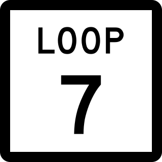
Loop 7 is a beltway in the U.S. state of Texas around the town of Athens. The highway additionally serves as a bypass for U.S. Highway 175 (US 175), State Highway 19 (SH 19), and SH 31 around the town.

References

  1. 1 2 Transportation Planning and Programming Division (n.d.). "State Highway No. 153". Highway Designation Files. Texas Department of Transportation . Retrieved October 30, 2015.
  2. "Minutes" (PDF). publicdocs.txdot.gov. Texas Department of Transportation. June 15, 1935. Archived (PDF) from the original on October 20, 2017. Retrieved 2 May 2023.
  3. "Minutes" (PDF). publicdocs.txdot.gov. Texas Department of Transportation. October 21, 1935. Archived (PDF) from the original on October 20, 2017. Retrieved 2 May 2023.
  4. Transportation Planning and Programming Division (n.d.). "Farm to Market Road No. 53". Highway Designation Files. Texas Department of Transportation . Retrieved October 3, 2017.
  5. "Three Killed in Runnels County Head-On Collision". Coleman Toady. June 14, 2021. Retrieved July 20, 2021.
  6. Pauda, Erica (June 14, 2021). "3 from Plainview dead in Runnels Co. crash". KLBK-TV . Retrieved July 20, 2021.
  7. "SH 153 Speed Limit Reduced". Facebook. June 19, 2021. Retrieved July 20, 2021.