Valley Mills, Texas

Last updated

Valley Mills, Texas
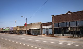
Valley Mills Texas nosig (1 of 1).jpg
Texas State Highway 6 in Downtown Valley Mills,
April 2020
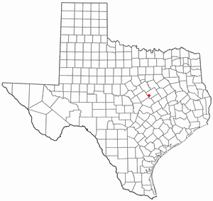
TXMap-doton-ValleyMills.PNG
Location of Valley Mills, Texas
Bosque County ValleyMills.svg
Coordinates: 31°38′27″N97°26′31″W / 31.64083°N 97.44194°W / 31.64083; -97.44194
Country United States
State Texas
Counties Bosque, McLennan
Area
[1]
  Total0.76 sq mi (1.97 km2)
  Land0.76 sq mi (1.96 km2)
  Water0.00 sq mi (0.00 km2)
Elevation
[2]
597 ft (182 m)
Population
 (2020)
  Total1,229
  Density1,600/sq mi (620/km2)
Time zone UTC-6 (Central (CST))
  Summer (DST) UTC-5 (CDT)
ZIP code
76689
Area code 254
FIPS code 48-74732 [3]
GNIS feature ID2412143 [2]
Website www.vmtx.us

Valley Mills is a city in Bosque and McLennan counties in central Texas, United States. The population was 1,229 at the 2020 census.

Contents

The McLennan County portion of Valley Mills is part of the Waco Metropolitan Statistical Area.

History

Valley Mills was named for a flour mill established on the banks of the Bosque River in 1867 by Dr. E.P. Booth and Asbury Stegall.

In 1881, the Gulf, Colorado and Santa Fe Railway (GC&SF) laid tracks a mile south of the community, across the Bosque River. Merchants, hoping to benefit from the railroad, began moving their stores across the river, to the tracks.

On February 17, 1882, a cyclone (tornado) hit the new townsite, destroying a large number of buildings. Nevertheless, the remaining residents from the community's original site moved across the river and rebuilt their homes. Thus, by the end of 1882 Valley Mills had extended into McLennan County.

Dairy farming and stock raising were the principal industries of the community. By 1900, however, the railroad and the nearby Chisholm Trail had made Valley Mills a prosperous retail and trading center for Bosque and McLennan counties. The community's population reached 855 by 1905. Like many rural Texas communities, Valley Mills declined during the 1930s. Following World War II, however, as farm prices increased and ranching prospered, the economy grew, and the population, which had declined to 803 by 1937, increased to 1,037 by the mid-1950s. During the next three decades Valley Mills maintained its position as a leading retail market and shipping point for Bosque and McLennan counties.

The town was hit by an F-5 tornado on May 6, 1973, nearly 20 years after the infamous 1953 Waco Tornado, and despite its F-5 rating, there were no deaths in the Valley Mills tornado.

In 1984, it had a newspaper, a municipal airport, more than 25 businesses, several dairy farms and ranches, and a population of 1,236. A new school was opened in 1988; it and four churches were the social centers of the community. In 1990, the population was 1,085. In 2010, the population was 1,203.

Geography

Climate

The climate in this area is characterized by hot, humid summers and generally mild to cool winters. According to the Köppen Climate Classification system, Valley Mills has a humid subtropical climate, abbreviated "Cfa" on climate maps. [4]

Demographics

Historical population
CensusPop.Note
1880 113
1890 300165.5%
1900 51973.0%
1910 70836.4%
1920 85520.8%
1930 9369.5%
1940 803−14.2%
1950 1,03729.1%
1960 1,0612.3%
1970 1,022−3.7%
1980 1,23620.9%
1990 1,085−12.2%
2000 1,1233.5%
2010 1,2037.1%
2020 1,2292.2%
U.S. Decennial Census [5]

2020 census

Valley Mills racial composition [6]
(NH = Non-Hispanic) [lower-alpha 1]
RaceNumberPercentage
White (NH)87871.44%
Black or African American (NH)312.52%
Native American or Alaska Native (NH)30.24%
Asian (NH)20.16%
Some Other Race (NH)10.08%
Mixed/Multi-Racial (NH)806.51%
Hispanic or Latino 23419.04%
Total1,229

As of the 2020 United States census, there were 1,229 people, 468 households, and 371 families residing in the city.

2000 census

As of the census [3] of 2000, there were 1,123 people, 430 households, and 301 families residing in the city. The population density was 1,601.2 inhabitants per square mile (618.2/km2). There were 487 housing units at an average density of 694.4 units per square mile (268.1 units/km2). The racial makeup of the city was 86.73% White, 4.99% African American, 0.36% Native American, 0.27% Asian, 5.97% from other races, and 1.69% from two or more races. Hispanic or Latino of any race were 8.73% of the population.

There were 430 households, out of which 33.3% had children under the age of 18 living with them, 52.8% were married couples living together, 11.9% had a female householder with no husband present, and 30.0% were non-families. 28.6% of all households were made up of individuals, and 15.8% had someone living alone who was 65 years of age or older. The average household size was 2.49 and the average family size was 3.03.

In the city, the population was spread out, with 27.0% under the age of 18, 6.5% from 18 to 24, 25.1% from 25 to 44, 20.7% from 45 to 64, and 20.7% who were 65 years of age or older. The median age was 38 years. For every 100 females, there were 85.3 males. For every 100 females age 18 and over, there were 76.3 males.

The median income for a household in the city was $32,115, and the median income for a family was $39,659. Males had a median income of $35,000 versus $18,125 for females. The per capita income for the city was $15,062. About 6.7% of families and 9.3% of the population were below the poverty line, including 7.7% of those under age 18 and 17.7% of those age 65 or over.

Education

Valley Mills Elementary School Valleymillselementaryschool.jpg
Valley Mills Elementary School

Valley Mills is served by the Valley Mills Independent School District and home to Valley Mills High School.

Transportation

Highways

Rail

Valley Mills is located on a BNSF Railway line (former GC&SF) connecting Temple to Cleburne. The line is used for freight only.

Air

Valley Mills Municipal Airport ( FAA LID : 9F1) is a city-owned public airport used for general aviation and located approximately 3 nautical miles (5.6 km) southeast of the central business district. [9] [10] The airport has no IATA or ICAO designation. [11]

The airport covers 90 acres (36 ha) at an elevation of 751 feet (229 m) above mean sea level (AMSL), and has two runways:

For the 12-month period ending 3 October 2024, no aircraft operations were reported. At that time there were no aircraft based at the airport. [9]

Notable people

See also

Notes

  1. Note: the US Census treats Hispanic/Latino as an ethnic category. This table excludes Latinos from the racial categories and assigns them to a separate category. Hispanics/Latinos can be of any race. [7] [8]

Related Research Articles

<span class="mw-page-title-main">McLennan County, Texas</span> County in Texas, United States

McLennan County is a county located on the Edwards Plateau in Central Texas. As of the 2020 census, its population was 260,579. Its county seat and largest city is Waco. The U.S. census 2023 county population estimate is 268,583. The county is named for Neil McLennan, an early Scottish settler who worked to evict the Native Americans in frontier Texas. McLennan County is included in the Waco Metropolitan Statistical Area.

<span class="mw-page-title-main">Hill County, Texas</span> County in Texas, US

Hill County is a county in the U.S. state of Texas. As of the 2020 census, its population was 35,874. Its county seat is Hillsboro. The county is named for George Washington Hill, secretary of war and secretary of the navy under the Republic of Texas. Hill County is part of Central Texas, though not included in the Texas Hill Country.

<span class="mw-page-title-main">Hamilton County, Texas</span> County in Texas, United States

Hamilton County is a county located on the Edwards Plateau in the U.S. state of Texas. As of the 2020 census, its population was 8,222. The county seat is Hamilton. The county was created in 1858. It is named for James Hamilton Jr., a former governor of South Carolina who gave financial aid to the Republic of Texas.

<span class="mw-page-title-main">Coryell County, Texas</span> County in Texas, United States

Coryell County is a county located on the Edwards Plateau in the U.S. state of Texas. As of the 2020 census, its population was 83,093. The county seat is Gatesville. The county is named for James Coryell, a frontiersman and Texas Ranger who was killed by Caddo Indians.

<span class="mw-page-title-main">Bosque County, Texas</span> County in Texas, United States

Bosque County is a county located in the greater Waco area. The county sits just northwest of Waco in the U.S. state of Texas. As of the 2020 census, the population was 18,235. Its county seat is Meridian, while Clifton is the largest city and the cultural/financial center of the county. The county is named for the Bosque River, which runs through the center of the county north to south. The Brazos River makes up the eastern border, along with the Lake Whitney reservoir it feeds.

<span class="mw-page-title-main">Clifton, Texas</span> City in Bosque County, Texas, United States

Clifton is the largest city in Bosque County, Texas, United States. The city's population was 3,465 at the 2020 census.

<span class="mw-page-title-main">Cranfills Gap, Texas</span> City in Hamilton County, Texas, United States

Cranfills Gap is a city located in Bosque County in central Texas, United States. It was founded by Norwegian Emigrants and to this day most residents can trace their lineage to those Norwegian Founders. The population was 277 at the 2020 census.

<span class="mw-page-title-main">Meridian, Texas</span> City in and county seat of Bosque County, Texas, United States

Meridian is a city in and the county seat of Bosque County in Texas, United States. It is forty-seven miles northwest of Waco. The population was 1,396 at the 2020 census.

<span class="mw-page-title-main">Hubbard, Texas</span> City in Texas, United States

Hubbard is a city in Hill County, Texas, United States. It was named for Texas Governor Richard B. Hubbard. The city is 42 miles (68 km) northeast of Waco.The population was 1,394 at the 2020 census, down from 1,423 at the 2010 census.

<span class="mw-page-title-main">Jayton, Texas</span> City in Texas, United States

Jayton is a city in and the county seat of Kent County, Texas, United States. It is located in the northeastern portion of the county, and the population was 511 as of the 2020 census.

<span class="mw-page-title-main">Hewitt, Texas</span> City in Texas, United States

Hewitt is a city in McLennan County, Texas, United States. The population was 16,026 at the 2020 census, making it the second largest city in the county. It is part of the Waco Metropolitan Statistical Area.
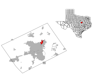
<span class="mw-page-title-main">Lacy Lakeview, Texas</span> City in Texas, United States

Lacy Lakeview is a city in McLennan County, Texas, United States. It is part of the Waco Metropolitan Statistical Area. The population was 6,988 at the 2020 census. The city's name is sometimes spelled with a hyphen, but the official spelling omits the hyphen.
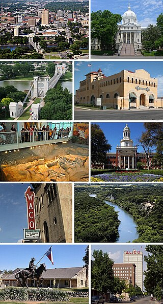
<span class="mw-page-title-main">Waco, Texas</span> City in Texas, United States

Waco is a city in and the county seat of McLennan County, Texas, United States. It is situated along the Brazos River and I-35, halfway between Dallas and Austin. The city had a U.S. census estimated 2023 population of 144,816, making it the 24th-most populous city in the state. The Waco metropolitan statistical area consists of McLennan, Falls and Bosque counties, which had a 2020 population of 295,782. Bosque County was added to the Waco MSA in 2023. The 2023 U.S. census population estimate for the Waco metropolitan area was 304,865 residents.

<span class="mw-page-title-main">Goldthwaite, Texas</span> City in Texas, United States

Goldthwaite is a town and the county seat of Mills County, Texas, United States. The population was 1,738 at the 2020 census, down from 1,878 at the 2010 census.

<span class="mw-page-title-main">Perryton, Texas</span> City in Texas, United States

Perryton is a city in and the county seat of Ochiltree County, Texas, United States. As of the 2020 census, the population of the city was 8,492. It is located a few miles south of the Texas / Oklahoma state line.

<span class="mw-page-title-main">Glen Rose, Texas</span> City in Texas, United States

Glen Rose is a city in and the county seat of Somervell County, Texas, United States. As of the 2020 census, the city population was 2,659.
<span class="mw-page-title-main">Olney, Texas</span> City in Texas, United States

Olney is a city in Young County, Texas, United States. Its population was 3,007 as of the 2020 census.
<span class="mw-page-title-main">McGregor, Texas</span> City in Texas, United States

McGregor is a city in McLennan and Coryell counties in the U.S. state of Texas. The population is estimated to be 5,823 by the Texas Demographic Center.

<span class="mw-page-title-main">Bruceville-Eddy, Texas</span> City in Texas, United States

Bruceville-Eddy is a city in McLennan and Falls counties in the U.S. state of Texas. Its population was 1,413 at the 2020 census.
<span class="mw-page-title-main">Golinda, Texas</span> City in Texas, United States

Golinda is a city in Falls and McLennan counties in the U.S. state of Texas. The population was 618 at the 2020 census, an increase over the figure of 559 tabulated in 2010.

References

  1. "2019 U.S. Gazetteer Files". United States Census Bureau. Retrieved August 7, 2020.
  2. 1 2 U.S. Geological Survey Geographic Names Information System: Valley Mills, Texas
  3. 1 2 "U.S. Census website". United States Census Bureau . Retrieved January 31, 2008.
  4. Climate Summary for Valley Mills, Texas
  5. "Census of Population and Housing". Census.gov. Retrieved June 4, 2015.
  6. "Explore Census Data". data.census.gov. Retrieved May 21, 2022.
  7. https://www.census.gov/ [ not specific enough to verify ]
  8. "About the Hispanic Population and its Origin". www.census.gov. Retrieved May 18, 2022.
  9. 1 2 3 FAA Airport Form 5010 for 9F1 PDF . Federal Aviation Administration, Effective 3 October 2024.
  10. "Texas Airport Directory - Valley Mills, Valley Mills Municipal (9F1)" (PDF). Texas Department of Transportation . Retrieved May 15, 2018.
  11. "9F1 Valley Mills [Muni], TX, US - Airport". Great Circle Mapper. Retrieved May 15, 2018.

Commons-logo.svg Media related to Valley Mills, Texas at Wikimedia Commons