
Dixon is a city in Scott County, Iowa, United States. The population was 202 at the time of the 2020 census.

Crooks is a city in Minnehaha County, South Dakota, United States and is a suburb of Sioux Falls. The population was 1,362 at the 2020 census. Crooks was named New Hope until 1904. The town's present name honors W. A. Crooks, a local politician.

Highland Haven is a city in Burnet County, Texas, United States. The population was 418 at the 2020 census.
Dean is a city in Clay County, Texas, United States. It is part of the Wichita Falls, Texas Metropolitan Statistical Area. The population was 488 at the 2020 census.
Jolly is a city in Clay County, Texas, United States. It is part of the Wichita Falls, Texas Metropolitan Statistical Area. The population was 172 at both the 2020 census and 2010 census.

Lowry Crossing is a city in Collin County, Texas, United States. The population was 1,689 at the 2020 census.
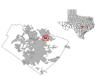
Northcliffe is a former census-designated place (CDP) in Guadalupe County, Texas, United States. The population was 1,819 at the 2000 census. The area is now part of the city of Schertz and did not have its population recorded separately at the 2010 census. It is part of the San Antonio Metropolitan Statistical Area.

Santa Clara is a city in Guadalupe County, Texas, United States. The population was 778 at the 2020 census, up from 725 at the 2010 census. It is part of the San Antonio Metropolitan Statistical Area.
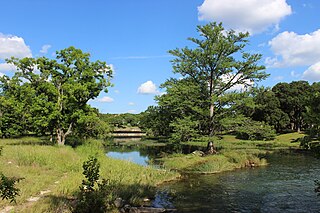
Woodcreek is a city in Hays County, Texas, United States. Like its neighbor of Wimberley, Woodcreek is a primarily a retirement community. The population was 1,770 at the 2020 census.
Log Cabin is a city in Henderson County, Texas, United States. The population was 678 at the 2020 census.

Lipan is a city in northwestern Hood County, Texas, United States. The population was 505 at the 2020 census. It is part of the Granbury, Texas Micropolitan Statistical Area.

Sunrise Beach Village is a city in Llano County, Texas, United States. The village was established in 1973. The population was 739 at the 2020 census.

Natalia is a city in Medina County, Texas, United States. The population was 1,202 at the 2020 census. It was founded in 1912 and was named after Natalie Pearson Nicholson, daughter of Frederick Stark Pearson, engineer, designer and builder of the Medina Dam.

Graford is a town in Palo Pinto County, Texas, United States. The population was 669 at the 2020 census.
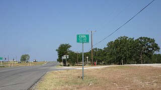
Cool is a city in Parker County, Texas, United States. The population was 211 at the 2020 census.

Huxley is a city in Shelby County, Texas, United States. The population was 361 at the 2020 census.
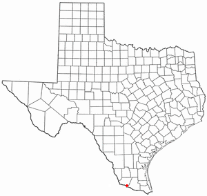
La Grulla is a city in Starr County, Texas, United States, founded by Juan Santiago Longoria in 1836. The population was 1,222 at the 2020 census.
Windermere is a former census-designated place (CDP) in Travis County, Texas, United States. The population was 1,037 at the 2010 census. It has since largely been annexed by the city of Pflugerville.

Summersville is a town in Shannon and Texas counties in the U.S. state of Missouri. The population was 453 at the 2020 census.
Scotland is a city in Archer County in the U.S. state of Texas. It is part of the Wichita Falls, Texas Metropolitan Statistical Area. The population was 413 at the 2020 census. The town is named for its founder, Henry J. Scott.


