Hewitt, Texas

Last updated

Hewitt, Texas
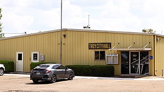
Hewitt Texas City Hall 2019.jpg
Hewitt city hall
Motto: 
"Life Just Right" [1]
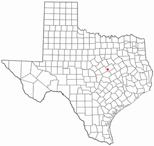
TXMap-doton-Hewitt.PNG
Location of Hewitt, Texas
McLennan County Hewitt.svg
Coordinates: 31°27′14″N97°11′42″W / 31.45389°N 97.19500°W / 31.45389; -97.19500
Country United States
State Texas
County McLennan
Area
[2]
  Total7.03 sq mi (18.21 km2)
  Land7.02 sq mi (18.19 km2)
  Water0.01 sq mi (0.01 km2)
Elevation
646 ft (197 m)
Population
 (2020)
  Total16,026
  Density2,126.87/sq mi (821.14/km2)
Time zone UTC-6 (Central (CST))
  Summer (DST) UTC-5 (CDT)
ZIP code
76643
Area code 254
FIPS code 48-33428 [3]
GNIS feature ID1359098 [4]
Website http://www.cityofhewitt.com/

Hewitt is a city in McLennan County, Texas, United States. The population was 16,026 at the 2020 census, making it the second largest city in the county. It is part of the Waco Metropolitan Statistical Area.

Contents

History

The community of Hewitt was established following the donation of land by John A. Warren, the town's first businessman, in the 1880s. Warren purchased roughly 40 acres (16 ha) and the town site was named Hewitt in 1883 for George A. Hewitt, an employee of the Missouri, Kansas and Texas Railroad. [5] During the following decades, the community flourished on farming and agriculture during the days when "cotton was king". Hewitt grew slowly but steadily, incorporating as a city in 1960, and the population skyrocketed in the 1970s. The steady upward growth that continued for more than a century gave way to a 700-percent population boom. In 1890, Hewitt had 60 residents; the town has approximately 13,500 residents as of the 2010 census. In 2015, Hewitt was rated the 20th-best place to live in the United States by MSN Money.

Geography

Hewitt is located at 31°27′14″N97°11′42″W / 31.45389°N 97.19500°W / 31.45389; -97.19500 (31.453789, –97.195023). [6]

According to the United States Census Bureau, the city has a total area of 6.9 square miles (18 km2), all land. The city is landlocked by the cities of Robinson and Waco (including its extraterritorial jurisdiction).

Demographics

Historical population
CensusPop.Note
1970 569
1980 5,247822.1%
1990 8,98371.2%
2000 11,08523.4%
2010 13,54922.2%
2020 16,02618.3%
U.S. Decennial Census [7]
Hewitt racial composition as of 2020 [8]
(NH = Non-Hispanic) [lower-alpha 1]
RaceNumberPercentage
White (NH)10,42565.05%
Black or African American (NH)1,5889.91%
Native American or Alaska Native (NH)570.36%
Asian (NH)5253.28%
Pacific Islander (NH)160.1%
Some Other Race (NH)390.24%
Mixed/Multi-Racial (NH)6073.79%
Hispanic or Latino 2,76917.28%
Total16,026

As of the 2020 United States census, there were 16,026 people, 5,167 households, and 3,842 families residing in the city.

As of the census [3] of 2000, 11,085 people, 3,931 households, and 3,223 families resided in the city. The population density was 1,608.0 inhabitants per square mile (620.9/km2). The 4,018 housing units averaged 582.9 per square mile (225.2/km2). The racial makeup of the city was 84.08% White, 7.70% African American, 0.42% Native American, 2.35% Asian, 0.06% Pacific Islander, 4.02% from other races, and 1.37% from two or more races. Hispanics or Latinos of any race were 9.28% of the population.

Of the 3,931 households, 45.6% had children under the age of 18 living with them, 68.3% were married couples living together, 10.9% had a female householder with no husband present, and 18.0% were not families. About 14.2% of all households were made up of individuals, and 3.3% had someone living alone who was 65 years of age or older. The average household size was 2.82 and the average family size was 3.12.

In the city, the population was distributed as 29.9% under the age of 18, 7.6% from 18 to 24, 33.0% from 25 to 44, 22.8% from 45 to 64, and 6.7% who were 65 years of age or older. The median age was 33 years. For every 100 females, there were 94.9 males. For every 100 females age 18 and over, there were 91.2 males.

The median income for a household in the city was $55,469, and for a family was $59,409. Males had a median income of $38,560 versus $24,659 for females. The per capita income for the city was $22,263. About 2.2% of families and 2.9% of the population were below the poverty line, including 3.1% of those under age 18 and 4.0% of those age 65 or over.

Hewitt was ranked number 44 on Money magazine's 2007 Top 100 places to live. [11]

Education

The city of Hewitt is served by the Midway Independent School District. There are three elementary schools, half of the district's total, and one of its two middle schools in the city.

Culture

Hewitt was the birthplace of the late U.S. Senator Tom Connally of Texas.

In 1994, Willie Nelson was arrested for marijuana possession in the city. [12]

The city was named in the film Harold & Kumar Escape from Guantanamo Bay , including the fictional Hewitt Regional Airport. The scenes that took place in Hewitt were actually filmed in a different location.

Climate

The climate in this area is characterized by hot, humid summers and generally mild to cool winters. According to the Köppen climate classification, Hewitt has a humid subtropical climate, Cfa on climate maps. [13]

Related Research Articles

<span class="mw-page-title-main">Garnett, Kansas</span> City in Anderson County, Kansas

Garnett is a city in and the county seat of Anderson County, Kansas, United States. As of the 2020 census, the population of the city was 3,242.

<span class="mw-page-title-main">Alton, Kansas</span> City in Osborne County, Kansas

Alton is a city in Osborne County, Kansas, United States. As of the 2020 census, the population of the city was 100.

<span class="mw-page-title-main">Randolph, Kansas</span> City in Riley County, Kansas

Randolph is a city in Riley County, Kansas, United States. As of the 2020 census, the population of the city was 159.

<span class="mw-page-title-main">Alta Vista, Kansas</span> City in Wabaunsee County, Kansas

Alta Vista is a city in Wabaunsee County, Kansas, United States. As of the 2020 census, the population of the city was 409.

<span class="mw-page-title-main">Troy, Texas</span> City in Texas, United States

Troy is a city in Bell County, Texas, United States. The population was 2,375 at the 2020 census. It is part of the Killeen–Temple–Fort Hood Metropolitan Statistical Area.

<span class="mw-page-title-main">Meridian, Texas</span> City in Texas, United States

Meridian is a city and the county seat of Bosque County in central Texas, United States. It is forty-seven miles northwest of Waco. The population was 1,493 at the 2010 census.

<span class="mw-page-title-main">Santa Rosa, Texas</span> Town in Texas, United States

Santa Rosa is a town in Cameron County, Texas, United States. The population was 2,873 at the 2010 census. It is part of the Brownsville–Harlingen–Raymondville and the Matamoros–Brownsville metropolitan areas.

<span class="mw-page-title-main">Itasca, Texas</span> City in Texas, United States

Itascaeye-TAS-kə is a city in Hill County in Northern Central Texas, United States. As of the 2010 census, the city population was 1,644.

<span class="mw-page-title-main">Falls City, Texas</span> City in Texas, United States

Falls City is a city in Karnes County, Texas, United States. The population was 514 at the 2020 census. Falls City is near the location of a uranium tailings disposal cell, completed in 1994 under the terms of the 1978 Uranium Mill Tailings Radiation Control Act. The early settlers, predominantly Polish Catholics, founded the Holy Trinity Catholic Church in 1902.

<span class="mw-page-title-main">Kenedy, Texas</span> City in Texas, United States

Kenedy is a city in Karnes County, Texas, United States, named for Mifflin Kenedy, who bought 400,000 acres (1,600 km2) and wanted to develop a new town that would carry his name. The population was 3,473 at the 2020 census, up from 3,296 at the 2010 census.

<span class="mw-page-title-main">Runge, Texas</span> Town in Texas, United States

Runge is a town in Karnes County, Texas, United States. The town is pronounced "Run-Gee". The population was 892 at the 2020 census.

<span class="mw-page-title-main">Benjamin, Texas</span> City in Texas, United States

Benjamin is a city in and the county seat of Knox County, Texas, United States. Its population was 258 at the 2010 census.

<span class="mw-page-title-main">Kempner, Texas</span> City in Texas, United States

Kempner is a city in Lampasas County, Texas, United States. The population was 1,146 at the 2020 census. It is part of the Killeen–Temple–Fort Hood Metropolitan Statistical Area.

<span class="mw-page-title-main">LaCoste, Texas</span> City in Texas, United States

La Coste is a city in Medina County, Texas, United States. The population was 1,119 at the 2010 census. It is part of the San Antonio Metropolitan Statistical Area.

<span class="mw-page-title-main">Sunset, Montague County, Texas</span> Census-designated place in Texas, United States

Sunset is an unincorporated community in Montague County, Texas, United States. Until 1900, a surveying error had placed the community in Wise County. The Fort Worth and Denver Railway runs through Sunset. The population was 339 at the 2000 census. The city disincorporated on April 19, 2007.

<span class="mw-page-title-main">Robstown, Texas</span> City in Texas, United States

Robstown is a city in Nueces County, Texas, United States, and a western suburb of Corpus Christi. It was founded circa 1906, and was named for Robert Driscoll. The population was 10,143 as of the 2020 census.

<span class="mw-page-title-main">Camp Wood, Texas</span> City in Texas, United States

Camp Wood is a city in Real County, Texas, United States, in the Texas Hill Country, which is part of the Edwards Plateau. The population was 706 at the 2010 census.

<span class="mw-page-title-main">Taft, Texas</span> City in Texas, United States

Taft is a city in San Patricio County, Texas, United States. The population was 3,048 at the 2010 census.

<span class="mw-page-title-main">Wheeler, Texas</span> City in Texas, United States

Wheeler is a city, and the county seat of Wheeler County, Texas, United States, located on the eastern border of the Texas Panhandle. The population was last reported at 1,592 in the 2010 census.

<span class="mw-page-title-main">McGregor, Texas</span> City in Texas, United States

McGregor is a city in McLennan and Coryell counties in the U.S. state of Texas. The population was 5,338 at the 2020 census.

References

  1. "City of Hewitt Texas". City of Hewitt Texas. Retrieved October 19, 2012.
  2. "2019 U.S. Gazetteer Files". United States Census Bureau. Retrieved August 7, 2020.
  3. 1 2 "U.S. Census website". United States Census Bureau . Retrieved January 31, 2008.
  4. "US Board on Geographic Names". United States Geological Survey. October 25, 2007. Retrieved January 31, 2008.
  5. "Profile for Hewitt, Texas, TX". ePodunk. Retrieved October 19, 2012.
  6. "US Gazetteer files: 2010, 2000, and 1990". United States Census Bureau. February 12, 2011. Retrieved April 23, 2011.
  7. "Census of Population and Housing". Census.gov. Retrieved June 4, 2015.
  8. "Explore Census Data". data.census.gov. Retrieved May 24, 2022.
  9. https://www.census.gov/ [ not specific enough to verify ]
  10. "About the Hispanic Population and its Origin". www.census.gov. Retrieved May 18, 2022.
  11. CNN Money. Best Places to Live: Top 100
  12. "Willie Nelson arrested on pot charge". UPI. May 10, 1994. Retrieved December 11, 2022.
  13. Climate Summary for Hewitt, Texas
  1. Note: the US Census treats Hispanic/Latino as an ethnic category. This table excludes Latinos from the racial categories and assigns them to a separate category. Hispanics/Latinos can be of any race. [9] [10]