This article needs additional citations for verification .(June 2014) |
Theunissen | |
|---|---|
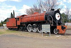 SAR Class 16DA no. 850 plinthed in Theunissen 29 May 2005 | |
 Theunissen  Theunissen | |
| Coordinates: 28°24′0″S26°43′0″E / 28.40000°S 26.71667°E | |
| Country | South Africa |
| Province | Free State |
| District | Lejweleputswa |
| Municipality | Masilonyana |
| Established | 13 September 1907 |
| Area | |
• Total | 9.2 km2 (3.6 sq mi) |
| Population (2011) [1] | |
• Total | 1,549 |
| • Density | 170/km2 (440/sq mi) |
| Racial makeup (2011) | |
| • Black African | 41.8% |
| • Coloured | 1.6% |
| • Indian/Asian | 0.9% |
| • White | 54.3% |
| • Other | 1.5% |
| First languages (2011) | |
| • Afrikaans | 54.8% |
| • Sotho | 28.9% |
| • English | 5.5% |
| • Xhosa | 4.0% |
| • Other | 6.8% |
| Time zone | UTC+2 (SAST) |
| Postal code (street) | 9410 |
| PO box | 9410 |
| Area code | 057 |
Theunissen is a small town that has the only wine estate, the Theunissen Wine Farm, in the Free State province of South Africa. It is located about 95 kilometers northeast of Bloemfontein and about 45 kilometers south of Welkom on the R30 road. It was founded by Boer War Commandant Helgaardt Theunissen.
Theunissen has a small community (mostly farmers and miners) which supports the local businesses.
