Three Rivers, New Mexico | |
|---|---|
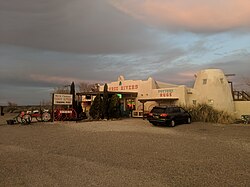 Three Rivers Trading Post | |
 Three Rivers, New Mexico Location within the state of New Mexico  Three Rivers, New Mexico Three Rivers, New Mexico (the United States) | |
| Coordinates: 33°19′17″N106°04′30″W / 33.32139°N 106.07500°W | |
| Country | United States |
| State | New Mexico |
| County | Otero County |
| Elevation | 4,570 ft (1,390 m) |
| Time zone | UTC-7 (Mountain (MST)) |
| • Summer (DST) | UTC-6 (CDT) |
| GNIS feature ID | 920716 [1] |
Three Rivers is an unincorporated community in northern Otero County, New Mexico, United States.
