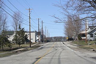
Hortonville, New Mexico

Last updated
Hortonville, New Mexico
Unincorporated community
USA New Mexico location map.svg
Red pog.svg
Hortonville, New Mexico
Coordinates: 32°54′41″N105°32′09″W / 32.91139°N 105.53583°W / 32.91139; -105.53583 Coordinates: 32°54′41″N105°32′09″W / 32.91139°N 105.53583°W / 32.91139; -105.53583
Country United States
State New Mexico
County Otero
Elevation 7,067 ft (2,154 m)
Time zone Mountain (MST) (UTC-7)
  Summer (DST) MDT (UTC-6)
Area code(s) 575
GNIS feature ID 1987529 [1]

Hortonville is an unincorporated community in Otero County, New Mexico, United States. [1]

Unincorporated area Region of land not governed by own local government

In law, an unincorporated area is a region of land that is not governed by a local municipal corporation; similarly an unincorporated community is a settlement that is not governed by its own local municipal corporation, but rather is administered as part of larger administrative divisions, such as a township, parish, borough, county, city, canton, state, province or country. Occasionally, municipalities dissolve or disincorporate, which may happen if they become fiscally insolvent, and services become the responsibility of a higher administration. Widespread unincorporated communities and areas are a distinguishing feature of the United States and Canada. In most other countries of the world, there are either no unincorporated areas at all, or these are very rare; typically remote, outlying, sparsely populated or uninhabited areas.

Otero County, New Mexico County in the United States

Otero County is a county located in the U.S. state of New Mexico. As of the 2010 census, the population was 63,797. Its county seat is Alamogordo. Its southern boundary is the Texas state line. It is named for Miguel Antonio Otero, the territorial governor when the county was created.

New Mexico State of the United States of America

New Mexico is a state in the Southwestern region of the United States of America; its capital and cultural center is Santa Fe, which was founded in 1610 as capital of Nuevo México, while its largest city is Albuquerque with its accompanying metropolitan area. It is one of the Mountain States and shares the Four Corners region with Utah, Colorado, and Arizona; its other neighboring states are Oklahoma to the northeast, Texas to the east-southeast, and the Mexican states of Chihuahua to the south and Sonora to the southwest. With a population around two million, New Mexico is the 36th state by population. With a total area of 121,592 sq mi (314,920 km2), it is the fifth-largest and sixth-least densely populated of the 50 states. Due to their geographic locations, northern and eastern New Mexico exhibit a colder, alpine climate, while western and southern New Mexico exhibit a warmer, arid climate.

Notes


Related Research Articles

Hortonville, Wisconsin Village in Wisconsin, United States

Hortonville is a village in Outagamie County, Wisconsin, United States. The population was 2,711 at the 2010 census.

The Spanish Colonial Revival Style is an architectural stylistic movement arising in the early 20th century based on the Spanish Colonial architecture of the Spanish colonization of the Americas.

Hortonville may refer to:

Bay Conference

The Bay Conference, is a high school athletic conference made up of eight teams in northeastern Wisconsin, centering primarily around the Green Bay / Fox Valley Metropolitan Areas. Conference schools are members of the Wisconsin Interscholastic Athletic Association.

Hortonville, Indiana Unincorporated community in Indiana, United States

Hortonville is an unincorporated community in Washington Township, Hamilton County, Indiana, United States.

The East Central Conference is a high school athletic conference of teams in the East Central Wisconsin area. The ECC was founded in 1970 and originally disbanded in 2007. The conference was revived for the 2015-2016 school year, the result of a realignment within the Wisconsin Interscholastic Athletic Association.

Bethlehem Lutheran Church is a common name for many churches in the United States. Some notable ones include:

Hortonville, Massachusetts human settlement in Massachusetts, United States of America

Hortonville is a village in the town of Swansea, Bristol County, Massachusetts, United States. The part of the village on Locust Street from Oak Street to Hortonville Rd. makes up the Hortonville Historic District, which was listed on the National Register of Historic Places in 1990.

Stephensville, Wisconsin Unincorporated community in Wisconsin, United States

Stephensville is a small unincorporated community located entirely within the town of Ellington in west-central Outagamie County, Wisconsin, United States. Stephensville is classified as a Class U6 Community by the USGS, being a populated place located wholly or substantially outside the boundaries of any incorporated place or CDP with a recognized authoritative common name.

Medina, Outagamie County, Wisconsin Unincorporated community in Wisconsin, United States

Medina, originally Young's Corner, is an unincorporated community in the Town of Dale in southwest Outagamie County, Wisconsin, United States. It is located 3.5 miles (5.6 km) south of the village of Hortonville, 11 miles (18 km) west of Appleton, and 20 miles (32 km) northwest of Oshkosh.

Hortonville, Nova Scotia human settlement in Nova Scotia, Canada

Hortonville is a community in the Canadian province of Nova Scotia, located in Kings County at the mouth of the Gaspereau River and is part of the Landscape of Grand Pré UNESCO World Heritage Site.

Hortonville High School

Hortonville High School is a high school located in Hortonville, Wisconsin. The only high school in the Hortonville Area School District, it serves students in grades 9 to 12 from the communities of Hortonville and Greenville, and portions of Center, Dale, Ellington, Grand Chute, Hortonia, and Liberty. Enrollment averages 270 in each of the four grades. The high school faculty is composed of 95 full-time professional staff, with a student to faculty ratio of approximately 11:1.

Hortonville Area School District

The Hortonville Area School District (HASD) is a school district in the U.S. state of Wisconsin. It serves the communities of Hortonville and Greenville, and parts of Center, Dale, Ellington, Grand Chute, Hortonia, and Liberty. As of 2012, the district enrollment was 3,555. The district maintains six school buildings on three campuses. Total district population was 18,952 at the 2010 Census.

German Presbyterian Church and Hortonville Cemetery church building in New York, United States of America

German Presbyterian Church and Hortonville Cemetery, also known as Hortonville Presbyterian Church, is a historic Presbyterian church and cemetery located at CR 121 and CR 131 in Hortonville, Sullivan County, New York. The church was built about 1860 and is a one-story, rectangular wood frame building, 27 feet long and 41 feet wide. It features a steep gable roof with two stage tower and small spire. The cemetery is located about a quarter mile from the church and contains approximately 100 stones. The cemetery contains the stone foundation of the original meeting house.

Hortonville, New York Census-designated place in New York, United States

Hortonville is a census-designated place in the town of Delaware, Sullivan County, New York, United States. As of the 2010 census, its population was 218. Its ZIP code is 12745.

Hortonville, Vermont Unincorporated community in Vermont, United States

Hortonville is an unincorporated community in Rutland County, Vermont, United States.

Hortonville Joint School District No. 1 v. Hortonville Education Association, 426 U.S. 482 (1976), was a United States Supreme Court case in which the Court ruled that a public school board did not violate the due process clause of the Fourteenth Amendment of the United States Constitution when it fired teachers who went on strike after contract negotiations with the board broke down.