
Alki Point is a neighborhood in western Seattle, Washington. It is a point jutting into Puget Sound, the westernmost landform in the city's West Seattle district. Alki is the peninsular neighborhood on Alki Point. Alki was the original settlement in what was to become the city of Seattle. It was part of the city of West Seattle from 1902 until that city's annexation by Seattle in 1907.

Carkeek Park is a 216-acre park (87 ha) in the Broadview neighborhood of Seattle, Washington. The park offers various attractions, including Piper Orchard, Pipers Creek with its tributaries, Venema Creek and Mohlendorph Creek, as well as picnic areas, shelters, and hiking trails.

Denny Blaine Park is a 2 acres (8,100 m2) water-front park in the Denny-Blaine neighborhood of Seattle, Washington. With picturesque views of Bellevue directly across the lake and Mount Rainier in the distance, it is primarily used for picnicking, sunbathing, and swimming. The park has also been one of Seattle's unofficial queer- and trans-friendly clothing optional beaches since the 1970s.

Denny Park is a park located in the South Lake Union neighborhood of Seattle, Washington. It occupies the block bounded by John Street and Denny Way on the north and south and Dexter and 9th Avenues N. on the west and east.

Cal Anderson Park is a public park on Seattle’s Capitol Hill that includes Lincoln Reservoir and the Bobby Morris Playfield.

Chief Sealth International High School (CSIHS) is a public high school in the Seattle Public Schools district of Seattle, Washington. Opened in 1957 in southern West Seattle, Chief Sealth students comprise one of the most ethnically and culturally diverse student bodies in Washington State. The school is named for Chief Seattle, a Duwamish chief and a recognized leader amongst the local peoples at the time of the arrival of European American settlers in the area. The school shares a campus with Denny International Middle School (DIMS).
The term seven hills of Seattle refers unofficially to the hills the U.S. city was built on and around, though there is no consensus on exactly which hills it refers to. The term has been used to refer to several other cities, most notably Rome and Constantinople.

Rainier Beach is a set of neighborhoods in Seattle, Washington that are mostly residential. Also called Atlantic City, Rainier Beach can include Dunlap, Pritchard Island, and Rainier View neighborhoods.

The South Waterfront is a high-rise district under construction on former brownfield industrial land in the South Portland neighborhood south of downtown Portland, Oregon, U.S. It is one of the largest urban redevelopment projects in the United States. It is connected to downtown Portland by the Portland Streetcar and MAX Orange Line, and to the Oregon Health & Science University (OHSU) main campus atop Marquam Hill by the Portland Aerial Tram, as well as roads to Interstate 5 and Oregon Route 43.

Daylighting is the opening up and restoration of a previously buried watercourse, one which had at some point been diverted below ground. Typically, the rationale behind returning the riparian environment of a stream, wash, or river to a more natural above-ground state is to reduce runoff, create habitat for species in need of it, or improve an area's aesthetics. In the United Kingdom, the practice is also known as deculverting.
The Duwamish tribe is a Native American tribe in western Washington, and the indigenous people of metropolitan Seattle. The Duwamish tribe today includes the People of the Inside (Dxw'Dəw?Abš), for Elliott Bay environs today; and the People of the Large Lake (Xacuabš), for those around Lake Washington of today.
Seattle Parks and Recreation is the government department responsible for maintaining the parks, open spaces, and community centers of the city of Seattle, Washington. The department maintains properties covering an area of over 6,200 acres (25 km2), which is equivalent to roughly 11% of the city's total area. Of those 6,200 acres (25 km2), 4,600 acres (19 km2) are developed.
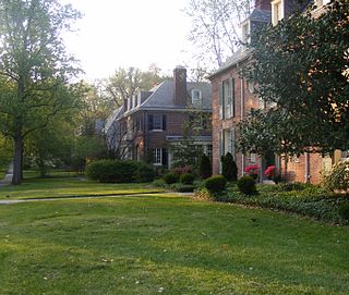
Guilford is a historic neighborhood in the northern part of Baltimore, Maryland.

The Plaza Blocks, two courthouse squares known as Chapman Square and Lownsdale Square, are located in downtown Portland, Oregon, United States. The blocks, as well as the adjacent Terry Schrunk Plaza, are surrounded by multiple government buildings including City Hall, the Green - Wyatt Federal Building, the Portland Building, the Multnomah County Justice Center, the Hatfield United States Courthouse, and the old Multnomah County Courthouse.

William Tecumseh Sherman, also known as the Sherman Memorial or Sherman Monument, is a sculpture group honoring William Tecumseh Sherman, created by Augustus Saint-Gaudens and located at Grand Army Plaza in Manhattan, New York. Cast in 1902 and dedicated on May 30, 1903, the gilded-bronze monument consists of an equestrian statue of Sherman and an accompanying statue, Victory, an allegorical female figure of the Greek goddess Nike. The statues are set on a Stony Creek granite pedestal designed by the architect Charles Follen McKim.
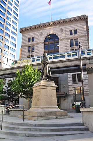
McGraw Square is a small plaza and streetcar stop in the Denny Triangle neighborhood of Seattle, Washington. The 0.01-acre (0.0040 ha) park, one of the smallest in the city park system, is named for and features a statue of former King County Sheriff and Governor of Washington John Harte McGraw. McGraw Square is bounded to the north by Stewart Street, to the west by 5th Avenue and the Times Square Building, and to the east by Olive Way and the Medical Dental Building.

An outdoor life-size sculpture of Chief Seattle by local artist James Wehn is installed in Tilikum Place in Seattle, Washington, in the United States.
Denny Way is an east–west arterial street in downtown Seattle, Washington, United States. It forms the northern end of the Belltown street grid as well as the boundaries of Belltown, Lower Queen Anne, South Lake Union, Denny Triangle, and Cascade. The street continues east through Capitol Hill to Madrona as a minor neighborhood street, ending near Madrona Park on Lake Washington.

