Street layout of Seattle

Last updated
Map showing the angled streets of downtown Seattle Seattle downtown neighborhoods.jpg
Map showing the angled streets of downtown Seattle

The street layout of Seattle is based on a series of disjointed rectangular street grids. Most of Seattle and King County use a single street grid, oriented on true north. Near the center of the city, various land claims were platted in the 19th century with differently oriented grids, which still survive today. Distinctly oriented grids also exist in some cities annexed by Seattle in the early 20th century, such as Ballard and Georgetown. A small number of streets and roads are exceptions to the grid pattern.

Contents

Street grid layout

The Hotel Seattle (pictured here in 1900, now demolished). To the right, Yesler Way follows Maynard's plat, and runs due east. To the left, James Street follows Denny's plat, and runs 32 degrees north of east. Hotel Seattle - 1900.jpg
The Hotel Seattle (pictured here in 1900, now demolished). To the right, Yesler Way follows Maynard's plat, and runs due east. To the left, James Street follows Denny's plat, and runs 32 degrees north of east.

Most streets in Seattle run either north–south or east–west. However, this orientation does not prevail in one of the oldest and densest parts of the town, bounded by Elliott Bay to the west, Broadway to the east, Yesler Way to the south, and Denny Way to the north. That exceptional area includes all of the Downtown Central Business District (CBD), the northernmost part of the Pioneer Square neighborhood south of the CBD, First Hill east of the CBD, and Belltown and the Denny Regrade north of the CBD. [1]

The grid is oriented 32 degrees west of north in the southern portion of that exceptional area, and 49 degrees west of north in the northern portion. The two portions are divided by a line that runs along Stewart Street (or its right-of-way) from Alaskan Way on the Central Waterfront east to 3rd Avenue, then along Olive Way from 3rd Avenue to 7th Avenue, and along Howell Street from 7th Avenue to Denny Way. [1]

Origins

These three grid patterns (due north, 32 degrees west of north, and 49 degrees west of north) are the result of a disagreement between David Swinson "Doc" Maynard, whose land claim lay south of Yesler Way, and Arthur A. Denny and Carson D. Boren, whose land claims lay to the north (with Henry Yesler and his mill soon brought in between Denny and the others): [2] Denny and Boren preferred that their streets follow the Elliott Bay shoreline, while Maynard favored a grid based on the cardinal directions for his (mostly flat, mostly wet) claim. All three were competing to have the downtown built on their land. Denny prevailed in what would become the central business district, but it was Maynard's grid that ended up being extended throughout the city [2] [3] and into all of King County (60 miles east to west). Several cities in King County, such as Renton, Kirkland, and North Bend, have their own naming system and grid in the center of town, but Maynard's Pioneer Square–based grid officially covers the entire county. [1] [4]

Addressing

Street addresses in Seattle (and throughout much of King County) follow a uniform numbering plan. On roads that run north and south [generally called an Avenue], odd numbered addresses are on the west side and even numbered addresses are on the east side. On roads that run east and west [generally called a Street], odd numbered addresses are on the south side and even numbered addresses are on the north side. The address is based on its location relative to the grid (not relative to the location of the beginning of each separate road, or its nearest intersection) with the last two digits consecutively incrementing with the grid and the leading digits designating the location on the grid. [1]

Some mnemonics are helpful here:

The name 32nd Avenue NE applies to several physically discontinuous street segments running along approximately the same line of the grid. One of these segments runs from NE 75th Street to NE 80th Street, crossed only by NE 77th Street; its two blocks are the 7500 block and the 7700 block. Buildings on that street between 75th and 77th would have four-digit addresses beginning with 75; buildings above 77th would have four-digit addresses beginning with 77. If there is such an address as 7764 32nd Avenue NE, then it is on the east side of the street rather far up the 7700 block, and if there is a 7765 it will be approximately across the street from 7764.

North of the ship canal in Seattle, and north of NE 140th St in East King County, grid numbers are spread in increments by 20 per mile (which works out to one numerical block per minute when walking at 3 miles per hour). In much of the rest of King County (south of NE 140th St, and east of 68th Ave NE at the north end of Lake Washington), grid numbers are spread in increments 16 per mile (which works out to 10 per kilometer). Due to the regular spacing of street numbers, approximate distances between two points on the grid can be easily calculated.

A few older cities within King County have their own distinct numbering plan, centered on their own historic downtown areas, including much of Renton and historic parts of Kirkland. In Kirkland, streets and avenues run perpendicular to the usual King County designations. In Renton (east of I-405), avenues are named for Washington State communities and arranged in alphabetical order (Aberdeen, Blaine, Camas, etc.).

In Seattle, the names of the twelve streets in the heart of the central business district are paired by their first letters. From south to north, they are: Jefferson, James, Cherry, Columbia, Marion, Madison, Spring, Seneca, University, Union, Pike, Pine. One way to remember the order of the street pairs is with the mnemonic "Jesus Christ Made Seattle Under Protest" (or "Pressure") (JCMSUP). [5] [6] [1]

Only one street in Seattle, Madison Street, runs uninterrupted from the salt water of Puget Sound in the west to the fresh water of Lake Washington in the east. The unusual orientation and contiguous nature of this street dates back to a time when it was a direct route to a cross-lake ferry between Madison Park and Houghton on the east side of Lake Washington. A cable car once operated on Madison Street from downtown Seattle to the ferry terminal at Madison Park, and the ferry route constituted an almost linear continuation of the street across the lake. Other historical cable cars ran along Yesler Way, Jackson Street, Queen Anne Avenue—"The Counterbalance", and 1st Avenue-2nd Avenue). [7] No street, excluding Interstate 5 and State Route 99 both freeways in whole or in partruns without interruption from the northern to the southern city limits.[ citation needed ] This is largely the result of Seattle's topography. Split by the Duwamish River and the Lake Washington Ship Canal, containing four lakes within the city limits, and boasting deep ravines and at least seven hills [8] there are few more-or-less straight routes where such a road could reasonably be built, even allowing for the short bridge or two.

Directionals

Map of directionals in Seattle Seattle WA Directional Zones v10-14-16.svg
Map of directionals in Seattle

Seattle and King County make systematic use of directionals (such as N for north or NE for northeast) in street names, although residents often omit the directionals when describing addresses in their own neighborhoods. To a lesser degree, street types such as avenue and street are also used systematically. As a rule, "streets" run east–west (or, in and near downtown, northeast–southwest), and "avenues" run north–south (or, in and near downtown, northwest–southeast). A road , boulevard , way, or thoroughfare with any other type designation may run in any direction. The land boundaries of the district laid out according to the Denny and Boren plats that follow the shoreline are all "Ways" (Denny Way, Yesler Way, Broadway).

Furthermore:

Seattle is divided into ten sections, each with a different combination of directionals. [9]

North of the Lake Washington Ship Canal are the following sections: west of 1st Avenue NW, the NW section; between 1st Avenue NW and 1st Avenue NE, the N section; east of 1st Avenue NE, the NE section.

South of the canal but north of Denny Way are the following sections: west of Queen Anne Avenue N, the W section; between Queen Anne Avenue N and a border defined by Eastlake Avenue E (south of E Nelson Place) and Lake Union (north of E Nelson Place), [10] the Avenue N section, in which avenues are suffixed N and in which streets have no prefix; east of the Eastlake Avenue E–Lake Union border, the E section.

South of Denny Way but north of Yesler Way are two sections: east of Broadway from Yesler Way north to Union Street, east of Minor Avenue from Union Street north to Pike Street, and east of Melrose Avenue from Pike Street north to Denny Way, the E Street section, streets are prefixed E and avenues have no suffix; to the west of this border, the downtown section, no directionals are used.

South of Yesler Way are two sections: east of the waterfront and (south of the Duwamish Waterway) east of 1st Avenue S, the S section; and west of 1st Avenue S, the SW section. Within the Seattle city limits there is no SE section; however, the non-Seattle SE section contains all of the southeastern suburbs and the rest of southern King County, including Mercer Island, parts of Renton, [11] and Bellevue south of Main Street, Sammamish south of E Main Street, and other locations within the county.

Arterials defined

The city defines three types of arterials — Principal, Minor, and Collector: [12]

See also

Related Research Articles

<span class="mw-page-title-main">Pioneer Square, Seattle</span> United States historic place

Pioneer Square is a neighborhood in the southwest corner of Downtown Seattle, Washington, US. It was once the heart of the city: Seattle's founders settled there in 1852, following a brief six-month settlement at Alki Point on the far side of Elliott Bay. The early structures in the neighborhood were mostly wooden, and nearly all burned in the Great Seattle Fire of 1889. By the end of 1890, dozens of brick and stone buildings had been erected in their stead; to this day, the architectural character of the neighborhood derives from these late 19th century buildings, mostly examples of Richardsonian Romanesque.

<span class="mw-page-title-main">University District, Seattle</span> Seattle Neighborhood

The University District is a major district in Seattle, Washington, comprising several distinct neighborhoods. The main campus of the University of Washington (UW) is located in the district, lending its name to both the district as well as University Way NE.

<span class="mw-page-title-main">Roosevelt, Seattle</span> Neighborhood in King, Washington, United States

Roosevelt is a neighborhood in north Seattle, Washington. Its main thoroughfare, originally 10th Avenue, was renamed Roosevelt Way upon Theodore Roosevelt's death in 1919. The neighborhood received the name as the result of a Community Club contest held eight years later, in 1927.

<span class="mw-page-title-main">Eastlake, Seattle</span> Neighborhood of Seattle in Washington, United States

Eastlake is a neighborhood in Seattle, Washington, so named because of its location on the eastern shore of Lake Union. Its main thoroughfare is Eastlake Avenue E., which runs from Howell Street at the northeast corner of Downtown north over the University Bridge to the University District, where it connects to Roosevelt Way N.E. and 11th Avenue N.E. A second thoroughfare is Boylston Avenue E.; as an arterial, it parallels Interstate 5 for the four blocks between E. Newton Street to the south and E. Roanoke Street to the north, acting as an extension of Capitol Hill's Lakeview Boulevard E.

<span class="mw-page-title-main">First Hill, Seattle</span> Neighborhood in Downtown Seattle

First Hill is a neighborhood in Seattle, Washington, United States. It is named for the hill on which it is located, which in turn is so named for being the first hill encountered while traveling east from downtown Seattle toward Lake Washington. First Hill is bounded on the west by Interstate 5, beyond which is Downtown, on the north by E. Pike and E. Madison Streets, beyond which is Capitol Hill, and on the south by Yesler Way, beyond which is the International District. The City of Seattle provides conflicting information about its eastern limit, beyond which are Cherry Hill and the Central District. Some describe it as being bounded by Broadway and Boren Avenues, while others describe it as being bounded by 12th Avenue.

<span class="mw-page-title-main">Roads and expressways in Chicago</span> Highway system

Roads and expressways in Chicago summarizes the main thoroughfares and the numbering system used in Chicago and its surrounding suburbs.

<span class="mw-page-title-main">Cascade, Seattle</span> Neighborhood in Seattle, Washington, United States

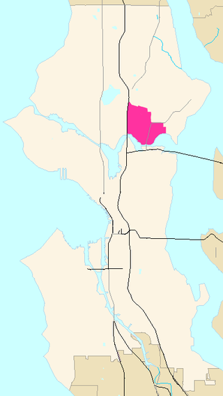
Cascade is an urban neighborhood abutting Downtown Seattle, Washington, United States, located adjacent to South Lake Union. It is bounded by: Fairview Avenue North on the west, beyond which is the rest of the Cascade Neighborhood; the Interstate 5 interchange for Mercer St to the north, beyond which is Eastlake; Interstate 5 on the east, beyond which is Capitol Hill; and Denny Way on the south, beyond which is Denny Triangle. It is surrounded by thoroughfares Mercer Street (eastbound), Fairview Avenue N. and Eastlake Avenue E., and Denny Way. The neighborhood, one of Seattle's oldest, originally extended much further: west to Terry Avenue, south to Denny Hill on the South, and east to Melrose Avenue E through the area now obliterated by Interstate 5. Some recent writers consider Cascade to omit the northern "arm", while others extend it westward to cover most of South Lake Union.

<span class="mw-page-title-main">Transportation in Seattle</span> Overview of transportation modes and routes in Seattle, Washington, U.S.

Transportation in Seattle is largely focused on the automobile like many other cities in western North America; however, the city is just old enough for its layout to reflect the age when railways and trolleys predominated. These older modes of transportation were made for a relatively well-defined downtown area and strong neighborhoods at the end of several former streetcar lines, now mostly bus lines.

<span class="mw-page-title-main">Madrona, Seattle</span> Seattle Neighborhood in King, Washington, United States

Madrona is a mostly residential neighborhood in east Seattle, Washington. It is bounded on the east by Lake Washington; on the south by E. Cherry Street, beyond which is Leschi; on the west by Martin Luther King Jr. Way, beyond which is the Central District; and on the north by E. Howell Street, beyond which is Denny-Blaine.

<span class="mw-page-title-main">Street system of Denver</span>

The oldest part of Denver, Colorado, now the neighborhoods of Auraria Campus, LoDo, much of downtown, and Five Points, is laid out on a grid plan that is oriented diagonal to the four cardinal directions. The rest of the city, including the eastern part of downtown, is laid out primarily on a grid oriented to the cardinal directions. In this larger grid, from east to west, there are generally 16 city blocks per mile, except between Zuni Street and Lowell Boulevard in west Denver. From north to south, there are typically eight blocks per mile, although there are many areas with more blocks per mile. Addresses follow a decimal system, with addresses advancing by one hundred at each cross street.

<span class="mw-page-title-main">David Denny</span> American judge

David Thomas Denny was a member of the Denny Party, who are generally collectively credited as the founders of Seattle, Washington, USA. Though he ultimately underwent bankruptcy, he was a significant contributor to the shape of the city. Roger Sale, in his book Seattle, Past to Present, described him as having been "the pioneer to turn to if one had a plan that would be 'good for Seattle', and one needed a respectable tone and a willing investor."

<span class="mw-page-title-main">Roads and freeways in metropolitan Detroit</span> List of roads in part of Michigan

The Detroit metropolitan area in southeast Michigan is served by a comprehensive network of roads and highways. Three primary Interstate Highways pass through the region, along with three auxiliary Interstates, and multiple state and U.S. Highways. These are supplemented by the Mile Road System, a series of local roads spaced one mile apart on a perpendicular grid.

<span class="mw-page-title-main">Broadway (Seattle)</span>

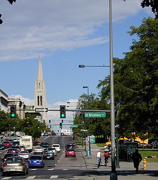
Broadway is a major north–south thoroughfare in Seattle, Washington. The 1.6-mile-long (2.6 km) arterial runs north from Yesler Way at Yesler Terrace through the First Hill and Capitol Hill neighborhoods to East Roy Street. Broadway East continues north to East Highland Drive. North of there the street is made up of shorter segments: one from just south of East Blaine Street to just north of East Miller Street, another from East Roanoke Street to East Shelby Street, and the last from East Allison Street to Fuhrman Avenue East.

<span class="mw-page-title-main">Yesler Way</span> Street in Seattle, Washington

Yesler Way is an east–west street in Seattle named for Henry Yesler, the founder of Seattle. East–west streets in Seattle south of Yesler Way are prefixed "South"; avenues are suffixed with "South" as they cross Yesler Way. The street originates at Alaskan Way on the downtown Seattle waterfront and runs east through Yesler Terrace, the Central District, and Leschi to just east of 32nd Avenue, where the arterial route switches to Lake Dell Avenue. A short residential segment of East Yesler Way, which turns into east of Broadway, exists to the west of Lake Washington Boulevard.

<span class="mw-page-title-main">Mercer Street (Seattle)</span>

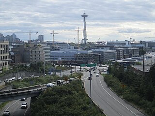
Mercer Street is a major east–west thoroughfare in the Lower Queen Anne and South Lake Union neighborhoods of Seattle, Washington. It travels 2 miles (3.2 km) and connects Elliott Avenue to the west and Interstate 5 to the east, serving as one of several downtown exits on the freeway. The street carries an average weekday volume of 38,000 vehicles on its central section.

Denny Way is an east–west arterial street in downtown Seattle, Washington, United States. It forms the northern end of the Belltown street grid as well as the boundaries of Belltown, Lower Queen Anne, South Lake Union, Denny Triangle, and Cascade. The street continues east through Capitol Hill to Madrona as a minor neighborhood street, ending near Madrona Park on Lake Washington.

<span class="mw-page-title-main">1st Avenue (Seattle)</span> Major street in Seattle, Washington, US

1st Avenue is a major street in Seattle, Washington, United States. It traverses Downtown Seattle, including Pioneer Square and Belltown, as well as the adjacent neighborhoods of SoDo and Lower Queen Anne. Numerous landmarks including parks, museums, and historic buildings are located along the street, including Pike Place Market. The Great Seattle Fire of 1889 destroyed much of it and it had to be rebuilt. Parades have taken place on it before and after the fire.

<span class="mw-page-title-main">Westlake Avenue</span>

Westlake Avenue is a major street in Seattle, Washington, connecting Downtown Seattle to the neighborhoods of South Lake Union, Westlake and northeastern Queen Anne. The street runs north–south along the west side of Lake Union for 2.5 miles (4.0 km) from McGraw Square to the Fremont Bridge.

<span class="mw-page-title-main">Sprague Avenue (Spokane, Washington)</span> Major east–west street serving Spokane

Sprague Avenue is a major east–west street serving Spokane, Spokane Valley, and Liberty Lake, Washington, United States. It travels approximately 17 miles (27 km), extending from Downtown Spokane eastward through Spokane Valley as an arterial road, and continues on as a collector road to its eastern terminus in Liberty Lake.

<span class="mw-page-title-main">North Hill, Spokane</span> Spokane Neighborhood in Washington, United States

North Hill is a neighborhood in Spokane, Washington. As the name suggests, it is atop a hill on the north side of Spokane, within which it is centrally located and crossed by numerous major thoroughfares. It is home to parks, commercial districts and single family residential areas. The historic Garland Theater is located in North Hill, and the city's main north–south arterial, Division Street, is home to a major commercial district along the eastern edge of the neighborhood.

References

  1. 1 2 3 4 5 Samson 2006
  2. 1 2 Speidel 1967
  3. Phelps 1978
  4. Gaudette, Karen (March 25, 2005). "The ABCs and 123s of Eastside streets". The Seattle Times. Retrieved March 3, 2019.
  5. Bear, Charla (27 April 2012). "Did Jesus Christ make Seattle under protest?". knkx.org. Retrieved 23 August 2023.
  6. Sale 1976, p. 76.
  7. Crowley 2000
  8. The landscape was carved by the Vashon glacier some 14,000 years ago. Anderson 2001.
  9. "Seattle Street Directional Designations" . Retrieved 2011-05-25.
  10. Google Maps (Map view is centered on Eastlake Avenue E and E Nelson Place. South of this point, the boundary between the Avenue N and E sections, the boundary is defined by Eastlake Avenue E. From there north to the Lake Washington Ship Canal all points east of Lake Union are in the E section.)
  11. Phelps 1978 , pp. 227–232 for street layout by compass direction; Phelps 1978 , pp. 233–235 for current grid.
  12. SDOT 2003b.

Bibliography

Further reading