Roosevelt, Seattle

Last updated
Roosevelt
Roosevelt High School (Seattle).jpg
Seattle Map - Roosevelt.png
General location of Roosevelt (highlighted in pink) within Seattle
Coordinates: 47°40′41″N122°18′55″W / 47.67806°N 122.31528°W / 47.67806; -122.31528
CountryUnited States
State Washington
County King
City Seattle
Named for Theodore Roosevelt
ZIP Code
98115
Area code 206

Roosevelt is a neighborhood in north Seattle, Washington. Its main thoroughfare, originally 10th Avenue, was renamed Roosevelt Way upon Theodore Roosevelt's death in 1919. The neighborhood received the name as the result of a Community Club contest held eight years later, in 1927. [1]

Contents

Roosevelt's principal and minor arterials are the one-way pair Roosevelt Way (southbound) and 12th Avenue NE (northbound), Lake City Way (SR 522) and 15th Avenue NE, and NE 65th and 75th Streets. [2] City streets are laid out and designated in a pattern; see street layout of Seattle, directionals.

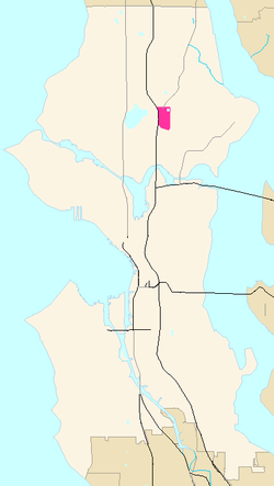
The boundaries of the neighborhood are Interstate 5 to the west, beyond which lies Green Lake; NE Ravenna Boulevard and NE 60th Street to the south, beyond which is the University District; 15th Avenue NE to the east, beyond which is Ravenna; and Lake City Way (SR 522) to the north, beyond which lies Maple Leaf. [3]

Schools

The Roosevelt district is also home to Roosevelt High School (RHS, opened 1922), one of the older schools in the Seattle Public Schools District. Like the street, it is named after Teddy, not Franklin D. Roosevelt. [1] For many years, Roosevelt High School and Garfield High School juggled the lead in the school district in many academic and sports fields. Alumni include Mark Pattison, who played football for the University of Washington Huskies and was drafted in the seventh round in 1985 by the Oakland Raiders of the NFL, actress Rose McGowan,(also attended Nova)[ citation needed ] and Nobel laureates Linda B. Buck and Robert Lucas Jr. [4]

Shops

Although primarily a residential neighborhood, the Roosevelt district had a Sears department store from 1928 to 1980. [5] After its closure, the land was redeveloped as Roosevelt Square, [1] which now features supermarket Whole Foods Market, local and pharmacy Bartell Drugs (chain established 1890), [6] a Mud Bay pet store and a Starbucks among other businesses. A block beyond Roosevelt Way to the west is the longest-established vegetarian restaurant in Seattle, independent Sunlight Cafe, nearly as old (1978) as Starbucks. [7] Numerous other small businesses still line 65th Street and Roosevelt Way. Teddy's is a multi-generational, multi-subculture popular biker bar. Roosevelt Way from 62nd Street north to 64th was somewhat of an "audio row", having featured a concentration of stores selling high-end audio and video systems and components. Today, only two such stores remain.

Parks

Map of Cowen's University Park Addition, southeast corner of present-day Roosevelt, showing original course of Ravenna Creek Cowens-university-park-addition.jpg
Map of Cowen's University Park Addition, southeast corner of present-day Roosevelt, showing original course of Ravenna Creek

The neighborhood includes two parks: Cowen Park, in the southeast corner (contiguous with the larger Ravenna Park of Ravenna); and Froula Playground, in the northeast corner, adjacent to the Green Lake Reservoir. The source of Ravenna Creek has been reduced to Cowen Park; since completion of the partial daylighting in 2006, the creek has been reconnected to Lake Washington.

Transportation

The underground Roosevelt Link light rail station located at NE 65th St and 12th Ave NE opened for service on October 2, 2021, which connects Roosevelt to downtown Seattle as well as the Northgate neighborhood to the north.

See also

Notes and references

  1. 1 2 3 Wilma (20 August 2001)
  2. "Street Arterial Classifications: Planning Maps" (PDF). Seattle Department of Transportation. 2004-01-12. Archived from the original (PDF) on 2006-06-22. Retrieved 2006-04-21.
    Low-Resolution Version, PDF format, at "Principal, Minor and Collector arterials" Archived 2006-06-14 at the Wayback Machine , 2005
    See Bibliography for map selection and links to definitions.
  3. (1) Wilma (20 August 2001).
    (1.1) With respect to historical documentation, the Seattle City Clerk's Neighborhood Map Atlas has a discrepancy regarding the north boundary with Maple Leaf.
    (2) Seattle City Clerk's Neighborhood Map Atlas (2002-06-17). ""Roosevelt", map". Office of the Seattle City Clerk. Retrieved 2006-04-21. Maps "NN-1030S", "NN-1040S".jpg dated 17 June 2002
    (3) "About the Seattle City Clerk's On-line Information Services". Information Services. Seattle City Clerk's Office. 2006-04-30. Retrieved 2006-05-21.
    See heading, "Note about limitations of these data".
    (4) "About us". Roosevelt Neighborhood Association (RNA). Roosevelt Neighborhood Seattle. n.d. Retrieved 2006-06-24.
    (4.1) RNA designation as official is for their non-profit 501(c)(3) corporation requirements. Since the abolition of wards in 1910, there exist no official neighborhoods or their boundaries in Seattle. [Wilma (1 May 2002, 28 September 2003)]
  4. (0) Unreferenced text: [ citation needed ] for Roosevelt-Garfield, for Pattison, and for McGowan.
    (1) "The Nobel Prize in Physiology or Medicine 2004". Medicine > Laureates > Linda B. Buck. Nobelprize.org. 2004-04-10. Retrieved 2006-04-21.
    (2) Buck as alumnus of RHS not found so far, [ citation needed ]; b. January 1947, graduated c. 1965.
    (3) "The Bank of Sweden Prize in Economic Sciences in Memory of Alfred Nobel 1995". Economics > Laureates > Robert E. Lucas. Nobelprize.org. 2005-04-13. Retrieved 2006-04-21.
    (4) Lucas is an alumnus of RHS, 1955 (Lucas in Frängsmyr, ed.).
  5. Sears Holding Corporation as of 2005 [Sears]
  6. Warren.
  7. (1) Eibel
    (2) Beans and equipment since 1971, drinks since 1985, corporate expansion 1987. "Company Timeline: February 2006" (PDF). "the company. What we are all about" . Starbucks. February 2006. Archived from the original (PDF) on 2007-08-10. Retrieved 2006-04-21.{{cite web}}: External link in |work= (help)

Bibliography

Further reading

Related Research Articles

<span class="mw-page-title-main">University District, Seattle</span> Seattle Neighborhood

The University District is a major district in Seattle, Washington, comprising several distinct neighborhoods. The main campus of the University of Washington (UW) is located in the district, lending its name to both the district as well as University Way NE.

<span class="mw-page-title-main">Union Bay Natural Area</span> Restored remainder of the former Union Bay and Union Bay Marsh

The Union Bay Natural Area (UBNA) in Seattle, Washington, also known as Union Bay Marsh, is the restored remainder of the filled former Union Bay and Union Bay Marsh. It is located at the east end of the main University of Washington campus, south of NE 45th Street and west of Laurelhurst. Ravenna Creek is connected to University Slough, thence to Union Bay, and Lake Washington. Drainage Canal is one of three or four areas of open water connected with Lake Washington around Union Bay Marsh. The canal extends from NE 45th Street, between the driving range and IMA Sports Field 1, south to the bay, ending southeast of the Husky Ballpark baseball grandstand. The Drainage Canal that carries Ravenna Creek past UBNA to Union Bay is locally sometimes called University Slough.

<span class="mw-page-title-main">Union Bay (Seattle)</span> Bay of Lake Washington in Seattle

Union Bay is a body of water located in Seattle, Washington. Part of Lake Washington, it is bounded by the Laurelhurst neighborhood to the north and the Montlake and Madison Park neighborhoods to the south. The Evergreen Point Floating Bridge, which carries State Route 520, crosses over a portion of the bay.

<span class="mw-page-title-main">Northgate, Seattle</span> Seattle Neighborhood in King, Washington, United States

Northgate is a neighborhood in north Seattle, Washington, named for and surrounding Northgate Mall, the first covered mall in the United States. Its north-south principal arterials are NE Northgate Way and 130th Street, and its east-west principal arterials are Roosevelt Way NE and Aurora Avenue N. Minor arterials are College Way-Meridian Avenue N, 1st, 5th, and 15th avenues NE. Interstate 5 runs through the district. Besides the eponymous mall, the most characteristic distinctions of the area are North Seattle College (NSC) and the south fork of the Thornton Creek watershed and Seattle Kraken Iceplex center.

<span class="mw-page-title-main">University Village, Seattle</span> Shopping mall in Washington, U.S.

University Village is a shopping mall in Seattle, Washington, United States, located in the south corner of the Ravenna neighborhood to the north of the Downtown area. It is an open-air shopping center which offers restaurants, locally owned boutiques, and national retailers, and is a popular retail destination in the region for home furnishings, popular fashions, gift items, and restaurants.

<span class="mw-page-title-main">Industrial District, Seattle</span> Seattle Neighborhood in King, Washington, United States

The Industrial District is the principal industrial area of Seattle, Washington. It is bounded on the west by the Duwamish River and Elliott Bay, beyond which lies Delridge of West Seattle; on the east by Interstate 5, beyond which lies Beacon Hill; on the north by S King and S Dearborn Streets, beyond which lie Pioneer Square and southwest International District of Downtown; and on the south by the main lines of the BNSF Railway and Union Pacific Railroad, or about S Lucille Street, beyond which is Georgetown. SoDo is the name of the northwest portion of the neighborhood, named for its being South of Downtown. SoDo is the location of T-Mobile Park, home of the Seattle Mariners, and Lumen Field, home of the Seattle Seahawks and Seattle Sounders FC. Lumen Field was also the site of the former Kingdome.

<span class="mw-page-title-main">Ravenna, Seattle</span> Seattle neighborhood

Ravenna is a neighborhood in northeastern Seattle, Washington named after Ravenna, Italy. Though Ravenna is considered a residential neighborhood, it also is home to several businesses, many of which are located in the University Village, a shopping mall.

<span class="mw-page-title-main">Wedgwood, Seattle</span> Seattle Neighborhood in USA

Wedgwood is a middle class residential neighborhood of northeast Seattle, Washington with a modest commercial strip. Wedgwood is located about two miles (3.2 km) north, and slightly east, of the University of Washington; it is about six miles (9.7 km) northeast of Downtown. The neighborhood is further typical of Seattle neighborhoods in having more than one name and having different, overlapping, but well-documented definitions of the neighborhood.

<span class="mw-page-title-main">Maple Leaf, Seattle</span> Seattle Neighborhood in King, Washington, United States

Maple Leaf is a mostly residential neighborhood located in northeast Seattle.

<span class="mw-page-title-main">Lake City, Seattle</span> Seattle Neighborhood in King, Washington, United States

Lake City is the northeast region of Seattle, centered along Lake City Way NE (SR-522), 7–8 miles (11–13 km) northeast of Downtown Seattle. A broader definition of the Lake City area includes all the land between 15th Avenue NE and Lake Washington, and between NE 95th and 98th streets to the Seattle city limits at NE 145th Street. Lake City encompasses much of the Thornton Creek watershed, the focus of a long restoration campaign by citizens and Seattle Public Utilities staff to enhance the residential environment of Lake City.

<span class="mw-page-title-main">Licton Springs, Seattle</span> Seattle Neighborhood in King, Washington, United States

Licton Springs or North College Park is a neighborhood in the informal Northgate district of North Seattle. It is bounded by Interstate 5 to the east, beyond which is Maple Leaf neighborhood and the Northgate Mall; Aurora Avenue N to the west, beyond which is Greenwood; N 85th Street to the south, beyond which is Green Lake, and N Northgate Way to the north, beyond which is Haller Lake.

<span class="mw-page-title-main">Matthews Beach, Seattle</span> Seattle Neighborhood in King, Washington, United States

Matthews Beach is a neighborhood in Seattle, Washington; it and Meadowbrook are the southern neighborhoods of the annexed township of Lake City (1954). Matthews Beach lies about 2 miles (3.2 km) northeast of the University of Washington, about 8 miles (13 km) northeast of Downtown.

<span class="mw-page-title-main">Atlantic, Seattle</span> Neighborhood of Seattle

Atlantic is a neighborhood in the Central District of Seattle, Washington, United States. It is the northernmost neighborhood in the Rainier Valley area, located between Mount Baker Ridge and Beacon Hill, and may also be considered part of South Seattle. It is home to the Judkins Park neighborhood.

<span class="mw-page-title-main">Ravenna Park</span>

Ravenna Park and Cowen Park comprise a single contiguous recreation and green space in the Ravenna neighborhood of Seattle, Washington in the United States. These public parks encompass the ravine with a maximum depth of 115 feet (35 m) through which Ravenna Creek flows.

<span class="mw-page-title-main">Rainier Beach, Seattle</span> Neighborhood in Seattle, Washington, U.S.

Rainier Beach is a set of neighborhoods in Seattle, Washington that are mostly residential. Also called Atlantic City, Rainier Beach can include Dunlap, Pritchard Island, and Rainier View neighborhoods.

<span class="mw-page-title-main">Northgate Station (shopping mall)</span> Shopping mall

Northgate Station is an enclosed shopping mall in Seattle, Washington, United States. It is located in the Northgate neighborhood on Interstate 5, adjacent to Northgate Way and Northgate station, a light rail station. The mall is anchored by Barnes & Noble, and Nordstrom Rack.

<span class="mw-page-title-main">The Ave</span> Main commercial street in Seattles University District

University Way Northeast, colloquially The Ave, is a major street and commercial district in the University District of Seattle, Washington, located near the University of Washington (UW) campus. Once "a department store eight blocks long," The Ave has gradually turned into what now resembles an eight-block-long global food court. The story of The Ave reflects the dynamics of many urban neighborhoods and the social and economic problems of countless American cities, though it is also a crossroads of diverse subcultures. It is patronized by many of the nearly 96,900 students, faculty, and staff of the UW and by a population of homeless or transient individuals, most of whom are youth.

<span class="mw-page-title-main">Meadowbrook, Seattle</span> Seattle Neighborhood in King, Washington, United States

Meadowbrook is a neighborhood in the Lake City district of Seattle, Washington. Meadowbrook is centered on open fields adjacent to the Community Center, Meadowbrook swimming pool, and Nathan Hale High School. It is bounded on the south by NE 95th Street and the Wedgwood neighborhood, on the north by NE 120th Street and Cedar Park, on the west by Lake City Way NE and Victory Heights, and on the east by 35th Avenue NE and Matthews Beach.

<span class="mw-page-title-main">Broadway (Seattle)</span>

Broadway is a major north–south thoroughfare in Seattle, Washington. The 1.6-mile-long (2.6 km) arterial runs north from Yesler Way at Yesler Terrace through the First Hill and Capitol Hill neighborhoods to East Roy Street. Broadway East continues north to East Highland Drive. North of there the street is made up of shorter segments: one from just south of East Blaine Street to just north of East Miller Street, another from East Roanoke Street to East Shelby Street, and the last from East Allison Street to Fuhrman Avenue East.