
The Union Bay Natural Area (UBNA) in Seattle, Washington, also known as Union Bay Marsh, is the restored remainder of the filled former Union Bay and Union Bay Marsh. It is located at the east end of the main University of Washington campus, south of NE 45th Street and west of Laurelhurst. Ravenna Creek is connected to University Slough, thence to Union Bay, and Lake Washington. Drainage Canal is one of three or four areas of open water connected with Lake Washington around Union Bay Marsh. The canal extends from NE 45th Street, between the driving range and IMA Sports Field 1, south to the bay, ending southeast of the Husky Ballpark baseball grandstand. The Drainage Canal that carries Ravenna Creek past UBNA to Union Bay is locally sometimes called University Slough.

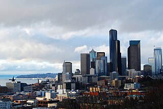
Union Bay is a body of water located in Seattle, Washington. Part of Lake Washington, it is bounded by the Laurelhurst neighborhood to the north and the Montlake and Madison Park neighborhoods to the south. The Evergreen Point Floating Bridge, which carries State Route 520, crosses over a portion of the bay.

Roosevelt is a neighborhood in northern Seattle, Washington. Its main thoroughfare, originally 10th Avenue, was renamed Roosevelt Way upon Theodore Roosevelt's death in 1919. The neighborhood received the name as the result of a Community Club contest held eight years later, in 1927.

Northgate is a neighborhood in north Seattle, Washington, named for and surrounding Northgate Mall, the first covered mall in the United States. Its north-south principal arterials are Roosevelt Way NE and Aurora Avenue N, and its east-west principal arterials are NE Northgate Way and 130th Street. Minor arterials are College Way-Meridian Avenue N, 1st, 5th, and 15th avenues NE. Interstate 5 runs through the district. Besides the eponymous mall, the most characteristic distinctions of the area are North Seattle College (NSC) and the south fork of the Thornton Creek watershed and Seattle Kraken Iceplex center.

First Hill is a neighborhood in Seattle, Washington, United States. It is named for the hill on which it is located, which in turn is so named for being the first hill encountered while traveling east from downtown Seattle toward Lake Washington. First Hill is bounded on the west by Interstate 5, beyond which is Downtown, on the north by E. Pike and E. Madison Streets, beyond which is Capitol Hill, and on the south by Yesler Way, beyond which is the International District. The City of Seattle provides conflicting information about its eastern limit, beyond which are Cherry Hill and the Central District. Some describe it as being bounded by Broadway and Boren Avenues, while others describe it as being bounded by 12th Avenue.

The Industrial District is a neighborhood and the principal industrial area of Seattle, Washington. It is bounded on the west by the Duwamish River and Elliott Bay, beyond which lies Delridge of West Seattle; on the east by Interstate 5, beyond which lies Beacon Hill; on the north by S King and S Dearborn Streets, beyond which lie Pioneer Square and southwest International District of Downtown; and on the south by the main lines of the BNSF Railway and Union Pacific Railroad, or about S Lucille Street, beyond which is Georgetown. SoDo is the name of the northwest portion of the neighborhood, named for its being South of Downtown. SoDo is the location of T-Mobile Park, home of the Seattle Mariners, and Lumen Field, home of the Seattle Seahawks and Seattle Sounders FC. Lumen Field was also the site of the former Kingdome.

Ravenna is a neighborhood in northeastern Seattle, Washington named after Ravenna, Italy. Though Ravenna is considered a residential neighborhood, it also is home to several businesses, many of which are located in the University Village, a shopping mall.

Beacon Hill is a hill and neighborhood in southeastern Seattle, Washington. It is roughly bounded on the west by Interstate 5, on the north by Interstate 90, on the east by Rainier Avenue South, Cheasty Boulevard South, and Martin Luther King Junior Way South, and on the south by the Seattle city boundary. It is part of Seattle's South End.
Dr. Jose Rizal Park is a 9.6 acre park on the west slope of Beacon Hill in Seattle, Washington. The land, condemned by the city in 1917 for engineering purposes, was acquired by the Parks Department in 1971, and the park was dedicated eight years later. The park is named after José Rizal, the de facto national hero of the Philippines.
Wedgwood is a middle-class residential neighborhood of northeast Seattle, Washington with a modest commercial strip. Wedgwood is located about two miles (3.2 km) north, and slightly east, of the University of Washington; it is about six miles (9.7 km) northeast of Downtown. The neighborhood is further typical of Seattle neighborhoods in having more than one name and having different, overlapping, but well-documented definitions of the neighborhood.
The Central Area is a mostly residential neighborhood in Seattle located east of downtown and First Hill ; west of Madrona, Leschi and Mt. Baker; south of Capitol Hill, and north of Rainier Valley. Historically, the Central District has been one of Seattle's most racially and ethnically diverse neighborhoods, and was once the center of Seattle's black community and a major hub of African-American businesses.

Lake City is a neighborhood and the northeast region of Seattle, centered along Lake City Way NE (SR-522), 7–8 miles (11–13 km) northeast of Downtown Seattle. A broader definition of the Lake City area includes all the land between 15th Avenue NE and Lake Washington, and between NE 95th and 98th streets to the Seattle city limits at NE 145th Street. Lake City encompasses much of the Thornton Creek watershed, the focus of a long restoration campaign by citizens and Seattle Public Utilities staff to enhance the residential environment of Lake City.

Licton Springs or North College Park is a neighborhood in the informal Northgate district of North Seattle. It is bounded by Interstate 5 to the east, beyond which is Maple Leaf neighborhood and the Northgate Mall; Aurora Avenue N to the west, beyond which is Greenwood; N 85th Street to the south, beyond which is Green Lake, and N Northgate Way to the north, beyond which is Haller Lake.

Matthews Beach is a neighborhood in Seattle, Washington; it and Meadowbrook are the southern neighborhoods of the annexed township of Lake City (1954). Matthews Beach lies about 2 miles (3.2 km) northeast of the University of Washington, about 8 miles (13 km) northeast of Downtown.

Rainier Beach is a set of neighborhoods in Seattle, Washington that are mostly residential. Also called Atlantic City, Rainier Beach can include Dunlap, Pritchard Island, and Rainier View neighborhoods.

Northgate Station is an enclosed shopping mall in Seattle, Washington, United States. It is located in the Northgate neighborhood on Interstate 5, adjacent to Northgate Way and Northgate station, a light rail station. The mall is anchored by Barnes & Noble, and Nordstrom Rack.

Meadowbrook is a neighborhood in the Lake City district of Seattle, Washington. Meadowbrook is centered on open fields adjacent to the Community Center, Meadowbrook swimming pool, and Nathan Hale High School. It is bounded on the south by NE 95th Street and the Wedgwood neighborhood, on the north by NE 120th Street and Cedar Park, on the west by Lake City Way NE and Victory Heights, and on the east by 35th Avenue NE and Matthews Beach.

Cherry Hill is a neighborhood and predominantly residential area in Seattle, Washington located south of Capitol Hill within the Central District, north of the International District, and east of First Hill. Cherry Hill is bound on the west by 14th Avenue, on the east by 23rd Avenue, on the north by East Madison Street and on the south by East Yesler Way. Cherry Hill overlaps considerably with the neighborhood of Squire Park as defined by the Squire Park Neighborhood Council. In the Seattle City Clerk's Geographic Indexing Atlas, Cherry Hill is designated as the Minor neighborhood of the Central Area. Cherry Hill was previously called Second Hill or Renton Hill.

Broadway is a major north–south thoroughfare in Seattle, Washington. The 1.6-mile-long (2.6 km) arterial runs north from Yesler Way at Yesler Terrace through the First Hill and Capitol Hill neighborhoods to East Roy Street. Broadway East continues north to East Highland Drive. North of there the street is made up of shorter segments: one from just south of East Blaine Street to just north of East Miller Street, another from East Roanoke Street to East Shelby Street, and the last from East Allison Street to Fuhrman Avenue East.


