
Pioneer Square is a neighborhood in the southwest corner of Downtown Seattle, Washington, US. It was once the heart of the city: Seattle's founders settled there in 1852, following a brief six-month settlement at Alki Point on the far side of Elliott Bay. The early structures in the neighborhood were mostly wooden, and nearly all burned in the Great Seattle Fire of 1889. By the end of 1890, dozens of brick and stone buildings had been erected in their stead; to this day, the architectural character of the neighborhood derives from these late 19th century buildings, mostly examples of Richardsonian Romanesque.

Capitol Hill is a densely populated residential district and a neighborhood in Seattle, Washington, United States. It is immediately east of Downtown Seattle and north of First Hill. The neighborhood is one of the city's most popular nightlife and entertainment districts and is home to a historic gay village and vibrant counterculture community.

The street layout of Seattle is based on a series of disjointed rectangular street grids. Most of Seattle and King County use a single street grid, oriented on true north. Near the center of the city, various land claims were platted in the 19th century with differently oriented grids, which still survive today. Distinctly oriented grids also exist in some cities annexed by Seattle in the early 20th century, such as Ballard and Georgetown. A small number of streets and roads are exceptions to the grid pattern.
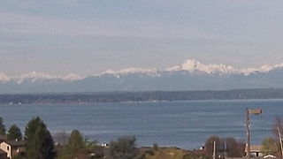
Downtown is the central business district of Seattle, Washington. It is fairly compact compared with other city centers on the U.S. West Coast due to its geographical situation, being hemmed in on the north and east by hills, on the west by Elliott Bay, and on the south by reclaimed land that was once tidal flats. It is bounded on the north by Denny Way, beyond which are Lower Queen Anne, Seattle Center, and South Lake Union; on the east by Interstate 5, beyond which is Capitol Hill to the northeast and Central District to the east; on the south by S Dearborn Street, beyond which is Sodo; and on the west by Elliott Bay, a part of Puget Sound.
Broadview is a neighborhood in northwestern Seattle, Washington, United States.
The Central Area is a mostly residential neighborhood in Seattle located east of downtown and First Hill ; west of Madrona, Leschi and Mt. Baker; south of Capitol Hill, and north of Rainier Valley. Historically, the Central District has been one of Seattle's most racially and ethnically diverse neighborhoods, and was once the center of Seattle's black community and a major hub of African-American businesses.

Transportation in Seattle is largely focused on the automobile like many other cities in western North America; however, the city is just old enough for its layout to reflect the age when railways and trolleys predominated. These older modes of transportation were made for a relatively well-defined downtown area and strong neighborhoods at the end of several former streetcar lines, now mostly bus lines.

Crown Hill is a neighborhood in the city of Seattle, in the U.S. state of Washington.

Yesler Terrace is a 22-acre (8.9 ha) mixed-income, mixed-use neighborhood in Seattle, Washington, United States. It was originally completed in 1941 as the state's first public housing development and the first racially integrated public housing development in the United States. It occupies much of the area formerly known as Yesler Hill, Yesler's Hill, or Profanity Hill. The development is administered by the Seattle Housing Authority, who have been redeveloping the neighborhood into a mixed-income area with multi-story buildings and community amenities since 2013.

Atlantic is a neighborhood in the Central District of Seattle, Washington, United States. It is the northernmost neighborhood in the Rainier Valley area, located between Mount Baker Ridge and Beacon Hill, and may also be considered part of South Seattle. It is home to the Judkins Park neighborhood.

Downtown Portland is the central business district of Portland, Oregon, United States. It is on the west bank of the Willamette River in the northeastern corner of the southwest section of the city and where most of the city's high-rise buildings are found.

Squire Park is a neighborhood in the city of Seattle, in the U.S. state of Washington. According to the Squire Park Community Council, it is bounded on the south by S. Jackson Street, on the west by 12th Avenue and 12th Avenue S., on the north by E. Union Street, and on the east by 23rd Avenue and 23rd Avenue S., placing it within the Central District. Its main thoroughfares are E. Jefferson and Cherry Streets and E. Yesler Way and 14th Avenue. Swedish Medical Center's Cherry Hill campus is located here, Seattle University, a Jesuit University has part of its campus in Squire Park, as the Admissions, some dormitories and Athletics departments are east of 12th Avenue.

Cherry Hill is a neighborhood and predominantly residential area in Seattle, Washington located south of Capitol Hill within the Central District, north of the International District, and east of First Hill. Cherry Hill is bound on the west by 14th Avenue, on the east by 23rd Avenue, on the north by East Madison Street and on the south by East Yesler Way. Cherry Hill overlaps considerably with the neighborhood of Squire Park as defined by the Squire Park Neighborhood Council. In the Seattle City Clerk's Geographic Indexing Atlas, Cherry Hill is designated as the Minor neighborhood of the Central Area. Cherry Hill was previously called Second Hill or Renton Hill.

David Thomas Denny was a member of the Denny Party, who are generally collectively credited as the founders of Seattle, Washington, United States. Though he ultimately underwent bankruptcy, he was a significant contributor to the shape of the city. Roger Sale, in his book Seattle, Past to Present, described him as having been "the pioneer to turn to if one had a plan that would be 'good for Seattle', and one needed a respectable tone and a willing investor."

Pioneer Square station is a light rail station that is part of the Downtown Seattle Transit Tunnel in Seattle, Washington, United States. The station is located under 3rd Avenue at James Street, between Symphony and International District/Chinatown stations. It is served by the 1 Line, part of Sound Transit's Link light rail system, and provides connections to local buses and Colman Dock, a major ferry terminal serving areas west of Seattle.

The First Hill Streetcar, officially the First Hill Line, is a streetcar route in Seattle, Washington, United States, forming part of the modern Seattle Streetcar system. It travels 2.5 miles (4.0 km) between several neighborhoods in central Seattle, including the International District, First Hill, and Capitol Hill. The line has ten stops and runs primarily in mixed traffic on South Jackson Street and Broadway.

The Seattle Streetcar is a system of two modern streetcar lines operating in the city of Seattle, Washington. The South Lake Union line opened first in 2007 and was followed by the First Hill line in 2016. The two lines are unconnected, but share similar characteristics: frequent service, station amenities, and vehicles. Streetcars typically arrive every 10–15 minutes most of the day, except late at night. The streetcar lines are owned by the Seattle Department of Transportation and operated by King County Metro. The system carried 1,326,500 passengers in 2023.

Broadway is a major north–south thoroughfare in Seattle, Washington. The 1.6-mile-long (2.6 km) arterial runs north from Yesler Way at Yesler Terrace through the First Hill and Capitol Hill neighborhoods to East Roy Street. Broadway East continues north to East Highland Drive. North of there the street is made up of shorter segments: one from just south of East Blaine Street to just north of East Miller Street, another from East Roanoke Street to East Shelby Street, and the last from East Allison Street to Fuhrman Avenue East.

The architecture of Seattle, Washington, the largest city in the Pacific Northwest region of the U.S., features elements that predate the arrival of the area's first settlers of European ancestry in the mid-19th century, and has reflected and influenced numerous architectural styles over time. As of the early 21st century, a major construction boom continues to redefine the city's downtown area as well as neighborhoods such as Capitol Hill, Ballard and, perhaps most dramatically, South Lake Union.

Pike Street is an east-west street in Seattle. It extends from Pike Place above Seattle's saltwater waterfront at Elliott Bay through Downtown Seattle, across Capitol Hill to the freshwater shore of Lake Washington at Lake Washington Boulevard. A segment less than a block long exists at Alaskan Way on Elliott Bay, connected to the rest of the street only by the pedestrian Pike Street Hill Climb; the bottom of the hillclimb under the Alaskan Way Viaduct was the original shoreline of the city before major modification and construction of the Seattle Seawall. It is included in the south-to-north mnemonic "Jesus Christ Made Seattle Under Protest" for the street layout of Seattle.


