
Green Lake is a neighborhood in north central Seattle, Washington. Its centerpiece is the lake and park after which it is named.

Capitol Hill is a densely populated residential district and a neighborhood in Seattle, Washington, United States. It is immediately east of Downtown Seattle and north of First Hill. The neighborhood is one of the city's most popular nightlife and entertainment districts and is home to a historic gay village and vibrant counterculture community.

The street layout of Seattle is based on a series of disjointed rectangular street grids. Most of Seattle and King County use a single street grid, oriented on true north. Near the center of the city, various land claims were platted in the 19th century with differently oriented grids, which still survive today. Distinctly oriented grids also exist in some cities annexed by Seattle in the early 20th century, such as Ballard and Georgetown. A small number of streets and roads are exceptions to the grid pattern.

Queen Anne is a neighborhood in northwestern Seattle, Washington. Queen Anne covers an area of 7.3 square kilometers (2.8 sq mi), and has a population of about 28,000. It is bordered by Belltown to the south, Lake Union to the east, the Lake Washington Ship Canal to the north and Interbay to the west.

Leschi is a neighborhood in the city of Seattle, Washington, United States. Located on the western shore of Lake Washington, the residential neighborhood was named by its 19th-century developer for Chief Leschi of the Nisqually tribe, who was executed by territorial authorities in 1858 in Pierce County, Washington.

Madison Park is an 8.3 acre (34,000 m2) park in the Madison Park neighborhood of Seattle, Washington, located between the western shore of Lake Washington on the east, 42nd Avenue E. on the west, E. Madison Street on the north, and E. Blaine Street on the south. 43rd Avenue E. divides it into two sections; the east is a swimming beach and public dock, and the west is a playground, playfield, and tennis courts. Next to the beach is Madison Park Co-op, a community playhouse for toddlers and children.

Washington Park is a public park in Seattle, Washington, United States, most of which is taken up by the Washington Park Arboretum, a joint project of the University of Washington, the Seattle Parks and Recreation, and the nonprofit Arboretum Foundation. Washington Park also includes a playfield and the Seattle Japanese Garden in its southwest corner. To the north is Union Bay; to the west are Montlake and Madison Valley; to the south is the Washington Park neighborhood; and to the east is the Broadmoor Golf Club.

Denny Blaine Park is a 2 acres (8,100 m2) water-front park in the Denny-Blaine neighborhood of Seattle, Washington. With picturesque views of Bellevue directly across the lake and Mount Rainier in the distance, it is primarily used for picnicking, sunbathing, and swimming. The park has also been one of Seattle's unofficial queer- and trans-friendly clothing optional beaches since the 1970s.
Lakeview Park is a 4.5-acre (18,000 m2) park in the Denny-Blaine neighborhood of Seattle, Washington, designed as part of the Olmsted Brothers park system in Seattle. It is located on both sides of Lake Washington Boulevard. as it winds down a hillside toward Lake Washington. The western half is a bowl-like park with grass and trees along 37th Ave E. and E. Harrison Street; the eastern half incorporates a lookout at the end of E. Harrison Street and undeveloped hillside between Hillside Drive E. and McGilvra Boulevard E.
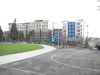
Cascade is an urban neighborhood abutting Downtown Seattle, Washington, United States, located adjacent to South Lake Union. It is bounded by: Fairview Avenue North on the west, beyond which is the rest of the Cascade Neighborhood; the Interstate 5 interchange for Mercer St to the north, beyond which is Eastlake; Interstate 5 on the east, beyond which is Capitol Hill; and Denny Way on the south, beyond which is Denny Triangle. It is surrounded by thoroughfares Mercer Street (eastbound), Fairview Avenue N. and Eastlake Avenue E., and Denny Way. The neighborhood, one of Seattle's oldest, originally extended much further: west to Terry Avenue, south to Denny Hill on the South, and east to Melrose Avenue E through the area now obliterated by Interstate 5. Some recent writers consider Cascade to omit the northern "arm", while others extend it westward to cover most of South Lake Union.
South Lake Union is a neighborhood in central Seattle, Washington, so named because it is at the southern tip of Lake Union.

Madrona is a mostly residential neighborhood in east Seattle, Washington. It is bounded on the east by Lake Washington; on the south by E. Cherry Street, beyond which is Leschi; on the west by Martin Luther King Jr. Way, beyond which is the Central District; and on the north by E. Howell Street, beyond which is Denny-Blaine.

Madison Park is a neighborhood in eastern Seattle, Washington, United States. It is named after the city park at the foot of Madison Street on the Lake Washington shore. The neighborhood is generally bounded on the east by Lake Washington; on the south by East Prospect Street, beyond which is Denny-Blaine; on the west by Lake Washington Boulevard E.; and on the north by Union Bay. Madison Park generally consists of single-family housing with a small business district near the park.

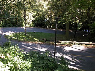
Viretta Park is a 1.8-acre (7,300 m2) park in the Denny-Blaine neighborhood of Seattle, Washington, located at the foot of E. John Street at 39th Avenue E. and stretching down to Lake Washington Boulevard. It was named by Charles L. Denny after his wife, Viretta Chambers Denny. It is located to the south of the former home of Kurt Cobain, where he was found dead. Nirvana fans gather at the park on the anniversary of Cobain's death, and to a lesser extent on his birthday, to pay tribute to him.

Madison Valley is a neighborhood in Seattle located east of Capitol Hill; west of Washington Park; south of Montlake; and north of Madrona.

Lake Washington Boulevard is a scenic, approximately 8-mile (13 km), road through Seattle, Washington, that hugs Lake Washington for much of the route. There are views of the lake, small sections of rainforest, meadows, and views of the Cascade mountains. At its northern end, Lake Washington Boulevard originates as East Lake Washington Boulevard at Montlake Boulevard East, soon becomes Lake Washington Boulevard East, and runs through the length of the Washington Park Arboretum. The road begins at S. Juneau Street in Seward Park, running thence along the lake to Colman Park, just south of Interstate 90. From here north to E. Alder Street in Leschi, the lakeside road is named Lakeside Avenue, and Lake Washington Boulevard diverts to a winding route through Colman, Frink, and Leschi Parks. At E. Alder, the boulevard once again runs along the lake through Madrona Park to just north of Madrona Drive, where private residences occupy the shore. At E. Denny-Blaine Place, the road heads northwest, through Lakeview Park and the grounds of The Bush School, to the south entrance of the Arboretum at E. Madison Street. It continues through the Arboretum. Just north of E. Roanoke Street, the boulevard turns due west and changes from Lake Washington Boulevard E. to E. Lake Washington Boulevard, following the city's street name designation system. The boulevard ends at the Montlake overpass of 520, where E. Montlake Place E. becomes Montlake Boulevard E.
Seattle Parks and Recreation is the government department responsible for maintaining the parks, open spaces, and community centers of the city of Seattle, Washington. The department maintains properties covering an area of over 6,200 acres (25 km2), which is equivalent to roughly 11% of the city's total area. Of those 6,200 acres (25 km2), 4,600 acres (19 km2) are developed.

Broadway is a major north–south thoroughfare in Seattle, Washington. The 1.6-mile-long (2.6 km) arterial runs north from Yesler Way at Yesler Terrace through the First Hill and Capitol Hill neighborhoods to East Roy Street. Broadway East continues north to East Highland Drive. North of there the street is made up of shorter segments: one from just south of East Blaine Street to just north of East Miller Street, another from East Roanoke Street to East Shelby Street, and the last from East Allison Street to Fuhrman Avenue East.
Denny Way is an east–west arterial street in downtown Seattle, Washington, United States. It forms the northern end of the Belltown street grid as well as the boundaries of Belltown, Lower Queen Anne, South Lake Union, Denny Triangle, and Cascade. The street continues east through Capitol Hill to Madrona as a minor neighborhood street, ending near Madrona Park on Lake Washington.

