
Haller Lake is a small lake and neighborhood in north central Seattle, Washington, named for Theodore N. Haller, who platted the neighborhood in 1905. His father, Granville O. Haller, was one of Seattle's early settlers, an army officer who amassed a large estate in the region.

Shilshole Bay is the part of Puget Sound east of a line drawn northeasterly from Seattle's West Point in the southwest to its Golden Gardens Park in the northeast. On its shores lie Discovery Park, the Lawton Wood section of the Magnolia neighborhood, the neighborhood of Ballard, and Golden Gardens Park. It is home to the Shilshole Bay Marina on Ballard's Seaview Avenue N.W. and communicates with the Lake Washington Ship Canal via the Ballard Locks.

West Seattle is a conglomeration of neighborhoods in Seattle, Washington, United States. It comprises two of the thirteen districts, Delridge and Southwest, and encompasses all of Seattle west of the Duwamish River. It was incorporated as an independent town in 1902 before being annexed by Seattle five years later. Among the area's attractions are its saltwater beach parks along Elliott Bay and Puget Sound, including Alki Beach Park and Lincoln Park. The area is also known for its views of the Olympic Mountains to the west and the Cascade Range to the east. One-third of Seattle's green space and urban forest is located in West Seattle, much of it in the West Duwamish Greenbelt.

Broadmoor is an 85 acre gated residential community with a 115 acre golf course in Seattle, Washington, United States. It is bounded on the west by the Washington Park Arboretum; on the south by East Madison Street, beyond which is the Washington Park neighborhood; on the east by 37th Avenue East, beyond which is the Madison Park neighborhood; and on the north by Union Bay marshland. It was founded on September 10, 1924.

Sand Point is a neighborhood in Seattle, Washington, United States, named after and consisting mostly of the Sand Point peninsula that juts into Lake Washington, which is itself largely given over to Magnuson Park. Its southern boundary can be said to be N.E. 65th Street, beyond which are Windermere and Hawthorne Hills; its northern boundary, N.E. 95th Street, beyond which is Lake City. The western limit of the neighborhood, beyond which are View Ridge and Wedgwood, is not fixed and can be said to be anywhere up the hill that extends west from Sand Point Way N.E. as far as 35th Avenue N.E. It is also the former home of Seattle Naval Air Station.

Madison Park is a neighborhood in eastern Seattle, Washington, United States. It is named after the city park at the foot of Madison Street on the Lake Washington shore. The neighborhood is generally bounded on the east by Lake Washington; on the south by East Prospect Street, beyond which is Denny-Blaine; on the west by Lake Washington Boulevard E.; and on the north by Union Bay. Madison Park generally consists of single-family housing with a small business district near the park.

Mount Baker is a neighborhood in southeastern Seattle, Washington. The neighborhood's name comes from the view of Mount Baker in Whatcom County, that is seen by looking north over Lake Washington. It is bounded by Lake Washington to the east, Interstate 90 and then Leschi to the north, Rainier Valley to the west, and Columbia City to the south. The neighborhood has a community club and a rowing team. It hosts Seattle's annual Seafair, which includes an airshow featuring the U.S. Navy Blue Angels, hydroplane races, a fireworks show, and other festivities. Franklin High School and Garfield High School serve this area. It is part of Seattle's South End.

Crown Hill is a neighborhood in the city of Seattle, in the U.S. state of Washington.
North Beach / Blue Ridge is a neighborhood in the city of Seattle, in the U.S. state of Washington.

Madison Valley is a neighborhood in Seattle located east of Capitol Hill; west of Washington Park; south of Montlake; and north of Madrona.

Squire Park is a neighborhood in the city of Seattle, in the U.S. state of Washington. According to the Squire Park Community Council, it is bounded on the south by S. Jackson Street, on the west by 12th Avenue and 12th Avenue S., on the north by E. Union Street, and on the east by 23rd Avenue and 23rd Avenue S., placing it within the Central District. Its main thoroughfares are E. Jefferson and Cherry Streets and E. Yesler Way and 14th Avenue. Swedish Medical Center's Cherry Hill campus is located here, Seattle University, a Jesuit University has part of its campus in Squire Park, as the Admissions, some dormitories and Athletics departments are east of 12th Avenue.

Westlake is a neighborhood in Seattle, Washington. It was named after its location on the western shore of Lake Union. It is a relatively narrow neighborhood, there being only a few blocks between the shoreline and its western limit at Aurora Avenue N., beyond which is Queen Anne. To the south beyond Aloha Street is South Lake Union, and to the north across the Fremont Cut is Fremont. Its main thoroughfares are Dexter and Westlake Avenues N..
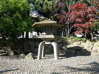
Kobe Terrace is a 1-acre (4,000 m2) public park in the International District neighborhood of Seattle, Washington. It incorporates the Danny Woo International District Community Garden. Named after Kobe, Seattle's sister city in Japan, it occupies most of the land bounded on the west by 6th Avenue S., on the north by S. Washington Street, on the east by Interstate 5, and on the south by S. Main Street.
The Fairmount Park is a neighborhood of West Seattle in Seattle, Washington. It runs southwest along both sides of Fauntleroy Way, from SW Graham Street in the south to SW Edmunds Street in the north. Neighborhood features include Fairmount Playfield, a city park, and Fairmount Park Elementary School, part of the Seattle Public Schools system.
Genesee is a neighborhood of West Seattle in Seattle, Washington. It extends north from SW Genesee St. to SW Charlestown St., and west from 46th to 56th Avenues SW. The neighborhood includes Ercolini Park and the new Genesee Hill Elementary School. It should not be confused with Genesee Park, in Rainier Valley.
Pinehurst is a neighborhood in the Northgate area of Seattle, Washington, United States. It is bounded by NE 145th Street to the north, NE Northgate Way to the south, I-5 to the west, and Lake City Way to the east. These boundaries were determined by the Pinehurst Community Council. Pinehurst's northern boundary of NE 145th Street makes Pinehurst one of the northernmost neighborhoods in the city of Seattle.

Loyal Heights is a neighborhood in Seattle, Washington. It is considered part of greater Ballard.

Briarcliff is a neighborhood in Seattle, Washington. The city's Department of Neighborhoods places Briarcliff on the west side of Magnolia, south of Discovery Park.
West Woodland is a neighborhood in Seattle, Washington. The city's Department of Neighborhoods places West Woodland in the south east corner of Ballard.
Broadway District is a neighborhood in Seattle, Washington. The city's Department of Neighborhoods places Broadway on the southwest side of Capitol Hill.
