Lake Union

Last updated • 5 min readFrom Wikipedia, The Free Encyclopedia

Lake Union
x̌ax̌čuʔ (Lushootseed)
Aerial Lake Union June 2012.jpg
Lake Union viewed from the north in 2012
USA Washington relief location map.jpg
Red pog.svg
Lake Union
Usa edcp relief location map.png
Red pog.svg
Lake Union
Location Seattle, Washington, U.S.
Coordinates 47°38′21″N122°20′01″W / 47.6392°N 122.3337°W / 47.6392; -122.3337 (Lake Union) [1]
Primary inflows Lake Washington Ship Canal
(Portage Bay from Montlake Cut)
Primary outflows Lake Washington Ship Canal
(Fremont Cut to Salmon Bay)
Catchment area 571 square miles (1,480 km2) [2]
Basin  countriesUnited States
Surface area580 acres (2.3 km2) [2]
Average depth34 feet (10 m) [2]
Max. depth50 feet (15 m) [2]
Water volume20,000 acre-feet (25,000,000 m3) [2]

Lake Union (Lushootseed : x̌ax̌čuʔ) [3] [a] is a freshwater lake located entirely within the city limits of Seattle, Washington, United States. It is a major part of the Lake Washington Ship Canal, which carries fresh water from the much larger Lake Washington on the east to Puget Sound on the west. The easternmost point of the lake is the Ship Canal Bridge, which carries Interstate 5 over the eastern arm of the lake and separates Lake Union from Portage Bay. Lake Union is the namesake of the neighborhoods located on three of its shores: Eastlake, Westlake and South Lake Union. Notable destinations on the lake include Lake Union Park, the Museum of History & Industry (MOHAI), and the Center for Wooden Boats on the southern shore and Gas Works Park on the northern shore.

Contents

University of Washington campus frontage on Lake Union, 1919 Lake Union frontage of the Univ of Wash campus 1919 (COBB 354).jpeg
University of Washington campus frontage on Lake Union, 1919

The Aurora Bridge (officially the George Washington Memorial Bridge) carries State Route 99 over the western arm of Lake Union. The Aurora Bridge is so named because it carries Aurora Ave N down the western side of the lake. Lake Union's westernmost point can be considered the Fremont Cut, which is located just west of the Aurora Bridge and is spanned by the Fremont Bridge. The Fremont Bridge carries Fremont Ave N between the neighborhoods of Fremont and Queen Anne and separates Lake Union from the rest of the Lake Washington Ship Canal to the west.

Description

Lake Union flows into the Fremont Cut towards the Puget Sound. Aerial Lake Union November 2011.JPG
Lake Union flows into the Fremont Cut towards the Puget Sound.

Lake Union is a natural lake in Seattle that lies north of the city's central business district. It is fully surrounded by urban neighborhoods and highways. Lake Union is the smaller of the two major lakes in Seattle, the other being Lake Washington. [4]

Part of the Lake Washington Ship Canal system, water flows into the lake from Lake Washington through the Montlake Cut, and out via the Fremont Cut on its way to Puget Sound. Before the construction of the canal, Lake Union emptied into Salmon Bay via a creek which followed roughly the same course as the Fremont Cut does today.[ citation needed ]

Because of the connection via the Hiram M. Chittenden Locks to the salt water of Puget Sound, the water is brackish to a certain extent, [2] which increases in the summer as the inflow rate from Lake Washington decreases and the locks open more frequently for pleasure craft. [2]

History

Residential area near by Lake Union in 1883 Residential area near Lake Union, Seattle, 1883 (PEISER 32).jpeg
Residential area near by Lake Union in 1883

A glacial lake, its basin was dug 12,000 years ago by the Vashon glacier, which also created Lake Washington and Seattle's Green, Bitter, and Haller Lakes.[ citation needed ]

Name

In Lushootseed, the lake is known as x̌ax̌čuʔ, meaning "small lake." [3] It is the diminutive form of the name of Lake Washington, x̌ačuʔ. [5]

In Chinook Jargon, the trade language primarily used in the 19th century, it is called Tenas Chuck ("small water"). [6]

Lake Union received its present name from Thomas Mercer, who in 1854 correctly predicted that canals would someday join Lake Washington to Puget Sound in a "union of waters." [7]

Pre-development

Lake Union was formed by the recession of the Vashon Glacier approximately 14,000 years before present. [4]

Geography

Aerial view of Lake Union, July 2011 Aerial Lake Union July 4 2011.JPG
Aerial view of Lake Union, July 2011

Several Seattle neighborhoods take their name from the lake: Eastlake, Westlake, Northlake, and South Lake Union; and three major streets are named in relation to it: Westlake Avenue, which runs along its western shore from Downtown to the Fremont Bridge; Eastlake Avenue, which runs along its eastern shore from Cascade to the University District, and Northlake Way, which runs along its northern shore from the University District past Gas Works Park to the edge of Fremont.[ citation needed ]

1907 Lake Union pano.jpg
Lake Union, 1907, from Queen Anne Hill. Capitol Hill is straight ahead; the gas works (now Gas Works Park) can be seen at left, jutting into the lake.
Lakeunion view.JPG
The view of Capitol Hill and Downtown Seattle from Lake Union

Uses

Boeing began production on Lake Union in 1916, there had a hangar assembled the company's first product B & W Seaplane. [8] Shipyards, wharves, and sawmills have also dotted the shore. [4]

Floating homes

Floating homes on Lake Union's eastern shore Floatinghomes.JPG
Floating homes on Lake Union's eastern shore

Floating homes line the east and west sides of Lake Union. In Sleepless in Seattle , the character played by Tom Hanks lived on one of these homes. [9]

Recreation

Kayaking on Lake Union with the Space Needle visible in the distance Recreational kayak.jpg
Kayaking on Lake Union with the Space Needle visible in the distance

Lake Union's proximity to and scenic views of the central Seattle and University District skylines make it a popular recreational spot. Seaplane operated by Kenmore Air and Seattle Seaplanes land and take off from the lake throughout the day. Pleasure boats from Lake Washington pass through on their way to Puget Sound. The Center for Wooden Boats holds a yearly wooden boat festival, while the annual Seattle Boat Show at the end of January demonstrates seacraft for sale on actual waters, in addition to its displays in the concourse of Lumen Field. The world-famous Duck Dodge sailboat races are run on Lake Union each Tuesday during the summer. Rowers in sweep and sculling boats use the lake year-round. Paddleboarding and kayaking are also popular on this lake.[ citation needed ]

Parks

Gas Works Park is the largest park on Lake Union and the most popular for Seattleites and visitors. It is the venue for summer concerts and Seattle's major Fourth of July fireworks show. Other parks ring the lake, clockwise around the compass from Gas Works which is nearly due north: North Passage Point Park, South Passage Point Park, Fairview Park, Terry Pettus Park, and South Lake Union Park.[ citation needed ]

Competitive rowing

Lake Union is home to several rowing centers and teams, including Holy Names Academy Crew, Lake Union Crew, Lake Washington Rowing Club and Pocock Rowing Center, all members of USRowing. Also rowing out of bodies of water attached to Lake Union are the Seattle Rowing Center and the Conibear Shellhouse, serving the Washington Huskies.[ citation needed ]

Transportation

Seaplane base

DHC-3 Otter floatplane of Kenmore Air on Lake Union Kenmore Air Lake Union.jpg
DHC-3 Otter floatplane of Kenmore Air on Lake Union

Lake Union is home to two seaplane bases: Kenmore Air Harbor Seaplane Base ( IATA : LKE, FAA LID : W55), and Seattle Seaplanes ( FAA LID : 0W0), located one nautical mile (1.85 km) north of the central business district of Seattle.[ citation needed ]

Notes

  1. Pronounced HAH-choh; lit. "small lake"

Related Research Articles

<span class="mw-page-title-main">Puget Sound</span> Sound in Washington, United States

Puget Sound is a complex estuarine system of interconnected marine waterways and basins located on the northwest coast of the U.S. state of Washington. As a part of the Salish Sea, the sound has one major and two minor connections to the Strait of Juan de Fuca, which in turn connects to the open Pacific Ocean. The major connection is Admiralty Inlet; the minor connections are Deception Pass and the Swinomish Channel.

<span class="mw-page-title-main">Lake Washington</span> Freshwater lake in the United States

Lake Washington is a large freshwater lake adjacent to the city of Seattle, Washington, United States. It is the largest lake in King County and the second largest natural lake in the state of Washington, after Lake Chelan. It borders the cities of Seattle on the west, Bellevue and Kirkland on the east, Renton on the south, and Kenmore on the north, and encloses Mercer Island. The lake is fed by the Sammamish River at its north end and the Cedar River at its south.

<span class="mw-page-title-main">Lake Washington Ship Canal</span> Waterway in Seattle, Washington, United States

The Lake Washington Ship Canal is a canal that runs through the city of Seattle and connects the fresh water body of Lake Washington to the salt water inland sea of Puget Sound. The Hiram M. Chittenden Locks accommodate the approximately 20-foot (6.1 m) difference in water level between Lake Washington and the sound. The canal runs east–west and connects Union Bay, the Montlake Cut, Portage Bay, Lake Union, the Fremont Cut, Salmon Bay, and Shilshole Bay, which is part of the sound.

<span class="mw-page-title-main">Haller Lake, Seattle</span> Lake and neighborhood in Seattle, Washington

Haller Lake is a small lake and neighborhood in north central Seattle, Washington, named for Theodore N. Haller, who platted the neighborhood in 1905. His father, Granville O. Haller, was one of Seattle's early settlers, an army officer who amassed a large estate in the region.

<span class="mw-page-title-main">Fremont, Seattle</span> Seattle Neighborhood in Washington, United States

Fremont is a neighborhood in the North Central District of Seattle, Washington, United States. Originally a separate city, it was annexed to Seattle in 1891. It is named after Fremont, Nebraska, the hometown of two of its founders: Luther H. Griffith and Edward Blewett.

<span class="mw-page-title-main">Montlake Cut</span>

The Montlake Cut is the easternmost section of the Lake Washington Ship Canal, which passes through the city of Seattle, linking Lake Washington to Puget Sound. It opened in 1916 after 56 years of conversation and construction to create the manmade canal.

<span class="mw-page-title-main">Fremont Cut</span> Canal in Seattle, Washington

The Fremont Cut is a canal in Seattle, Washington, United States, that connects Lake Union to the east with Salmon Bay to the west. It is part of the Lake Washington Ship Canal linking Lake Washington to Puget Sound, and is 5,800 feet (1,800 m) long and 270 feet (82 m) wide. The center channel is 100 feet (30 m) wide and 30 feet (9.1 m) deep.

<span class="mw-page-title-main">Union Bay (Seattle)</span> Bay of Lake Washington in Seattle

Union Bay is a body of water located in Seattle, Washington. Part of Lake Washington, it is bounded by the Laurelhurst neighborhood to the north and the Montlake and Madison Park neighborhoods to the south. The Evergreen Point Floating Bridge, which carries State Route 520, crosses over a portion of the bay.

<span class="mw-page-title-main">Shilshole Bay</span> Bay in Washington, United States

Shilshole Bay is the part of Puget Sound east of a line drawn northeasterly from Seattle's West Point in the southwest to its Golden Gardens Park in the northeast. On its shores lie Discovery Park, the Lawton Wood section of the Magnolia neighborhood, the neighborhood of Ballard, and Golden Gardens Park. It is home to the Shilshole Bay Marina on Ballard's Seaview Avenue N.W. and communicates with the Lake Washington Ship Canal via the Ballard Locks.

<span class="mw-page-title-main">Salmon Bay</span> Bay in Seattle, Washington

Salmon Bay is a portion of the Lake Washington Ship Canal, which passes through the city of Seattle, linking Lake Washington to Puget Sound, lying west of the Fremont Cut. It is the westernmost section of the canal and empties into Puget Sound's Shilshole Bay. Because of the Hiram M. Chittenden Locks, the smaller, western half of the bay is salt water, and the eastern half is fresh water.

<span class="mw-page-title-main">Portage Bay</span>

Portage Bay is a body of water, often thought of as the eastern arm of Lake Union, that forms a part of the Lake Washington Ship Canal in Seattle, Washington.

<span class="mw-page-title-main">Green Lake (Seattle)</span> Lake and park in north central Seattle, Washington

Green Lake is a freshwater lake in north central Seattle, Washington, within Green Lake Park. The park is surrounded by the Green Lake neighborhood to the north and east, the Wallingford neighborhood to the south, the Phinney Ridge neighborhood to the west, and Woodland Park to the southwest. It is a glacial lake, its basin having been dug 50,000 years ago by the Vashon glacier, which also created Lake Washington, Union, Bitter and Haller Lakes.

<span class="mw-page-title-main">Ballard Locks</span> United States historic place

The Hiram M. Chittenden Locks, or Ballard Locks, is a complex of locks at the west end of Salmon Bay in Seattle, Washington's Lake Washington Ship Canal, between the neighborhoods of Ballard to the north and Magnolia to the south.

<span class="mw-page-title-main">Gas Works Park</span> Public park in Seattle, United States

Gas Works Park is a park located in Seattle, Washington, United States. It has a 19.1-acre (77,000 m2) public park on the site of the former Seattle Gas Light Company gasification plant, located on the north shore of Lake Union at the south end of the Wallingford neighborhood. The park was added to the National Register of Historic Places on January 2, 2013, over a decade after being nominated.

<span class="mw-page-title-main">Transportation in Seattle</span> Overview of transportation modes and routes in Seattle, Washington, U.S.

Transportation in Seattle is largely focused on the automobile like many other cities in western North America; however, the city is just old enough for its layout to reflect the age when railways and trolleys predominated. These older modes of transportation were made for a relatively well-defined downtown area and strong neighborhoods at the end of several former streetcar lines, now mostly bus lines.

<span class="mw-page-title-main">South Lake Union, Seattle</span> Neighborhood of Seattle

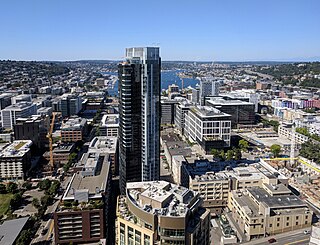
South Lake Union is a neighborhood in central Seattle, Washington, so named because it is at the southern tip of Lake Union.

<span class="mw-page-title-main">Northlake, Seattle</span>

Northlake is a neighborhood in Seattle, Washington, that consists of the southern part of Wallingford, below N 40th Street. It is so named for being on the northern shore of Lake Union. Landmarks include the Northlake Shipyard, Gas Works Park, the Wallingford Steps art installation, and Ivar's Salmon House. Circa 1900, the eastern part of Northlake was known as Latona, and the John Stanford International School building was formerly the Latona School. Nowadays, the name Latona is likely to refer to anywhere along Latona Ave. NE from Northlake north to NE 65th St. near Green Lake.

<span class="mw-page-title-main">Westlake Avenue</span>

Westlake Avenue is a major street in Seattle, Washington, connecting Downtown Seattle to the neighborhoods of South Lake Union, Westlake and northeastern Queen Anne. The street runs north–south along the west side of Lake Union for 2.5 miles (4.0 km) from McGraw Square to the Fremont Bridge.

<span class="mw-page-title-main">Shoreline street ends in Seattle</span>

In 1996, the city of Seattle, Washington adopted a resolution to preserve shoreline street ends throughout the city as public rights-of-way, to allow improvements for public uses and access. This resolution gave a broad outline of considerations that would apply to public access improvements to shoreline street ends and to removing private encroachments and severely limiting future permits for private uses of street ends. Three years later, this was enhanced with a statement, "Fees for use of shoreline street ends may take into consideration City policy of discouraging encroachments inconsistent with the public right of access to shorelines and may be included in the schedule of fees for use of public places under the jurisdiction of Seattle Transportation."

References

  1. U.S. Geological Survey Geographic Names Information System: Lake Union
  2. 1 2 3 4 5 6 7 "Lake Union". King County. Retrieved November 15, 2010.
  3. 1 2 "The Waterlines Project Map" (PDF). The Burke Museum. 2019. Retrieved October 5, 2023.
  4. Thrush, Coll (2007). Native Seattle: Histories from the Crossing-Over Place. University of Washington Press. p. 223. ISBN   978-0-295-98700-2.
  5. "Living Lightly, Duwamish Tribe on Lake Union". www.lakeunionhistory.org. Retrieved October 6, 2023.
  6. Phillips, James W. (1971). Washington State Place Names . University of Washington Press. pp.  149. ISBN   0-295-95158-3.
  7. "Boeing's Lake Union Seaplane Hangar". The Historical Marker Database. Retrieved April 11, 2022.
  8. PacificNorthwestMovies.com Archived 2005-11-08 at the Wayback Machine , Sleepless in Seattle