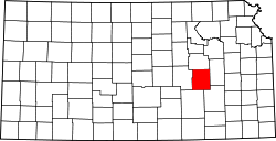
Toledo, Kansas | |
---|---|
![]() | |
Coordinates: Coordinates: 38°25′20″N96°22′16″W / 38.42222°N 96.37111°W [1] | |
Country | United States |
State | Kansas |
County | Chase |
Elevation | 1,171 ft (357 m) |
Time zone | UTC-6 (CST) |
• Summer (DST) | UTC-5 (CDT) |
Area code | 620 |
FIPS code | 20-70765 [1] |
GNIS ID | 477280 [1] |
Toledo is an unincorporated community in Chase County, Kansas, United States. [1] It is located about 7 miles west of Emporia at the intersection of Yy Rd and 240 Rd (about 1 mile north of U.S. Route 50 highway).
A post office was opened in Toledo in 1858, and remained in operation until it was discontinued in 1903. [2]
The community is served by Chase County USD 284 public school district. It has two schools.
Chase County is a county located in the U.S. state of Kansas. As of the 2020 census, the county population was 2,572. Its county seat and most populous city is Cottonwood Falls. The center of population of Kansas is located in Chase County, about four miles north of Strong City.
Cottonwood Falls is the largest city and county seat of Chase County, Kansas, United States. As of the 2020 census, the population of the city was 851. It is located south of Strong City along the south side of the Cottonwood River.
Elmdale is a city in Chase County, Kansas, United States. As of the 2020 census, the population of the city was 40. It is located along U.S. Route 50 highway.
Matfield Green is a city in Chase County, Kansas, United States. As of the 2020 census, the population of the city was 49. It is located along K-177 highway.
Bazaar is an unincorporated community in Chase County, Kansas, United States. It is located about halfway between Strong City and Matfield Green near the intersection of K-177 highway and Sharps Creek Rd.
Elyria is an unincorporated community in McPherson County, Kansas, United States. As of the 2020 census, the population of the community and nearby areas was 120. It is located southeast of McPherson at Old U.S. 81 Highway and Comanche Rd.
Toledo Township is a township in Chase County, Kansas, United States. As of the 2000 census, its population was 302.
Zeandale is an unincorporated community in Riley County, Kansas, United States. As of the 2020 census, the population of the community and nearby areas was 62. It is located about 6.8 miles (10.9 km) east of Manhattan at the intersection of Tabor Valley Rd and K-18 highway.
Silica is an unincorporated community in southwestern Pioneer Township, Rice County, Kansas, United States. It lies along local roads a fraction of a mile north of U.S. Route 56/K-96, 6 miles (9.7 km) east of Ellinwood and 14 miles (23 km) west of Lyons.
Canada is an unincorporated community in Marion County, Kansas, United States. It is named for many Canadian immigrants coming to the area. It is located between Hillsboro and Marion about 0.5 miles south of the intersection of Nighthawk Road and U.S. Route 56 highway, southwest of the Hillsboro Cove of the Marion Reservoir.
Clements is an unincorporated community in Chase County, Kansas, United States. It is located about half way between Strong City and Florence near the intersection of U.S. Route 50 highway and G Rd.
Saffordville is an unincorporated community in Chase County, Kansas, United States. It is located about half way between Strong City and Emporia near the intersection of U.S. Route 50 highway and Zz Rd.
Wonsevu is an unincorporated community in southwest Chase County, Kansas, United States. It is located at the intersection of Cedar Creek Rd and E Rd, which is 4.5 miles (7.2 km) north of the Chase-Butler county line and 3.75 miles (6.04 km) east of the Chase-Marion county line in the Flint Hills.
Ashton is an unincorporated community in Walton Township, Sumner County, Kansas, United States. It is located about halfway between South Haven and Arkansas City at 1.75 miles north of the intersection of S Rock Rd and U.S. Route 166, which is 5.5 miles east of I-35, next to an abandoned railroad.
Adamsville is an unincorporated community in Sumner County, Kansas, United States. It is located about 4 miles north of Geuda Springs at 0.5 mile west of the intersection of S Oxford Rd and E 80th St, next to an abandoned railroad.
Anson is an unincorporated community in Sumner County, Kansas, United States. It is located about 6 miles east of Conway Springs at 1.5 miles south of the intersection of N Anson Rd and W 90th St N, next to an abandoned railroad.
Millerton is an unincorporated community in Sumner County, Kansas, United States. It is located about 5 miles northeast of Conway Springs at the intersection of N Maple Rd and W 123rd Ave N, next to the railroad.
Portland is an unincorporated community in Sumner County, Kansas, United States. It is located about 5 miles northeast of South Haven at 1.5 miles north of the intersection of S Hydraulic Rd and U.S. Route 166, next to an abandoned railroad. It is 1.5 miles east of I-35 at 37°04′40″N97°18′44″W.
Riverdale is an unincorporated community in Sumner County, Kansas, United States. It is located about 6 miles southwest of Belle Plaine at the intersection of N Sand Plum Rd and 77th Ave N, or west of U.S. Route 81 next to the railroad.
Chase County USD 284 is a public unified school district headquartered in Cottonwood Falls, Kansas, United States. The district includes the communities of Cottonwood Falls, Strong City, Cedar Point, Elmdale, Matfield Green, Bazaar, Clements, Saffordville, Toledo, and nearby rural areas of Chase, Lyon, Morris Counties. It covers almost all of Chase County.