Town of Maine, Wisconsin

Last updated

Maine, Wisconsin
MaineWisconsinTownHallOutagamieCountyWIS187.jpg
Town hall
WIMap-doton-Maine b.png
Location of Maine, Wisconsin
Coordinates: 44°33′56″N88°32′53″W / 44.56556°N 88.54806°W / 44.56556; -88.54806
Country Flag of the United States.svg  United States
State Flag of Wisconsin.svg  Wisconsin
County Outagamie
Area
  Total37.4 sq mi (96.9 km2)
  Land36.6 sq mi (94.8 km2)
  Water0.8 sq mi (2.0 km2)
Elevation
[1]
784 ft (239 m)
Population
 (2000)
  Total831
  Density22.7/sq mi (8.8/km2)
Time zone UTC-6 (Central (CST))
  Summer (DST) UTC-5 (CDT)
FIPS code 55-48250 [2]
GNIS feature ID1583631 [1]
Website townofmaineoutagamie.com

Maine is a town in Outagamie County, Wisconsin, United States. The population was 831 at the 2000 census. The unincorporated community of Leeman is located in the town.

Contents

Geography

According to the United States Census Bureau, the town has a total area of 37.4 square miles (96.9 km2), of which, 36.6 square miles (94.8 km2) of it is land and 0.8 square miles (2.0 km2) of it (2.11%) is water.

Demographics

Landscape along Wisconsin Highway 187. MaineWisconsinLandscapeOutagamieCountyWIS187.jpg
Landscape along Wisconsin Highway 187.

As of the census [2] of 2000, there were 831 people, 304 households, and 231 families residing in the town. The population density was 22.7 people per square mile (8.8/km2). There were 326 housing units at an average density of 8.9 per square mile (3.4/km2). The racial makeup of the town was 96.99% White, 0.24% African American, 0.48% Native American, 1.93% from other races, and 0.36% from two or more races. Hispanic or Latino of any race were 2.41% of the population.

There were 304 households, out of which 32.6% had children under the age of 18 living with them, 65.1% were married couples living together, 6.3% had a female householder with no husband present, and 23.7% were non-families. 18.8% of all households were made up of individuals, and 5.6% had someone living alone who was 65 years of age or older. The average household size was 2.73 and the average family size was 3.12.

In the town, the population was spread out, with 25.4% under the age of 18, 8.4% from 18 to 24, 28.2% from 25 to 44, 26.8% from 45 to 64, and 11.2% who were 65 years of age or older. The median age was 38 years. For every 100 females, there were 121.0 males. For every 100 females age 18 and over, there were 118.3 males.

The median income for a household in the town was $46,058, and the median income for a family was $49,531. Males had a median income of $34,653 versus $26,364 for females. The per capita income for the town was $18,125. About 3.7% of families and 4.8% of the population were below the poverty line, including 5.2% of those under age 18 and 6.4% of those age 65 or over.

Town of Maine versus Village of Maine

in Marathon County, there is also a Village of Maine. In Wisconsin, villages and towns are distinct types of administrative units.

Related Research Articles

<span class="mw-page-title-main">Eagle Lake, Maine</span> Town in the state of Maine, United States

Eagle Lake is a town in Aroostook County, Maine, United States. The population was 772 at the 2020 census. The town was named by a body of troops heading from Bangor to the Aroostook War for the many eagles that they saw around the lake. A total of 49.0% of the population speaks French, reflecting a trend in Northeastern Maine.

<span class="mw-page-title-main">Island Falls, Maine</span> Town in the state of Maine, United States

Island Falls is a town in Aroostook County, Maine, United States. The population was 758 at the 2020 census. The primary village of Island Falls in the town is situated at a falls in the West Branch Mattawamkeag River.

<span class="mw-page-title-main">Littleton, Maine</span> Town in the state of Maine, United States

Littleton is a town in Aroostook County, Maine, United States. The population was 997 at the 2020 census.
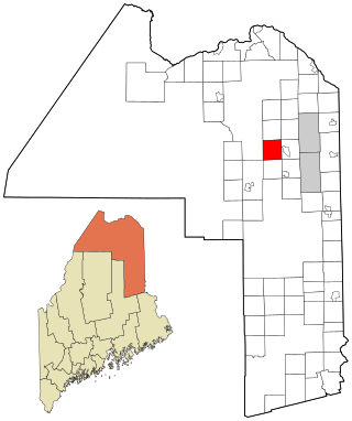
<span class="mw-page-title-main">St. Francis, Maine</span> Town in the state of Maine, United States

St. Francis is a town in Aroostook County, Maine, United States on the Canada–United States border at the junction of the St. Francis River and the Saint John River. The population was 438 at the 2020 census. First settled by English speakers from southern Maine, the original population has been supplanted by French-speaking Acadians.

<span class="mw-page-title-main">Stockholm, Maine</span> Town in the state of Maine, United States

Stockholm is a town in Aroostook County, Maine, United States. The population was 250 at the 2020 census.

<span class="mw-page-title-main">Penobscot, Maine</span> Town in the state of Maine, United States

Penobscot is a town in Hancock County, Maine, United States. The Bagaduce River flows through the town. The population was 1,136 at the 2020 census.

<span class="mw-page-title-main">Manchester, Maine</span> Town in Maine, United States

Manchester is a town in Kennebec County, Maine, United States, located at 44.33°N 69.87°W. The population was 2,456 at the 2020 census. The southern part of the town bordering Cobbosseecontee Lake is a popular recreation spot in central Maine, and part of the Winthrop Lakes Region. Manchester is included in the Augusta, Maine micropolitan and included in the Lewiston-Auburn, Maine metropolitan New England City and Town Area.

<span class="mw-page-title-main">West Gardiner, Maine</span> Town in the state of Maine, United States

West Gardiner is a town in Kennebec County, Maine, United States. The population was 3,671 at the 2020 census. West Gardiner is included in the Augusta, Maine micropolitan New England City and Town Area.

<span class="mw-page-title-main">Hartford, Maine</span> Town in the state of Maine, United States

Hartford is a town in Oxford County, Maine, United States. Hartford is included in the Lewiston-Auburn, Maine metropolitan New England City and Town Area. The population was 1,203 at the 2020 census.

Stoneham is a town in Oxford County, Maine, United States. The population was 261 at the 2020 census.

<span class="mw-page-title-main">Stow, Maine</span> Town in the state of Maine, United States

Stow is a town in Oxford County, Maine, United States. The population was 393 at the 2020 census.

<span class="mw-page-title-main">Upton, Maine</span> Town in the state of Maine, United States

Upton is a town in Oxford County, Maine, United States. The population was 69 at the 2020 census.

Woodstock is a town in Oxford County, Maine, United States. Woodstock is included in the Lewiston-Auburn, Maine metropolitan New England city and town area. The population was 1,352 at the 2020 census. The village of Bryant Pond, on State Route 26 in the northern part of Woodstock, is the town's urban center and largest settlement.

Bradley is a town in Penobscot County, Maine, United States. It is part of the Bangor Metropolitan Statistical Area. The population was 1,532 at the 2020 census. The village of Bradley is in the northwestern corner of the town.

<span class="mw-page-title-main">Smithfield, Maine</span> Town in the state of Maine, United States

Smithfield is a town in Somerset County, Maine, United States. The population was 925 at the 2020 census. The town was incorporated on February 29, 1840, making it the only town in Maine incorporated on Leap Day. The town was named after the Rev. Henry Smith, an early settler.

Alexander is a town in Washington County, Maine, United States. The population was 525 at the 2020 census. The town is named for Alexander Baring, 1st Baron Ashburton, the British negotiator of the Webster–Ashburton Treaty which ended the Aroostook War in 1838–1839.

<span class="mw-page-title-main">Northeast Piscataquis, Maine</span> Unorganized territory in Maine, United States

Northeast Piscataquis is an unincorporated area in Piscataquis County, Maine, United States. The population was 304 at the 2020 census.

<span class="mw-page-title-main">Randolph, Maine</span> Town in the state of Maine, United States

Randolph is a town and a census-designated place (CDP) in Kennebec County, Maine, United States. The population was 1,743 at the 2020 census. The town was named for Randolph, Massachusetts. Randolph is included in the Augusta, Maine micropolitan New England City and Town Area.

The Town of Potosi is located in Grant County, Wisconsin, United States. The population was 831 at the 2000 census. The Village of Potosi and the unincorporated communities of British Hollow, Buena Vista, Rockville, and Van Buren are located in the town.

<span class="mw-page-title-main">East Millinocket, Maine</span> Town in the state of Maine, United States

East Millinocket is a town in Penobscot County, Maine, United States. The population was 1,572 at the 2020 census.

References

  1. 1 2 "US Board on Geographic Names". United States Geological Survey. October 25, 2007. Retrieved January 31, 2008.
  2. 1 2 "U.S. Census website". United States Census Bureau . Retrieved January 31, 2008.