
Redruth is a town and civil parish in Cornwall, England, United Kingdom. According to the 2011 census, the population of Redruth was 14,018 In the same year the population of the Camborne-Redruth urban area, which also includes Carn Brea, Illogan and several outlying villages, stood at 55,400 which made it the largest conurbation in Cornwall. Redruth lies approximately at the junction of the A393 and A3047 roads, on the route of the old London to Land's End trunk road, and is approximately 9 miles (14 km) west of Truro, 12 miles (19 km) east of St Ives, 18 miles (29 km) north east of Penzance and 11 miles (18 km) north west of Falmouth. Camborne and Redruth together form the largest urban area in Cornwall and before local government reorganisation were an urban district.

Camborne is a town in Cornwall, England. The population at the 2011 Census was 20,845. The northern edge of the parish includes a section of the South West Coast Path, Hell's Mouth and Deadman's Cove.
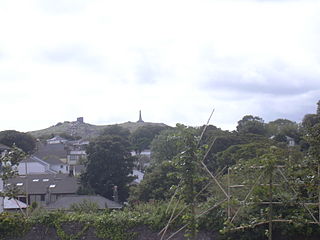
Carn Brea is a civil parish and hilltop site in Cornwall, England, United Kingdom. The population of Carn Brea including Bosleake and Church Coombe was 8,013 at the 2011 census. The hilltop site is situated approximately one mile (1.6 km) southwest of Redruth. The settlements of Bosleake, Brea, Broad Lane, Carn Arthen, Carn Brea Village, Carnkie, Four Lanes, Grillis, Illogan Highway, Pencoys, Penhallick, Piece, Pool, Tolskithy, Tregajorran, Treskillard, Tuckingmill and West Tolgus are in the parish.
Stithians, also known as St Stythians, is a village and civil parish in Cornwall, England, United Kingdom. It lies in the middle of the triangle bounded by Redruth, Helston and Falmouth. Its population (2001) is 2,004, increasing to 2,101 at the 2011 census An electoral ward in the same name also exists but stretches north to St Day. The population here also at the 2011 census was 5,023.

Talskiddy is a small rural village about two miles north of St Columb Major in Cornwall, England, United Kingdom. Originally a manorial settlement belonging to the Earldom of Cornwall, the place prospered in the 19th century as a centre of the wool-combing industry.

Morwenstow is a civil parish in north Cornwall, England, United Kingdom. The parish abuts the west coast, about six miles (10 km) north of Bude and within the Cornwall Area of Outstanding Natural Beauty (AONB).

Trevenson is in the parish of Carn Brea, between the towns of Camborne and Redruth in Cornwall, United Kingdom.

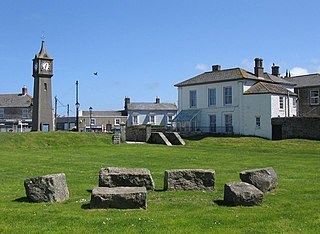
Illogan is a village and civil parish in west Cornwall, England, United Kingdom, two miles (3 km) northwest of Redruth. The population of Illogan was 5,404 at the 2011 census. In the same year the population of the Camborne-Redruth urban area, which also includes Carn Brea, Illogan and several satellite villages, stood at 55,400 making it the largest conurbation in Cornwall. Originally a rural area supporting itself by farming and agriculture, Illogan shared in the general leap into prosperity brought about by the mining boom, which was experienced by the whole Camborne-Redruth area.

Perranarworthal is a civil parish and village in Cornwall, England, United Kingdom. The village is about four miles (6.5 km) northwest of Falmouth and five miles (8 km) southwest of Truro. The parish population at the 2011 census was 1,496.

Kenwyn is a settlement and civil parish in Cornwall, England, United Kingdom. The settlement is a suburb of the city of Truro and lies 0.5 mi (1 km) north of the city centre, within Truro parish, whereas Kenwyn parish covers an area west and north-west of the city. Kenwyn gives its name to one of three rivers that flow through the city.

Kea is a civil parish and village in Cornwall, England, United Kingdom. It is a "large straggling parish" in a former mining area south of Truro.
Philleigh is a civil parish and village in Cornwall, England, one of the four civil parishes in the Roseland Peninsula. The civil parish includes the hamlets of Treworlas, Treworthal and a number of smaller settlements.

Grade–Ruan is a civil parish on the Lizard peninsula in Cornwall, England, United Kingdom, approximately ten miles (16 km) south of Falmouth.

Sithney is a village and civil parish in the West of Cornwall, England, United Kingdom. Sithney is north of Porthleven. The population including Boscadjack and Crowntown at the 2011 census was 841.
Werrington is a civil parish and former manor now in Cornwall, England, United Kingdom. Prior to boundary changes it straddled the Tamar and lay within the county of Devon. The portion on the west side was transferred to Cornwall by the abolition of Broadwoodwidger Rural District by the Local Government Commission for England in 1966. It is situated 1 mile (1.6 km) to the west of the Tamar, the traditional boundary between Devon and Cornwall, and 1 mile (1.6 km) north of Launceston.

St Breward is a civil parish and village in Cornwall, England, United Kingdom. It is on the western side of Bodmin Moor, about 6 miles (10 km) north of Bodmin. At the 2011 census the parish population including Cooksland and Fentonadle was 919.

Withiel is a civil parish and village in mid Cornwall, England, United Kingdom. The parish of Withiel is between the parishes of St Breock, Lanivet, Roche and St Wenn. The name Withiel comes from the Cornish word Gwydhyel, meaning "wooded place". The parish contains the hamlets of Withielgoose, Retire and Tregawne; the parish had a total population of about 300 in 1824.

Four Lanes is a village in west Cornwall, England, United Kingdom approximately 3 miles (4.8 km) south of Redruth at grid reference SW 689 386 in the civil parish of Carn Brea.

Devoran is a village in south Cornwall, England, United Kingdom. It is 4 miles (6.4 km) southwest of Truro at grid reference SW 793 392. Formerly an ecclesiastical parish, Devoran is now in the civil parish of Feock.
A plen-an-gwarry or plain-an-gwary, is a "playing-place" or round, a medieval amphitheatre found in Cornwall. A circular outdoor space used for plays, sports, and public events, the plen-an-gwary was a Cornish variant of a construction style found across Great Britain. Formerly common across Cornwall, only two survive nearly complete today: the Plain in St Just in Penwith and Saint Piran's Round near Perranporth.
