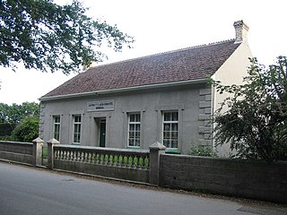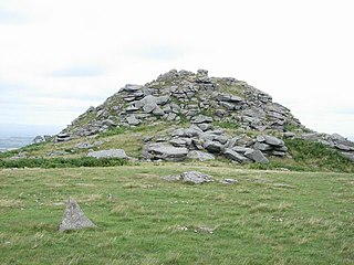
Trelowia is a hamlet southeast of Widegates, Cornwall, England, United Kingdom. [1]
Trelowia is in the parish of St Martin-by-Looe and the manor belongs to the Duchy of Cornwall. [2]

Trelowia is a hamlet southeast of Widegates, Cornwall, England, United Kingdom. [1]
Trelowia is in the parish of St Martin-by-Looe and the manor belongs to the Duchy of Cornwall. [2]

The Duchy of Lancaster is a private estate of the British sovereign. The estate has its origins in the lands held by the medieval Dukes of Lancaster, which came under the direct control of the monarch when Henry Bolingbroke, the then duke of Lancaster, ascended the throne in 1399. In 1461 King Edward IV confirmed that the Duchy would be inherited by the monarch, but held separately from the Crown Estate, the other assets which belong to the monarch.

Bradninch is a small town, civil parish and manor in Devon, England, lying about 3 mi (5 km) south of Cullompton. Much of the surrounding farmland belongs to the Duchy of Cornwall. There is an electoral ward with the same name, which since May 2023 comprises the entire parish. The population was 2,165 in 2021.

The Duchy of Cornwall is one of two royal duchies in England, the other being the Duchy of Lancaster. The eldest son of the reigning British monarch obtains possession of the duchy and the title of Duke of Cornwall at birth or when his parent succeeds to the throne, but may not sell assets for personal benefit and has limited rights and income while a minor.
The title of Earl of Cornwall was created several times in the Peerage of England before 1337, when it was superseded by the title Duke of Cornwall, which became attached to heirs-apparent to the throne.

The constitutional status of Cornwall has been a matter of debate and dispute. Cornwall is an administrative county of England.

Restormel Castle lies by the River Fowey near Lostwithiel in Cornwall, England, UK. It is one of the four chief Norman castles of Cornwall, the others being Launceston, Tintagel and Trematon. The castle is notable for its perfectly circular design. Once a luxurious residence of the Earl of Cornwall, the castle was all but ruined by the 16th century. It was briefly reoccupied and fought over during the English Civil War, but was subsequently abandoned. It is now in the care of English Heritage and open to the public.

An overlord in the English feudal system was a lord of a manor who had subinfeudated a particular manor, estate or fee, to a tenant. The tenant thenceforth owed to the overlord one of a variety of services, usually military service or serjeanty, depending on which form of tenure the estate was held under. The highest overlord of all, or lord paramount, was the monarch, who due to his ancestor William the Conqueror's personal conquest of the Kingdom of England, owned by inheritance from him all the land in England under allodial title and had no superior overlord, "holding from God and his sword", although certain monarchs, notably King John (1199–1216) purported to grant the Kingdom of England to Pope Innocent III, who would thus have become overlord to English monarchs.

Luxulyan, also spelt Luxullian or Luxulian, is a village and civil parish in mid Cornwall, England, United Kingdom. The village lies four miles (6.5 km) northeast of St Austell and six miles (10 km) south of Bodmin. The population of the parish was 1,371 in the 2001 census. This had risen to 1,381 at the 2011 census.

Calstock is a civil parish and a large village in south east Cornwall, England, United Kingdom, on the border with Devon. The village is situated on the River Tamar 6 miles (9.7 km) south west of Tavistock and 10 miles (16 km) north of Plymouth.

The hundreds of Cornwall were administrative divisions or Shires (hundreds) into which Cornwall, the present day administrative county of England, in the United Kingdom, was divided between c. 925 and 1894, when they were replaced with local government districts.
The Antiqua maneria, or assessionable manors, were the original 17 manors belonging to the Earldom of Cornwall.

Lanlivery is a village and civil parish in Cornwall, England, United Kingdom. The village is about 1+1⁄2 miles (2.4 km) west of Lostwithiel and five miles (8 km) south of Bodmin. The Saints' Way runs past Lanlivery. Helman Tor, Red Moor and Breney Common nature reserves lie within the parish.

Stoke Climsland is a village in the valley of the River Tamar, Cornwall, England, United Kingdom within the civil parish of Stokeclimsland. The population of the parish including Luckett at the 2011 census was 1,703. An electoral ward of the same name also exists. At the same census the population was 3,703.

Linkinhorne is a civil parish and village in southeast Cornwall, England, United Kingdom. The village itself is situated at grid reference SX 320 736 and is approximately four miles (6.5 km) northwest of Callington and seven miles (11 km) south of Launceston. The parish population at the 2011 census including Downgate was 1,541

Barcelona is a hamlet in the parish of Pelynt in southeast Cornwall, England, UK.
Landulph is a hamlet and a rural civil parish in south-east Cornwall, England, United Kingdom. It is about 3 miles (5 km) north of Saltash in the St Germans Registration District.

Helstone is a hamlet in north Cornwall, England, United Kingdom. It is situated two miles (3 km) southwest of Camelford on the A39 road.
Penmayne is a hamlet next to Splatt in the civil parish of St Minver Lowlands in north Cornwall, England, UK.

Harewood House was an ancient manor house, built originally by the Saxons, in Cornwall, England. Harewood Estate is surrounded by old mine workings, so the house faces towards Morwellham Quay.

Arrallas was a manorial settlement recorded in the Domesday book, when in 1086 it had seven households and three ploughlands. It is located in the parish of St Enoder in Cornwall, England. Its name derives from the Cornish language words arghans and lys meaning "silver court", with the lys likely denoting a site of royal importance.