Tropical storm (39–73 mph, 63–118 km/h)
Category 1 (74–95 mph, 119–153 km/h)
Category 2 (96–110 mph, 154–177 km/h)
Category 3 (111–129 mph, 178–208 km/h)
Category 4 (130–156 mph, 209–251 km/h)
Category 5 (≥157 mph, ≥252 km/h)
Unknown
Around September 1, a tropical wave moved off the western coast of Africa. It progressed westward through the tropical Atlantic Ocean, initially at a moderate speed before accelerating to 23 mph (37 km/h) on September 6. A tropical depression developed along the tropical wave early on September 7, and satellite imagery indicated that it quickly intensified into Tropical Storm Danielle about 385 mi (620 km) east-southeast of Grenada, an island in the Lesser Antilles. [1] [2]
On September 8, Hurricane Hunters flew into Tropical Storm Danielle and reported maximum sustained winds of 60 mph (95 km/h), as well as a pressure of 1,000 millibars (30 inHg). [1] Initially, forecasters anticipated Danielle would strengthen further. [3] As the storm moved through Saint Vincent and the Grenadines, a rainband north of the center contained winds of near hurricane force, which moved across the island of Saint Vincent. After maintaining peak winds for about 18 hours, Danielle began weakening in the eastern Caribbean Sea, [1] due to entrainment of dry air from northern South America. [4] Paralleling the northern coast of the continent, the circulation became dislocated from the convection. Late on September 9, the system weakened to tropical depression status, and the next day it dissipated in the western Caribbean. [1] It was the only tropical cyclone in the Caribbean Sea during 1986. [2]
Preparations and impact
Before Tropical Storm Danielle moved through the Lesser Antilles, a small-craft advisory was issued, and later, gale warnings were posted for Barbados as well as Saint Vincent and the Grenadines. [5] On Saint Vincent, the threat of the storm forced the closure of the main commercial airport, as well as schools, businesses, and stores. [6] Further west, Danielle briefly posed a threat to Jamaica, prompting officials in that country to issue a tropical storm watch. [7] Two months earlier, the precursor to Tropical Storm Andrew killed 49 people on the island; to avoid a recurrence, the Jamaican government worked to evacuate fishermen from two small islands as a precaution. [8]
As Danielle moved through the Lesser Antilles, a rainband struck the island of Saint Vincent with wind gusts of near hurricane-force. The winds caused a major power outage on the island, [1] and destroyed the roofs of more than 30 houses. [6] Elsewhere in the country, the combination of winds and heavy rains caused heavy crop damage. [1] Twelve days after Danielle struck, a severe rainstorm affected Saint Vincent and the Grenadines. The combined disasters produced a damage total of $9.3 million (1986 USD, $18 million 2010 USD), the majority of it from crop damage. About 40% of the banana crop was destroyed or unfit for cultivation, and 2,050 acres (8.3 km2) of other crops were seriously affected. The two storms caused the deaths of 120 animals, although there were no human fatalities. In addition to the crop damage, the combined impact of the two storms left over 100 houses destroyed, with a total of 436 dwellings damaged; this forced 142 people to seek emergency shelter. Across the country, the heavy rainfall caused mudslides and flooding which disrupted the transportation and utility network. [9]
During its passage, Danielle produced a 40 mph (64 km/h) wind gust at the airport in Bridgetown, Barbados. [3] A coast guard ship from Barbados ran aground into a reef in the southern Grenadines, but it was rescued. [1] [6] Further south, rainbands from Danielle swept through Trinidad and Tobago, producing up to 4 feet (1.2 m) of flooding. The flooding caused 27 landslides and destroyed 4 bridges. Damage in the country was estimated at $8 million (1986 TTD, $1.2 million 1986 USD). [10]
See also
Notes
- ↑ Monetary damage total includes losses from a subsequent storm unrelated to Danielle.
Related Research Articles

Hurricane Lili was the second costliest, deadliest, and strongest hurricane of the 2002 Atlantic hurricane season, only surpassed by Hurricane Isidore, which affected the same areas around a week before Lili. Lili was the twelfth named storm, fourth hurricane, and second major hurricane of the 2002 Atlantic hurricane season. The storm developed from a tropical disturbance in the open Atlantic on September 21. It continued westward, affecting the Lesser Antilles as a tropical storm, then entered the Caribbean. As it moved west, the storm dissipated while being affected by wind shear south of Cuba, and regenerated when the vertical wind shear weakened. It turned to the northwest and strengthened up to category 2 strength on October 1. Lili made two landfalls in western Cuba later that day, and then entered the Gulf of Mexico. The hurricane rapidly strengthened on October 2, reaching Category 4 strength that afternoon. It weakened rapidly thereafter, and hit Louisiana as a Category 1 hurricane on October 3. It moved inland and dissipated on October 6.

The 1963 Atlantic hurricane season was a slightly below average season in terms of tropical cyclone formation, with a total of ten nameable storms. Even so, it was also a notoriously deadly and destructive season. The season officially began on June 15, 1963, and lasted until November 15, 1963. These dates conventionally delimit the period of each year when most tropical cyclones form in the Atlantic basin. The first system, an unnamed tropical storm, developed over the Bahamas on June 1.

The 1986 Atlantic hurricane season was a very inactive season that produced 10 depressions, 6 named storms, 4 hurricanes, and no major hurricanes. The season officially began on June 1, 1986, and lasted until November 30, 1986. These dates conventionally delimit the period of each year when most tropical cyclones form in the Atlantic basin. During the 1986 season, the first subtropical depression formed in the first week of June, while the last tropical cyclone dissipated at the end of the third week of November. The 1986 season had lower than average activity because of an ongoing El Niño event, and was the least active season in the North Atlantic since the 1983 Atlantic hurricane season. This was also the first season since 1972 to have no major hurricanes.

The 1990 Atlantic hurricane season was the most active Atlantic hurricane season since 1969, with a total of 14 named storms. The season also featured eight hurricanes, one of which intensified into a major hurricane. It officially began on June 1, 1990, and lasted until November 30, 1990. These dates conventionally delimit the period of each year when most tropical cyclones form in the Atlantic basin. However, tropical cyclogenesis can occur prior to the start of the season, as demonstrated with Tropical Depression One, which formed in the Caribbean Sea on May 24.

Hurricane Flora is among the deadliest Atlantic hurricanes in recorded history, with a death total of at least 7,193. The seventh tropical storm and sixth hurricane of the 1963 Atlantic hurricane season, Flora developed from a disturbance in the Intertropical Convergence Zone on September 26 while located 755 miles (1,215 km) southwest of the Cape Verde islands. After remaining a weak depression for several days, it rapidly organized on September 29 to attain tropical storm status. Flora continued to strengthen, reaching Category 3 hurricane status after moving through the Windward Islands and passing over Tobago, and it reached maximum sustained winds of 145 miles per hour (233 km/h) in the Caribbean.

The 1951 Atlantic hurricane season was the first hurricane season in which tropical cyclones were officially named by the United States Weather Bureau. The season officially started on June 15, when the United States Weather Bureau began its daily monitoring for tropical cyclone activity; the season officially ended on November 15. It was the first year since 1937 in which no hurricanes made landfall on the United States; as Hurricane How was the only tropical storm to hit the nation, the season had the least tropical cyclone damage in the United States since the 1939 season. As in the 1950 season, names from the Joint Army/Navy Phonetic Alphabet were used to name storms this season.

The 1918 Atlantic hurricane season was inactive, with a total of six tropical storms developing, four of which intensified into hurricanes. Two of the season's hurricanes made Landfall in the United States, and one became a major hurricane, which is Category 3 or higher on the modern-day Saffir–Simpson scale. Additionally, there were four suspected tropical depressions, including one that began the season on June 19 and one that ended the season when it dissipated on October 19. The early 20th century lacked modern forecasting and documentation, and thus, the hurricane database from these years may be incomplete. Four previously unknown tropical cyclones were identified using records, including historical weather maps and ship reports, while information on the known storms was amended.

Hurricane Erika was the strongest and longest-lasting tropical cyclone in the 1997 Atlantic hurricane season. It developed from a tropical wave on September 3 and moved west-northwestward across the tropical Atlantic Ocean, steadily intensifying until it attained hurricane status on September 4, becoming the fifth named storm and third hurricane of the season. Erika passed a short distance to the north of the Lesser Antilles, and later turned to the north in response to an approaching trough. The hurricane quickly strengthened to become the only major hurricane of the season, reaching maximum sustained winds of 125 mph (201 km/h) on September 8; after maintaining its peak strength for 24 hours, Erika began to weaken as it passed over cooler waters. It turned to the east, weakened to a tropical storm, and became extratropical after passing near the Azores archipelago.

Hurricane Jose was the fourteenth tropical cyclone, tenth named storm, and seventh hurricane of the annual hurricane season that caused moderate damage in the Lesser Antilles in October 1999. Jose developed from a tropical wave several hundred miles east of the Windward Islands on October 17. The depression intensified and was subsequently upgraded to Tropical Storm Jose on October 18. The storm tracked northwestward and was upgraded to a hurricane the following day as it approached the northern Leeward Islands. Jose briefly peaked as a Category 2 hurricane with winds of 100 mph (160 km/h) on October 20. However, wind shear weakened the storm back to a Category 1 hurricane before it struck Antigua. Further deterioration occurred and Jose weakened to a tropical storm before landfall in Tortola on October 21. While located north of Puerto Rico on October 22, the storm turned northward, shortly before curving north-northeastward. Wind shear decreased, allowing Jose to re-intensify into a hurricane while passing east of Bermuda on October 24. However, on the following day, wind shear increased again, while sea surface temperatures decreased, causing Jose to weaken and quickly transition into an extratropical cyclone.

Tropical Storm Debby was a weak but costly tropical cyclone that affected the Lesser Antilles in September 1994. It was the fourth named tropical storm of the 1994 Atlantic hurricane season; it developed on September 9 east of Barbados. Debby made landfall on Saint Lucia early on September 10, producing heavy rainfall and tropical storm-force wind gusts. The rains caused flooding and landslides, damaging about half of the island's banana plantations. Several villages were isolated after roads and bridges were damaged. Damage totaled about $103 million (1994 USD). On nearby Dominica, Debby damaged crops and fisheries.

Tropical Storm Earl caused minor damage in the Windward Islands in mid-August 2004. The fifth tropical cyclone and named storm of the annual hurricane season, Earl developed on August 13 from a tropical wave centered well east of the Lesser Antilles. The depression gradually organized as it tracked west-northwestward and was upgraded to Tropical Storm Earl roughly a day after genesis. As the system approached the Windward Islands it continued to slowly strengthen, peaking as a 50 mph (85 km/h) tropical storm early on August 15. However, the system unexpectedly degenerated into a tropical wave that afternoon, likely due to its fast forward motion. The remnants of Earl continued across the Caribbean Sea and eventually re-developed into Hurricane Frank in the eastern Pacific Ocean on August 23.

Tropical Storm Chantal was a North Atlantic tropical cyclone that moved across the Caribbean Sea in August 2001. The fourth depression and third named storm of the 2001 Atlantic hurricane season, Chantal developed from a tropical wave on August 14 in the tropical Atlantic Ocean. It tracked rapidly westward for much of its duration, and after degenerating into a tropical wave, it passed through the Windward Islands. Chantal reached a peak intensity of 70 mph (110 km/h) twice in the Caribbean Sea, and each time it was anticipated to attain hurricane status; however, wind shear and later land interaction prevented strengthening to hurricane status. On August 21 Chantal, moved ashore near the border of Mexico and Belize, before dissipating on the next day.

Hurricane Iris was the first of three tropical cyclones to affect the Lesser Antilles in a three-week period, preceding the more destructive hurricanes Luis and Marilyn. The ninth named storm and fifth hurricane of the 1995 Atlantic hurricane season, Iris developed from a tropical wave to the east of the Lesser Antilles on August 22 and attained hurricane status within 30 hours. The hurricane weakened to a tropical storm before crossing the islands of the eastern Caribbean from August 26 through August 28. During that time, Iris became one of four active tropical storms in the Atlantic basin. Earlier it had interacted with Hurricane Humberto, and beginning on August 30, Iris interacted with Tropical Storm Karen. Iris re-intensified into a hurricane and attained peak sustained winds of 110 mph (175 km/h) while moving slowly across the central Atlantic. The hurricane accelerated to the north and absorbed a dissipating Karen on September 3. Iris weakened to a tropical storm and became extratropical on September 4, though its remnants re-attained hurricane-force winds, before affecting western Europe on September 7. The storm dissipated soon afterward.

The effects of Hurricane Dean in the Lesser Antilles were spread over five island countries and included 3 fatalities. Hurricane Dean formed in the Atlantic Ocean west of Cape Verde on August 14, 2007. The National Hurricane Center's first Forecast Advisory on the system anticipated that the Cape Verde-type hurricane would pass into the Caribbean through the Lesser Antilles. The storm moved persistently towards the small island chain, strengthening until it passed through the islands three days later on August 17 as a Category 2 hurricane on the Saffir-Simpson Hurricane Scale. It went on to brush the island of Jamaica and reached Category 5 strength before making landfall on Mexico's Yucatán Peninsula.

In September 2004, Hurricane Ivan caused significant effects in the Lesser Antilles and South America, including 44 deaths and over $1 billion in damage (2004 USD), primarily in Grenada where it was considered the worst hurricane in nearly 50 years. Hurricane Ivan developed from a tropical wave on September 2 and rapidly intensified to become a major hurricane, passing through the southern Lesser Antilles on September 7 with winds of 125 mph (201 km/h). At the time, its typical storm force winds extended outward up to 160 miles (260 km) with hurricane-force winds outward to 70 miles (110 km), and the northern portion of the eye passed over Grenada.

Hurricane Abby was the only tropical cyclone in the Caribbean Sea during the 1960 Atlantic hurricane season. The second tropical cyclone and first named storm of the season, Abby developed on July 10 from a tropical wave in the vicinity of the Lesser Antilles. Abby rapidly intensified into a hurricane after being a tropical storm for less than six hours. It briefly peaked as a category 2 hurricane before weakening back. Abby rapidly weakened to a minimal tropical storm a few days thereafter. The storm re-strengthened into a hurricane as it began to parallel the coast of Honduras. Hurricane Abby made landfall in British Honduras on July 15. Abby dissipated over Mexico later the next day. The remnants of Abby ultimately became Hurricane Celeste in the Pacific Ocean. Despite passing through or near several countries, Hurricane Abby had a relatively light impact on land, resulting in just $640,500 in damage and six fatalities.

Tropical Storm Alma, the first named storm to develop in the 1974 Atlantic hurricane season, was a short lived tropical cyclone that made a rare Venezuelan landfall. The storm formed from the Intertropical Convergence Zone (ITCZ) on August 12 well to the east of the Windward Islands, but advisories were not issued until the next day when Alma was at peak intensity. Alma entered the southeastern Caribbean Sea at an unusually brisk westward pace of between 20 mph (32 km/h) to 25 mph (40 km/h), prompting numerous watches and gale warnings throughout the nations in this region. After crossing Trinidad, Alma became one of only four tropical storms to traverse the Paria Peninsula of northeastern Venezuela. The storm dissipated on August 15 over the high terrain of Venezuela.

Hurricane Edith brought flooding and wind damage to portions of the Greater and Lesser Antilles. The sixth tropical storm and fifth hurricane of the 1963 season, Edith developed east of the Windward Islands on September 23 from an Intertropical Convergence Zone (ITCZ) disturbance. Initially a tropical depression, it strengthened into Tropical Storm Edith the next day. Shortly thereafter, Edith reached hurricane status. Edith fluctuated between Category 1 and 2 status as it moved west-northwest. Upon reaching Category 2 intensity on September 25, the storm peaked with winds of 100 mph (155 km/h). After striking Saint Lucia on September 25, the storm traversed the eastern Caribbean Sea. Curving north-northwest on September 26, Edith made landfall near La Romana, Dominican Republic, early on the following day as a minimal hurricane. Interaction with land and an upper-level trough caused Edith to weaken to a tropical storm on September 28 and to a tropical depression by the next day. The storm dissipated just east of the Bahamas on September 29.

Hurricane Tomas was a moderately powerful late-season tropical cyclone which is the latest Atlantic hurricane on record in the calendar year to strike the Windward Islands. The nineteenth named storm and twelfth hurricane of the 2010 Atlantic hurricane season, Tomas developed from a tropical wave east of the Windward Islands on October 29. Quickly intensifying into a hurricane, it moved through the Windward Islands and passed over Saint Lucia. After reaching Category 2 status on the Saffir–Simpson scale, Tomas quickly weakened to a tropical storm in the central Caribbean Sea, due to strong wind shear and dry air. Tomas later reintensified into a hurricane near the Windward passage.

Tropical Storm Kirk was the second lowest-latitude tropical storm on record in the Atlantic basin. The eleventh named storm of the 2018 Atlantic hurricane season, Kirk originated from a tropical wave that left Africa on September 20 and organized into a tropical depression two days later. The system intensified into Tropical Storm Kirk early on September 22 but quickly degenerated into a tropical wave again early the next day. A reduction in the disturbance's forward speed allowed it to regain tropical storm intensity on September 26. Kirk reached maximum sustained winds of 65 mph (105 km/h) that morning before increasing westerly wind shear caused the cyclone to steadily weaken. The storm made landfall on Saint Lucia with winds of 50 mph (80 km/h) before continuing into the Caribbean Sea. Kirk degenerated to a tropical wave again on September 28, and its remnants continued westward, contributing to the formation of Hurricane Michael ten days later.
References
- 1 2 3 4 5 6 7 Gilbert B. Clark (1986). "Tropical Storm Danielle Preliminary Report". National Hurricane Center. Retrieved 2010-08-09.
- 1 2 "Atlantic hurricane best track (HURDAT version 2)" (Database). United States National Hurricane Center. April 5, 2023. Retrieved August 28, 2024.
 This article incorporates text from this source, which is in the public domain.
 - 1 2 Jane Meinhardt (1986-09-08). "Tropical Storm Danielle is expected to slowly strengthen, turn northward". The Evening Independent. Retrieved 2010-08-11.
- ↑ Verne Williams (1986-09-10). "Danielle fizzles, is downgraded to a tropical wave". Miami Herald. Retrieved 2010-08-11.[ permanent dead link ]
- ↑ "Storm Danielle Forms Off Barbados". The Palm Beach Post. Associated Press. 1986-09-08. Retrieved 2013-10-27.[ permanent dead link ]
- 1 2 3 Andrea Rowand (1986-09-10). "Danielle Loses Punch On Way to Caribbean". The Day. Associated Press. Retrieved 2010-08-11.
- ↑ Verne Williams (1986-09-10). "Danielle's course prompts storm watch for Jamaica". The Miami News. Retrieved 2010-08-11.[ permanent dead link ]
- ↑ Staff Writer. "Danielle weakens, loses storm status". Mojave Daily Miner. United Press International. Retrieved 2010-08-11.
- ↑ United Nations Department of Humanitarian Affairs (DHA) (1986-10-06). "St. Vincent Tropical Storm Danielle Sep 1986 UNDRO Situation Reports 1–2". ReliefWeb . Retrieved 2010-08-11.
- ↑ C. B. Daniel and R. Maharaj (1986). "Tropical Cyclones Affecting Trinidad and Tobago, 1725 to 2000". Trinidad and Tobago Meteorological Service. Retrieved 2010-08-11.
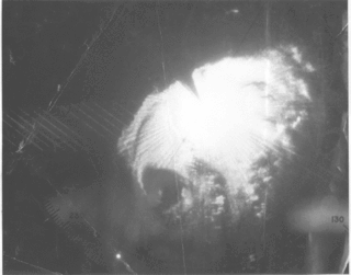
 Tropical Storm Danielle at peak intensity over the Windward Islands on September 8 |
Tropical cyclones of the 1986 Atlantic hurricane season | ||
|---|---|---|
