Tropical Storm Danny (2021)

Last updated

Map key
  Tropical depression (≤38 mph, ≤62 km/h)
  Tropical storm (39–73 mph, 63–118 km/h)
  Category 1 (74–95 mph, 119–153 km/h)
  Category 2 (96–110 mph, 154–177 km/h)
  Category 3 (111–129 mph, 178–208 km/h)
  Category 4 (130–156 mph, 209–251 km/h)
  Category 5 (≥157 mph, ≥252 km/h)
  Unknown
Storm type
Disc Plain black.svg Tropical cyclone
Solid black.svg Subtropical cyclone
ArrowUp.svg Extratropical cyclone, remnant low, tropical disturbance, or monsoon depression

On June 22, an upper-level trough separated from the jet stream and evolved into an upper-level low-pressure system. Two days later, the low-pressure area turned westward under the influence of a strong ridge to its north. Disorganized convection, or showers and thunderstorms, increased as the system moved over warmer waters. Near this time, a surface trough in relation to the upper-level low became better defined. [1] Over the next few days, the trough moved west-northwestward, and on June 26, the National Hurricane Center (NHC) began to monitor the disturbance for development as it passed several hundred miles south of Bermuda. [2] [3] [4] On June 27, ship observations, buoy, and satellite imagery revealed that a small area of low pressure had developed about 500 miles (800 km) east-southeast of the Georgia-South Carolina border. [1] [5] Surface pressure decreased, [5] and over the next 12 hours, the system continued to organize. At 18:00 UTC on June 27, the disturbance consolidated into a tropical depression, [1] but operationally, the NHC did not upgrade the system to a tropical depression until 15:00 UTC on June 28, while it was located offshore South Carolina. [6] A short time after formation, convection over the system decreased, and low-level circulation center (LLCC) became partially exposed. [1] Convection remained displaced to the northwest of the center due to strong upper-level wind shear. [7] Nevertheless, an advanced scatterometer pass discovered peak winds of 40 mph (64 km/h) – tropical storm-force – early on June 28. The NHC estimated that the depression strengthened into a tropical storm at 06:00 UTC that day, receiving the name Danny. [1]

On the morning of June 28, the cloud structure of the cyclone continued to consolidate, sporting deep convection with cloud top temperatures of −76 °F (−60 °C) on its western periphery. [8] Later, in the afternoon, a mass of deep convection quickly expanded over Danny's center. A U.S. Air Force Hurricane Hunter reconnaissance aircraft found gale-force surface winds of 45 mph (72 km/h), and NEXRAD radar in Charleston also found data supporting this value. [1] [9] Thus, it is estimated that Danny reached its peak intensity with maximum sustained winds of 45 mph (70 km/h) and a minimum barometric pressure of 1009 mb (29.80 inHg) at 18:00 UTC on July 28. [1] Steadily maintaining its motion, Danny made landfall on Pritchards Island, South Carolina, north of Hilton Head Island, as a minimal tropical storm at 23:20 UTC, with winds of 40 mph (65 km/h). This indicated that the storm weakened slightly before moving inland. [1] [10] While moving ashore, a weather station at Folly Beach recorded a wind gust of 41 mph (66 kph) as Danny moved inland. [11] Upon entering the east-central portion of Georgia, the system weakened to a tropical depression as evidenced by Doppler weather radar velocity data and surface observations. [10] [1] The weakening tropical cyclone dissipated by 06:00 UTC on July 29. [1]

Preparations and impact

Map of rainfall accumulations from Tropical Storm Danny across the United States Danny2021filledrainblk.gif
Map of rainfall accumulations from Tropical Storm Danny across the United States

Danny's tropical cyclogenesis was poorly forecast due to the disorganized nature of the precursor disturbance and low model confidence. This resulted in tropical cyclone watches and warnings occurring only 12 hours before landfall. [1] A Tropical Storm Warning was issued from Edisto Beach to Santee River in South Carolina at 15:00 UTC on June 28. [12] The warnings in the state from Danny were canceled at 03:00 UTC on June 29 as the system weakened to a tropical depression, inland Georgia. [13] [10] The Storm Prediction Center, in anticipation of Danny, also published a marginal risk of severe weather on the state on June 29, along with a 2 percent tornado risk. [14] [15] As the system moved inland, Lake Wind Advisories were also issued on portions of the South Carolina Midlands on the same day. [16] Despite Danny being predicted not to bring any major impacts to the Southeastern United States, portions of Georgia, South Carolina, and northern Alabama were expected to see increased rainfall from the system, causing the potential of flash flooding. [17] [18] Double red flags were placed on Myrtle Beach, South Carolina to warn people that swimming in the area was prohibited, along with a high risk of rip currents from Sumter to Charleston beaches. [19] [20] This, however, did not stop people from going to beaches. [21]

Danny was one of three systems to make landfall in South Carolina in the month of June, the others being an unnamed Category 1 hurricane in 1867 and a unnamed tropical depression in 1979. [22] Palmetto Electric and Dominion Energy both reported over 1,251 power outages in total in Beaufort County, South Carolina. [23] Lightning strikes were also observed in the state, along with minor flooding and heavy rainfall. [24] A tree was downed in SC 170 and downed trees also occurred in Savannah, Georgia. [24] Minor flooding was reported in portions of Jasper, Chatham, and Horry counties. [25] [26] Purrysburg, South Carolina received the highest rainfall total from Danny, accumulating to 5.21 inches (132 mm). [27] Ten rescues were required on Carolina and Wrightsville beaches on North Carolina due to rip currents on June 28. [17]

See also

Related Research Articles

<span class="mw-page-title-main">1991 Atlantic hurricane season</span> Hurricane season in the Atlantic Ocean

The 1991 Atlantic hurricane season was the first season since 1984 in which no hurricanes developed from tropical waves, which are the source for most North Atlantic tropical cyclones. The hurricane season officially began on June 1, and ended on November 30. It was the least active in four years due to higher than usual wind shear across the Atlantic Ocean. The first storm, Ana, developed on July 2 off the southeast United States and dissipated without causing significant effects. Two other tropical storms in the season – Danny and Erika – did not significantly affect land. Danny dissipated east of the Lesser Antilles, and Erika passed through the Azores before becoming extratropical. In addition, there were four non-developing tropical depressions. The second depression of the season struck Mexico with significant accompanying rains.

<span class="mw-page-title-main">2003 Pacific hurricane season</span> Hurricane season in the Pacific Ocean

The 2003 Pacific hurricane season was the first season to feature no major hurricanes – storms of Category 3 intensity or higher on the Saffir–Simpson hurricane wind scale (SSHWS) – since 1977. The dates conventionally delimiting the period when most tropical cyclones form in the Pacific Ocean are May 15 in the Eastern Pacific Ocean and June 1 in the Central Pacific, with both seasons ending on November 30. The 2003 season featured 16 tropical storms between May 19 and October 26; 7 of these became hurricanes, which was then considered an average season. Damage across the basin reached US$129 million, and 23 people were killed by the storms.

<span class="mw-page-title-main">2011 Pacific hurricane season</span> Hurricane season in the Pacific Ocean

The 2011 Pacific hurricane season was a below average season in terms of named storms, although it had an above average number of hurricanes and major hurricanes. During the season, 13 tropical depressions formed along with 11 tropical storms, 10 hurricanes and 6 major hurricanes. The season officially began on May 15 in the East Pacific Ocean, and on June 1 in the Central Pacific; they both ended on November 30. These dates conventionally delimit the period of each year when most tropical cyclones form in the Pacific basin. The season's first cyclone, Hurricane Adrian formed on June 7, and the last, Hurricane Kenneth, dissipated on November 25.

<span class="mw-page-title-main">2012 Pacific hurricane season</span> Hurricane season in the Pacific Ocean

The 2012 Pacific hurricane season was a moderately active Pacific hurricane season that saw an unusually high number of tropical cyclones pass west of the Baja California Peninsula. The season officially began on May 15 in the eastern Pacific Ocean, and on June 1 in the central Pacific (from 140°W to the International Date Line, north of the equator; they both ended on November 30. These dates conventionally delimit the period of each year when most tropical cyclones form in these regions of the Pacific Ocean. However, the formation of tropical cyclones is possible at any time of the year. This season's first system, Tropical Storm Aletta, formed on May 14, and the last, Tropical Storm Rosa, dissipated on November 3.

<span class="mw-page-title-main">Timeline of the 1972 Atlantic hurricane season</span>

The 1972 Atlantic hurricane season was a cycle of the annual tropical cyclone season in the Atlantic Ocean in the Northern Hemisphere. It was a significantly below average season, having only four fully tropical named storms, the fewest since 1930. It was one of only five Atlantic hurricane seasons since 1944 to have no major hurricanes, the others being 1968, 1986, 1994, and 2013. The season officially began on June 1, 1972 and ended on November 30, 1972. These dates, adopted by convention, historically describe the period in each year when most tropical systems form. However, storm formation is possible at any time of the year, as demonstrated in 1972 by the formation of Subtropical Storm Alpha on May 23. The season's final storm, Subtropical Storm Delta, dissipated on November 7.

<span class="mw-page-title-main">2016 Pacific hurricane season</span> Hurricane season in the Pacific Ocean

The 2016 Pacific hurricane season was tied as the fifth-most active Pacific hurricane season on record, alongside the 2014 season. Throughout the course of the year, a total of 22 named storms, 13 hurricanes and six major hurricanes were observed within the basin. Although the season was very active, it was considerably less active than the previous season, with large gaps of inactivity at the beginning and towards the end of the season. It officially started on May 15 in the Eastern Pacific, and on June 1 in the Central Pacific ; they both ended on November 30. These dates conventionally delimit the period of each year when most tropical cyclones form in these regions of the Pacific Ocean. However, tropical development is possible at any time of the year, as demonstrated by the formation of Hurricane Pali on January 7, the earliest Central Pacific tropical cyclone on record. After Pali, however, no tropical cyclones developed in either region until a short-lived depression on June 6. Also, there were no additional named storms until July 2, when Tropical Storm Agatha formed, becoming the latest first-named Eastern Pacific tropical storm since Tropical Storm Ava in 1969.

<span class="mw-page-title-main">2015 Atlantic hurricane season</span> Hurricane season in the Atlantic Ocean

The 2015 Atlantic hurricane season was the last of three consecutive below average Atlantic hurricane seasons. It produced twelve tropical cyclones, eleven named storms, four hurricanes, and two major hurricanes. The Accumulated Cyclone Energy (ACE) for the season was 68% of the long-term median value. The hurricane season officially began on June 1, 2015, and ended on November 30, 2015. These dates historically describe the period each year when most tropical cyclones form in the North Atlantic basin. However, the first named storm, Ana, developed on May 8, nearly a month before the official start of the season, the first pre-season cyclone since Beryl in 2012 and the earliest since Ana in 2003. The formation of Ana marked the start of a series of seven consecutive seasons with pre-season activity, spanning from 2015 to 2021. The season concluded with Kate transitioning into an extratropical cyclone on November 11, almost three weeks before the official end.

<span class="mw-page-title-main">2016 Atlantic hurricane season</span> Hurricane season in the Atlantic Ocean

The 2016 Atlantic hurricane season was the deadliest Atlantic hurricane season since 2008, and the first above-average hurricane season since 2012, producing 15 named storms, 7 hurricanes and 4 major hurricanes. The season officially started on June 1 and ended on November 30, though the first storm, Hurricane Alex which formed in the Northeastern Atlantic, developed on January 12, being the first hurricane to develop in January since 1938. The final storm, Otto, crossed into the Eastern Pacific on November 25, a few days before the official end. Following Alex, Tropical Storm Bonnie brought flooding to South Carolina and portions of North Carolina. Tropical Storm Colin in early June brought minor flooding and wind damage to parts of the Southeastern United States, especially Florida. Hurricane Earl left 94 fatalities in the Dominican Republic and Mexico, 81 of which occurred in the latter. In early September, Hurricane Hermine, the first hurricane to make landfall in Florida since Hurricane Wilma in 2005, brought extensive coastal flooding damage especially to the Forgotten and Nature coasts of Florida. Hermine was responsible for five fatalities and about $550 million (2016 USD) in damage.

<span class="mw-page-title-main">2020 Atlantic hurricane season</span> Hurricane season in the Atlantic Ocean

The 2020 Atlantic hurricane season was the most active Atlantic hurricane season on record, in terms of number of systems. It featured a total of 31 tropical or subtropical cyclones, with all but one cyclone becoming a named storm. Of the 30 named storms, 14 developed into hurricanes, and a record-tying seven further intensified into major hurricanes. It was the second and final season to use the Greek letter storm naming system, the first being 2005, the previous record. Of the 30 named storms, 11 of them made landfall in the contiguous United States, breaking the record of nine set in 1916. During the season, 27 tropical storms established a new record for earliest formation date by storm number. This season also featured a record ten tropical cyclones that underwent rapid intensification, tying it with 1995, as well as tying the record for most Category 4 hurricanes in a singular season in the Atlantic Basin. This unprecedented activity was fueled by a La Niña that developed in the summer months of 2020, continuing a stretch of above-average seasonal activity that began in 2016. Despite the record-high activity, this was the first season since 2015 in which no Category 5 hurricane formed.

<span class="mw-page-title-main">2019 Pacific hurricane season</span> Hurricane season in the Pacific Ocean

The 2019 Pacific hurricane season was a near average season which produced nineteen named storms, though most were rather weak and short-lived. Only seven hurricanes formed, the fewest since 2010. The season officially began on May 15 in the East Pacific Ocean, and on June 1 in the Central Pacific; they both ended on November 30. These dates conventionally delimit the period of each year when most tropical cyclones form in the Pacific basin. This season was one of the latest-starting Pacific hurricane seasons on record, with the first tropical cyclone, Hurricane Alvin, forming on June 25. The final system, Tropical Depression Twenty-One-E, dissipated on November 18.

<span class="mw-page-title-main">2021 Atlantic hurricane season</span> Hurricane season in the Atlantic Ocean

The 2021 Atlantic hurricane season was the third-most active Atlantic hurricane season on record, although many storms were weak and short-lived. With 21 named storms forming, it became the second season in a row and third overall in which the designated 21-name list of storm names was exhausted. Seven of those storms strengthened into a hurricane, four of which reached major hurricane intensity, which is slightly above-average. The season officially began on June 1 and ended on November 30. These dates historically describe the period in each year when most Atlantic tropical cyclones form. However, subtropical or tropical cyclogenesis is possible at any time of the year, as demonstrated by the development of Tropical Storm Ana on May 22, making this the seventh consecutive year in which a storm developed outside of the official season.

<span class="mw-page-title-main">2021 Pacific hurricane season</span> Hurricane season in the Pacific Ocean

The 2021 Pacific hurricane season was a moderately active Pacific hurricane season, with above-average activity in terms of number of named storms, but below-average activity in terms of major hurricanes, with 19 named storms, 8 hurricanes, and 2 major hurricanes forming in all. It also had a near-normal accumulated cyclone energy (ACE). The season officially began on May 15, 2021 in the Eastern Pacific Ocean, and on June 1, 2021, in the Central Pacific in the Northern Hemisphere. The season ended in both regions on November 30, 2021. These dates historically describe the period each year when most tropical cyclogenesis occurs in these regions of the Pacific and are adopted by convention. However, the formation of tropical cyclones is possible at any time of the year, as illustrated by the formation of Tropical Storm Andres on May 9, which was the earliest forming tropical storm on record in the Eastern Pacific. Conversely, 2021 was the second consecutive season in which no tropical cyclones formed in the Central Pacific.

<span class="mw-page-title-main">Hurricane Marco (2020)</span> Category 1 Atlantic hurricane in 2020

Hurricane Marco was the first of two tropical cyclones to threaten the Gulf Coast of the United States within a three-day period. The thirteenth named storm and third hurricane of the record-breaking 2020 Atlantic hurricane season, Marco developed from a fast-moving tropical wave west of the Windward Islands and south of Jamaica on August 20. The fast motion of the wave inhibited intensification initially, but as the wave slowed down and entered a more favorable environment, the system developed into a tropical depression, which in turn rapidly intensified into a strong tropical storm. Due to strong wind shear, Marco's intensification temporarily halted. However, after entering the warm waters of the Gulf of Mexico on August 23, Marco briefly intensified into a hurricane, only to quickly weaken later that evening due to another rapid increase in wind shear. Marco subsequently weakened to a tropical depression before degenerating into a remnant low early the next morning. Marco's remnants subsequently dissipated on August 26.

<span class="mw-page-title-main">
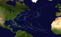
Meteorological history of Hurricane Laura</span>

Hurricane Laura tied the record for the strongest hurricane to make landfall in Louisiana as measured by maximum sustained winds, along with the 1856 Last Island hurricane and Hurricane Ida, and was overall the tenth-strongest hurricane to make landfall in the United States. The thirteenth tropical cyclone, twelfth named storm, fourth hurricane, and first major hurricane of the 2020 Atlantic hurricane season, Laura originated from a large tropical wave that moved off the West African coast on August 16. The tropical wave gradually organized, becoming a tropical depression on August 20. Though in only a marginally conducive environment for intensification, the depression nevertheless intensified into a tropical storm a day later, becoming the earliest twelfth named storm on record in the North Atlantic basin, forming eight days earlier than 1995's Hurricane Luis. The depression received the name Laura and tracked west-northwest towards the Lesser Antilles.

<span class="mw-page-title-main">Hurricane Sally</span> Category 2 Atlantic hurricane in 2020

Hurricane Sally was a destructive and slow-moving Atlantic hurricane that was the first hurricane to make landfall in the U.S. state of Alabama since Ivan in 2004, coincidentally on the same date in the same place. The eighteenth named storm and seventh hurricane of the extremely active 2020 Atlantic hurricane season, Sally developed from an area of disturbed weather which was first monitored over the Bahamas on September 10. The system grew a broad area of low-pressure on September 11, and was designated as a tropical depression late that day. Early the next day, the depression made landfall at Key Biscayne and subsequently strengthened into Tropical Storm Sally that afternoon. Moderate northwesterly shear prevented significant intensification for the first two days, but convection continued to grow towards the center and Sally slowly intensified. On September 14, a center reformation into the center of the convection occurred, and data from a hurricane hunter reconnaissance aircraft showed that Sally had rapidly intensified into a strong Category 1 hurricane. However, an increase in wind shear and upwelling of colder waters halted the intensification and Sally weakened slightly on September 15 before turning slowly northeastward. Despite this increase in wind shear, it unexpectedly re-intensified, reaching Category 2 status early on September 16 before making landfall at peak intensity at 09:45 UTC on September 16, near Gulf Shores, Alabama, with maximum sustained winds of 110 mph (180 km/h) and a minimum central pressure of 965 millibars (28.5 inHg). The storm rapidly weakened after landfall before transitioning into an extratropical low at 12:00 UTC the next day. Sally's remnants lasted for another day as they moved off the coast of the Southeastern United States before being absorbed into another extratropical storm on September 18.

<span class="mw-page-title-main">Hurricane Paulette</span> Category 2 Atlantic hurricane in 2020

Hurricane Paulette was a strong and long-lived Category 2 Atlantic hurricane which became the first to make landfall in Bermuda since Hurricane Gonzalo did so in 2014. The sixteenth named storm and sixth hurricane of the record-breaking 2020 Atlantic hurricane season, Paulette developed from a tropical wave that left the coast of Africa on September 2. The wave eventually consolidated into a tropical depression on September 7. Paulette fluctuated in intensity over the next few days, due to strong wind shear, initially peaking as a strong tropical storm on September 8. It eventually strengthened into a hurricane early on September 13 as shear decreased. On September 14, Paulette made landfall in northeastern Bermuda as a Category 2 hurricane, while making a gradual turn to the northeast. The cyclone further strengthened as it moved away from the island, reaching its peak intensity with 1-minute sustained winds of 105 mph (169 km/h) and a minimum central atmospheric pressure of 965 mbar (28.5 inHg) on September 14. On the evening of September 15, Paulette began to weaken and undergo extratropical transition, which it completed on September 16. The hurricane's extratropical remnants persisted and moved southward then eastward, and eventually, Paulette regenerated into a tropical storm early on September 20 south of the Azores– which resulted in the U.S National Weather Service coining the phrase "zombie storm" to describe its unusual regeneration. Paulette's second phase proved short-lived, however, as the storm quickly weakened and became post-tropical again two days later. The remnant persisted for several days before dissipating south of the Azores on September 28. In total, Paulette was a tropical cyclone for 11.25 days, and the system had an overall lifespan of 21 days.

<span class="mw-page-title-main">Tropical Storm Beta (2020)</span> Atlantic tropical storm in 2020

Tropical Storm Beta was a tropical cyclone that brought heavy rainfall, flooding, and severe weather to the Southeastern United States in September 2020. The twenty-third tropical depression and twenty-third named storm of the record-breaking 2020 Atlantic hurricane season, Beta originally formed from a trough of low pressure that developed in the northeastern Gulf of Mexico on September 10. The low moved slowly southwestward, with development hampered initially by the development of nearby Hurricane Sally. After Sally moved inland over the Southeastern United States and weakened, the disturbance became nearly stationary in the southwestern Gulf, where it began to organize. By September 16, the storm had gained a low-level circulation center and had enough organization to be designated as Tropical Depression Twenty-Two. The system held its intensity for a day due to the influence of strong wind shear and dry air, before eventually attaining tropical storm strength. It slowly moved northward and intensified to a mid-range tropical storm before dry air and wind shear halted its intensification. Beta then became nearly stationary on September 19, before starting to move west towards the Texas coast the next day, weakening as it approached. On September 21, Beta made landfall near Matagorda Peninsula, Texas as a minimal tropical storm. It subsequently weakened to a tropical depression the next day before becoming post-tropical early on September 23. Its remnants moved northeastward, before the center elongated and merged with a cold front early on September 25.

<span class="mw-page-title-main">Hurricane Gamma</span> Category 1 Atlantic hurricane in 2020

Hurricane Gamma was a Category 1 hurricane that brought heavy rains, flooding, and landslides to the Yucatán Peninsula in early October 2020. The twenty-fifth depression, twenty-fourth named storm and ninth hurricane of the extremely active 2020 Atlantic hurricane season, Gamma developed from a vigorous tropical wave that had been monitored as it was entering the Eastern Caribbean on September 29. The wave moved westward and slowed down as it moved into the Western Caribbean, where it began to interact with a dissipating cold front. A low formed within the disturbance on October 1 and the next day, it organized into a tropical depression. It further organized into Tropical Storm Gamma early the next day. It continued to intensify and made landfall as a minimal hurricane near Tulum, Mexico, on October 3. It weakened over land before reemerging in the Gulf of Mexico. Gamma then briefly restrengthened some before being blasted by high amounts of wind shear, causing it to weaken again. It made a second landfall as a tropical depression in Nichili, Mexico on October 6 before dissipating as it was absorbed by the approaching Hurricane Delta.

<span class="mw-page-title-main">Hurricane Delta</span> Category 4 Atlantic hurricane in 2020

Hurricane Delta was the record-tying fourth named storm of 2020 to make landfall in Louisiana, as well as the record-breaking tenth named storm to strike the United States in that year. The twenty-sixth tropical cyclone, twenty-fifth named storm, tenth hurricane, and third major hurricane of the record-breaking 2020 Atlantic hurricane season, Delta formed from a tropical wave which was first monitored by the National Hurricane Center (NHC) on October 1. Moving westward, the tropical wave began to quickly organize. A well-defined center of circulation formed with sufficiently organized deep convection on October 4, and was designated as Tropical Depression Twenty-six and soon thereafter, Tropical Storm Delta. Extremely rapid intensification ensued throughout October 5 into October 6, with Delta becoming a Category 4 hurricane within 28 hours of attaining tropical storm status. The rate of intensification was the fastest in the Atlantic basin since Hurricane Wilma in 2005. After peaking in intensity however, an unexpected increase in wind shear and dry air quickly weakened the small storm before it made landfall in Puerto Morelos, Mexico as a Category 2 hurricane with 105 mph (169 km/h) winds. It weakened some more over land before emerging into the Gulf of Mexico, where it was downgraded to a Category 1 hurricane. After that, it began to restrengthen, regaining Category 3 status late on October 8. It then turned northward and reached a secondary peak intensity of 953 mbar (28.14 inHg) and winds of 120 mph early on October 9. Delta then began to turn more north-northeastward into an area of cooler waters, higher wind shear, and dry air, causing it to weaken back to Category 2 status. Delta then made landfall at 23:00 UTC near Creole, Louisiana with winds of 100 mph (160 km/h) and a pressure of 970 mbar (29 inHg). The storm began to weaken more rapidly after landfall, becoming post-tropical just 22 hours later.

<span class="mw-page-title-main">Hurricane Enrique (2021)</span> Category 1 Pacific hurricane in 2021

Hurricane Enrique was a Category 1 Pacific hurricane that brought heavy rainfall and flooding to much of western Mexico in late June 2021. The fifth named storm and first hurricane of the 2021 Pacific hurricane season, Enrique developed from a tropical wave the entered the Pacific Ocean off the coast of Nicaragua on June 22. In an environment conducive for intensification, the disturbance moved west-northwestward and developed into a tropical storm by 6:00 UTC on June 25, as it was already producing winds of 40 mph (65 km/h), and received the name Enrique. Enrique strengthened steadily within an environment of warm waters and low-to-moderate wind shear while continuing its northwestward motion. By 12:00 UTC on June 26, Enrique had intensified into a Category 1 hurricane as the storm turned more northwestward. Nearing the coast of Mexico, Enrique reached its peak intensity around 6:00 UTC the following day, with maximum sustained winds of 90 mph (150 km/h) and a minimum barometric pressure of 972 mbar (28.7 inHg). Enrique, passing closely offshore west-central Mexico, maintained its intensity for another 24 hours as it turned northward toward the Gulf of California. Turning back to the northwest on June 28, increasing wind shear and dry air caused the hurricane to weaken. Enrique dropped to tropical storm status at 18:00 UTC that day, and further weakened to a tropical depression on June 30 just to the northeast of Baja California. The depression was absorbed into a larger low pressure area to the southeast later that day.

References

  1. 1 2 3 4 5 6 7 8 9 10 11 Latto, Andrew (October 14, 2021). Tropical Cyclone Report: Tropical Storm Danny (AL042021) (PDF) (Report). National Hurricane Center. Archived (PDF) from the original on October 14, 2021. Retrieved October 14, 2021.
  2. Tropical Weather Discussion: Atlantic [1205 UTC Thu Jun 24 2021]. nhc.noaa.gov (Report). Miami, Florida: National Hurricane Center. June 24, 2021. Archived from the original on June 28, 2021. Retrieved June 28, 2021.
  3. Tropical Weather Discussion: Atlantic [1205 UTC Fri Jun 25 2021]. nhc.noaa.gov (Report). Miami, Florida: National Hurricane Center. June 25, 2021. Archived from the original on June 28, 2021. Retrieved June 28, 2021.
  4. "NHC Graphical Outlook Archive". www.nhc.noaa.gov. Archived from the original on August 12, 2023. Retrieved August 12, 2023.
  5. 1 2 "NHC Graphical Outlook Archive". www.nhc.noaa.gov. Archived from the original on August 12, 2023. Retrieved August 12, 2023.
  6. Stewart, Stacy (June 28, 2021). Tropical Depression Four Discussion Number 1. www.nhc.noaa.gov (Report). Miami, Florida: National Hurricane Center. Archived from the original on June 29, 2021. Retrieved June 29, 2021.
  7. "NHC Graphical Outlook Archive". www.nhc.noaa.gov. Archived from the original on August 12, 2023. Retrieved August 12, 2023.
  8. Stewart, Stacy (June 28, 2021). Tropical Depression Four Discussion Number 1 (Report). National Hurricane Center. Archived from the original on June 29, 2021. Retrieved October 14, 2021.
  9. Stewart, Stacy (June 28, 2021). Tropical Storm Danny Discussion Number 2 (Report). Miami, Florida: National Hurricane Center. Archived from the original on June 29, 2021. Retrieved June 29, 2021.
  10. 1 2 3 Cangialosi, John (June 28, 2021). Tropical Depression Danny Discussion Number 3. www.nhc.noaa.gov (Report). Miami, Florida: National Hurricane Center. Archived from the original on June 29, 2021. Retrieved June 29, 2021.
  11. "Danny weakens to a tropical depression, heavy rains continue". Associated Press. June 29, 2021. Archived from the original on June 30, 2021. Retrieved June 29, 2021.
  12. Stewart, Stacy (June 28, 2021). Tropical Depression Four Forecast/Advisory Number 1. www.nhc.noaa.gov (Report). Miami, Florida: National Hurricane Center. Archived from the original on June 29, 2021. Retrieved June 29, 2021.
  13. "Danny weakens to a tropical depression, heavy rains continue". News Observers. June 29, 2021. Archived from the original on June 30, 2021. Retrieved June 30, 2021.
  14. Gard, Hannah; Brink, Haley (June 29, 2021). "Tropical Storm Danny forms and quickly makes landfall in South Carolina". CNN. Archived from the original on June 30, 2021. Retrieved June 29, 2021.
  15. "Storm Prediction Center Jun 28, 2021 2000 UTC Day 1 Convective Outlook". www.spc.noaa.gov. Archived from the original on February 25, 2023. Retrieved February 25, 2023.
  16. Saric, Ivana (June 29, 2021). "Tropical Storm Danny forms off coast of South Carolina". Yahoo News. Archived from the original on June 30, 2021. Retrieved June 30, 2021. A Lake Wind Advisory has been issued for much of the state.
  17. 1 2 "Tropical Storm Danny Made Landfall in South Carolina Just Hours After Forming". The Weather Channel. June 29, 2021. Archived from the original on June 29, 2021. Retrieved June 29, 2021.
  18. McCloud, Cheryl; Rice, Doyle (June 28, 2021). "Tropical Storm Danny makes landfall north of Georgia, South Carolina border; expected to dissipate late Tuesday". USA Today. Archived from the original on June 30, 2021. Retrieved June 29, 2021.
  19. Brooking, Ian (June 28, 2021). "Myrtle Beach area to see impacts of Tropical Storm Danny as it approaches the Lowcountry". MyHorryNews. Archived from the original on June 30, 2021. Retrieved June 30, 2021.
  20. ian.brooking@myhorrynews.com, Ian Livingston Brooking (June 28, 2021). "Myrtle Beach area to see impacts of Tropical Storm Danny as it approaches the Lowcountry". MyHorryNews.com. Archived from the original on June 28, 2021. Retrieved February 25, 2023.
  21. "Tropical Storm Danny brings strong winds to South Carolina coast". USA TODAY. Archived from the original on February 25, 2023. Retrieved February 25, 2023.
  22. McCray, Shamira (June 29, 2021). "Danny was 1 of 3 recorded tropical systems to make landfall in June on SC coast". Post and Courier. Archived from the original on February 25, 2023. Retrieved February 25, 2023.
  23. Sanches, Sofia; Wilson, Lisa; Ferguson, Lana (June 29, 2021). "Tropical Storm Danny makes landfall just north of Hilton Head. Here's Tuesday's outlook". The State. Archived from the original on June 30, 2021. Retrieved June 29, 2021.
  24. 1 2 Curley, Molly (June 29, 2021). "Tropical Storm Danny brings lightning, flooding locally". WSAV-TV. Archived from the original on June 30, 2021. Retrieved June 29, 2021.
  25. "Tropical Storm Danny is gone. But another potential storm is on the horizon". WJCL. June 29, 2021. Archived from the original on June 30, 2021. Retrieved June 29, 2021.
  26. "Rain Drenches South Carolina's Coast as Tropical Storm Danny Makes Landfall". uk.news.yahoo.com. June 29, 2021. Archived from the original on February 25, 2023. Retrieved February 25, 2023.
  27. Duff, Renee (June 29, 2021). "Danny makes landfall in the southeastern US". Accuweather. Archived from the original on June 30, 2021. Retrieved June 29, 2021.
Tropical Storm Danny
Danny 2021-06-28 1840Z.jpg
Tropical Storm Danny at peak intensity on June 28