Fern made a direct hit at Yap on Christmas Day. A cargo ship was abandoned after it was damaged by high winds offshore. On the island,Fern caused $3 million (1996USD) of damage. Roads and bridges were significantly damaged,and other public facilities were destroyed. Crops and private properties also received damage. A state of emergency was declared in Yap State two weeks later,and became a disaster area two months later.
Meteorological history
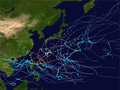
Map plotting the storm's track and intensity,according to the Saffir–Simpson scale
In the middle of December, twin monsoon troughs were established in the extreme western Pacific Ocean, which will later spawn storms Greg, and Fern itself in the northern hemisphere. The trough in the southern hemisphere spawned cyclones Ophelia, Phil, and Fergus. Around that time, convection began to increase near the equator, and was associated with a westerly wind burst. A low level circulation center was noted by JTWC on December 19 at 0600 UTC. Two days later, convection consolidated near the circulation center,[1] and JMA began tracking it at 0000 UTC as a tropical depression.[2][nb 1] JTWC issued a Tropical Cyclone Formation Alert at 1500 UTC, as sea level pressure began to deepen, and signs of upper level divergence were found in the system. The first advisory for Tropical Depression 42W followed three hours later, on December 17 at 1200 UTC.[1][4] JTWC upgraded the depression to a tropical storm on December 22 at 0000 UTC as it traveled westerly, and was given the name Fern.[1] According to JTWC, the wind speeds meandered at minimal tropical storm strength.[1][4] JMA proceeded to upgrade the depression into a tropical storm at 1800 UTC, with winds of 65km/h (40mph), and a pressure reading of 996 hectopascals (996mbar).[2][nb 2] On Christmas Eve, Fern slowly traveled toward Yap.[1] The storm passed over Yap the next day, strengthening to 105km/h (65mph) at 0000 UTC, according to JTWC.[4] JMA assessed Fern had winds of 100km/h (60mph) at the same time.[2] Fern also began its recurvature that day, beginning its turn north.[6]
Eighteen hours later on Christmas Day, JTWC upgraded Fern to a typhoon, with winds of 120km/h (75mph).[1][4] JMA continued to keep it as a severe tropical storm at that time.[2] On December 26 at 1200 UTC, Fern reached its peak at 150km/h(90mph) north of Yap after its recurvature, according to JTWC.[1][4] JMA assessed that Fern reached its peak of 110km/h (70mph), with a pressure reading of 975hPa (975mb) twelve hours later.[2] On December 28, Fern began to weaken when it encountered a shear line.[1] On the next day, JTWC downgraded Fern back to tropical storm strength, with winds of 110km/h (70mph).[4] At the same time according to JMA, the storm had weakened to 80km/h (50mph), with a pressure reading of 985hPa (985mbar).[2] Both warning centers downgraded Fern into a tropical depression by December 30, as it continued to travel along a shear line.[1][2][4] JTWC issued the final warning at 0600 UTC,[1] while JMA stopped tracking the depression at 1200 UTC.[2] JTWC continued to track the low until December 31, where it stalled north of Guam.[4][6]
Impact and aftermath
At sea, a cargo ship en route from Guam to Yap was abandoned after it was damaged by high winds. The passengers entered a life raft, and were later found by a Navysearch and rescue airplane. They were soon rescued by a Maltesetanker. No one was injured when the accident occurred.[1]
Yap was directly hit by Fern on Christmas Day, causing about $3 million (1996USD) of damage. The Weather Service Office received a peak wind gust of 116km/h (72mph), and a pressure reading of 983hPa (983mbar). The island received gusts around 93km/h (58mph) for several hours. One person was injured on the island, and no deaths were attributed to the storm. Roads and bridges were severely damaged, accounting for half of the damage.[1] Homes and other private properties were also significantly damaged. Most crops on the island, such as coconuts, bananas, papayas, and breadfruit, were destroyed by the storm. Public facilities, like schools and hospitals, suffered widespread destruction.[7]
On January 3, 1997, a state of emergency was declared for Yap by Acting PresidentJacob Nena, stating that Fern caused "an imminent threat to health, safety and welfare of the people of the affected areas."[7] Two months later, on March 20, United StatesPresidentBill Clinton declared Yap State a disaster area, allowing the Federal Emergency Management Agency (FEMA) to start the damage assessment of the area. The FEMA funding was only for public facilities, and did not include private properties.[8] The request for individual assistance was not approved by FEMA, as damage to private properties were not much, and assistance from the national government and Yap State were sufficient.[9]
↑ Wind estimates from the JMA and most other basins throughout the world are sustained over 10minutes, while estimates from the United States-based Joint Typhoon Warning Center are sustained over 1minute. 10minute winds are about 1.14 times the amount of 1minute winds.[5]
References
1 2 3 4 5 6 7 8 9 10 11 12 Kubat, Gary B.; Carle, William J.; Wells, Frank H.; Sanchez, Paul G.; Hong, Bryan Y.; Cross, Christopher; Boyd, Mathew A. (1996). 1996 Annual Tropical Cyclone Report(PDF) (Report). Joint Typhoon Warning Center. pp.207–209. Archived from the original(PDF) on February 21, 2013. Retrieved August 1, 2014.
↑ Landsea, Chris (April 21, 2006). "Subject: D4) What does "maximum sustained wind" mean? How does it relate to gusts in tropical cyclones?". Frequently Asked Questions. National Oceanic and Atmospheric Administration's Atlantic Oceanographic and Meteorological Laboratory. Archived from the original on October 9, 2014. Retrieved August 1, 2014.
1 2 Knapp, Kenneth R.; Kruk, Michael C.; Levinson, David H.; Diamond, Howard J.; Neumann, Charles J. (2010). 1996 FERN (1996353N05151). The International Best Track Archive for Climate Stewardship (IBTrACS): Unifying tropical cyclone best track data (Report). Bulletin of the American Meteorological Society. Archived from the original on March 5, 2016. Retrieved August 2, 2014.
↑ "Typhoon Fern Individual Assistance" (Press release). Palikir: FSM Information Service. FSM Office of the President. April 16, 1997. Archived from the original on March 4, 2016. Retrieved August 1, 2014.
This page is based on this Wikipedia article Text is available under the CC BY-SA 4.0 license; additional terms may apply. Images, videos and audio are available under their respective licenses.