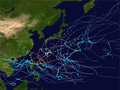
1996 Pacific typhoon season

Last updated
1996 Pacific typhoon season
1996 Pacific typhoon season summary map.png
Season summary map
Seasonal boundaries
First system formedJanuary 12, 1996
Last system dissipatedDecember 29, 1996
Strongest storm
Name Herb
  Maximum winds175 km/h (110 mph)
(10-minute sustained)
  Lowest pressure925 hPa (mbar)
Seasonal statistics
Total depressions52
Total storms30
Typhoons16
Super typhoons6 (unofficial)
Total fatalities936 total
Total damage$8.12 billion (1996 USD)
Related articles
Pacific typhoon seasons
1994, 1995, 1996, 1997, 1998

The 1996 Pacific typhoon season has no official bounds; it ran year-round in 1996, but most tropical cyclones tend to form in the northwestern Pacific Ocean between May and November. [1] These dates conventionally delimit the period of each year when most tropical cyclones form in the northwestern Pacific Ocean.

Contents

The scope of this article is limited to the Pacific Ocean, north of the equator and west of the international date line. Storms that form east of the date line and north of the equator are called hurricanes; see 1996 Pacific hurricane season. Tropical Storms formed in the entire west pacific basin were assigned a name by the Joint Typhoon Warning Center. Tropical depressions in this basin have the "W" suffix added to their number. Tropical depressions that enter or form in the Philippine area of responsibility are assigned a name by the Philippine Atmospheric, Geophysical and Astronomical Services Administration or PAGASA. This can often result in the same storm having two names, like Herb or Sally.

Season summary

Tropical Depression GregTropical Storm FernTyphoon Sally (1996)Typhoon Herb1996 Pacific typhoon season

Systems

Tropical Storm 01W (Asiang)

Tropical storm (JMA)
Tropical depression (SSHWS)
Asiang 1996-02-29 0900Z.png   Asiang 1996 track.png
DurationFebruary 28 – March 1
Peak intensity65 km/h (40 mph) (10-min); 998  hPa  (mbar)

On February 23, a large area of convection developed south of the Philippine Sea. The convection developed into a low pressure area and was at first bombarded by wind shear, but conditions soon turned favorable which allowed it to strengthen rapidly on February 27 before becoming a Tropical depression later that day. The JMA upgraded 01W into a Tropical Storm before it drifted over the Philippines on February 29, and weakened slightly due to land interaction. [2] [3] On March 1, a cold front brought cold, dry air and vertical wind shear which pushed the system south caused the system's low level circulation center to become exposed. The exposed remnants of 01W continued to drift south, before being completely absorbed by the Intertropical Convergence Zone.[ citation needed ]

Tropical Storm Ann (Biring)

Tropical storm (JMA)
Tropical storm (SSHWS)
Ann 1996-04-07 0900Z.png   Ann 1996 track.png
DurationApril 1 – April 10
Peak intensity65 km/h (40 mph) (10-min); 1000  hPa  (mbar)

Ann (Biring) developed on March 30. The storm struck the Philippines on April 7 and dissipated three days later.

Tropical Depression 03W

Tropical depression (JMA)
Tropical depression (SSHWS)
03W 1996-04-25 1000Z.png   3-W 1996 track.png
DurationApril 25 – April 26
Peak intensity45 km/h (30 mph) (1-min); 1004  hPa  (mbar)

Tropical Depression 03W existed over the South China Sea from April 25 to April 26.

Typhoon Bart (Konsing)

Very strong typhoon (JMA)
Category 4 typhoon (SSHWS)
Bart 1996-05-14 0800Z.png   Bart 1996 track.png
DurationMay 8 – May 18
Peak intensity175 km/h (110 mph) (10-min); 930  hPa  (mbar)

Bart existed from May 8 to May 18.

Tropical Storm Cam (Ditang)

Tropical storm (JMA)
Tropical storm (SSHWS)
Cam 1996-05-23 0300Z.png   Cam 1996 track.png
DurationMay 18 – May 24
Peak intensity75 km/h (45 mph) (10-min); 994  hPa  (mbar)

Cam developed over the South China Sea on May 18. The cyclone headed northeastward to east-northeastward and dissipated over the Pacific Ocean on May 23.

Typhoon Dan

Strong typhoon (JMA)
Category 1 typhoon (SSHWS)
Dan 1996-07-09 0000Z.png   Dan 1996 track.png
DurationJuly 5 – July 12
Peak intensity120 km/h (75 mph) (10-min); 970  hPa  (mbar)

Dan existed from July 5 to July 11.

Typhoon Eve

Very strong typhoon (JMA)
Category 5 super typhoon (SSHWS)
Eve 1996-07-16 0100Z.png   Eve 1996 track.png
DurationJuly 13 – July 24
Peak intensity155 km/h (100 mph) (10-min); 940  hPa  (mbar)

A Tropical Upper Tropospheric Trough spawned Tropical Depression 7W on July 10 over the open Western Pacific. It tracked generally west-northwestward, strengthening to a tropical storm on the 14th. On the 15th Eve became a typhoon, which was followed by a period of explosive deepening to a 100 mph Typhoon, with a pressure drop of 40 mb from early on the 15th to early on the 16th. An eyewall replacement cycle weakened Eve to a 95 mph typhoon, but as the outer eyewall contracted, the storm again reached wind speeds of 97 mph before hitting southern Japan on the 18th. Rapidly weakening over the mountains, Eve turned eastward over the islands and the last warning was issued on the 20th. It restrengthened to a tropical storm east of Japan, and continued northeastward until dissipation on the 27th. Eve, despite being a Category 4 at landfall, caused no reported deaths and only 9 injuries. [4]

Severe Tropical Storm Frankie (Edeng)

Severe tropical storm (JMA)
Category 2 typhoon (SSHWS)
Frankie 1996-07-23 1600Z.png   Frankie 1996 track.png
DurationJuly 20 – July 25
Peak intensity95 km/h (60 mph) (10-min); 975  hPa  (mbar)

An active monsoon trough over the Western Pacific Ocean developed 3 typhoons; Frankie, Gloria, and Herb. The first, Frankie, developed in the South China Sea on July 19. It tracked west-northwestward and became a tropical storm on the 21st. After crossing the island of Hainan Frankie rapidly intensified to a 100 mph typhoon, 945 millibar over the Gulf of Tonkin. It northern Vietnam on the 23rd, and dissipated 2 days later over China. 104 people were reported killed or missing in association with Frankie, [4] and damage figures in Vietnam are estimated at over 16.65 trillion (US$1.4 billion) (1996 US Dollars). [5]

Typhoon Gloria (Gloring)

Strong typhoon (JMA)
Category 2 typhoon (SSHWS)
Gloria 1996-07-25 0500Z.png   Gloria 1996 track.png
DurationJuly 21 – July 28
Peak intensity120 km/h (75 mph) (10-min); 965  hPa  (mbar)

The same monsoon trough that spawned Frankie also spawned a tropical depression on July 19 east of the Philippines. It headed northwestward, slowly organizing into a tropical storm on the 22nd. The next day Gloria reached typhoon strength, and a day later it reached its peak of 100 mph winds. Gloria brushed the northern coast of the Philippines and turned northward to hit Taiwan on the 26th. After crossing the island and the Taiwan Strait, Gloria hit China where she dissipated on the 27th. Gloria caused 23 casualties, 20 of which were in the northern Philippines. In addition, damage was estimated at $20 million (1996 USD). [4]

Typhoon Herb (Huaning)

Very strong typhoon (JMA)
Category 5 super typhoon (SSHWS)
Herb 1996-07-30 2300Z.png   Herb 1996 track.png
DurationJuly 23 – August 4
Peak intensity175 km/h (110 mph) (10-min); 925  hPa  (mbar)

Super Typhoon Herb was the strongest and the largest storm of 1996. Herb struck Ryūkyū Islands, Taiwan and China. Maximum sustained winds of the cyclone reached 160 miles per hour (260 km/h) over the open ocean. The system led to 590 casualties and US$5 billion in damage (1996 dollars). [4]

Tropical Depression Ian

Tropical depression (JMA)
Tropical storm (SSHWS)
Ian 1996-07-29 0600Z.png   Ian 1996 track.png
DurationJuly 28 – July 29
Peak intensity75 km/h (45 mph) (1-min); 1002  hPa  (mbar)

Ian existed from July 27 to July 31.

Severe Tropical Storm Joy

Severe tropical storm (JMA)
Category 1 typhoon (SSHWS)
Joy 1996-08-02 0100Z.png   Joy 1996 track.png
DurationJuly 29 – August 6
Peak intensity100 km/h (65 mph) (10-min); 980  hPa  (mbar)

Joy existed from July 29 to August 6.

Typhoon Kirk (Isang)

Strong typhoon (JMA)
Category 2 typhoon (SSHWS)
Kirk 1996-08-12 0600Z.png   Kirk 1996 track.png
DurationAugust 3 – August 15
Peak intensity140 km/h (85 mph) (10-min); 955  hPa  (mbar)

A monsoon depression developed on July 28 over the open Pacific Ocean. It headed northwestward, slowly consolidating to become a tropical storm on the 5th. While south of Japan, Kirk drifted to the southeast and looped back to the west, strengthening to a typhoon on the 8th while looping. It continued slowly northwestward, and while curving to the northeast Kirk reached a peak of 110 mph winds. The typhoon struck southwestern Japan at that intensity on the 14th. It weakened over the country, and dissipated on the 16th over the northern Pacific. Kirk caused heavy flooding, resulting in at least 2 deaths and moderate damage. [4]

Tropical Storm Lisa

Tropical storm (JMA)
Tropical storm (SSHWS)
Lisa 1996-08-06 0500Z.png   Lisa 1996 track.png
DurationAugust 5 – August 9
Peak intensity75 km/h (45 mph) (10-min); 996  hPa  (mbar)

Lisa developed over the South China Sea on August 4. The storm headed northeastward and struck China on August 6, then dissipated two days later.

Tropical Depression 15W

Tropical depression (JMA)
Tropical depression (SSHWS)
15W 1996-08-15 0300Z.png   15-W 1996 track.png
DurationAugust 12 – August 16
Peak intensity55 km/h (35 mph) (1-min); 998  hPa  (mbar)

Tropical Depression 15W existed from August 11 to August 17.

Tropical Depression Marty

Tropical depression (JMA)
Tropical storm (SSHWS)
Marty 1996-08-14 0200Z.png   Marty 1996 track.png
DurationAugust 12 – August 16
Peak intensity95 km/h (60 mph) (1-min); 998  hPa  (mbar)

The monsoon trough spawned a tropical depression over southern China on August 11. It drifted southwestward, entering the Gulf of Tonkin on the 12th. An extremely small cyclone, it reached tropical storm strength on the 13th and a peak of 60 mph on the 14th. Marty made landfall on the 14th on northern Vietnam, where it dissipated 3 days later. Though small and somewhat weak, Marty managed to cause moderate damage and flooding, amounting to the deaths of 125 with 107 people missing. [4]

Tropical Depression 17W

Tropical depression (JMA)
Tropical depression (SSHWS)
17W 1996-08-14 0000Z.png   17-W 1996 track.png
DurationAugust 13 – August 16 (Out of basin from August 14 to August 15)
Peak intensity55 km/h (35 mph) (1-min); 1008  hPa  (mbar)

Tropical Depression 17W existed from August 13 to August 16.

Typhoon Niki (Lusing)

Strong typhoon (JMA)
Category 2 typhoon (SSHWS)
Niki 1996-08-21 2000Z.png   Niki 1996 track.png
DurationAugust 17 – August 23
Peak intensity120 km/h (75 mph) (10-min); 970  hPa  (mbar)

Niki developed on August 16. It struck Luzon on August 19 and then crossed the South China Sea. The typhoon later made landfall in Hainan on August 20 and northern Vietnam on August 21. Niki dissipated by August 23.

Typhoon Orson

Strong typhoon (JMA)
Category 4 typhoon (SSHWS)
Orson 1996-08-25 0600Z.png   Orson 1996 track.png
DurationAugust 20 – September 3
Peak intensity140 km/h (85 mph) (10-min); 955  hPa  (mbar)

Orson existed from August 20 to September 3.

Tropical Storm Piper

Tropical storm (JMA)
Category 1 typhoon (SSHWS)
Piper 1996-08-25 0000Z.png   Piper 1996 track.png
DurationAugust 22 – August 26
Peak intensity75 km/h (45 mph) (10-min); 996  hPa  (mbar)

Piper existed from August 22 to August 26.

Tropical Depression 21W

Tropical depression (JMA)
Tropical depression (SSHWS)
21W 1996-08-25 2100Z.png   21-W 1996 track.png
DurationAugust 26 – August 27
Peak intensity45 km/h (30 mph) (1-min); 1008  hPa  (mbar)

Tropical Depression 21W existed from August 25 to August 29.

Tropical Storm Rick

Tropical depression (JMA)
Tropical storm (SSHWS)
Rick 1996-08-28 0000Z.png   Rick 1996 track.png
DurationAugust 28 – September 2
Peak intensity65 km/h (40 mph) (1-min); 1004  hPa  (mbar)

Rick existed from August 27 to September 3.

Typhoon Sally (Maring)

Strong typhoon (JMA)
Category 5 super typhoon (SSHWS)
Sally 1996-09-07 2248Z.png   Sally 1996 track.png
DurationSeptember 5 – September 10
Peak intensity150 km/h (90 mph) (10-min); 940  hPa  (mbar)

On September 2, a tropical depression developed well east of the Philippines. It headed west-northwestward, reaching tropical storm strength on the 5th and typhoon strength on the 6th. On the 7th Sally rapidly intensified to a 160 mph Super Typhoon while passing just north of the Philippines. It weakened slightly yet steadily to a 115 mph typhoon over the South China Sea, hitting the Luichow Peninsula of China on the 9th, and dissipated the next day over the country. Sally brought heavy rain and damage to China, causing 114 casualties, 110 people missing, and economic losses estimated at $1.5 billion (1996 USD). [4]

Tropical Depression 24W (Ningning)

Tropical depression (JMA)
Tropical storm (SSHWS)
Ningning 1996-09-12 1000Z.png   Ningning 1996 track.png
DurationSeptember 10 – September 14
Peak intensity85 km/h (50 mph) (1-min); 996  hPa  (mbar)

Ningning developed on September 6. It struck Luzon on September 9 and then entered the South China Sea. Ningning dissipated offshore Vietnam on September 14.

Typhoon Violet (Osang)

Very strong typhoon (JMA)
Category 4 super typhoon (SSHWS)
Violet 1996-09-16 0500Z.png   Violet 1996 track.png
DurationSeptember 11 – September 23
Peak intensity165 km/h (105 mph) (10-min); 935  hPa  (mbar)

Violet existed from September 11 to September 23.

Typhoon Tom

Strong typhoon (JMA)
Category 1 typhoon (SSHWS)
Tom 1996-09-16 0500Z.png   Tom 1996 track.png
DurationSeptember 12 – September 20
Peak intensity130 km/h (80 mph) (10-min); 965  hPa  (mbar)

Tom existed from September 11 to September 21.

Severe Tropical Storm Willie

Severe tropical storm (JMA)
Category 1 typhoon (SSHWS)
Willie 1996-09-20 0100Z.png   Willie 1996 track.png
DurationSeptember 15 – September 23
Peak intensity100 km/h (65 mph) (10-min); 985  hPa  (mbar)

An active monsoon trough that also developed Typhoons Tom (25W) and Violet (26W) spawned a tropical depression in the Gulf of Tonkin on September 16. It moved counter-clockwise around Hainan Island, becoming a tropical storm on the 17th and a typhoon on the 19th. It crossed the narrow Hainan Strait between Hainan and China, and continued west-southwestward across the Gulf of Tonkin. Willie made landfall on Vietnam on the 22nd, and dissipated the next day. The typhoon resulted in 38 fatalities from flooding. [4] Damage in Vietnam reached over 500 billion dong (US$40 million, 1996 dollars). [5]

Typhoon Yates

Very strong typhoon (JMA)
Category 4 super typhoon (SSHWS)
Yates 1996-09-25 0000Z.png   Yates 1996 track.png
DurationSeptember 21 – October 1
Peak intensity165 km/h (105 mph) (10-min); 935  hPa  (mbar)

Yates lasted from September 19 to October 1.

Typhoon Zane (Paring)

Strong typhoon (JMA)
Category 3 typhoon (SSHWS)
Zane 1996-09-28 0300Z.png   Zane 1996 track.png
DurationSeptember 23 – October 3
Peak intensity150 km/h (90 mph) (10-min); 950  hPa  (mbar)

Zane existed from September 23 to October 3.

Tropical Depression Abel (Reming)

Tropical depression (JMA)
Tropical storm (SSHWS)
Abel 1996-10-12 1200Z.png   Abel 1996 track.png
DurationOctober 10 – October 17
Peak intensity95 km/h (60 mph) (1-min); 1002  hPa  (mbar)

In the Philippines, Abel killed eight people, left seven others missing and caused $4.3 million (1996 USD, $6.4 million 2013 USD [6] ) in damages.

Tropical Depression 31W

Tropical depression (JMA)
Tropical depression (SSHWS)
31W 1996-10-13 0700Z.png   31-W 1996 track.png
DurationOctober 15 – October 16
Peak intensity45 km/h (30 mph) (1-min); 1006  hPa  (mbar)

Tropical Depression 31W existed from October 13 to October 17.

Severe Tropical Storm Beth (Seniang)

Severe tropical storm (JMA)
Category 2 typhoon (SSHWS)
Beth 1996-10-17 1400Z.png   Beth 1996 track.png
DurationOctober 11 – October 22
Peak intensity110 km/h (70 mph) (10-min); 975  hPa  (mbar)

Beth developed on October 13. It struck Luzon on October 17 and then reached the South China Sea. On October 21, Beth moved ashore in Vietnam and dissipated the next day. One person had drowned in northern Philippines, in the province of Ifugao, while another four remained missing in another province. The PAGASA recorded sustained winds of 120 km/h (75 mph) as the storm impacted the northeastern portion of Cagayan. [7] [ full citation needed ]

Typhoon Carlo

Strong typhoon (JMA)
Category 3 typhoon (SSHWS)
Carlo Oct 24 1996 0336Z.png   Carlo 1996 track.png
DurationOctober 20 – October 26
Peak intensity130 km/h (80 mph) (10-min); 965  hPa  (mbar)

Carlo existed from October 20 to October 26.

Tropical Depression 34W

Tropical depression (SSHWS)
34W 1996-10-27 2000Z.png   34-W 1996 track.png
DurationOctober 24 – October 30 (Exited basin)
Peak intensity55 km/h (35 mph) (1-min); 1000  hPa  (mbar)

Tropical Depression 34W formed over the Sulu Sea on October 24. It struck Palawan on the next day. After tracking across the South China Sea, 34W made landfall in Thailand on October 30. It crossed the Malay Peninsula and entered the North Indian Ocean basin later that day. The storm dissipated shortly thereafter, but later re-developing into the Andhra Pradesh cyclone.

Tropical Depression 35W

Tropical depression (JMA)
Tropical storm (SSHWS)
35W 1996-11-02 2100Z.png   35-W 1996 track.png
DurationNovember 1 – November 3
Peak intensity75 km/h (45 mph) (1-min); 998  hPa  (mbar)

35W killed 60 people and caused $138 million in damages. [8]

Typhoon Dale (Ulpiang)

Very strong typhoon (JMA)
Category 5 super typhoon (SSHWS)
Dale 1996-11-09 1200Z.png   Dale 1996 track.png
DurationNovember 3 – November 13
Peak intensity165 km/h (105 mph) (10-min); 930  hPa  (mbar)

A cluster of thunderstorm activity formed southeast of Guam on November 2. The system slowly organized, becoming a tropical depression on November 4. Remaining nearly stationary, the depression intensified into a tropical storm late in the day. The cyclone then turned westward, becoming a typhoon by November 7. Late in the day, Dale passed south of Guam bringing winds as high as 74 knots (137 km/h) and high seas which overtopped cliffs 30 metres (98 ft) high. Damage on the island totaled US$3.5 million (1996 dollars.) Continuing to intensify, Dale became a supertyphoon in the Philippine Sea on November 9. On November 10, Dale turned north, recurving east of the Philippines. On November 14, Dale accelerated east-northeast at more than 60 knots (110 km/h) as it became an extratropical cyclone. [4]

Tropical Storm Ernie (Toyang)

Tropical storm (JMA)
Tropical storm (SSHWS)
Ernie 1996-11-07 0800Z.png   Ernie 1996 track.png
DurationNovember 4 – November 16
Peak intensity75 km/h (45 mph) (10-min); 992  hPa  (mbar)

In the Philippines, Ernie killed 24 people, left 12 others missing and caused $5.1 million in damages.

Tropical Depression 38W

Tropical depression (JMA)
Tropical storm (SSHWS)
38W 1996-11-05 0000Z.png   38-W 1996 track.png
DurationNovember 5 – November 8
Peak intensity95 km/h (60 mph) (1-min); 1000  hPa  (mbar)

Tropical Storm 38W existed from November 4 to November 12.

Tropical Depression 39W

Tropical depression (SSHWS)
39W 1996-11-09 0000Z.png   39-W 1996 track.png
DurationNovember 7 – November 8
Peak intensity55 km/h (35 mph) (1-min); 1006  hPa  (mbar)

Tropical Depression 39W developed on November 6. It struck Luzon on November 8 and then dissipated two days later.

Tropical Depression 40W

Tropical depression (JMA)
Tropical depression (SSHWS)
40W 1996-11-25 1200Z.png   40-W 1996 track.png
DurationNovember 24 – November 26
Peak intensity45 km/h (30 mph) (1-min); 1002  hPa  (mbar)

Tropical Depression 40W developed on November 25. It struck Mindanao several hours before dissipating on November 30.

Tropical Depression 41W

Tropical depression (SSHWS)
41W 1996-12-17 0400Z.png   41-W 1996 track.png
DurationDecember 14 – December 20
Peak intensity55 km/h (35 mph) (1-min); 1000  hPa  (mbar)

Tropical Depression 41W existed over the South China Sea from December 14 to December 20.

Severe Tropical Storm Fern

Severe tropical storm (JMA)
Category 1 typhoon (SSHWS)
Fern 1996-12-26 2300Z.png   Fern 1996 track.png
DurationDecember 21 – December 29
Peak intensity110 km/h (70 mph) (10-min); 975  hPa  (mbar)

A tropical depression formed on December 21, when a low-level circulation center began to produce deep convection. The depression strengthened into a tropical storm the next day, and was given the name Fern by the Joint Typhoon Warning Center (JTWC). The storm slowly intensified into a Category 1 typhoon on the Saffir–Simpson hurricane wind scale, according to JTWC. Fern peaked north of Yap on December 26, with JTWC assessing winds of 150 km/h (90 mph), while the Regional Specialized Meteorological Center, Japan Meteorological Agency (JMA) assessed peak winds of 110 km/h (70 mph), just below typhoon strength. The storm soon became sheared and weakened slowly. Fern continued to weaken to a tropical depression on December 30. Both agencies stopped advisories later on the same day.

Tropical Depression Greg

Tropical depression (JMA)
Tropical storm (SSHWS)
Greg 1996-12-25 0100Z.png   Greg 1996 track.png
DurationDecember 24 – December 27
Peak intensity85 km/h (50 mph) (1-min); 1002  hPa  (mbar)

Two active monsoon troughs that also developed Typhoon Fern and Southern Hemisphere Cyclones Ophelia, Phil, and Fergus spawned Tropical Depression 43W in the South China Sea on December 21. Due to the troughs' nature, the depression headed east-southeastward, where it strengthened into the final tropical storm of the year on the 24th; Greg. After reaching a peak of 45 knots (83 km/h) winds it crossed the northern part of Borneo on the 25th. It continued east-southeastward until dissipation on the 27th, south of the Philippines. Greg caused extensive property damage on Borneo from torrential flooding, resulting in 127 deaths and 100 people missing. [4]

Storm names

During the season 30 named tropical cyclones developed in the Western Pacific and were named by the Joint Typhoon Warning Center, when it was determined that they had become tropical storms. These names were contributed to a revised list which started in 1996.

AnnBartCamDanEveFrankieGloriaHerbIanJoyKirkLisaMartyNikiOrson
PiperRickSallyTomVioletWillieYatesZaneAbelBethCarloDaleErnieFernGreg

Philippines

AsiangBiringKonsingDitangEdeng
GloringHuaningIsangLusingMaring
NingningOsangParingRemingSeniang
ToyangUlpiangWelpring (unused)Yerling (unused)
Auxiliary list
Apiang (unused)
Basiang (unused)Kayang (unused)Dorang (unused)Enang (unused)Grasing (unused)

The Philippine Atmospheric, Geophysical and Astronomical Services Administration uses its own naming scheme for tropical cyclones in their area of responsibility. PAGASA assigns names to tropical depressions that form within their area of responsibility and any tropical cyclone that might move into their area of responsibility. Should the list of names for a given year prove to be insufficient, names are taken from an auxiliary list, the first 10 of which are published each year before the season starts. Names not retired from this list will be used again in the 2000 season. This is the same list used for the 1992 season. PAGASA uses its own naming scheme that starts in the Filipino alphabet, with names of Filipino female names ending with "ng" (A, B, K, D, etc.). Names that were not assigned/going to use are marked in gray.

Season effects

This table summarizes all the systems that developed within or moved into the North Pacific Ocean, to the west of the International Date Line during 1997. The tables also provide an overview of a systems intensity, duration, land areas affected and any deaths or damages associated with the system.

NameDatesPeak intensityAreas affectedDamage
(USD)
DeathsRefs
Category Wind speedPressure
TDJanuary 12Tropical depressionNot specified1008 hPa (29.77 inHg)PhilippinesNoneNone
01W (Asiang)February 28 – March 1Tropical storm65 km/h (40 mph)998 hPa (29.47 inHg)Philippines NoneNone
Ann (Biring)April 1 – 10Tropical storm65 km/h (40 mph)1000 hPa (29.53 inHg)Caroline Islands, Philippines NoneNone
03WApril 25 – 26Tropical depression45 km/h (30 mph)1004 hPa (29.65 inHg)NoneNoneNone
Bart (Konsing)May 8 – 18Typhoon175 km/h (110 mph)930 hPa (27.46 inHg)PhilippinesNoneNone
Cam (Ditang)May 18 – 24Tropical storm75 km/h (45 mph)994 hPa (29.35 inHg)Philippines, Taiwan NoneNone
TDJune 13 – 15Tropical depressionNot specified1004 hPa (29.65 inHg)South ChinaNoneNone
DanJuly 5 – 12Typhoon120 km/h (75 mph)970 hPa (28.64 inHg)JapanNoneNone
EveJuly 13 – 24Typhoon155 km/h (100 mph)940 hPa (27.76 inHg)JapanNoneNone
Frankie (Edeng)July 20 – 25Severe tropical storm95 km/h (60 mph)975 hPa (28.79 inHg)South China, Vietnam$1.4 billion104 [5] [4]
Gloria (Gloring)July 21 – 18Typhoon120 km/h (75 mph)965 hPa (28.50 inHg)Philippines, Taiwan, China$20 million23
Herb (Huaning) July 23 – August 4Typhoon175 km/h (110 mph)925 hPa (27.32 inHg)Mariana Islands, Taiwan, Ryukyu Islands, China$5 billion284
IanJuly 28 – 29Tropical depression75 km/h (45 mph)1002 hPa (29.59 inHg)Mariana IslandsNoneNone
JoyJuly 29 – August 6Severe tropical storm100 km/h (65 mph)980 hPa (28.94 inHg)NoneNoneNone
TDJuly 31Tropical depressionNot specified1004 hPa (29.65 inHg)Caroline IslandsNoneNone
TDAugust 2 – 3Tropical depressionNot specified998 hPa (29.47 inHg)South ChinaNoneNone
Kirk (Isang)August 3 – 15Typhoon140 km/h (85 mph)955 hPa (28.20 inHg)JapanNone2
LisaAugust 5 – 9Tropical depression55 km/h (35 mph)996 hPa (29.41 inHg)South China NoneNone
TDAugust 7Tropical depressionNot specified1002 hPa (29.59 inHg)NoneNoneNone
15WAugust 12 – 16Tropical depression55 km/h (35 mph)998 hPa (29.47 inHg)NoneNoneNone
TDAugust 12Tropical depressionNot specified1002 hPa (29.59 inHg)South ChinaNoneNone
MartyAugust 12 – 16Tropical depression95 km/h (60 mph)998 hPa (29.47 inHg)South China, Vietnam$198 million125
17WAugust 14 – 16Tropical depression55 km/h (35 mph)1008 hPa (29.77 inHg)NoneNoneNone
Niki (Lusing)August 17 – 23Typhoon140 km/h (85 mph)955 hPa (28.20 inHg)Philippines, Vietnam, South China$65 millionUnknown
TDAugust 17Tropical depressionNot specified1008 hPa (29.77 inHg)NoneNoneNone
OrsonAugust 20 – September 3Typhoon140 km/h (85 mph)955 hPa (28.20 inHg)Mariana IslandsNoneNone
TDAugust 21 – 22Tropical depressionNot specified1008 hPa (29.77 inHg)NoneNoneNone
PiperAugust 22 – 26Tropical storm75 km/h (45 mph)996 hPa (29.41 inHg)None NoneNone
TDAugust 25 – 26Tropical depressionNot specified1008 hPa (29.77 inHg)NoneNoneNone
21WAugust 26 – 27Tropical depression45 km/h (30 mph)1008 hPa (29.77 inHg)NoneNoneNone
RickAugust 28 – September 1Tropical depression65 km/h (40 mph)1004 hPa (29.65 inHg)NoneNoneNone
Sally (Maring) September 4 – 10Typhoon155 km/h (100 mph)940 hPa (27.76 inHg)Philippines, South China$1.5 billion140
24W (Ningning)September 10 – 14Tropical depression85 km/h (50 mph)996 hPa (29.41 inHg)Philippines, VietnamNoneNone
Violet (Osang)September 11 – 23Typhoon165 km/h (105 mph)935 hPa (27.32 inHg)JapanNoneNone
TomSeptember 12 – 20Typhoon130 km/h (80 mph)965 hPa (28.50 inHg)Mariana IslandsNoneNone
WillieSeptember 15 – 23Severe tropical storm100 km/h (65 mph)985 hPa (29.09 inHg)South China, Vietnam, Cambodia, Laos$40 million38 [5]
YatesSeptember 21 – October 1Typhoon165 km/h (105 mph)935 hPa (27.32 inHg)Mariana IslandsNoneNone
Zane (Paring)September 23 – October 3Typhoon150 km/h (90 mph)950 hPa (28.05 inHg)Marshall Islands, Mariana IslandsNoneNone
Abel (Reming)October 10 – 17Tropical depression95 km/h (60 mph)1002 hPa (29.59 inHg)Philippines, Vietnam$4.3 million8
Beth (Seniang)October 11 – 22Severe tropical storm110 km/h (70 mph)975 hPa (28.79 inHg)Philippines, VietnamUnknown1[ citation needed ]
31WOctober 15 – 16Tropical depression55 km/h (35 mph)1006 hPa (29.41 inHg)Mariana IslandsNoneNone
CarloOctober 20 – 26Typhoon130 km/h (80 mph)965 hPa (28.50 inHg)Mariana IslandsNoneNone
34WOctober 24 – 25Tropical depression55 km/h (35 mph)1006 hPa (29.41 inHg)Mariana IslandsNoneNone
35WNovember 1 – 3Tropical depression75 km/h (45 mph)998 hPa (29.47 inHg)Vietnam$138 million60
Dale (Ulpiang)November 3 – 13Typhoon135 km/h (105 mph)930 hPa (27.46 inHg)Caroline Islands, Mariana IslandsNoneNone
Ernie (Toyang)November 4 – 16Tropical storm75 km/h (45 mph)996 hPa (29.41 inHg)Philippines$5.1 million24
38WNovember 5 – 8Tropical depression95 km/h (60 mph)1000 hPa (29.53 inHg)Wake IslandNoneNone
39WNovember 7 – 8Tropical depression55 km/h (35 mph)1006 hPa (29.41 inHg)Mariana IslandsNoneNone
40WNovember 24 – 26Tropical depression45 km/h (30 mph)1002 hPa (29.59 inHg)Mariana IslandsNoneNone
41WDecember 14 – 20Tropical depression55 km/h (35 mph)1000 hPa (29.53 inHg)NoneNoneNone
Fern December 21 – 29Severe tropical storm110 km/h (70 mph)975 hPa (28.79 inHg)Caroline Islands, Mariana Islands$3 millionNone
Greg December 24 – 27Tropical depression85 km/h (50 mph)1002 hPa (29.59 inHg)Malaysia, Philippines, BorneoNone127
Season aggregates
52 systemsJanuary 12 – December 29, 1996175 km/h (110 mph)925 hPa (27.32 inHg)8.12 billion936

See also

Related Research Articles

<span class="mw-page-title-main">2004 Pacific typhoon season</span> Typhoon season in the Western Pacific Ocean

The 2004 Pacific typhoon season was an extremely active season that featured the second-highest ACE ever recorded in a single season, second only to 1997, which featured 29 named storms, nineteen typhoons, and six super typhoons. It was an event in the annual cycle of tropical cyclone formation, in which tropical cyclones form in the western Pacific Ocean. The season ran throughout 2004, though most tropical cyclones typically develop between May and October. The season's first named storm and also the first typhoon, Sudal, developed on April 4, later was reached typhoon status two days later, and became the first super typhoon of the year three days later. The season's last named storm, Noru, dissipated on December 21.

<span class="mw-page-title-main">2002 Pacific typhoon season</span> Typhoon season in the Western Pacific Ocean

The 2002 Pacific typhoon season was a slightly above average Pacific typhoon season, producing twenty-six named storms, fifteen becoming typhoons, and eight super typhoons. It had one of the highest ACE of any season worldwide, with over 400 units. It was an event in the annual cycle of tropical cyclone formation, in which tropical cyclones form in the western Pacific Ocean. The season ran throughout 2002, though most tropical cyclones typically develop between May and October. The season's first named storm, Tapah, developed on January 11, while the season's last named storm, Pongsona, dissipated on December 11. The season's first typhoon, Mitag, reached typhoon status on March 1, and became the first super typhoon of the year four days later.

<span class="mw-page-title-main">2001 Pacific typhoon season</span> Typhoon season in the Western Pacific Ocean

The 2001 Pacific typhoon season was the fourth and final consecutive year with below-average activity, making it the lowest four-year period of activity since 1976–1979, due to the presence of a strong La Niña that had persisted from 1998 to 2001. However, it was more active than the previous seasons, producing twenty-five named storms, sixteen typhoons and three super typhoons, with a near normal Accumulated Cyclone Energy (ACE) of 307.3 units. It ran year-round in 2001, with most tropical cyclones in the northwestern Pacific Ocean tending between May and November.

<span class="mw-page-title-main">2000 Pacific typhoon season</span> Typhoon season in the Western Pacific Ocean

The 2000 Pacific typhoon season marked the first year using names contributed by the World Meteorological Organization. It was a rather below-average season, producing a total of 23 tropical storms, 13 typhoons and 4 intense typhoons. The season ran throughout 2000, though typically most tropical cyclones develop between May and October. The season's first named storm, Damrey, developed on May 7, while the season's last named storm, Soulik, dissipated on January 4 of the next year.

<span class="mw-page-title-main">1998 Pacific typhoon season</span> Typhoon season in the Western Pacific Ocean

The 1998 Pacific typhoon season was at the time the least active Pacific typhoon season on record, until the record was surpassed 12 years later, spawning 16 tropical storms and 8 typhoons. The scope of this article is limited to the Pacific Ocean, north of the equator and west of the international date line. Storms that form east of the date line and north of the equator are called hurricanes; see 1998 Pacific hurricane season. Tropical Storms formed in the entire west Pacific basin were assigned a name by the Joint Typhoon Warning Center. Tropical depressions in this basin have the "W" suffix added to their number. Tropical depressions that enter or form in the Philippine area of responsibility are assigned a name by the Philippine Atmospheric, Geophysical and Astronomical Services Administration or PAGASA. This can often result in the same storm having two names.

<span class="mw-page-title-main">1997 Pacific typhoon season</span> Typhoon season in the Western Pacific Ocean

The 1997 Pacific typhoon season was a record-breaking season featuring 11 tropical cyclones reaching super typhoon intensity, tying the record with 1965 with the most violent tropical cyclones globally. It has no official bounds; it ran year-round in 1997, but most tropical cyclones tend to form in the northwestern Pacific Ocean between May and November. These dates conventionally delimit the period of each year when most tropical cyclones form in the northwestern Pacific Ocean.

<span class="mw-page-title-main">1995 Pacific typhoon season</span> Typhoon season in the Western Pacific Ocean

The 1995 Pacific typhoon season occurred all year round, unusual in that most tropical cyclones tend to form in the northwestern Pacific Ocean between May and November.

<span class="mw-page-title-main">1993 Pacific typhoon season</span> Typhoon season in the Western Pacific Ocean

The 1993 Pacific typhoon season has no official bounds; it ran year-round in 1993, but most tropical cyclones tend to form in the northwestern Pacific Ocean between May and November. These dates conventionally delimit the period of each year when most tropical cyclones form in the northwestern Pacific Ocean.

<span class="mw-page-title-main">1992 Pacific typhoon season</span> Typhoon season in the Western Pacific Ocean

The 1992 Pacific typhoon season had no official bounds; it ran year-round in 1992. Despite this, most tropical cyclones tend to form in the northwestern Pacific Ocean between May and November. These dates conventionally delimit the period of each year when most tropical cyclones form in the northwestern Pacific Ocean.

<span class="mw-page-title-main">1987 Pacific typhoon season</span> Typhoon season in the Pacific Ocean

The 1987 Pacific typhoon season has no official bounds; it ran year-round in 1987, but most tropical cyclones tend to form in the northwestern Pacific Ocean between May and November. These dates conventionally delimit the period of each year when most tropical cyclones form in the northwestern Pacific Ocean. Tropical storms formed in the entire west pacific basin were assigned a name by the Joint Typhoon Warning Center. Tropical depressions that enter or form in the Philippine area of responsibility are assigned a name by the Philippine Atmospheric, Geophysical and Astronomical Services Administration or PAGASA. This can often result in the same storm having two names.

<span class="mw-page-title-main">1980 Pacific typhoon season</span> Period of formation of tropical cyclones in the Western Pacific Ocean in 1980

The 1980 Pacific typhoon season has no official bounds; it ran year-round in 1980, but most tropical cyclones tend to form in the northwestern Pacific Ocean between June and December. These dates conventionally delimit the period of each year when most tropical cyclones form in the northwestern Pacific Ocean. Tropical storms which formed in the entire west Pacific basin were assigned a name by the Joint Typhoon Warning Center. Tropical depressions that enter or form in the Philippine area of responsibility are assigned a name by the Philippine Atmospheric, Geophysical and Astronomical Services Administration or PAGASA. This can often result in the same storm having two names.

<span class="mw-page-title-main">1979 Pacific typhoon season</span> Period of formation of tropical cyclones in the Western Pacific Ocean in 1979

The 1979 Pacific typhoon season featured the largest and most intense tropical cyclone recorded globally, Typhoon Tip. The season also experienced slightly above-average tropical cyclone activity. The season had no official bounds; it ran year-round in 1979, but most tropical cyclones tend to form in the northwestern Pacific Ocean between June and December. These dates conventionally delimit the period of each year when most tropical cyclones form in the northwestern Pacific Ocean.

<span class="mw-page-title-main">1978 Pacific typhoon season</span> Typhoon season in the Northwestern Pacific ocean

The 1978 Pacific typhoon season was a very active season that produced 31 tropical storms, 16 typhoons and one intense typhoon. It has no official bounds; it ran year-round in 1978, but most tropical cyclones tend to form in the northwestern Pacific Ocean between June and December. These dates conventionally delimit the period of each year when most tropical cyclones form in the northwestern Pacific Ocean.

<span class="mw-page-title-main">1959 Pacific typhoon season</span> Typhoon season in the Pacific Ocean

The 1959 Pacific typhoon season was regarded as one of the most devastating years for Pacific typhoons on record, with China, Japan and South Korea sustaining catastrophic losses.

<span class="mw-page-title-main">1976 Pacific typhoon season</span>

The 1976 Pacific typhoon season has no official bounds; it ran year-round in 1976, but most tropical cyclones tend to form in the northwestern Pacific Ocean between June and December. These dates conventionally delimit the period of each year when most tropical cyclones form in the northwestern Pacific Ocean.

<span class="mw-page-title-main">1970 Pacific typhoon season</span> Typhoon season in the Pacific Ocean

The 1970 Pacific typhoon season has no official bounds; it ran year-round in 1970, but most tropical cyclones tend to form in the northwestern Pacific Ocean between June and December. These dates conventionally delimit the period of each year when most tropical cyclones form in the northwestern Pacific Ocean.

<span class="mw-page-title-main">1974 Pacific typhoon season</span> Typhoon season in the Pacific Ocean

The 1974 Pacific typhoon season was the first season on record to not feature a Category 5 equivalent super typhoon; a feat later repeated by the 1977 and 2017 seasons. Even so, the season was overly active, with 32 tropical storms and 16 typhoons being developed this year. It has no official bounds; it ran year-round in 1974, but most tropical cyclones tend to form in the northwestern Pacific Ocean between June and December. These dates conventionally delimit the period of each year when most tropical cyclones form in the northwestern Pacific Ocean.

<span class="mw-page-title-main">1972 Pacific typhoon season</span>

The 1972 Pacific typhoon season was an above average season, producing 31 tropical storms, 24 typhoons and 2 intense typhoons. It has no official bounds; it ran year-round in 1972, but most tropical cyclones tend to form in the northwestern Pacific Ocean between June and December. These dates conventionally delimit the period of each year when most tropical cyclones form in the northwestern Pacific Ocean.

<span class="mw-page-title-main">1957 Pacific typhoon season</span>

The 1957 Pacific typhoon season has no official bounds; it ran year-round in 1957, but most tropical cyclones tend to form in the northwestern Pacific Ocean between June and December. These dates conventionally delimit the period of each year when most tropical cyclones form in the northwestern Pacific Ocean.

<span class="mw-page-title-main">1981 North Indian Ocean cyclone season</span>

The 1981 North Indian Ocean cyclone season was part of the annual cycle of tropical cyclone formation. The season has no official bounds but cyclones tend to form between April and December. These dates conventionally delimit the period of each year when most tropical cyclones form in the northern Indian Ocean. There are two main seas in the North Indian Ocean—the Bay of Bengal to the east of the Indian subcontinent and the Arabian Sea to the west of India. The official Regional Specialized Meteorological Centre in this basin is the India Meteorological Department (IMD), while the Joint Typhoon Warning Center (JTWC) releases unofficial advisories. An average of five tropical cyclones form in the North Indian Ocean every season with peaks in May and November. Cyclones occurring between the meridians 45°E and 100°E are included in the season by the IMD.

References

  1. Gary Padgett. May 2003 Tropical Cyclone Summary. Archived September 25, 2006, at the Wayback Machine Retrieved 2006-08-26.
  2. ftp://eclipse.ncdc.noaa.gov/pub/ibtracs/.original_source/tokyo/bst_all.txt.htm#45718 JMA Best Track of 01W
  3. http://www.usno.navy.mil/NOOC/nmfc-ph/RSS/jtwc/atcr/1996atcr.pdf Archived 2013-02-21 at the Wayback Machine JTWC Annual Tropical Cyclone Report
  4. 1 2 3 4 5 6 7 8 9 10 11 Joint Typhoon Warning Center. 1996 Pacific Typhoon Tropical Cyclone Report: Chapter 3. Archived 2011-06-07 at the Wayback Machine Retrieved on 2007-01-07.
  5. 1 2 3 4 Vũ Như Hoán, Thiên tai ven biển và cách phòng chống (PDF), Khoa Học Kỹ Thuật Publisher, Hanoi, 2004.
  6. "Inflation Calculator | Find US Dollar's Value from 1913-2022". www.usinflationcalculator.com.
  7. "Manila Standard - Google News Archive Search".
  8. "Archived copy". Archived from the original on 2005-03-16. Retrieved 2009-01-23.{{cite web}}: CS1 maint: archived copy as title (link)