1992 Pacific typhoon season

Last updated

1992 Pacific typhoon season
1992 Pacific typhoon season summary.png
Season summary map
Seasonal boundaries
First system formedJanuary 4, 1992
Last system dissipatedNovember 29, 1992
Strongest storm
Name Gay
  Maximum winds205 km/h (125 mph)
(10-minute sustained)
  Lowest pressure900 hPa (mbar)
Seasonal statistics
Total depressions40
Total storms31
Typhoons16
Super typhoons6 (unofficial)
Total fatalities399
Total damage$2.64 billion (1992 USD)
Related articles
Pacific typhoon seasons
1990, 1991, 1992, 1993, 1994

The 1992 Pacific typhoon season is the fourth consecutive above-average season, producing 31 tropical storms, 16 typhoons and five super typhoons. It had no official bounds; it ran year-round in 1992. Despite this, most tropical cyclones tend to form in the northwestern Pacific Ocean between May and November. [1] These dates conventionally delimit the period of each year when most tropical cyclones form in the northwestern Pacific Ocean.

Contents

In the West Pacific basin, tropical depressions have the "W" suffix added to their number. Storms reaching tropical storm intensity of 34 kn (63 km/h) sustained winds were assigned a name by the Joint Typhoon Warning Center (JTWC). Storms with sustained winds exceeding 64 knots (119 km/h) are called typhoons, while intense typhoons with sustained winds exceeding 130 knots (240 km/h) are designated super typhoons by the JTWC (see tropical cyclone scales).

Furthermore, tropical depressions that enter or form in the Philippine Area of Responsibility are assigned an internal name by the Philippine Atmospheric, Geophysical and Astronomical Services Administration (PAGASA). This can often result in the same storm having two names.

Season summary

Typhoon Gay (1992)Cyclone ForrestTyphoon OmarTyphoon Kent (1992)Typhoon JanisTropical Storm Irving (1992)Typhoon EliHurricane Ekeka1992 Pacific typhoon season
Tropical Storm Kent making landfall in Kyushu,along with Lois, Mark and Nina (as either tropical storms or tropical depressions) on August 18 Kent Aug 18 1992 IR.jpg
Tropical Storm Kent making landfall in Kyushu,along with Lois, Mark and Nina (as either tropical storms or tropical depressions) on August 18
Most intense Pacific typhoon seasons
RankSeasons ACE value
1 1997 570.4
2 2004 480.6
3 1992 470.1
4 2015 462.9
5 1994 454.6
6 1958 445.8
7 1957 440.2
8 1965 436.2
9 1962 423
10 1996 416.5
Source: [2]

There were a total of 40 tropical cyclones in the Western Pacific in 1992. 39 of these formed within the basin, and 1 storm, Tropical Storm Ekeka, formed in the Central Pacific basin, crossing the Date Line to enter the Western Pacific. Out of the 39, 32 became named tropical storms, 21 reached typhoon intensity, and 5 reached super typhoon strength. Storms are listed in numerical ascending order by their JTWC tropical depression numbers except for Ekeka, and not in alphabetical order of names. Thus, Tropical Storm Zack (22W) is listed before Super Typhoon Yvette (23W).

The season was hyperactive, featuring the highest Accumulated Cyclone Energy (ACE) for a Pacific typhoon season on record at the time, until it was surpassed by the 1997 Pacific typhoon season. The ACE index for the 1992 Pacific typhoon season as calculated by Colorado State University using data from the Joint Typhoon Warning Center was 470.1 units. [3] Broadly speaking, ACE is a measure of the power of a tropical or subtropical storm multiplied by the length of time it existed. It is only calculated for full advisories on specific tropical and subtropical systems reaching or exceeding wind speeds of 39 miles per hour (63 km/h).

Systems

Severe Tropical Storm Axel

Severe tropical storm (JMA)
Category 1 typhoon (SSHWS)
Axel jan 9 1992 0343Z.jpg   Axel 1992 track.png
Duration4 January – 15 January
Peak intensity100 km/h (65 mph) (10-min);
980  hPa  (mbar)

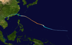
On 2 January, stronger-than-normal low-level westerlies were observed east of New Guinea. As a result of these increased winds and an area of cloudiness, two areas of convection on different sides of the equator formed. The next day, these areas began consolidating. [4] As a result, on 4 January, the Japan Meteorological Agency (JMA) noted that the northern area of convection had developed into a tropical depression. [5] Several hours later, the Joint Typhoon Warning Center (JTWC) issued a Tropical Cyclone Formation Alert (TCFA) on the depression, issuing their first warning on Tropical Depression 01W later that day. [4] Early on 6 January, both the JTWC and JMA had noted that the tropical depression had intensified into a tropical storm, [5] [4] causing the former agency to name it Axel. [4]

As a result of favorable upper-level divergence, Axel was able to significantly intensify, [4] with the JMA noting that the cyclone had developed into a severe tropical storm the next day. [5] Despite the JMA stating that Axel did not develop further until 9 January, [5] later that day, the JTWC noted that Axel had intensified into a typhoon. [4] Soon after, they noted that Axel had peaked with 1-minute sustained winds of 65 mph (100 km/h) [4] while the JMA stated that Axel had peaked with 10-minute sustained winds of 80 mph (130 km/h). [5] However, on 10 January, Axel tracked into an environment with high wind shear, causing it to weaken. [4] As a result, three days later, both the JMA and JTWC noted that Axel had weakened into a tropical depression. [4] [5] Two days later, Axel had transitioned into a weak extratropical low, causing both agencies to stop tracking it. [4] [5]

The worst typhoon to affect the Marshall Islands in over 70 years, waves produced by Axel flooded homes and cars while gusts amounting to 100 mph (160 km/h) destroyed scores of houses, submerging houses and cars in knee-deep water and leaving hundreds homeless. [6] After passing Majuro, Axel passed across Jaluit Atoll, causing over four feet of water to cover most of the main islands. As a result of Axel's winds, a majority of the outhouses were destroyed, resulting in serious health concerns for the islanders. In the eastern Caroline Islands, Kosrae experienced gusts of 75–90 mph (120–150 km/h) resulting in severe crop losses, damaged fauna, and several structures being destroyed.As Axel passed just north of Pohnpei, the island’s electrical power was knocked out for several hours and many buildings in low-lying areas flooded. In those islands, a storm surge of fifteen feet was recorded, with a daily total of 9.73 in (247 mm) of rain seen. [4]

Severe Tropical Storm Ekeka

Severe tropical storm (JMA)
Tropical storm (SSHWS)
Ekeka Feb 3 1992 1448Z.png   Ekeka 1992 track.png
Duration3 February – 8 February
Peak intensity95 km/h (60 mph) (10-min);
985  hPa  (mbar)

On 3 February, a weakening Tropical Storm Ekeka tracked west of the International Date Line, entering the West Pacific basin and being monitored by the JMA. [5] Early the next day, the JTWC began issuing bulletins on Ekeka, which was in an environment with high wind shear. [7] Later that same day, Ekeka weakened into a tropical depression. [5] [7] Several days later, on 8 February, the JMA stopped tracking the depression. [5] The JTWC kept tracking Ekeka for a few hours until it passed over Chuuk. [7] Early on February 9, Ekeka finally dissipated about 800 miles (1,300 km) east-southeast of Palau, or about 310 miles (500 km) off the north coast of Papua New Guinea. [8]

Typhoon Bobbie (Asiang)

Very strong typhoon (JMA)
Category 4 typhoon (SSHWS)
Bobbie Jun 26 1992 2325Z.png   Bobbie 1992 track.png
Duration21 June – 31 June
Peak intensity165 km/h (105 mph) (10-min);
940  hPa  (mbar)

On 20 June, a poorly organized area of convection south of Guam near the central Caroline Islands began developing. Embedded in the monsoon trough, the disturbance's circulation began consolidating, prompting the JTWC to issue a TCFA on the disturbance. [9] As a result, on 23 June, the JMA noted that the disturbance had developed into a tropical depression. [5] [9] Around that time, the JTWC also upgraded the disturbance into a depression, issuing their first warning on Tropical Depression 02W later that day. [9] Intensifying, early on 24 June, both the JTWC and JMA noted Bobbie intensified into a tropical storm, causing the latter agency to name it Bobbie. [9] [5] Just a few hours later, Bobbie began undergoing a binary interaction with nearby Tropical Storm Chuck, which at the time, just formed off the Philippines. [9] As Bobbie was intensifying, it crossed into the Philippine Area of Responsibility (PAR), prompting the Philippine Atmospheric, Geophysical, and Astronomical Services Administration (PAGSA) to name it Asiang. [10]

Early the next day, Bobbie intensified into a severe tropical storm. [9] At that time, the JTWC claimed that Bobbie had intensified into a typhoon, [9] while the JMA noted that Bobbie had actually became a typhoon several hours later. [5] On 18:00 UTC on 26 June, Bobbie peaked with 1-minute sustained winds of 140 mph (220 km/h) as it tracked the western extent of the mid-level subtropical ridge. [9] Several hours later, Bobbie peaked with 10-minute sustained winds of 105 mph (165 km/h). [5] As Bobbie began recurving east of Taiwan at 12:00 UTC that day, increasing southwesterly winds caused Bobbie to steadily weaken. Passing over Miyako Jima on 28 June and then just southeast of Okinawa on 29 June, Bobbie began undergoing an extratropical transition on at that time. [9] At that time, Bobbie weakened into a severe tropical storm as it left the PAR, causing PAGASA to stop issuing advisories on the storm. [9] As Bobbie transitioned into an extratropical storm, the JTWC issued their final warning on the system the next day, prior to it brushing the southern tip of Honshu. [9] The JMA noted that Bobbie became extratropical early the next day, prior to it dissipating on 3 July. [5]

Bobbie would primarily bring beneficial rainfall to Luzon, as mostly light showers had persevered over the region. [11] However, combined with the effects of nearby Chuck, heavy rainfall would produce mudflows pouring down the Bucao, Balinquero and Maraunot rivers, causing them to rise up 6 ft (1.8 m). [12] In Manila, 23 homes were destroyed while 2 people went missing. [13] In Japan, Bobbie primarily brought severe rainfall, causing the prefectures of Okinawa, Miyazaki, Kagoshima, Tokyo, Gifu, and Fukui to receive heavy rainfall. Yakushima received 178 mm (7.0 in) in a day. [14]

Typhoon Chuck

Typhoon (JMA)
Category 1 typhoon (SSHWS)
Chuck Jun 28 1992 0045Z.png   Chuck 1992 track.png
Duration24 June – 2 July
Peak intensity130 km/h (80 mph) (10-min);
965  hPa  (mbar)

On 19:00 UTC on 21 June, a tropical disturbance began developing over the central Philippines. [15] Initially weakening as it traversed the Philippines, once it crossed into the South China Sea two days later, the convection of the disturbance began organizing. [16] [15] As a result, on 24 June, the JMA noted that the disturbance had developed into a tropical depression. [5] As it kept consolidating, the JTWC issued a TCFA on the disturbance later that day, issuing their first warning on it the next day as Tropical Depression 03W. [15] Several hours later, the JMA noted that Chuck had intensified into a tropical storm, [5] causing the JTWC to name it Chuck around 12 hours later. [15]

Steadily intensifying, on 27 June, both the JTWC and JMA noted that Chuck had became a typhoon. [5] [15] As a result, the JMA stated that Chuck peaked with 10-minute sustained winds of 80 mph (130 km/h) around that time. [15] Just a few hours later, early on 28 June, the JTWC stated that Chuck peaked with 1-minute sustained winds of 90 mph (150 km/h). [15] Later that day, Chuck made landfall along the southern tip of Hainan island as a minimal typhoon. [15] Weakening into a tropical storm as it crossed into the Gulf of Tonkin, [15] [5] Chuck made its second landfall around 100 mi (160 km) east-southeast of Hanoi early on 29 June. [16] [15] As a result of this, Chuck rapidly weakened, causing the JTWC to stop tracking it on 1 July. [15] The JMA kept tracking Chuck until it dissipated two days later. [5]

In Vietnam, at least 21 people died and while 80 were reported missing. [15] Intense winds uprooted over 500 trees, downed electrical cables and damaged about 140 houses in Hanoi. As a result of the storm, in the capital alone, three people were killed while another three were injured. Massive waves engulfed several coastal fishing villages in Cát Hải district, with seven people being missing there. [17] Elsewhere, in Hainan, one person died. [16] In the Philippines, combined with the effects of nearby Bobbie, heavy rainfall would produce mudflows in the Philippines. These poured down the Bucao, Balinquero and Maraunot rivers, causing them to rise up 6 ft (1.8 m). [12]

Tropical Storm Deanna (Biring)

Tropical storm (SSHWS)
Deanna Jul 2 1992 2257Z.png   Deanna 1992 track.png
Duration26 June – 3 July
Peak intensity75 km/h (45 mph) (1-min);
994  hPa  (mbar)

On 25 June, the Joint Typhoon Warning Center (JTWC) began tracking a tropical disturbance over the open Pacific. On 6:00 UTC the next day, they issued a TCFA on the consolidating system, later issuing their first advisory on it just a few hours later as Tropical Depression 04W. [18] Initially, the depression was slow to consolidate due to wind shear produced by a nearby Typhoon Bobby alongside a tropical upper tropospheric trough (TUTT). This hindered much development of the depression's convection, causing it to not intensify into a tropical storm until 1 July. As a result of it becoming a tropical storm, the JTWC named it Deanna. Slowly developing, the next day, Deanna peaked with 1-minute sustained winds of 45 mph (75 km/h). [18] Accelerating towards the northeast, Deanna weakened into a depression around 700 km (380 NM) east-northeast of Okinawa. [19] As Deanna tracked northwards, it dissipated on 3 July. [18] Despite that, the remnants of Dianna tracked towards Japan, prior to becoming extratropical the next day. [19]

In the Philippines, Deanna, known there as Biring, would prompt PAGASA to issue PSWS #1 for Batanes and Cagayan. [20] Additionally, the remnants of Deanna produced moderate to heavy rainfall in the Ryukyu Islands and Southern Japan. [21]

Typhoon Eli (Konsing)

Typhoon (JMA)
Category 1 typhoon (SSHWS)
Eli Jul 10 1992 2329Z.png   Eli 1992 track.png
DurationJuly 8 – July 14
Peak intensity130 km/h (80 mph) (10-min);
965  hPa  (mbar)

One person was killed and eight others were reported missing when the storm moved through the Philippines. Extensive damage took place in China with losses amounting to $235 million.

Tropical Storm Faye

Tropical storm (JMA)
Tropical storm (SSHWS)
Faye Jul 18 1992 0019Z.png   Faye 1992 track.png
DurationJuly 15 – July 18
Peak intensity65 km/h (40 mph) (10-min);
1000  hPa  (mbar)

Two people were killed in Hong Kong.

Severe Tropical Storm Gary (Ditang)

Severe tropical storm (JMA)
Category 1 typhoon (SSHWS)
Gary Jul 22 1992 0659Z.png   Gary 1992 track.png
DurationJuly 17 – July 24
Peak intensity100 km/h (65 mph) (10-min);
980  hPa  (mbar)

At least 48 people were killed by Gary. Extensive damage took place in China with losses reaching $940 million.

Tropical Storm Helen

Tropical storm (JMA)
Tropical storm (SSHWS)
Helen Jul 26 1992 0430Z.png   Helen 1992 track.png
DurationJuly 26 – July 28
Peak intensity75 km/h (45 mph) (10-min);
996  hPa  (mbar)

Helen moved north away from land.

Severe Tropical Storm Irving (Edeng)

Severe tropical storm (JMA)
Category 1 typhoon (SSHWS)
Irving Aug 3 1992 2313Z.png   Irving 1992 track.png
DurationJuly 31 – August 5
Peak intensity100 km/h (65 mph) (10-min);
980  hPa  (mbar)

Typhoon Irving caused over $4 million in damages and 3 fatalities. The storm formed south of Japan and moved north. Then, it recurved west and moved towards South Korea and dissipated.

Typhoon Janis (Gloring)

Very strong typhoon (JMA)
Category 4 typhoon (SSHWS)
Janis Aug 6 1992 1200Z.png   Janis 1992 track.png
DurationAugust 3 – August 9
Peak intensity175 km/h (110 mph) (10-min);
935  hPa  (mbar)

In Japan, Typhoon Janis killed two people and injured 41 others. Total losses from the storm reached 5.8 billion yen ($45.6 million).

Typhoon Kent

Very strong typhoon (JMA)
Category 4 super typhoon (SSHWS)
Kent Aug 11 1992 1711Z.png   Kent 1992 track.png
DurationAugust 6 – August 19
Peak intensity175 km/h (110 mph) (10-min);
930  hPa  (mbar)

Kent formed on August 5 in the Federated States of Micronesia. Then, it tracked northwest and was intensified into a tropical storm. Then, it was upgraded into a category 1 typhoon. A few days later, the JTWC upgraded Kent into a category 2 typhoon. Then, Kent intensified into a category 3 then to a category 4 typhoon. Kent reached its peak intensity as a super typhoon. Afterwards, Kent moved very slowly. Then, the JTWC downgraded Kent into a category 4 typhoon then to a category 3 typhoon. Kent still moved slowly. Afterwards, the JTWC downgraded Kent into a category 2 typhoon. However, it still moved slowly until it was downgraded into a category 1 typhoon. Afterwards, the JTWC downgraded Kent into a tropical storm. Kent moved northeastwards then affected Japan. After it affected Japan, it weakened into a tropical depression then dissipated on the Sea of Japan.

When Kent was traveling towards Japan, its large waves swept five people on the sea. Overall, Kent caused five deaths.

Tropical Storm Lois (Huaning)

Tropical storm (JMA)
Tropical storm (SSHWS)
Lois Aug 18 1992 0300Z.png   Lois 1992 track.png
DurationAugust 14 – August 21
Peak intensity65 km/h (40 mph) (10-min);
996  hPa  (mbar)

Lois moved northeast away from Japan.

Tropical Storm Mark

Tropical storm (JMA)
Tropical storm (SSHWS)
Mark Aug 17 1992 2319Z.png   Mark 1992 track.png
DurationAugust 15 – August 19
Peak intensity85 km/h (50 mph) (10-min);
990  hPa  (mbar)

One person was killed and another reported missing. Losses reached $10.4 million.

Tropical Storm Nina

Tropical storm (JMA)
Tropical storm (SSHWS)
Nina Aug 19 1992 2052Z.png   Nina 1992 track.png
DurationAugust 17 – August 21
Peak intensity65 km/h (40 mph) (10-min);
996  hPa  (mbar)

Nina curved away from land.

Typhoon Omar (Lusing)

Very strong typhoon (JMA)
Category 4 super typhoon (SSHWS)
Omar 1992-08-29 0000Z.png   Omar 1992 track.png
DurationAugust 24 – September 9
Peak intensity185 km/h (115 mph) (10-min);
920  hPa  (mbar)

Typhoon Omar originated into a tropical disturbance on August 20. On those days, the basin saw the dissipation of 2 tropical cyclones and another two more cyclones that begin their extratropical transition. The system intensified, prompting JMA and JTWC to name the Tropical depression 15W. 15W tracked westward, and it intensified to a tropical storm then was named Omar by the JMA. Omar begin to track westward, causing the outflow of Tropical Storm Polly to shear the system and slowing intensification. Then JTWC noticed that the wind shear can weaken Omar. The two storms furthered apart, allowing a ridge to develop between them. This caused Omar to drift slowly on the north, and because of the decreasing wind shear, Omar resumed strengthening. The storm later resumed its west-northwest track. On August 27, JTWC designed the storm as a typhoon, developing an eye. On August 28, Omar rapidly intensified and it made landfall on Guam with maximum sustained winds with 195 km/h (121 mph). On August 29, the storm reached its peak intensity with 10 min. sustained winds of 185 km/h (115 mph) and the lowest pressure of 920 mbar. This intensity remained for 24 hours before it weakened. However, JTWC estimated 1 min. winds at 240 km/h (150 mph). Two days later, Omar entered the PAR and PAGASA assigned the local name Lusing. On September 3, Omar weakened into a tropical storm by JMA, but JTWC maintained the storm at the typhoon strength. The storm still tracked westward, then made landfall on east coast of Taiwan. Then it made its final landfall near Fujian in Eastern China on September 5. Then it degenerated to a tropical depression before turning west-southwest. Then it moved on southern China as a weak system, dissipating on September 9 on northern Vietnam.

Typhoon Omar was a destructive storm to Guam, causing over a foot of rain there, amounting to $702 million in damage (2008 USD) and a death. In Taiwan, the storm caused 2 deaths and heavy rainfall, which warranted the name's retirement. The name Omar was replaced with Oscar which was first used in the 1995 season.

Severe Tropical Storm Polly (Isang)

Severe tropical storm (JMA)
Tropical storm (SSHWS)
Polly Aug 29 1992 0900Z.png   Polly 1992 track.png
DurationAugust 27 – September 1
Peak intensity100 km/h (65 mph) (10-min);
975  hPa  (mbar)

Developing to Omar's west, Polly began its life on August 23 and reached tropical storm strength on the 26th. As a developing monsoon depression, it had a large outflow. Polly retained that throughout its lifetime, inhibiting intensification past 60 mph (97 km/h) winds. On the 30th, the storm hit southeastern Taiwan, and on the 31st it hit China.

Torrential rains produced by Tropical Storm Polly triggered devastating floods that killed 202 people and injured hundreds more. More than 5 million people were left homeless across Fujian and Zhejiang Provinces in China. Total losses from the storm were roughly $450 million.

Typhoon Ryan

Very strong typhoon (JMA)
Category 4 typhoon (SSHWS)
Typhoon Ryan Sept 7 1992 0300Z.png   Ryan 1992 track.png
DurationSeptember 1 – September 11
Peak intensity155 km/h (100 mph) (10-min);
945  hPa  (mbar)

Ryan was a potent typhoon that passed east of Japan.

Typhoon Sibyl

Very strong typhoon (JMA)
Category 3 typhoon (SSHWS)
Sibyl 1992-09-11 2103Z.jpg   Sibyl 1992 track.png
DurationSeptember 4 – September 15
Peak intensity155 km/h (100 mph) (10-min);
940  hPa  (mbar)

Typhoon Sibyl took an unusual track east of Japan, first heading northward, then back south, and finally north again while strengthening. Then, it curved west and dissipated as it recurved eastward.

Severe Tropical Storm Ted (Maring)

Severe tropical storm (JMA)
Category 1 typhoon (SSHWS)
Ted Sep 22 1992 0014Z.png   Ted 1992 track.png
DurationSeptember 18 – September 24
Peak intensity95 km/h (60 mph) (10-min);
985  hPa  (mbar)

Tropical Storm Ted, having developed on September 14, stalled off northern Luzon on the 20th. It turned northward, and hit southern Taiwan on the 22nd as a minimal typhoon. Ted weakened to a tropical storm over the island, and hit eastern China on the 23rd. It turned to the northeast, hit South Korea, and became extratropical on the 24th.

At least 61 people were killed by Typhoon Ted and 51 others were reported missing. Losses from the storm reached $360 million in China.

Tropical Storm Val

Tropical storm (JMA)
Tropical storm (SSHWS)
Val Sep 26 1992 0530Z.png   Val 1992 track.png
DurationSeptember 24 – September 27
Peak intensity85 km/h (50 mph) (10-min);
990  hPa  (mbar)

Val stayed at sea.

Typhoon Ward

Very strong typhoon (JMA)
Category 2 typhoon (SSHWS)
Ward Oct 3 1992 0405Z.png   Ward 1992 track.png
DurationSeptember 27 (Entered basin) – October 6
Peak intensity155 km/h (100 mph) (10-min);
945  hPa  (mbar)

On September 23, a tropical depression developed just east of the International Dateline; however, it was warned upon by the Joint Typhoon Warning Center rather than the Central Pacific Hurricane Center as it was expected to become a significant tropical cyclone outside of the CPHC's area of responsibility. Just prior to crossing into the Western Pacific basin, it reached tropical storm intensity, at which time it was given the name Ward from the list of Pacific typhoon names. Winds at this time were estimated at 40 mph (64 km/h); [22] the Japan Meteorological Agency reported the system to have also attained a pressure of 1,002 mbar (1,002 hPa; 29.6 inHg). [23] Over the following days, Ward gradually intensified, peaking as a Category 2 storm with winds of 110 mph (180 km/h). The storm eventually weakened as it moved through higher latitudes, becoming extratropical on October 7 over open waters. [22]

Typhoon Yvette (Ningning)

Very strong typhoon (JMA)
Category 5 super typhoon (SSHWS)
Yvette Oct 13 1992 2305Z.png   Yvette 1992 track.png
DurationOctober 7 – October 17
Peak intensity185 km/h (115 mph) (10-min);
915  hPa  (mbar)

A depression that formed near the Mariana Islands organized and was upgraded into a tropical storm on October 7, and was given the name Yvette. It rapidly intensified into a super typhoon which started to recurve out at sea, preventing major impacts at the Philippines. Yvette started to weaken as it headed towards colder waters and eventually dissipated on October 17.

Tropical Storm Zack

Tropical storm (JMA)
Tropical storm (SSHWS)
Zack Oct 13 1992 2122Z.png   Zack 1992 track.png
DurationOctober 8 – October 16
Peak intensity75 km/h (45 mph) (10-min);
992  hPa  (mbar)

Zack stayed away from land.

Typhoon Angela (Osang)

Typhoon (JMA)
Category 2 typhoon (SSHWS)
Angela Oct 19 1992 0734Z.png   Angela 1992 track.png
DurationOctober 15 – October 30
Peak intensity120 km/h (75 mph) (10-min);
970  hPa  (mbar)

At least 49 people were killed by Typhoon Angela, mostly in Vietnam, while 14 others were reported missing.

Typhoon Brian

Typhoon (JMA)
Category 2 typhoon (SSHWS)
Brian Oct 22 1992 1800Z.png   Brian 1992 track.png
DurationOctober 17 – October 25
Peak intensity150 km/h (90 mph) (10-min);
950  hPa  (mbar)

Brian caused small damage in Guam, but no deaths were reported.

Severe Tropical Storm Colleen (Paring)

Severe tropical storm (JMA)
Category 1 typhoon (SSHWS)
Colleen Oct 20 1992 1200Z.png   Colleen 1992 track.png
DurationOctober 17 – October 29
Peak intensity100 km/h (65 mph) (10-min);
980  hPa  (mbar)

Colleen intensified over the South China Sea before making landfall in Vietnam.

Typhoon Dan

Very strong typhoon (JMA)
Category 3 typhoon (SSHWS)
Dan Nov 1 1992 0850Z.png   Dan 1992 track.png
DurationOctober 25 (Entered basin) – November 3
Peak intensity165 km/h (105 mph) (10-min);
935  hPa  (mbar)

Dan came nowhere near land.

Typhoon Elsie (Reming)

Very strong typhoon (JMA)
Category 5 super typhoon (SSHWS)
Elsie Nov 5 1992 0550Z.png   Elsie 1992 track.png
DurationOctober 29 – November 7
Peak intensity185 km/h (115 mph) (10-min);
915  hPa  (mbar)

Elsie recurved away from land.

Tropical Depression 29W

Tropical depression (JMA)
Tropical depression (SSHWS)
29W Oct 31 1992 1601Z.png   29-W 1992 track.png
DurationOctober 31 – November 3
Peak intensity45 km/h (30 mph) (1-min);
1004  hPa  (mbar)

On October 30, a tropical disturbance began to form west of the International Date Line. The JTWC then issued a Tropical Cyclone Formation Alert late the next day as the system moved westward and started warnings on Tropical Depression 29W on November 1. However, intensification was severely inhibited by outflow from nearby Typhoon Dan, and the depression failed to develop. It passed within 30 nautical miles (56 kilometres) of Wake Island, causing a minor pressure dip and gusts to 32 kn (60 km/h). No damage was reported, due to the relative weakness of 29W as compared to Dan, which ravaged the island 3 days earlier. The depression dissipated on November 2 over open ocean. [24]

Tropical Storm Forrest

Tropical storm (JMA)
Tropical storm (SSHWS)
Forrest Nov 15 1992 0850Z.png   Forrest 1992 track.png
DurationNovember 13 – November 15 (Exited basin)
Peak intensity85 km/h (50 mph) (10-min);
996  hPa  (mbar)

On November 8 a tropical depression formed from the monsoon trough east of the Philippines. It crossed the islands, and strengthened to a tropical storm in the South China Sea on the 12th. Forrest continued westward until hitting and crossing the Malay Peninsula on the 15th. It reached a peak of 145 mph (233 km/h) winds in the Bay of Bengal before hitting Myanmar on the 21st.

At least two people were killed by Tropical Storm Forrest and 31 others were reported missing after a ship capsized.

Typhoon Gay (Seniang)

Violent typhoon (JMA)
Category 5 super typhoon (SSHWS)
Gay nov 20 1992 2115Z.jpg   Gay 1992 path.png
DurationNovember 14 – November 29
Peak intensity205 km/h (125 mph) (10-min);
900  hPa  (mbar)

Typhoon Gay was the strongest and longest-lasting storm of the season, forming on November 13 near the International Date Line. As it moved to the west, Gay steadily intensified and moved through the Marshall Islands as an intensifying typhoon. After passing through the country, it intensified its peak intensity over open waters. The JTWC estimated peak winds of 295 km/h (183 mph) and a minimum barometric pressure of 872 mb (25.8 inHg). However, the Japan Meteorological Agency (JMA), which is the official warning center in the western Pacific, estimated winds of 205 km/h (127 mph), with a pressure of 900 mbar (27 inHg). Typhoon Gay weakened rapidly after peaking due to interaction with another typhoon, and it struck Guam with winds of 160 km/h (99 mph) on November 23. The typhoon briefly re-intensified, although it weakened as it turned toward Japan and became extratropical on November 29. [25] [26]

The typhoon first affected the Marshall Islands, where 5,000 people were left homeless and heavy crop damage was reported. The nation's capital of Majuro lost power during the storm and experienced power and water outages. No Marshall Islands citizens were killed, [25] although the typhoon killed a sailor who was traveling around the world. [27] When Gay struck Guam, it became the sixth typhoon of the year to affect the island. Most of the weaker structures were destroyed during Typhoon Omar earlier in the year. Due to its substantial weakening, Gay had a disrupted inner-core that dropped minimal rainfall, which caused extensive defoliation of plants due to salt water scorching. Further north, the typhoon destroyed a house on Saipan from high waves. [25]

Typhoon Hunt

Very strong typhoon (JMA)
Category 4 super typhoon (SSHWS)
Hunt nov 20 1992 0611Z.jpg   Hunt 1992 track.png
DurationNovember 15 – November 22
Peak intensity165 km/h (105 mph) (10-min);
940  hPa  (mbar)

The last storm of the year formed on November 13 and became extratropical on November 22.

Storm names

During the season 31 named tropical cyclones developed in the Western Pacific and were named by the Joint Typhoon Warning Center, when it was determined that they had become tropical storms. These names were contributed to a revised list which started on mid-1989.

AxelBobbieChuckDeannaEliFayeGaryHelenIrvingJanisKentLoisMarkNinaOmarPolly
RyanSibylTedValWardYvetteZackAngelaBrianColleenDanElsieForrestGayHunt

Philippines

AsiangBiringKonsingDitangEdeng
GloringHuaningIsangLusingMaring
NingningOsangParingRemingSeniang
Toyang (unused)Ulpiang (unused)Welpring (unused)Yerling (unused)
Auxiliary list
Apiang (unused)
Basiang (unused)Kayang (unused)Dorang (unused)Enang (unused)Grasing (unused)

The Philippine Atmospheric, Geophysical and Astronomical Services Administration uses its own naming scheme for tropical cyclones in their area of responsibility. PAGASA assigns names to tropical depressions that form within their area of responsibility and any tropical cyclone that might move into their area of responsibility. Should the list of names for a given year prove to be insufficient, names are taken from an auxiliary list, the first 6 of which are published each year before the season starts. Names not retired from this list will be used again in the 1996 season. This is the same list used for the 1988 season, except for Ulpiang and Yerling, which replaced Unsang and Yoning . PAGASA uses its own naming scheme that starts in the Filipino alphabet, with names of Filipino female names ending with "ng" (A, B, K, D, etc.). Names that were not assigned/going to use are marked in gray.

Retirement

Due to extensive damage caused by Omar in Guam, the name was later retired and was replaced by Oscar and was first used in the 1995 season.

Season effects

This table summarizes all the systems that developed within or moved into the North Pacific Ocean, to the west of the International Date Line during 1992. The tables also provide an overview of a systems intensity, duration, land areas affected and any deaths or damages associated with the system.

NameDatesPeak intensityAreas affectedDamage
(USD)
DeathsRefs
Category Wind speedPressure
AxelJanuary 4 – 15Severe tropical storm100 km/h (62 mph)980 hPa (28.94 inHg)Marshall Islands, Caroline Islands, Mariana IslandsNoneNone
EkekaFebruary 3 – 8Tropical storm85 km/h (53 mph)990 hPa (29.23 inHg)Marshall Islands NoneNone
Bobbie (Asiang)June 23 – 30Typhoon165 km/h (103 mph)940 hPa (27.76 inHg)Philippines, Japan$2.9 millionUnknown
Chuck (Biring)June 24 – July 1Typhoon130 km/h (81 mph)965 hPa (28.50 inHg)Philippines, South China, Vietnam$36.4 million7
DeannaJune 28 – July 3Tropical depression75 km/h (47 mph)1002 hPa (29.59 inHg)Caroline IslandsNoneNone
Eli (Konsing) July 8 – 14Typhoon130 km/h (81 mph)965 hPa (28.50 inHg)Caroline Islands, Philippines, South China, Vietnam$235 million1
FayeJuly 15 – 18Tropical storm65 km/h (40 mph)1000 hPa (29.53 inHg)Philippines, South China None2
Gary (Ditang)July 17 – 24Severe tropical storm100 km/h (62 mph)980 hPa (28.94 inHg)Marshall Islands, Caroline Islands, Mariana Islands$940 million48
HelenJuly 26 – 28Tropical storm75 km/h (47 mph)996 hPa (29.41 inHg)None NoneNone
TDJuly 29Tropical depressionNot specified1010 hPa (29.83 inHg)None NoneNone
TDJuly 30 – 31Tropical depressionNot specified1012 hPa (29.89 inHg)None NoneNone
Irving (Edeng)July 31 – August 5Severe tropical storm100 km/h (62 mph)980 hPa (28.94 inHg)Japan, South Korea$835,0003
Janis (Gloring) August 3 – 9Typhoon175 km/h (109 mph)935 hPa (27.61 inHg)Caroline Islands, Mariana Islands, Japan$45.6 million2
Kent August 6 – 19Typhoon175 km/h (109 mph)930 hPa (27.46 inHg)Marshall Islands, JapanUnknown5
Lois (Huaning)August 14 – 21Tropical storm65 km/h (40 mph)996 hPa (29.41 inHg)None NoneNone
MarkAugust 15 – 19Tropical storm85 km/h (53 mph)990 hPa (29.23 inHg)China, Taiwan$10.4 million1
NinaAugust 17 – 21Tropical storm65 km/h (40 mph)996 hPa (29.41 inHg)None NoneNone
TDAugust 23 – 24Tropical depressionNot specified1008 hPa (29.77 inHg)Japan NoneNone
Omar (Lusing) August 24 – September 9Typhoon185 km/h (115 mph)920 hPa (27.17 inHg)Marshall Islands, Caroline Islands, Mariana Islands, Philippines, Taiwan, China, Ryukyu Islands$561 million15
TDAugust 25 – 26Tropical depressionNot specified1000 hPa (29.53 inHg)None NoneNone
Polly (Isang)August 27 – September 1Severe tropical storm100 km/h (62 mph)975 hPa (28.79 inHg)Taiwan, Ryukyu Islands, China$450 million202
RyanSeptember 1 – 11Typhoon155 km/h (96 mph)945 hPa (27.91 inHg)Mariana IslandsNoneNone
SibylSeptember 4 – 15Typhoon155 km/h (96 mph)940 hPa (27.76 inHg)NoneNoneNone
Ted (Maring)September 18 – 24Severe tropical storm95 km/h (59 mph)985 hPa (29.09 inHg)Philippines, Taiwan, East China, Korean Peninsula$360 million61
TDSeptember 19 – 20Tropical depressionNot specified1004 hPa (29.65 inHg)South China, VietnamNoneNone
ValSeptember 24 – 27Tropical storm85 km/h (53 mph)990 hPa (29.23 inHg)None NoneNone
WardSeptember 27 – October 6Typhoon155 km/h (96 mph)945 hPa (27.91 inHg)NoneNoneNone
TDOctober 7Tropical depressionNot specified1008 hPa (29.77 inHg)VietnamNoneNone
Yvette (Ningning)October 7 – 17Typhoon185 km/h (115 mph)915 hPa (27.02 inHg)PhilippinesNoneNone
ZackOctober 8 – 16Tropical storm75 km/h (47 mph)992 hPa (29.29 inHg)Marshall Islands NoneNone
Angela (Osang)October 15 – 30Typhoon120 km/h (75 mph)970 hPa (28.94 inHg)Philippines, Vietnam, Cambodia, Thailand, MalaysiaUnknown49
BrianOctober 17 – 25Typhoon150 km/h (93 mph)950 hPa (28.05 inHg)Caroline Islands, Mariana IslandsNoneNone
Colleen (Paring)October 17 – 29Severe tropical storm100 km/h (62 mph)985 hPa (29.09 inHg)Philippines, Vietnam, Cambodia, Laos, Thailand, MyanmarUnknownUnknown
DanOctober 25 – November 3Typhoon165 km/h (103 mph)935 hPa (27.61 inHg)Marshall IslandsNoneNone
Elsie (Reming)October 29 – November 7Typhoon150 km/h (93 mph)950 hPa (28.05 inHg)Caroline Islands, Mariana IslandsNoneNone
29WOctober 31 – November 2Tropical depression45 km/h (28 mph)1004 hPa (29.65 inHg)NoneNoneNone
TDNovember 10 – 11Tropical depressionNot specified1008 hPa (29.77 inHg)PhilippinesNoneNone
Forrest November 13 – 15Tropical storm75 km/h (47 mph)992 hPa (29.29 inHg)Vietnam, Thailand, Myanmar None2
Gay (Seniang) November 14 – 29Typhoon205 km/h (127 mph)900 hPa (26.58 inHg)Marshall Islands, Caroline Islands, Mariana Islands, Guam, Japan, Aleutian Islands None1
HuntNovember 15 – 21Typhoon165 km/h (103 mph)940 hPa (27.76 inHg)Mariana IslandsNoneNone
Season aggregates
40 systemsJanuary 4 – November 29, 1992205 km/h (127 mph)900 hPa (26.58 inHg)>$2.64 billion399

See also

Related Research Articles

<span class="mw-page-title-main">2007 Pacific typhoon season</span>

The 2007 Pacific typhoon season was a near average season which featured 24 named storms, fourteen typhoons, and five super typhoons. It was an event in the annual cycle of tropical cyclone formation, in which tropical cyclones form in the western Pacific Ocean. The season ran throughout 2007, though most tropical cyclones typically develop between May and November. The season's first named storm, Kong-rey, developed on March 30, while the season's last named storm, Mitag, dissipated on November 27. The season's first typhoon, Yutu, reached typhoon status on May 18, and became the first super typhoon of the year on the next day.

<span class="mw-page-title-main">2004 Pacific typhoon season</span>

The 2004 Pacific typhoon season was an extremely active season that featured the second-highest ACE ever recorded in a single season, second only to 1997, which featured 29 named storms, nineteen typhoons, and six super typhoons. It was an event in the annual cycle of tropical cyclone formation, in which tropical cyclones form in the western Pacific Ocean. The season ran throughout 2004, though most tropical cyclones typically develop between May and October. The season's first named storm and also the first typhoon, Sudal, developed on April 4, later was reached typhoon status two days later, and became the first super typhoon of the year three days later. The season's last named storm, Noru, dissipated on December 21.

<span class="mw-page-title-main">2002 Pacific typhoon season</span>

The 2002 Pacific typhoon season was a slightly above average Pacific typhoon season, producing twenty-six named storms, fifteen becoming typhoons, and eight super typhoons. It had an ACE over 400 units, making it one of the most active seasons worldwide. It was an event in the annual cycle of tropical cyclone formation, in which tropical cyclones form in the western Pacific Ocean. The season ran throughout 2002, though most tropical cyclones typically develop between May and October. The season's first named storm, Tapah, developed on January 11, while the season's last named storm, Pongsona, dissipated on December 11. The season's first typhoon, Mitag, reached typhoon status on March 1, and became the first super typhoon of the year four days later.

<span class="mw-page-title-main">2001 Pacific typhoon season</span>

The 2001 Pacific typhoon season was an average season with twenty-six named storms, sixteen typhoons and three super typhoons, with a near normal Accumulated Cyclone Energy (ACE) of 307.3 units. It ran year-round in 2001, with most tropical cyclones in the northwestern Pacific Ocean tending between May and November.

<span class="mw-page-title-main">1997 Pacific typhoon season</span> Typhoon season in the Western Pacific Ocean

The 1997 Pacific typhoon season was a record-breaking season featuring 11 tropical cyclones reaching super typhoon intensity, tying the record with 1965 with the most violent tropical cyclones globally. It has no official bounds; it ran year-round in 1997, but most tropical cyclones tend to form in the northwestern Pacific Ocean between May and November. These dates conventionally delimit the period of each year when most tropical cyclones form in the northwestern Pacific Ocean.

<span class="mw-page-title-main">1988 Pacific typhoon season</span>

The 1988 Pacific typhoon season was a very active season in terms of named storms, though it only featured 11 typhoons and 1 super typhoon. It had no official bounds; it ran year-round in 1988, but most tropical cyclones formed between May and November. Tropical storms that formed in the entire west Pacific basin were assigned a name by the Joint Typhoon Warning Center. Tropical depressions that enter or form in the Philippine area of responsibility are assigned a name by the Philippine Atmospheric, Geophysical and Astronomical Services Administration or PAGASA. This can often result in the same storm having two names.

<span class="mw-page-title-main">1987 Pacific typhoon season</span>

The 1987 Pacific typhoon season was a below average season, though it featured a relatively high amount of typhoons. It had no official bounds; it ran year-round in 1987, but most tropical cyclones formed between May and November. Tropical storms that formed in the entire basin were assigned a name by the Joint Typhoon Warning Center. Tropical depressions that enter or form in the Philippine area of responsibility are assigned a name by the Philippine Atmospheric, Geophysical and Astronomical Services Administration or PAGASA. This can often result in the same storm having two names.

<span class="mw-page-title-main">2008 Pacific typhoon season</span>

The 2008 Pacific typhoon season was a below average season which featured 22 named storms, eleven typhoons, and two super typhoons. The season had no official bounds; it ran year-round in 2008, but most tropical cyclones tend to form in the northwestern Pacific Ocean between May and November. These dates conventionally delimit the period of each year when most tropical cyclones form in the northwestern Pacific Ocean.

<span class="mw-page-title-main">Typhoon Isa</span> Pacific typhoon in 1997

Typhoon Isa was the first of a record eleven super typhoons to occur during the 1997 Pacific typhoon season. The second tropical cyclone of the season, Isa developed from a disturbance in the monsoon trough near the Caroline Islands on April 12. It moved erratically at first, though after attaining tropical storm status it curved westward due to the subtropical ridge to its north. Isa very gradually intensified, and on April 20 the typhoon reached peak 1-min winds of 270 km/h (170 mph), as reported by the Joint Typhoon Warning Center; Japan Meteorological Agency reported maximum 10-min winds of 155 km/h (95 mph). After turning northward, it accelerated to the northeast, and merged with a larger extratropical cyclone on April 24.

<span class="mw-page-title-main">Timeline of the 2008 Pacific typhoon season</span>

This timeline documents all the storm formations, strengthening, weakening, landfalls, extratropical transitions, as well as dissipation during the 2008 Pacific typhoon season. The 2008 Pacific typhoon season officially started on January 1, 2008 and ended on January 1, 2009.

<span class="mw-page-title-main">Typhoon Dolphin (2008)</span> Pacific typhoon in 2008

Typhoon Dolphin, known in the Philippines as Typhoon Ulysses, was the final named storm and typhoon of the 2008 Pacific typhoon season. The only impact that was reported from Dolphin was to the M/Bca Mae Jan, which was a cargo passenger ship which sank on December 14, due to rough seas caused by Dolphin. There were 46 people reported dead while seven were reported as missing.

<span class="mw-page-title-main">Typhoon Yagi (2006)</span> Pacific typhoon in 2006

Typhoon Yagi was an intense typhoon, the strongest of the 2006 Pacific typhoon season, which reached the equivalence of Category 5 on the Saffir–Simpson scale. Forming out of a tropical depression on September 16, Yagi quickly strengthened as it executed a slow clockwise loop over the open waters of the western Pacific Ocean. On September 19, Yagi strengthened into a typhoon as a subtropical ridge steered the storm towards the west. Two days later, the storm reached its peak intensity with winds of 195 km/h (121 mph) 10-minute winds with a minimum pressure of 910 hPa (mbar). The typhoon gradually weakened as it recurved towards the northeast and was downgraded to a severe tropical storm on September 24 and became extratropical the next day. The storm was last noted near the Aleutian Islands on September 27. The typhoon caused severe damage on the island of Chichijima but no injuries were reported as a result of the storm.

<span class="mw-page-title-main">Typhoon Melor (2009)</span> Pacific typhoon in 2009

Typhoon Melor, known in the Philippines as Super Typhoon Quedan, was a powerful typhoon that hit Japan in early October 2009, causing significant damage. As part of the 2009 Pacific typhoon season, Melor formed as a tropical depression on September 29 and rapidly intensified into a Category 4-equivalent typhoon just three days later. Subsequently, on October 4, Melor became the second Category 5-equivalent super typhoon to form in the season. During the next days, the typhoon would interact with Typhoon Parma southeast of Taiwan, causing Parma to be almost stationary over northern Luzon and drop near-records of rainfall there. Afterwards, Melor gradually weakened in its approach to Japan, making landfall on October 7. As the storm exited Japan during the next day, it transitioned into an extratropical cyclone. The remnants of Melor were absorbed by a newly-formed extratropical cyclone near Alaska, which strengthened significantly and impacted the West Coast of the United States on October 13.

<span class="mw-page-title-main">2011 Pacific typhoon season</span>

The 2011 Pacific typhoon season was a below average season that produced a total of 21 named storms, 8 typhoons, and four super typhoons. This season was much more active than the previous season, although both seasons were below the Pacific typhoon average of 26. The season ran throughout 2011, though most tropical cyclone tend to develop between May and October. The season's first named storm, Aere, developed on May 7 while the season's last named storm, Washi dissipated on December 19.

<span class="mw-page-title-main">Typhoon Gay (1992)</span> Pacific typhoon in 1992

Typhoon Gay, known in the Philippines as Typhoon Seniang, was the strongest and longest-lasting storm of the 1992 Pacific typhoon season and most intense globally in 1992. It formed on November 14 near the International Date Line from a monsoon trough, which also spawned two other systems. Typhoon Gay later moved through the Marshall Islands as an intensifying typhoon, and after passing through the country it reached its peak intensity over open waters. The Joint Typhoon Warning Center (JTWC) estimated peak winds of 295 km/h (183 mph) and a minimum barometric pressure of 872 mb (25.8 inHg). However, the Japan Meteorological Agency (JMA), which is the official warning center in the western Pacific, estimated winds of 205 km/h (127 mph), with a pressure of 900 mbar (27 inHg). Gay weakened rapidly after peaking because of interaction with another typhoon, and it struck Guam with winds of 160 km/h (99 mph) on November 23. The typhoon briefly re-intensified before weakening and becoming extratropical south of Japan on November 30.

<span class="mw-page-title-main">Typhoon Yuri</span> Pacific typhoon in 1991

Typhoon Yuri was the most intense tropical cyclone in 1991 in terms of minimum central pressure. The nineteenth typhoon and final super typhoon of the 1991 Pacific typhoon season, Yuri was a tropical disturbance that strengthened into a tropical depression on November 22 in the Philippine Sea. Moving rather slowly at first, the system continued to intensify, and was given the name Yuri. It had become a severe tropical storm about 1,480 kilometers east of Truk Island and took on a west-northwestward track at 22 km/h. Typhoon intensity was attained that night when Yuri was 1,050 km. Yuri turned more to the west on 26 November and reached peak intensity the following morning packing winds of over 220 km/h near its centre. Moving northwestwards at 30 km/h, Yuri passed 140 km to the south-southwest of Guam on the evening of November 27. After recurving November 29, Yuri accelerated northeastwards on November 30 and weakened to a severe tropical storm that night. By the morning of December 1, it had degenerated into a tropical storm about a few hundred kilometers east-northeast of Iwo Jima. Extratropical transition was completed soon afterward, and the storm's remnants persisted until December 3.

<span class="mw-page-title-main">Timeline of the 2013 Pacific typhoon season</span>

Most of the tropical cyclones of the 2013 Pacific typhoon season formed between May and November of that year. The scope of this article is the Pacific Ocean north of the equator, between 100°E and the International Date Line. Tropical storms which form in the Western Pacific basin are assigned a name by the Japan Meteorological Agency (JMA). Tropical depressions forming in this basin are given a number with a "W" suffix by the United States' Joint Typhoon Warning Center (JTWC). The Philippine Atmospheric, Geophysical and Astronomical Services Administration (PAGASA) assigns names to tropical cyclones that enter or form in the Philippine area of responsibility, but these names are not in common use outside the Philippines.

<span class="mw-page-title-main">Timeline of the 2014 Pacific typhoon season</span>

This timeline documents all of the events of the 2014 Pacific typhoon season. Most of the tropical cyclones forming between May and November. The scope of this article is limited to the Pacific Ocean, north of the equator between 100°E and the International Date Line. Tropical storms that form in the entire Western Pacific basin are assigned a name by the Japan Meteorological Agency. Tropical depressions that form in this basin are given a number with a "W" suffix by the United States' Joint Typhoon Warning Center. In addition, the Philippine Atmospheric, Geophysical and Astronomical Services Administration (PAGASA) assigns names to tropical cyclones that enter or form in the Philippine area of responsibility. These names, however, are not in common use outside of the Philippines.

<span class="mw-page-title-main">Tropical Storm Axel (1992)</span> Pacific tropical storm in 1992

Severe Tropical Storm Axel was a moderate tropical storm which affected the Marshall, Caroline, and Mariana islands in January 1992. The first tropical depression and storm of the 1992 Pacific typhoon season, Axel developed from a significant equatorial westerly wind burst east of New Guinea, alongside two other cyclones, Betsy and Mark, in the Southern Hemisphere, intensifying at an abnormally low latitude. By January 9, Axel had peaked as a high-end tropical storm, passing near Kosrae and Pingelap in the eastern Caroline Islands. Soon after, Axel began steadily weakening due to increased wind shear. As a result, just prior of passing south of Guam, Axel weakened into a tropical depression. Recurving northwards soon after, on January 15, Axel transitioned into an extratropical low, dissipating just a few hours later.

<span class="mw-page-title-main">Typhoon Bobbie</span> Pacific typhoon in 1992

Typhoon Bobbie, known in the Philippines as Typhoon Asiang, was an intense typhoon which affected the Philippines and Japan during June 1992. The third tropical depression, storm, and first typhoon of the 1992 Pacific typhoon season, Bobbie developed from a weak area of convection in the monsoon trough. Intensifying as it underwent a binary interaction with nearby Chuck, on 25 June, Bobbie became a typhoon. Further developing as it tracked northwards, two days later, Bobbie peaked as a very strong typhoon. Soon after, Bobbie began weakening as it recurved northeastward, transitioning into an extratropical cyclone on 1 July. It was at this time when Bobbie made its closest approach to Japan, just southeast of Kyushu. The extratropical remnants of the former typhoon persevered until they dissipated on 3 July.

References

  1. Gary Padgett (2003-08-17). "May 2003 Global Tropical Cyclone Summary". Archived from the original on 25 September 2006. Retrieved 2006-08-26.
  2. http://tropical.atmos.colostate.edu/Realtime/index.php?arch&loc=northwestpacific
  3. "Basin Archives: Northwest Pacific Ocean Historical Tropical Cyclone Statistics". Fort Collins, Colorado: Colorado State University. Retrieved 21 June 2023.
  4. 1 2 3 4 5 6 7 8 9 10 11 1992 Annual Tropical Cyclone Report (PDF) (Report). Guam, Mariana Islands: Joint Typhoon Warning Center. 1993. p. 44-59. Retrieved August 24, 2024.
  5. 1 2 3 4 5 6 7 8 9 10 11 12 13 14 15 16 17 18 19 20 RSMC Best Track Data – 1990–1999 (Report). Tokyo, Japan: Japan Meteorological Agency. Archived from the original on 2011-07-23. Retrieved 2024-08-24.
  6. Archives, L. A. Times (1992-01-09). "Typhoon Batters Marshall Islands". Los Angeles Times. Retrieved 2024-08-24.
  7. 1 2 3 1992 Annual Tropical Cyclone Report (PDF) (Report). Guam, Mariana Islands: Joint Typhoon Warning Center. 1993. p. 50-51. Retrieved August 24, 2024.
  8. National Hurricane Center; Hurricane Research Division; Central Pacific Hurricane Center (April 26, 2024). "The Northeast and North Central Pacific hurricane database 1949–2023". United States National Oceanic and Atmospheric Administration's National Weather Service. Archived from the original on May 29, 2024. A guide on how to read the database is available here. PD-icon.svg This article incorporates text from this source, which is in the public domain.
  9. 1 2 3 4 5 6 7 8 9 10 11 1992 Annual Tropical Cyclone Report (PDF) (Report). Guam, Mariana Islands: Joint Typhoon Warning Center. 1993. p. 52-55. Retrieved August 24, 2024.
  10. Marshall, J. Lee; Nilo, Prisco D.; Servando, Nathaniel T.; Rouse, B.; Adug, E.A. (1995). Typhoon Monitoring and Trajectory Prediction in the Philippine Region using a PC-based NOAA Direct Readout System and an integrated Data Base (PDF). University of Wisconsin-Madison. p. 3.
  11. Weekly Weather and Crop Bulletin. Vol. 79. The Bureau. 1992. Retrieved 25 August 2024.
  12. 1 2 "Officials Sunday advised residents of a town near the..." United Press International. 28 June 1992. Retrieved 25 August 2024.
  13. "In other International news". Dubuque, Iowa: The Telegraph-Herald. 1 July 1992. p. 12. Retrieved 27 August 2024.
  14. "Digital Typhoon: Typhoon 199203 (BOBBIE) - Disaster Information". Digital Typhoon. KITAMOTO Asanobu @ National Institute of Informatics. Retrieved 26 August 2024.
  15. 1 2 3 4 5 6 7 8 9 10 11 12 1992 Annual Tropical Cyclone Report (PDF) (Report). Guam, Mariana Islands: Joint Typhoon Warning Center. 1993. p. 57-58. Retrieved August 24, 2024.
  16. 1 2 3 Meteorological Results 1992 (PDF) (Report). Hong Kong: Hong Kong Observatory. 1993. p. 21-23. Archived from the original (PDF) on 2003-08-11. Retrieved July 15, 2024.
  17. "Typhoon lashes northern Vietnam - UPI Archives". United Press International. 1 July 1992. Retrieved 28 August 2024.
  18. 1 2 3 1992 Annual Tropical Cyclone Report (PDF) (Report). Guam, Mariana Islands: Joint Typhoon Warning Center. 1993. p. 59-60. Retrieved August 24, 2024.
  19. 1 2 "1992 Tropical Cyclone Summary for the Western North Pacific Ocean (west of 180 degrees)". BULLETIN (PDF) (3 ed.). Hong Kong Meteorological Society. 1993. p. 42. Retrieved 28 August 2024.
  20. "Biring loses strength". Manila Standard. 3 July 1992. Retrieved 28 August 2024.
  21. Weekly Climate Bulletin. Climate Analysis Center, NMC, National Weather Service, NOAA. 1993. p. 10.
  22. 1 2 Joint Typhoon Warning Center (1993). "Typhoon Ward (21W) Preliminary Report" (PDF). Naval Meteorology and Oceanography Command. Archived from the original (PDF) on June 8, 2011. Retrieved July 21, 2010.
  23. "Japan Meteorological Agency Best Tracks for 1991–1995". Japan Meteorological Agency. 1996. Archived from the original (TXT) on May 21, 2008. Retrieved July 21, 2010.
  24. Elizabeth B. Borelli (1993). "Tropical Depression 29W" (PDF). 1992 Annual Tropical Cyclone Report. Joint Typhoon Warning Center. Archived from the original (PDF) on 7 June 2011. Retrieved 1 January 2010.
  25. 1 2 3 "1992 Annual Tropical Cyclone Report" (PDF). Joint Typhoon Warning Center. Archived from the original (PDF) on 2012-09-15. Retrieved 2011-11-28.
  26. Japan Meteorological Agency (1992-12-25). "RSMC Best Track Data - 1990-1999". Archived from the original (TXT) on 2013-01-22. Retrieved 2011-11-28.
  27. Sherryl Connelly (1999-06-03). "A Lady In Distress ... And The Lover Who Threw Her Cautions To The Wind". New York Daily News. Archived from the original on July 22, 2012. Retrieved 2011-12-05.