The Llano Uplift is a geologically ancient, low geologic dome that is about 90 miles (140 km) in diameter and located mostly in Llano, Mason, San Saba, Gillespie, and Blanco counties, Texas. It consists of an island-like exposure of Precambrian igneous and metamorphic rocks surrounded by outcrops of Paleozoic and Cretaceous sedimentary strata. At their widest, the exposed Precambrian rocks extend about 65 miles (105 km) westward from the valley of the Colorado River and beneath a broad, gentle topographic basin drained by the Llano River. The subdued topographic basin is underlain by Precambrian rocks and bordered by a discontinuous rim of flat-topped hills. These hills are the dissected edge of the Edwards Plateau, which consist of overlying Cretaceous sedimentary strata. Within this basin and along its margin are down-faulted blocks and erosional remnants of Paleozoic strata which form prominent hills.

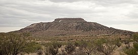
The Llano Estacado, sometimes translated into English as the Staked Plains, is a region in the Southwestern United States that encompasses parts of eastern New Mexico and northwestern Texas. One of the largest mesas or tablelands on the North American continent, the elevation rises from 3,000 feet (900 m) in the southeast to over 5,000 feet (1,500 m) in the northwest, sloping almost uniformly at about 10 feet per mile (2 m/km).

Black Mesa is a mesa located in an area covering parts of the U.S. states of Colorado, New Mexico, and Oklahoma. It extends from Mesa de Maya, Colorado southeasterly 28 miles (45 km) crossing into the northeast corner of New Mexico, and ending in the Oklahoma panhandle along the north bank of the Cimarron River at its confluence with the North Carrizo Creek near Kenton. Its highest elevation is 5,705 feet (1,739 m) in Colorado. The highest point of Black Mesa within New Mexico is 5,239 feet (1,597 m). In northwestern Cimarron County, Oklahoma, Black Mesa reaches 4,973 feet (1,516 m), the highest point in the state of Oklahoma. The plateau that formed at the top of the mesa has been known as a "geological wonder" of North America. There is abundant wildlife in this shortgrass prairie environment, including mountain lions, butterflies, and the Texas horned lizard.
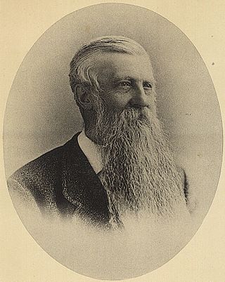
Jules Marcou was a French-Swiss-American geologist.

The Morrison Formation is a distinctive sequence of Upper Jurassic sedimentary rock found in the western United States which has been the most fertile source of dinosaur fossils in North America. It is composed of mudstone, sandstone, siltstone, and limestone and is light gray, greenish gray, or red. Most of the fossils occur in the green siltstone beds and lower sandstones, relics of the rivers and floodplains of the Jurassic period.

The Dallas–Fort Worth Metroplex sits above Cretaceous-age strata ranging from ≈145-66 Ma. These Cretaceous-aged sediments lie above the eroded Ouachita Mountains and the Fort Worth Basin, which was formed by the Ouachita Orogeny. Going from west to east in the DFW Metroplex and down towards the Gulf of Mexico, the strata get progressively younger. The Cretaceous sediments dip very gently to the east.

The Chinle Formation is an Upper Triassic continental geological formation of fluvial, lacustrine, and palustrine to eolian deposits spread across the U.S. states of Nevada, Utah, northern Arizona, western New Mexico, and western Colorado. In New Mexico, it is often raised to the status of a geological group, the Chinle Group. Some authors have controversially considered the Chinle to be synonymous to the Dockum Group of eastern Colorado and New Mexico, western Texas, the Oklahoma panhandle, and southwestern Kansas. The Chinle Formation is part of the Colorado Plateau, Basin and Range, and the southern section of the Interior Plains. A probable separate depositional basin within the Chinle is found in northwestern Colorado and northeastern Utah. The southern portion of the Chinle reaches a maximum thickness of a little over 520 meters (1,710 ft). Typically, the Chinle rests unconformably on the Moenkopi Formation.
Texas contains a wide variety of geologic settings. The state's stratigraphy has been largely influenced by marine transgressive-regressive cycles during the Phanerozoic, with a lesser but still significant contribution from late Cenozoic tectonic activity, as well as the remnants of a Paleozoic mountain range.

The Dakota is a sedimentary geologic unit name of formation and group rank in Midwestern North America. The Dakota units are generally composed of sandstones, mudstones, clays, and shales deposited in the Mid-Cretaceous opening of the Western Interior Seaway. The usage of the name Dakota for this particular Albian-Cenomanian strata is exceptionally widespread; from British Columbia and Alberta to Montana and Wisconsin to Colorado and Kansas to Utah and Arizona. It is famous for producing massive colorful rock formations in the Rocky Mountains and the Great Plains of the United States, and for preserving both dinosaur footprints and early deciduous tree leaves.
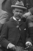
Robert Thomas Hill was a significant figure in the development of American geology during the late 19th and early 20th centuries. As a pioneer Texas geologist, Hill discovered and named the Comanche series of the Lower Cretaceous, and was a lifelong student of the structure and stratigraphy of the Cretaceous deposits of Central Texas and neighboring regions.
Prehistory of Colorado provides an overview of the activities that occurred prior to Colorado's recorded history. Colorado experienced cataclysmic geological events over billions of years, which shaped the land and resulted in diverse ecosystems. The ecosystems included several ice ages, tropical oceans, and a massive volcanic eruption. Then, ancient layers of earth rose to become the Rocky Mountains.

The Pajarito Formation is a geologic formation in eastern New Mexico and west Texas. It preserves fossils dating back to the Albian Age of the Cretaceous Period.
The Kiowa Formation or Kiowa Shale is a Cretaceous geologic formation in Kansas, diminishing to member status in Colorado and Oklahoma. In Colorado, the Kiowa Shale was classified as a member of the now abandoned Purgatoire Formation. In the vicinity of Longford, Kansas, the local Longford member comprises thinly bedded siltstone, clay, polished gravel, lignite, and sandstone suggests a river and estuary environment.

Paleontology in Oklahoma refers to paleontological research occurring within or conducted by people from the U.S. state of Oklahoma. Oklahoma has a rich fossil record spanning all three eras of the Phanerozoic Eon. Oklahoma is the best source of Pennsylvanian fossils in the United States due to having an exceptionally complete geologic record of the epoch. From the Cambrian to the Devonian, all of Oklahoma was covered by a sea that would come to be home to creatures like brachiopods, bryozoans, graptolites and trilobites. During the Carboniferous, an expanse of coastal deltaic swamps formed in areas of the state where early tetrapods would leave behind footprints that would later fossilize. The sea withdrew altogether during the Permian period. Oklahoma was home a variety of insects as well as early amphibians and reptiles. Oklahoma stayed dry for most of the Mesozoic. During the Late Triassic, carnivorous dinosaurs left behind footprints that would later fossilize. During the Cretaceous, however, the state was mostly covered by the Western Interior Seaway, which was home to huge ammonites and other marine invertebrates. During the Cenozoic, Oklahoma became home to creatures like bison, camels, creodonts, and horses. During the Ice Age, the state was home to mammoths and mastodons. Local Native Americans are known to have used fossils for medicinal purposes. The Jurassic dinosaur Saurophaganax maximus is the Oklahoma state fossil.
The Mesa Rica Sandstone is a geologic formation in Oklahoma and New Mexico. It preserves fossils dating back to the Cretaceous period.
The Tucumcari Formation is a geologic formation in New Mexico. It preserves fossils dating back to the Albian Age of the early Cretaceous period.

The Burro Canyon Formation is an Early Cretaceous Period sedimentary geologic formation, found in western Colorado, the Chama Basin and eastern San Juan Basin of northern New Mexico, and in eastern Utah, US.
ReBecca Hunt-Foster is an American paleontologist. She has worked with dinosaur remains from the Late Jurassic to Late Cretaceous of the Colorado Plateau, Rocky Mountains, Southcentral, and the Southwestern United States of America. She described the dinosaur Arkansaurus fridayi and identified the first juvenile Torosaurus occurrences from Big Bend National Park in North America in 2008.
The Glencairn Formation is a geologic formation found in Colorado and New Mexico. It preserves fossils characteristic of the Albian Age of the Cretaceous Period.

Texigryphaea is an extinct genus of oyster belonging to the order Ostreida and family Gryphaeidae. It dates to the Albian to Cenomanian Ages of the Cretaceous period and is primarily found in Texas and the southern Western Interior of North America. However, specimens have been identified from northern Spain.