 Severe Tropical Storm Nakri on November 8, 2019 | |
| Meteorological history | |
|---|---|
| Formed | November 4,2019 |
| Dissipated | November 11,2019 |
| Typhoon | |
| 10-minute sustained (JMA) | |
| Highest winds | 120 km/h (75 mph) |
| Lowest pressure | 975 hPa (mbar);28.79 inHg |
| Category 1-equivalent typhoon | |
| 1-minute sustained (SSHWS/JTWC) | |
| Highest winds | 120 km/h (75 mph) |
| Lowest pressure | 984 hPa (mbar);29.06 inHg |
| Overall effects | |
| Fatalities | 24 total |
| Missing | 13 |
| Damage | $49.4 million (2019 USD) |
| Areas affected | Vietnam,Philippines |
| IBTrACS | |
Part of the 2019 Pacific typhoon season | |
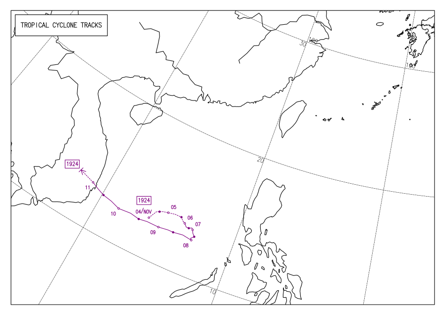
Typhoon Nakri,known in the Philippines as Typhoon Quiel,was a strong typhoon which made landfall in Vietnam causing 24 deaths,with 13 missing,and up to $49.4 million in damages.
Contents
The typhoon was initially spotted off the coast of the Philippines,developing into a tropical depression. Nakri later became a typhoon.
