Related Research Articles

The Marshall Islands, officially the Republic of the Marshall Islands, is an independent island country near the Equator in the Pacific Ocean, slightly west of the International Date Line. Geographically, the country is part of the larger island group of Micronesia. The country's population of 58,413 people is spread out over five islands and 29 coral atolls, comprising 1,156 individual islands and islets. The capital and largest city is Majuro. It has the largest portion of its territory composed of water of any sovereign state, at 97.87%.

Majuro is the capital and largest city of the Marshall Islands. It is also a large coral atoll of 64 islands in the Pacific Ocean. It forms a legislative district of the Ratak (Sunrise) Chain of the Marshall Islands. The atoll has a land area of 9.7 square kilometres (3.7 sq mi) and encloses a lagoon of 295 square kilometres (114 sq mi). As with other atolls in the Marshall Islands, Majuro consists of narrow land masses. It has a tropical trade wind climate, with an average temperature of 27 °C (81 °F).

The Ralik Chain is a chain of islands within the island nation of the Marshall Islands. Ralik means "sunset". It is west of the Ratak Chain. In 1999 the total population of the Ralik islands was 19,915. Christopher Loeak, who became President of the Marshall Islands in 2012, was formerly Minister for the Ralik Chain.

Mili Atoll is a coral atoll of 92 islands in the Pacific Ocean, and forms a legislative district of the Ratak Chain of the Marshall Islands. It is located approximately 78 kilometres (48 mi) southeast of Arno. Its total land area is 14.9 square kilometres (5.8 sq mi) making it the second largest of the Marshall Islands after Kwajalein. It encloses a much smaller lagoon than Kwajalein, with an area of 760 square kilometres (290 sq mi). The atoll is separated by a water channel called the Klee Passage from the Knox Atoll which is considerably smaller. The population of Mili Atoll was 738 as of 2011. The main village is also called Mili. Other villages include Nallu, Enejet, Lukonor, Tokewa, and Wau, Mili. Nallu, Enejet and Lukonwor are only accessible from Mili by land during lowtide. Only Mili, Mili and Enejet, Mili have runways for small aircraft. Mili Airport and Enejit Airport are served by Air Marshall Islands when its aircraft are operational.

Jaluit Atoll is a large coral atoll of 91 islands in the Pacific Ocean and forms a legislative district of the Ralik Chain of the Marshall Islands. Its total land area is 11.34 square kilometres (4.38 sq mi), and it encloses a lagoon with an area of 690 square kilometres (270 sq mi). Most of the land area is on the largest islet (motu) of Jaluit (10.4 km²). Jaluit is approximately 220 kilometres (140 mi) southwest of Majuro. Jaluit Atoll is a designated conservation area and Ramsar Wetland.
The Maloelap Atoll is a coral atoll of 71 islands in the Pacific Ocean, and forms a legislative district of the Ratak Chain of the Marshall Islands. Its land area is only 9.8 square kilometres (3.8 sq mi), but that encloses a lagoon of 972 square kilometres (375 sq mi). It is located 18 kilometres (11 mi) north of the atoll of Aur. In 2011 the population of the islands of the atoll was 682.
Ailinglaplap or Ailinglapalap is a coral atoll of 56 islands in the Pacific Ocean, and forms a legislative district of the Ralik Chain in the Marshall Islands. It is located 152 kilometres (94 mi) northwest of Jaluit Atoll. Its total land area is only 14.7 square kilometres (5.7 sq mi), but it encloses a lagoon of 750 square kilometres (290 sq mi). The economy of the atoll is dominated by coconut plantations. The population of the atoll was 1,729 in 2011. Jabat Island is located off the coast of Ailinglaplap Atoll. The former president of the Marshall Islands, Kessai Note, was born on Jeh Island, Ailinglaplap Atoll.

Wotho Atoll is a coral atoll of 13 islands in the Pacific Ocean, and forms a legislative district of the Ralik Chain of the Marshall Islands. Its total land area is only 4.33 square kilometres (1.67 sq mi), but it encloses a lagoon of 94.92 square kilometres (36.65 sq mi). The name "Wotho" means either "entrance through the reef", or "island far away" according to different sources.

USS Burns (DD-588), a Fletcher-class destroyer, was the second ship of the United States Navy to be named for Captain Hugh Otway Burns (1775–1850), a privateer in the War of 1812.

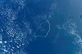
Ujae Atoll is a coral atoll of 15 islands in the Pacific Ocean, and forms a legislative district of the Ralik Chain of the Marshall Islands. Its total land area is only 1.86 square kilometres (0.72 sq mi), but it encloses a lagoon of 185.94 square kilometres (71.79 sq mi). It is located about 122 kilometres (76 mi) west of Kwajalein Atoll.

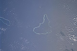
Utirik Atoll or Utrik Atoll is a coral atoll of 10 islands in the Pacific Ocean, and forms a legislative district of the Ratak Chain of the Marshall Islands. Its total land area is only 2.4 square kilometres (0.94 sq mi), but it encloses a lagoon with an area of 57.7 square kilometres (22.29 sq mi). It is located approximately 47 kilometres (29 mi) east of Ujae Atoll. The population of Utirik Atoll is 300-400 as of 2020. it is one of the northernmost Marshall Islands with permanent habitation.

Bucholz Army Airfield is a United States Army airfield located on Kwajalein Island, Kwajalein Atoll, Marshall Islands. Its position is ideal for refueling during trans-Pacific flights, and the airport is available to civilians through Air Marshall Islands and United Airlines.

Marshall Islands International Airport, also known as Amata Kabua International Airport, is located in the western part of Rairok on the south side of Majuro Atoll, the capital of the Republic of the Marshall Islands. The airport was built during World War II (1943) on Anenelibw and Lokojbar islets. It replaced Majuro Airfield, a coral-surfaced airstrip at Delap Island near the eastern end of Majuro Atoll that had been originally constructed by Japanese occupation forces in 1942.

Marine Torpedo Bombing Squadron 151 (VMTB-151) was a dive bombing squadron in the United States Marine Corps. The squadron fought in World War II but was quickly deactivated after the war on March 20, 1946.

The following is an alphabetical list of topics related to the Republic of the Marshall Islands.

A general election was held in the Marshall Islands on 21 November 2011. The general election is held every four years.

Tropical Storm Bavi, known in the Philippines as Tropical Storm Betty, influenced the trade winds over the Pacific Ocean and was partially responsible for one of the strongest trade wind reversals ever observed. The system was first noted as a tropical disturbance during March 8, 2015, while it was located to the southeast of Kwajalein Atoll in the Marshall Islands. Over the next couple of days the system moved north-westwards through the Marshall Islands, before it was classified as a tropical depression during March 10. The system subsequently moved north-westwards and continued to develop further, before it was classified as the third tropical storm of the 2015 Pacific typhoon season and named Bavi by the Japan Meteorological Agency (JMA) during March 11. After continuing its north-westwards movement, the system peaked as a tropical storm during March 14, before it started to weaken as it approached the Mariana Islands. The system subsequently passed over Guam during the next day, before continuing its west-northwestwards movement as it gradually weakened over the next few days. The system entered the Philippine area of responsibility, where it was named Betty by PAGASA during March 17 as the system weakened into a tropical depression. The system was subsequently last noted during March 21, as it dissipated over the Philippines.

Republic of Marshall Islands Public School System (PSS) is the public school system of the Marshall Islands, headquartered in Majuro. It was established in November 2013 by Public Law 2013-23.
Kwajalein Atoll High School is a secondary school in Kwajalein, Marshall Islands. It is a part of the Marshall Islands Public School System.

Marshallese cuisine comprises the fare, foods, beverages and foodways of the Marshall Islands, including its food-related customs and traditions. Common indigenous and traditional foods include breadfruit, coconut, bananas, papaya, seafood, pandanus and bwiro. Additional imported foods, such as rice and flour, are also a part of people's diets and contribute to the cuisine as well. The practice of food preservation is a part of the history of the islands, and continues to occur today.
References
- ↑ "UJE - Ujae Atoll, Marshall Islands - Ujae Airport". Great Circle Mapper. Retrieved 2009-11-16.
Marshall Islands articles | |||||||
|---|---|---|---|---|---|---|---|
| History | |||||||
| Geography |
| ||||||
| Politics |
| ||||||
| Economy | |||||||
| Culture |
| ||||||
| |||||||
| | This article about an Oceanian airport is a stub. You can help Wikipedia by expanding it. |