Stamps is a city in Lafayette County, Arkansas, United States. The population was 1,693 at the 2010 census, down from 2,131 at the 2000 census.

Cove is a town in Polk County, Arkansas, United States. The population was 382 at the 2010 census.

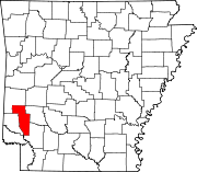
Grannis is a city in Polk County, Arkansas, United States. The population was 554 at the 2010 census.

Vandervoort is a town in Polk County, Arkansas, United States. The population was 120 at the 2000 census. The place is named in honor of the mother of an important early-20th-century railway financier, Jan de Goeijen. Her maiden name was Van der Voort.

Wickes is a city in Polk County, Arkansas, United States. The population was 754 at the 2010 census.

Judsonia is a city in White County, Arkansas, United States. Stan Robinson is the current mayor, first elected in 2018. The population was 1,854 at the 2020 census. The city is located immediately northeast of neighboring Searcy, and north of the Little Red River before it turns southeast toward the White River.

Madison is a city in and the county seat of Jefferson County, Indiana, United States, along the Ohio River. As of the 2010 United States Census its population was 11,967. Over 55,000 people live within 15 miles (24 km) of downtown Madison. Madison is the largest city along the Ohio River between Louisville and Cincinnati. In 2006, the majority of Madison's downtown area was designated a National Historic Landmark—133 blocks of the downtown area is known as the Madison Historic Landmark District.
Scotland is an unincorporated community in southwestern Van Buren County, Arkansas, United States, near the head of the South Fork of the Little Red River. In April 2010, a tornado struck this community which resulted in extreme damage.
The 1978 Bossier City tornado outbreak was an outbreak of 11 tornadoes that occurred during the early morning hours of December 3, 1978, in Louisiana and Arkansas. The outbreak produced several significant (F2–F5) tornadoes, several of which were long tracked. The first and most destructive of the tornadoes was a violent F4 tornado touched down on the eastern bank of the Red River in Bossier City, Louisiana, at approximately 1:50 a.m. CST. The tornado produced a path up to .5 miles (0.8 km) wide and nearly 4 miles (6.4 km) long through the heart of Bossier City. The only two deaths to occur in Bossier City were two young girls who were killed when a car was thrown through their bedroom wall. The Bossier City tornado became the fifth tornado in American history to produce at least $100 million (non-adjusted) in damage.
Mineola is an unincorporated community in Howard County, Arkansas, United States. On April 24, 2011, an EF1 tornado traveled from Umpire to Mineola parallel to Arkansas Highway 84, damaging a few structures. The tornado was on the back end of a period of heighted tornado activity that led directly into the 2011 Super Outbreak that began on April 25.
Sweden is an unincorporated community in Jefferson County, Arkansas, United States. Sweden is located on Arkansas Highway 88, 16.1 miles (25.9 km) east of Pine Bluff. On January 22, 2012, an EF2 tornado struck Sweden, damaging grain bins and metal buildings; the tornado continued to a point northeast of Lodge Corner in Arkansas County.
Cossatot River School District is a public school district located along the Cossatot River and is based in Wickes, Arkansas, United States. The Cossatot River School District provides early childhood, elementary and secondary education for more than 1,150 prekindergarten through grade 12 students at its six facilities.
Umpire High School is a public high school located in Umpire, Arkansas, United States. The school provides secondary education in grades 7 through 12 serving rural, distant communities of Howard County, Arkansas. It is one of four public high schools in Howard County and one of two high schools administered by the Cossatot River School District.
Van–Cove High School was a comprehensive public high school located in Cove, Arkansas, United States. The school provided secondary education in grades 7 through 12 serving rural, distant communities of Polk County, Arkansas, primarily Vandervoort and Cove, hence Van–Cove. At the time of closure it was a part of the Cossatot River School District.
Wickes High School was a comprehensive public high school located in Wickes, Arkansas, United States. The school provided secondary education for students in grades 7 through 12 serving rural, distant communities of Polk County, Arkansas, primarily Wickes and Grannis. It was one of five public high schools in Polk County and one of three high schools administered by the Cossatot River School District.
Wickes School District was a school district headquartered in Wickes, Arkansas.

A relatively widespread, damaging, and deadly tornado outbreak struck the central and southern United States in late April 2014. The storm complex responsible for the outbreak produced multiple long-track tornadoes – seven of which were deadly, causing 35 fatalities. One additional death occurred in Florida, due to severe flooding associated with this system.
The Umpire School District or Umpire Public Schools was a school district headquartered in Umpire, Arkansas.
Van-Cove School District or Van-Cove Public Schools was a school district headquartered in Cove, Arkansas. It served Cove and Vandervoort.

Hurricane Laura was a deadly and destructive Category 4 hurricane that is tied with the 1856 Last Island hurricane and 2021's Hurricane Ida as the strongest hurricane on record to make landfall in the U.S. state of Louisiana, as measured by maximum sustained winds. The twelfth named storm, fourth hurricane, and first major hurricane of the record-breaking 2020 Atlantic hurricane season, Laura originated from a large tropical wave that moved off the West African coast on August 16 and became a tropical depression on August 20. Laura intensified into a tropical storm a day later, becoming the earliest twelfth named storm on record in the North Atlantic basin, forming eight days earlier than 1995's Hurricane Luis.