Tollette, Arkansas

Last updated

Tollette, Arkansas
Howard County Arkansas Incorporated and Unincorporated areas Tollette Highlighted 0569500.svg
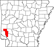
Location of Tollette in Howard County, Arkansas.
Coordinates: 33°49′9″N93°53′45″W / 33.81917°N 93.89583°W / 33.81917; -93.89583
Country United States
State Arkansas
County Howard
Area
[1]
  Total0.96 sq mi (2.49 km2)
  Land0.96 sq mi (2.49 km2)
  Water0.00 sq mi (0.00 km2)
Elevation
[2]
360 ft (110 m)
Population
 (2020)
  Total185
  Density192.11/sq mi (74.21/km2)
Time zone UTC-6 (Central (CST))
  Summer (DST) UTC-5 (CDT)
FIPS code 05-69500
GNIS feature ID0058751 [2]

Tollette is a town in southern Howard County, Arkansas, United States. The population was 240 at the 2010 census, [3] down from 324 in 2000.

Contents

Tollette was established as an all-African American town by Sanford Tollette and his wife Caldonia Crofton Tollette in the 1800s. They built a church, a store, and a public school. Caldonia Tollette was postmistress of the United States Post Office in 1893. Their daughter, Mattye Tollette Bond began a teaching career at the age of fifteen. She married Ollie Seahorn Bond and resided in his hometown of Brownsville, Tennessee where they organized the first NAACP chapter in Haywood County in 1939. Sanford and Caldonia's granddaughter Mildred Bond Roxborough began working for the NAACP in Tennessee at the age of nine in 1935 and continued her distinguished service to the organization in New York from 1954 through 1997 rising to executive positions including Director of Operations. [4]

Geography

Tollette is located in southern Howard County at 33°49′9″N93°53′45″W / 33.81917°N 93.89583°W / 33.81917; -93.89583 (33.819078, -93.895742). [5] Arkansas Highway 355 passes through the town, leading north 4 miles (6 km) to Mineral Springs and south 17 miles (27 km) to Fulton and Interstate 30.

According to the United States Census Bureau, the town has a total area of 0.97 square miles (2.5 km2), all land. [3]

Demographics

Historical population
CensusPop.Note
1980 407
1990 316−22.4%
2000 3242.5%
2010 240−25.9%
2020 185−22.9%
U.S. Decennial Census [6]

2020 census

Tollette racial composition [7]
RaceNumberPercentage
White (non-Hispanic)52.7%
Black or African American (non-Hispanic)17393.51%
Other/Mixed 42.16%
Hispanic or Latino 31.62%

As of the 2020 United States census, there were 185 people, 108 households, and 72 families residing in the town.

2000 census

As of the census [8] of 2000, there were 324 people, 136 households, and 90 families residing in the town. The population density was 133.1/km2 (343.0/mi2). There were 149 housing units at an average density of 61.2/km2 (157.7/mi2). The racial makeup of the town was 0.62% White, 98.46% Black or African American, and 0.93% from two or more races.

There were 136 households, out of which 24.3% had children under the age of 18 living with them, 33.8% were married couples living together, 29.4% had a female householder with no husband present, and 33.1% were non-families. 31.6% of all households were made up of individuals, and 16.9% had someone living alone who was 65 years of age or older. The average household size was 2.38 and the average family size was 3.01.

In the town, the population was spread out, with 24.1% under the age of 18, 10.5% from 18 to 24, 24.7% from 25 to 44, 22.5% from 45 to 64, and 18.2% who were 65 years of age or older. The median age was 37 years. For every 100 females, there were 90.6 males. For every 100 females age 18 and over, there were 86.4 males.

The median income for a household in the town was $24,688, and the median income for a family was $31,250. Males had a median income of $19,063 versus $18,295 for females. The per capita income for the town was $10,589. About 11.7% of families and 18.5% of the population were below the poverty line, including 17.5% of those under age 18 and 40.0% of those age 65 or over.

Notable person

Related Research Articles

<span class="mw-page-title-main">South Lead Hill, Arkansas</span> Town in Arkansas, United States

South Lead Hill is a town in Boone County, Arkansas, United States. The population was 102 at the 2010 census. It is part of the Harrison Micropolitan Statistical Area.

<span class="mw-page-title-main">Hermitage, Arkansas</span> City in Arkansas, United States

Hermitage is a city in Bradley County, Arkansas, United States. The United States Census Bureau estimated the population to be 830 as of the 2010 census.

<span class="mw-page-title-main">Whelen Springs, Arkansas</span> Town in Arkansas, United States

Whelen Springs is a town in Clark County, Arkansas, United States. The population was 92 at the 2010 census. From 1930 through 1939 the town thrived, being a main hub of operations for the then powerful Ozan Lumber Company.

<span class="mw-page-title-main">Caraway, Arkansas</span> City in Arkansas, United States

Caraway is a city in Craighead County, Arkansas, United States. The population was 1,279 at the 2010 census. It is included in the Jonesboro, Arkansas Metropolitan Statistical Area.

<span class="mw-page-title-main">Dyer, Arkansas</span> City in Arkansas, United States

Dyer is a city in Crawford County, Arkansas, United States. It is part of the Fort Smith, Arkansas-Oklahoma Metropolitan Statistical Area. The population was 876 at the 2010 census.

<span class="mw-page-title-main">Perla, Arkansas</span> Town in Arkansas, United States

Perla is a town in Hot Spring County, Arkansas, United States. The population was 241 at the 2010 census, up from 115 at the 2000 census. The city's water association filed for Chapter 9 Bankruptcy in the Western District of Arkansas Bankruptcy Court on May 26, 2019.

<span class="mw-page-title-main">Tupelo, Arkansas</span> Town in Arkansas, United States

Tupelo is a town in Jackson County, Arkansas, United States. The population was 180 at the 2010 census.

<span class="mw-page-title-main">Blue Mountain, Arkansas</span> Town in Arkansas

Blue Mountain is a town in Logan County, Arkansas, United States. The population was 124 at the 2010 census.

<span class="mw-page-title-main">Garland, Arkansas</span> Town in Arkansas, United States

Garland, also known as Garland City, is a town in Miller County, Arkansas, United States. It is part of the Texarkana, Texas - Texarkana, Arkansas Metropolitan Statistical Area. The population was 195 at the 2020 census, down from 242 in 2010.

<span class="mw-page-title-main">Marie, Arkansas</span> Town in Arkansas, United States

Marie is a town in Mississippi County, Arkansas, United States. It was founded by the R.E.L. Wilson cotton company. The population was 108 at the 2020 census.

<span class="mw-page-title-main">Oden, Arkansas</span> Town in Arkansas, United States

Oden is a town in Montgomery County, Arkansas, United States. As of the 2020 census, its population was 180, down from 232 in 2010.

<span class="mw-page-title-main">Bodcaw, Arkansas</span> Town in Arkansas, United States

Bodcaw is a town in Nevada County, Arkansas, United States. The population was 121 at the 2020 census. It is part of the Hope Micropolitan Statistical Area.

<span class="mw-page-title-main">Cale, Arkansas</span> Town in Arkansas, United States

Cale is a town in Nevada County, Arkansas, United States. The population was 75 at the 2000 census. It is part of the Hope Micropolitan Statistical Area.

<span class="mw-page-title-main">Rosston, Arkansas</span> Town in Arkansas, United States

Rosston is a town in south-central Nevada County, Arkansas, United States. The population was 265 at the 2000 census. It is part of the Hope Micropolitan Statistical Area.

<span class="mw-page-title-main">Willisville, Arkansas</span> Town in Arkansas, United States

Willisville is a town in Nevada County, Arkansas, United States. The population was 148 at the 2020 census. It is part of the Hope Micropolitan Statistical Area.

<span class="mw-page-title-main">Adona, Arkansas</span> City in Arkansas, United States

Adona is a city in Perry County, Arkansas, United States. The population was 209 at the 2010 census.

<span class="mw-page-title-main">Daisy, Arkansas</span> Town in Arkansas, United States

Daisy is a town in Pike County, Arkansas, United States. Its population is 88 as of the 2020 census. Daisy is also the home of Daisy State Park.

<span class="mw-page-title-main">Ulm, Arkansas</span> Town in Arkansas, United States

Ulm is a town in Prairie County, Arkansas, United States. The population was 205 at the 2000 census.

<span class="mw-page-title-main">Patterson, Arkansas</span> City in Arkansas, United States

Patterson is a city in Woodruff County, Arkansas, United States. The population was 452 at the 2010 census.

<span class="mw-page-title-main">Corinth, Arkansas</span> Town in Arkansas, United States

Corinth is a town in Yell County, Arkansas, United States. The population was 65 at the 2000 census. It is part of the Russellville Micropolitan Statistical Area.

References

  1. "2020 U.S. Gazetteer Files". United States Census Bureau. Retrieved October 29, 2021.
  2. 1 2 U.S. Geological Survey Geographic Names Information System: Tollette, Arkansas
  3. 1 2 "Geographic Identifiers: 2010 Demographic Profile Data (G001): Tollette town, Arkansas". American Factfinder. U.S. Census Bureau. Retrieved April 21, 2017.[ dead link ]
  4. Bond, Jo Zanice, Race, Place, and Family Narratives of the Civil Rights Movement in Brownsvile, Tennessee, and the Nation, University of Kansas Press, 2011, 25. a
  5. "US Gazetteer files: 2010, 2000, and 1990". United States Census Bureau. February 12, 2011. Retrieved April 23, 2011.
  6. "Census of Population and Housing". Census.gov. Retrieved June 4, 2015.
  7. "Explore Census Data". data.census.gov. Retrieved December 30, 2021.
  8. "U.S. Census website". United States Census Bureau . Retrieved January 31, 2008.