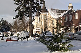
Grantown-on-Spey is a town in the Highland Council Area, historically within the county of Moray. It is located on a low plateau at Freuchie beside the river Spey at the northern edge of the Cairngorm mountains, about 20 miles (32 km) south-east of Inverness.

Banffshire is a historic county, registration county and lieutenancy area of Scotland. The county town is Banff, although the largest settlement is Buckie to the west. It borders the Moray Firth to the north, Morayshire and Inverness-shire to the west, and Aberdeenshire to the east and south.

Almondsbury is a large village near junction 16 of the M5 motorway, on the outskirts of the city of Bristol, in South Gloucestershire, England, and a civil parish which also includes the villages of Hortham, Gaunt's Earthcott, Over, Easter Compton, Compton Greenfield, Hallen and Berwick.
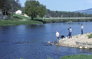
The River Spey is a river in the northeast of Scotland. At 98 mi (158 km) it is the ninth longest river in the United Kingdom, as well as the second longest and fastest-flowing river in Scotland.. It is important for salmon fishing and whisky production.
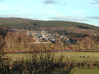
Fochabers is a village in the Parish of Bellie, in Moray, Scotland, 10 miles (16 km) east of the cathedral city of Elgin and located on the east bank of the River Spey. 1,728 people live in the village, which enjoys a rich musical and cultural history. The village is also home to Baxters, the family-run manufacturer of foodstuffs.
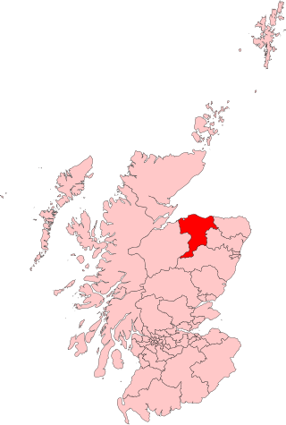
Moray was a county constituency of the House of Commons of the Parliament of the United Kingdom. It elected one Member of Parliament (MP) by the first past the post system of election.

Boat of Garten is a small village and post town in Badenoch and Strathspey, Highland, Scotland. In 1951, the population was less than 400; in 1971, it was almost 500; in 1981, it was almost 700, and the same in 2001.
Burn is a small village and civil parish in North Yorkshire, England. It is situated 3 miles (4.8 km) south of Selby and 14 miles (22.5 km) south of York. The village is mainly situated around the main A19 road with the addition of a small housing estate built in the mid-1960s to the west of the main road.

Henstridge is a village and civil parish in Somerset, England, situated 5 miles (8.0 km) east of Sherborne in the South Somerset district, near the border with Dorset. The parish includes the hamlet of Yenston. In 2011, the village had a population of 1,814.
Newtonmore is a village of approximately 1100 inhabitants in Badenoch, within the Highland council area of Scotland. The village is only a few miles from a location that is claimed to be the exact geographical centre of Scotland.
Kingston on Spey is a small coastal village in Moray, Scotland. It is situated immediately north of Garmouth at the western side of the mouth of the River Spey on the coast of the Moray Firth. Kingston was founded in 1784 and was named after Kingston upon Hull, in East Yorkshire.

Bradwell-on-Sea is a village and civil parish in Essex, England; it is on the Dengie peninsula. It is located 5.6 mi (9.0 km) north-north-east of Southminster and is 19 mi (31 km) east of the county town of Chelmsford. The village is in the District of Maldon and in the parliamentary constituency of Maldon, whose boundaries were last varied at the 2010 general election. In 2011, it had a population of 863, a decline from 877 in the previous census. In 2021 the population was 892.
Spey Bay is a small settlement in Moray, Scotland. It is situated at the eastern side of the mouth of the River Spey on the coast of the Moray Firth between the village of Kingston on the western side of the Spey, and the fishing port of Buckie to the east.

Yapham is a village and civil parish in the East Riding of Yorkshire, Northern England. It is situated about 2 miles (3.2 km) north-east of Pocklington. The parish includes the hamlet of Meltonby and is approximately 1,830 acres (740 ha).

Royal Air Force Merryfield or more simply RAF Merryfield is a former Royal Air Force station in the village of Ilton near Ilminster in southwest Somerset, England. The airfield is located approximately 7 miles (11 km) north of Chard, about 130 miles (210 km) southwest of London. It is now RNAS Merryfield and serves as a satellite to the larger RNAS Yeovilton; it is used mainly as a training facility for helicopter pilots.
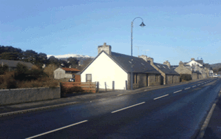
Lower Auchenreath is a tiny rural settlement situated in the North East Coast of Scotland. It is home to a mixed arable/animal farm and is only a mile to the West of Port Gordon. Nearby is the Speyside walk and Spey Bay Golf Club. Originally there were several small crofts which over the years have been amalgamated into a single farm. There are 9 dwellings at Lower Auchenreath. The Tynet burn flows through the farm, which was the old boundary between Morayshire and Banffshire. The dwellings are all situated on the Morayshire (west) side of the Tynet burn but some of the fields are on the Banffshire side. The settlement is bordered on the West side by the old Dallachy aerodrome, which was used in World War 2, but has long since been disused.

Royal Air Force Dallachy or more simply RAF Dallachy, is a former Royal Air Force station situated east of Elgin, Moray, Scotland.

Royal Air Force Warboys or more simply RAF Warboys is a former Royal Air Force heavy bomber station, situated just outside the village of Warboys in Huntingdonshire, England.

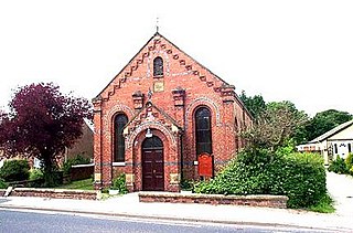
Strubby is a village in the East Lindsey district of Lincolnshire, England. It is situated just north of the A157 road, 8 miles (13 km) south-east from Louth and 4 miles (6.4 km) north from Alford. The village forms part of Strubby and Woodthorpe civil parish, with the nearby hamlet of Woodthorpe.

