Uruachi

Last updated
Uruachi
Municipal seat
Uruachi en Chihuahua.svg
Municipality of Uruachi in Chihuahua
Mexico States blank map.svg
Red pog.svg
Uruachi
Location in Mexico
Coordinates: 27°52′02″N108°12′57″W / 27.86722°N 108.21583°W / 27.86722; -108.21583
CountryFlag of Mexico.svg  Mexico
State Chihuahua
Municipality Uruachi
Elevation
1,360 m (4,460 ft)
Population
 (2010)
  Total
1,199
Postal code
33300
Area code 635

Uruachi (a name in the Tarahumara language of disputed meaning; [1] also known as Mineral de Urachi on account of its mining activities) is a town in the Mexican state of Chihuahua, close to the border with the state of Sonora. It serves as the municipal seat of the surrounding municipality of Uruachi.

As of 2010, the town of Uruachi had a population of 1,199. [2] up from 806 as of 2005. [1]

The settlement was founded by Jesuit missionaries in 1736.[ citation needed ]

Related Research Articles

<span class="mw-page-title-main">Catazajá</span> Municipality in Chiapas, Mexico

Catazajá is a town and municipality in the southeastern Mexican state of Chiapas and is the northernmost municipality in the state. It covers an area of 621 km².
<span class="mw-page-title-main">La Grandeza</span> Municipality in Chiapas, Mexico

La Grandeza is a town and municipality in the Mexican state of Chiapas in southern Mexico.
<span class="mw-page-title-main">Ixtacomitán</span> Municipality in Chiapas, Mexico

Ixtacomitán is a town and municipality in the Mexican state of Chiapas in southern Mexico.

<span class="mw-page-title-main">Socoltenango</span> Municipality in Chiapas, Mexico

Socoltenango is a town and municipality in the Mexican state of Chiapas in southern Mexico.
<span class="mw-page-title-main">Jitotol</span> Municipality in Chiapas, Mexico

Jitotol is a town and municipality in the Mexican state of Chiapas in southern Mexico.
<span class="mw-page-title-main">Larráinzar</span> Municipality in Chiapas

Larráinzar is a municipality in the Mexican state of Chiapas in southern Mexico. The municipal seat is the town of San Andrés Larráinzar.
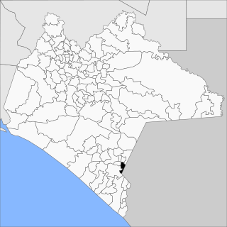
<span class="mw-page-title-main">Mazapa de Madero</span> Municipality in Chiapas, Mexico

Mazapa de Madero is a town and municipality in the Mexican state of Chiapas in southern Mexico.

<span class="mw-page-title-main">La Libertad, Chiapas</span> Municipality in Chiapas, Mexico

La Libertad is a town and municipality in the Mexican state of Chiapas in southern Mexico.

<span class="mw-page-title-main">Ocotepec, Chiapas</span> Municipality in Chiapas, Mexico

Ocotepec is a town and municipality in the Mexican state of Chiapas in southern Mexico.

<span class="mw-page-title-main">Osumacinta</span> Municipality in Chiapas, Mexico

Osumacinta is a town and municipality in the Mexican state of Chiapas in southern Mexico.
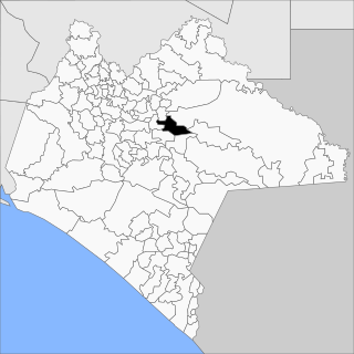
<span class="mw-page-title-main">Oxchuc</span> Municipality in Chiapas, Mexico

Oxchuc is a town and municipality in the Mexican state of Chiapas in southern Mexico.

<span class="mw-page-title-main">Santiago el Pinar</span> Municipality in Chiapas, Mexico

Santiago el Pinar is a town and municipality in the Mexican state of Chiapas in southern Mexico.

<span class="mw-page-title-main">San Lucas, Chiapas</span> Municipality in Chiapas, Mexico

San Lucas is a town and municipality in the Mexican state of Chiapas in southern Mexico.

<span class="mw-page-title-main">Soyaló</span> Municipality in Chiapas, Mexico

Soyaló is a town and municipality in the Mexican state of Chiapas in southern Mexico.
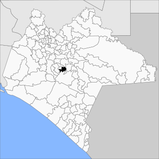
<span class="mw-page-title-main">Totolapa</span> Municipality in Chiapas, Mexico

Totolapa is a town and municipality in the state of Chiapas in southern Mexico.

<span class="mw-page-title-main">Tapilula</span> Municipality in Chiapas, Mexico

Tapilula is a town and municipality in the Mexican state of Chiapas in southern Mexico.
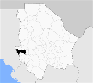
<span class="mw-page-title-main">Uruachi Municipality</span> Municipality in the Mexican state of Chihuahua

Uruachi is one of the 67 municipalities of Chihuahua, in northern Mexico. The municipal seat lies at Uruachi. The municipality covers an area of 3,058.31 km2.

<span class="mw-page-title-main">Rodeo Municipality</span> Municipality in the Mexican state of Durango

Rodeo is a municipality in the Mexican state of Durango. The municipal seat lies at Rodeo. The municipality covers an area of 1,854.9 km².

<span class="mw-page-title-main">Topia Municipality</span> Municipality in the Mexican state of Durango

Topia is a municipality in the Mexican state of Durango. The municipal seat lies at Topia. The municipality covers an area of 1,617.8 km2.

Xochistlahuaca Municipality is a municipality in the Mexican state of Guerrero and is the easternmost municipality in Guerrero. The municipal seat lies at Xochistlahuaca. The municipality covers an area of 321.1 km2.

References

  1. 1 2 "Uruachi". Enciclopedia de los Municipios de México. Instituto Nacional para el Federalismo y el Desarrollo Municipal. Archived from the original on February 23, 2007. Retrieved October 25, 2008.
  2. "Uruachi". Catálogo de Localidades. Secretaría de Desarrollo Social (SEDESOL). Retrieved 23 April 2014.