Utah State Route 103

Last updated • 5 min readFrom Wikipedia, The Free Encyclopedia

Utah 103.svg

State Route 103

650 North
Utah State Route 103
SR-103 highlighted in red
Route information
Maintained by UDOT
Length0.225 mi [1]  (362 m)
ExistedApril 19, 1965 (1965-04-19) [2] –present
Major junctions
West endUtah 126.svg SR-126 in Clearfield
East endI-15.svg I-15 in Clearfield
Location
Country United States
State Utah
Highway system
  • Utah State Highway System
Utah 102.svg SR-102 Utah 104.svg SR-104

State Route 103 (SR-103) is a 0.225-mile-long (362 m) urban minor arterial state highway in the U.S. state of Utah. It branches off from SR-126 (Main Street) in downtown Clearfield and extends east to Interstate 15 (I-15), with the roadway continuing to the Falcon Hill National Aerospace Research Park, just outside Hill Air Force Base. The entire route is located in Davis County and was formed in 1965 coinciding with the construction of I-15.

Contents

The western terminus, in a stretch of fourteen years from its inception, has gone from SR-1 in 1965, to SR-106 in 1967, to SR-84 in 1969, and SR-126 in 1979. In 1979, the moniker of the roadway for SR-103 was changed from 600 North to 650 North. SR-103 is one of four Utah state highways that connect to Hill Air Force Base, the others being SR-97, SR-168, and SR-232. Only SR-168 has a lower average daily traffic count, with roughly 1,000 vehicles-per-day traveling along the highway compared to SR-103's approximately 16,000 vehicles-per-day. The highway has been largely unchanged since its formation, except for the addition of traffic lights at the on and off ramps for I-15, and a slight truncation of the east end from the air force base gate to I-15.

Route description

State Route 103 (SR-103) begins at an intersection with SR-126, locally known as Main Street in Clearfield. At this intersection, 650 North, which continues the right-of-way, lengthens from a two lane local street into a four lane arterial boulevard at SR-126. SR-103 begins its progression eastward, passing between two commercial complexes. After a crossing of the Davis-Weber Canal, the sidewalk on the southern side of the roadway turns to the south to follow the canal forming the Clearfield Canal Trail. [3] SR-103 highway turns to the northeast, intersecting with the southbound on-ramp and off-ramp to Interstate 15 (I-15). After this intersection, SR-103 expands to five lanes, and crosses under the southbound and northbound lanes of I-15. [4] After the overpasses, SR-103 intersects with the northbound on-ramp and off-ramp from I-15. At this point, the SR-103 designation ends. However, the 650 North roadway progresses straight for about 300 ft (91 m), passing a gated fence on the north side of the highway leading to a rail stub, and the dead-end of Aspen Avenue, before reaching the entrance to the Falcon Hill National Aerospace Research Park, just outside Hill Air Force Base. From there, the right-of-way continues on the arterial in the base itself. [4]

SR-103 serves the function of connecting the town of Clearfield and residents along I-15 to Hill Air Force Base. The base, as of 2012, was the sixth largest employer in the state of Utah and is the third largest employer which is neither the state government nor a state-funded higher education institution. [5] SR-103 is one of four Utah state highways that connect to Hill Air Force Base, the others being SR-97, [6] SR-168 [7] and SR-232, [8] Only SR-168 has a lower average daily traffic count, with roughly 1,000 vehicles-per-day traveling along the highway compared to SR-103's approximately 16,000 vehicles-per-day. [9] This is a decline from previous years (in 2007 the average on SR-103 was 22,525; in 2006, the average was 22,215; in 2005, 21,275). Four percent of this traffic was composed of trucks. [10] The measurement point for the traffic counts is at the eastern terminus of SR-103, the entrance to the Falcon Hill National Aerospace Research Park. The highway is codified as Utah Code §72-4-116, and is designated as a minor arterial, [11] which the Federal Highway Administration defines as linking major arterials at a lower volume than a primary arterial. [12]

History

SR-103 was originally on a road from West Ogden north to the junction with US 89 (then cosigned with US-91 and SR-1) at North Ogden Hot Springs. In 1935 the state of Utah and the Utah Department of Transportation (UDOT) decommissioned this alignment of SR-103. The SR-103 designation was rewritten in the Utah Code as a highway following Harrison Street in the city of Ogden. Between 1964 and 1965, the state of Utah and the Utah Department of Transportation (UDOT) decommissioned the alignment of SR-103 on Harrison Street, renumbering the portion of Harrison Street as SR-203. The SR-103 designation was soon rewritten in the Utah Code as an access road to Hill Air Force Base on April 19, 1965. [2]

The SR-103 exit from northbound I-15 Northbound I-15 at UT-103 - 650 North.jpg
The SR-103 exit from northbound I-15

The new alignment, which the state felt was a major connector to a federal military institution, Hill Air Force Base, from U.S. Route 91 (US-91) and I-15 was chosen as a state highway [2] US-91, before the formation of I-15, was the major thoroughfare through Utah, connecting it to California and Montana. [13] SR-103 was then designated onto its alignment, adding 0.225-mile (362 m) to the Utah state route system. [2] Prior to designation, the alignment of 600 North went from U.S. Route 91 and uninterrupted until the Hill Air Force Base. In 1964, a year prior to designation, a 27-foot-long (8.2 m) concrete culvert bridge was constructed over the Davis Weber Canal. [14] The two bridges for I-15's southbound and northbound roadways were built in 1966 and are two 159-foot-long (48.5 m) concrete continuous tee beam overpasses. [15] [16]

The route has been mostly unchanged since its formation, except for the moniker of the highway and the western terminus, of which SR-103 progresses. The western terminus, in a stretch of fourteen years from its inception, went from SR-1 in 1965, to SR-106 in 1967 to SR-84 in 1969 and SR-126 in 1979. In 1979, the moniker of the roadway for SR-103 was changed from 600 North to 650 North. In 1998, the legal definition of SR-103 was changed in the state codes. [2]

The alignment of SR-103, outside of the roadway renumbering, has received some technical changes as well. In November 1992, UDOT confirmed that the interchange of I-15 and SR-103 (exit 335) was to be given traffic lights to help monitor traffic. The mayor at the time, Neldon Hamblin, approved of the project, and put the project up for bids for construction. The interchange was holding up motorists needing to turn left up to 20 minutes. [17]

The most recent change to SR-103 came in March 2019, when the Utah State Legislature approved a slight truncation of the east end of the route. The segment of 650 North between I-15 and the base gate was removed from the legal definition of SR-103 at that time, bringing the eastern terminus back to the I-15 interchange. [18]

Major intersections

The entire route is in Clearfield, Davis County. [19]

mi [1] kmDestinationsNotes
0.0000.000Utah 126.svg SR-126 (Main Street)Western terminus, roadway continues west as 650 North
0.080–
0.225
0.129–
0.362
I-15.svg I-15  Salt Lake City, Ogden Eastern terminus; I-15 exit 335; diamond interchange
1.000 mi = 1.609 km; 1.000 km = 0.621 mi

See also

Related Research Articles

<span class="mw-page-title-main">U.S. Route 189</span> Highway in the United States

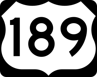
U.S. Route 189 is a spur of U.S. Route 89. It currently runs for 322 miles (518 km) from Provo, Utah at Interstate 15 to Jackson, Wyoming. The highway was not part of the original 1926 U.S. Highway system. The highway was created in the 1930s, absorbing former U.S. Route 530 and a portion of U.S. Route 30S. The portion through Provo Canyon has been designated the Provo Canyon Scenic Byway by the state of Utah.

<span class="mw-page-title-main">Utah State Route 154</span> State highway in Salt Lake County, Utah, United States

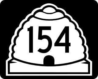
State Route 154 (SR-154) or Bangerter Highway is a partial expressway running west and then north from Draper through western Salt Lake County, eventually reaching the Salt Lake City International Airport in Salt Lake City. Construction began in 1988 after planning for the highway began more than two decades prior. For the next ten years, portions of the highway opened as constructed, with the entire route finished by 1998.

<span class="mw-page-title-main">Mountain View Corridor</span> State highway in Utah and Salt Lake counties in Utah, United States

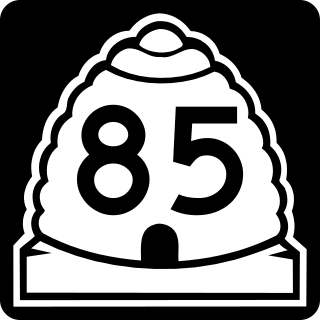
The Mountain View Corridor is a freeway under construction in northern Utah that will run along the western periphery of Salt Lake County and south into northwest Utah County. Except for the last several miles on its southern end the Mountain View Corridor is numerically designated as State Route 85 (SR-85) in the Utah state highway system. The entire Mountain View Corridor will be maintained by the Utah Department of Transportation (UDOT).

<span class="mw-page-title-main">U.S. Route 50 in Utah</span> Highway in Utah

U.S. Route 50 (US-50) in Utah crosses the center of the state. The highway serves no major population centers in Utah, with the largest city along its path being Delta. Most of the route passes through desolate, remote areas. Through the eastern half of the state the route is concurrent with Interstate 70 (I-70). US-50 both enters and exits Utah concurrent with US-6, however the two routes are separate through the center of the state.

<span class="mw-page-title-main">Utah State Route 68</span> State highway in Utah, Salt Lake, and Davis counties in Utah, United States

State Route 68 (SR-68) is a state highway in the U.S. state of Utah. It is a major thoroughfare throughout the Wasatch Front as it runs north–south for 70.8 miles (113.9 km), linking US-6 near Elberta to US-89 in Woods Cross. The route intersects several major freeways and highways in the Salt Lake City metropolitan area including I-215, I-80, and I-15. The route is more commonly referred to as Redwood Road, after the street it is routed along throughout Salt Lake County. The highway is also routed for a short distance along 500 South and 200 West in Bountiful and Camp Williams Road in Utah County. The route is a surface street for its entire length.

<span class="mw-page-title-main">Interstate 80 Business (West Wendover, Nevada–Wendover, Utah)</span> Interstate Highway business loop in Nevada and Utah in the United States

Interstate 80 Business is an unofficial business loop of Interstate 80 (I-80) that is 2.26 miles (3.64 km) long and serves as the main street for the US cities of West Wendover, Nevada, and Wendover, Utah, along a roadway named Wendover Boulevard. Wendover Boulevard was originally part of US Route 40 (US 40), which connected California to New Jersey via Nevada and Utah. A portion of the Nevada segment runs concurrently with US 93 Alternate, and the entire portion in Utah is coterminous with State Route 58 (SR-58). The Nevada Department of Transportation (NDOT) applied for the business loop designation in the early 1980s, but the designation has never been approved; nevertheless, signs are posted in both states. Between July 1976 and 1993, I-80 Bus was concurrent with State Route 224 (SR 224) in Nevada.

<span class="mw-page-title-main">Interstate 80 in Utah</span> Section of Interstate highway in Utah, United States

Interstate 80 (I-80) is a part of the Interstate Highway System that runs from San Francisco, California, to Teaneck, New Jersey. The portion of the highway in the US state of Utah is 197.51 miles (317.86 km) long through the northern part of the state. From west to east, I-80 crosses the state line from Nevada in Tooele County and traverses the Bonneville Salt Flats—which are a part of the larger Great Salt Lake Desert. It continues alongside the Wendover Cut-off—the corridor of the former Victory Highway—US Route 40 (US-40) and the Western Pacific Railroad Feather River Route. After passing the Oquirrh Mountains, I-80 enters the Salt Lake Valley and Salt Lake County. A short portion of the freeway is concurrent with I-15 through Downtown Salt Lake City. At the Spaghetti Bowl, I-80 turns east again into the mouth of Parleys Canyon and Summit County, travels through the mountain range, and intersects the eastern end of I-84 near Echo Reservoir before turning northeast toward the Wyoming border near Evanston. I-80 was built along the corridor of the Lincoln Highway and the Mormon Trail through the Wasatch Range. The easternmost section also follows the historical routes of the first transcontinental railroad and US-30S.

<span class="mw-page-title-main">Interstate 84 in Utah</span> Section of Interstate Highway in Utah, United States

Interstate 84 (I-84) is a part of the Interstate Highway System that links Portland, Oregon, to I-80 near Echo, Utah. The 117.38-mile-long (188.90 km) segment in the US state of Utah is the shortest of any of the three states the western I-84 passes through and contains the eastern terminus of the highway. I-84 enters Box Elder County near Snowville before becoming concurrent with I-15 in Tremonton. The concurrent highways travel south through Brigham City and Ogden and separate near Ogden-Hinckley Airport. Turing east along the Davis County border, I-84 intersects US Route 89 (US-89) and enters Weber Canyon as well as Morgan County. While in Morgan County, I-84 passes the Devil's Gate-Weber Hydroelectric Power Plant and Devil's Slide rock formation. Past Morgan, the highway crosses into Summit County, past the Thousand Mile Tree before reaching its eastern terminus at I-80 near Echo.

<span class="mw-page-title-main">Interstate 15 in Utah</span> Section of Interstate highway in Utah, United States

Interstate 15 (I-15) runs north–south in the U.S. state of Utah through the southwestern and central portions of the state, passing through most of the state's population centers, including St. George and those comprising the Wasatch Front: Provo–Orem, Salt Lake City, and Ogden–Clearfield. It is Utah's primary and only north–south interstate highway, as the vast majority of the state's population lives along its corridor; the Logan metropolitan area is the state's only Metropolitan Statistical Area through which I-15 does not pass. In 1998, the Utah State Legislature designated Utah's entire portion of the road as the Veterans Memorial Highway.

<span class="mw-page-title-main">Wendover Cut-off</span> Highway in Utah

The Wendover Cut-off, also called the Wendover Road or Wendover Route, is a two-lane highway in the western part of Tooele County in the U.S. state of Utah. Stretching 40.3 miles (64.9 km) from Wendover to Knolls across the Bonneville Salt Flats, a part of the Great Salt Lake Desert, the cut-off was once part of the primary link between the Nevada state line and Salt Lake City. In 2012, between 240 and 250 vehicles used the cut-off near its western terminus in Wendover on an average day.

<span class="mw-page-title-main">Utah State Route 161</span> Highway in Utah, United States

State Route 161 (SR-161) is a 3.084-mile (4.963 km) long state highway, designated as a rural major connector, completely within Millard County in central Utah. The highway connects Interstate 70 (I-70) to I-15 while providing service to historic Cove Fort. The route was once part of U.S. Route 91 (US-91), but was renumbered to SR-161 in the 1970s, in parallel with the construction of I-70.

<span class="mw-page-title-main">Utah State Route 94</span> State highway in Utah, United States

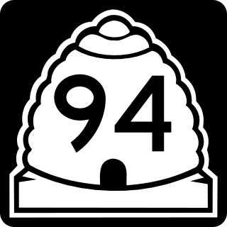
State Route 94 (SR-94), located entirely within Grand County, is a 0.958-mile-long (1.542 km) minor collector state highway in the U.S. state of Utah. The highway serves as a spur route into Thompson Springs. The highway was formed in 1969, at the same time Interstate 70 (I-70) was constructed through the area.

<span class="mw-page-title-main">Legacy Parkway</span> State highway in Utah, United States

Legacy Parkway is an 11.5-mile-long (18.5 km) four-lane controlled-access parkway located almost completely within Davis County in the northern part of the U.S. state of Utah. The parkway travels north from Interstate 215 (I-215) in northwestern Salt Lake City to an interchange named the Wasatch Weave in Farmington with two intermediate interchanges providing access to Woods Cross and Centerville. Wetlands of the nearby Great Salt Lake and nature preserves border the western side of the parkway while the eastern side roughly parallels Union Pacific and Utah Transit Authority rail lines and I-15. On average, between 20,000 and 23,000 vehicles use the parkway daily.

<span class="mw-page-title-main">Utah State Route 92</span> State highway in Utah, United States

State Route 92 (SR-92), also known in various portions as the Timpanogos Highway, and Alpine Loop Scenic Highway is a scenic state highway in Utah County, Utah that runs from I-15/US-89 in Lehi to US-189 in Provo Canyon. The route is 27.296 miles (43.929 km) long and is the only road with access to Sundance Ski Resort and the Aspen Grove Family Camp and Conference Center.

<span class="mw-page-title-main">Utah State Route 34</span> State highway in Utah, United States

State Route 34 (SR-34) is a short east–west state highway in the city of St. George in southwestern Utah that connects Bluff Street (SR-18) on the west to River Road on the east while providing a connection to I-15. The route runs two miles through central St. George as St. George Boulevard. SR-34 was a portion of US-91 when it passed through the city, and serves as the northern corridor of the St. George Business Loop for I-15; Bluff St. (SR-18) from Interstate 15's Exit 6 to St. George Blvd. serves as the southern half.

<span class="mw-page-title-main">Utah State Route 61</span> Highway in Utah, United States

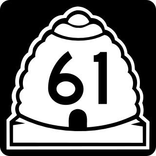
State Route 61 (SR-61) is a nearly 7.3-mile-long (11.7 km) state highway in Cache County, Utah, connecting SR-23 in Cornish, to U.S. Route 91 (US-91) in Cove via Lewiston, in the extreme northern part of the state. The highway has existed since at least 1914 and as SR-61 since at least 1937. Between 735 and 2,180 vehicles travel along the highway on an average day in 2012.

<span class="mw-page-title-main">Utah State Route 241</span> State highway in Utah, United States

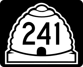
State Route 241 is a state highway completely within Utah County in northern Utah, in the cities of Orem and Lindon. The route connects SR-114 to US-89 via an interchange at I-15.

<span class="mw-page-title-main">Utah State Route 179</span> Proposed highway

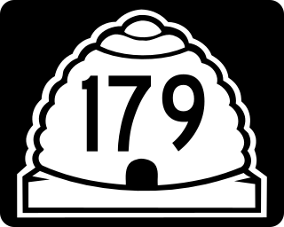
State Route 179, also known as the Midvalley Highway, is a highway in the U.S. state of Utah. It runs through the northern part of the Tooele Valley, located in eastern Tooele County.

<span class="mw-page-title-main">West Davis Corridor</span> Freeway in Davis County, Utah, United States

The West Davis Corridor is a 16-mile-long (26 km) freeway completely within Davis County in northern Utah. The corridor splits off from Interstate 15 (I-15) and U.S. Route 89 (US-89) along with the Legacy Parkway (SR-67) in Farmington and goes through the western confines of the Ogden–Clearfield metropolitan area before ending at an T-intersection with SR-193 in West Point.

References

  1. 1 2 "Highway Reference Online - SR 103". maps.udot.utah.gov. Utah Department of Transportation . Retrieved December 18, 2013.
  2. 1 2 3 4 5 "State Road Resolutions SR-103.pdf". Utah Department of Transportation . Retrieved December 17, 2013.
  3. Roberts, Shayln (June 4, 2008). "Clearfield Canal Trail to open Saturday". The Davis Clipper. Bountiful, Utah. OCLC   11930754 . Retrieved December 18, 2013.
  4. 1 2 Google (December 17, 2013). "Overview map of UT 103" (Map). Google Maps . Google. Retrieved December 17, 2013.
  5. Utah's Largest Employers — Annual Average Employment (PDF) (Report). Utah Department of Workforce Services. 2012.
  6. "State Road Resolutions SR-97.pdf". Utah Department of Transportation . Retrieved December 18, 2013.
  7. "State Road Resolutions SR-168.pdf". Utah Department of Transportation . Retrieved December 19, 2013.
  8. "State Road Resolutions SR-232.pdf". Utah Department of Transportation . Retrieved December 18, 2013.
  9. "Traffic Statistics". udot.utah.gov. Utah Department of Transportation. 2012. Retrieved December 17, 2013.
  10. "Traffic Statistics". udot.utah.gov. Utah Department of Transportation. 2012. Retrieved December 17, 2013.
  11. Ogden — Layton Urbanized Area Functional Class System (Map). 1 in ≈ 1.2 mi (2.54 cm ≈ 1.93 km). Utah Department of Transportation. March 29, 2012. Retrieved December 17, 2013.
  12. Highway Functional Classification Concepts, Criteria and Procedures (PDF). Federal Highway Administration. 2013. pp. 15–16. Retrieved December 17, 2013.
  13. Bureau of Public Roads & American Association of State Highway Officials (November 11, 1926). United States System of Highways Adopted for Uniform Marking by the American Association of State Highway Officials (Map). 1:7,000,000. Washington, DC: United States Geological Survey. OCLC   32889555 . Retrieved November 7, 2013 via Wikimedia Commons.
  14. Federal Highway Administration (2012). "NBI Structure Number: 0E1346". National Bridge Inventory . Federal Highway Administration.
  15. Federal Highway Administration (2012). "NBI Structure Number: 3D 719". National Bridge Inventory. Federal Highway Administration.
  16. Federal Highway Administration (2012). "NBI Structure Number: 1D 719". National Bridge Inventory. Federal Highway Administration.
  17. Staff (November 12, 1992). "Clearfield To Get Signals for I-15 Junction". Deseret News . p. 1. OCLC   10171976.
  18. "State Highway System Amendments, 2019 General Session". Utah State Legislature . Retrieved May 18, 2019.
  19. Davis County (Map). .25 in ≈ 1 mi (.64 cm ≈ 1.93 km). General Highway Map. Utah Department of Transportation. 2005. Archived from the original on October 23, 2013. Retrieved December 18, 2013.
Template:Attached KML/Utah State Route 103
KML is from Wikidata