Valley Falls, Oregon

Last updated

Valley Falls, Oregon
Store at Valley Falls, Oregon, 2014.jpg
Valley Falls store and gas station
USA Oregon location map.svg
Red pog.svg
Valley Falls
Usa edcp location map.svg
Red pog.svg
Valley Falls
Coordinates: 42°29′03″N120°16′55″W / 42.48417°N 120.28194°W / 42.48417; -120.28194
Country United States
State Oregon
County Lake
Elevation
4,327 ft (1,319 m)
Time zone UTC-8 (Pacific)
  Summer (DST) UTC-7 (Pacific)

Valley Falls is a small unincorporated community in Lake County, Oregon, United States. The settled area is located at the junction of U.S. Route 395 and Oregon Route 31. The community is named for a small falls on the Chewaucan River just north of the occupied site. East of Valley Falls, the cliff face of Abert Rim overlooks the community.

Contents

History

The area around Valley Falls was occupied by Native Americans for up to 11,000 years prior to the arrival of white settlers. Archaeological evidence shows that the peak period for use by native tribes was between 2,000 and 500 years ago. During that period, the people who lived in the Valley Falls area were probably ancestors of the Klamath and Modoc peoples. Most of these Native Americans lived in pit-houses along the shore of Abert Lake, just north of Valley Falls. [1] There are also a number of ancient petroglyphs near Valley Falls. The Abert Lake Petroglyphs, at the foot of Abert Rim, are thought to be over 10,000 years old. [2]

In 1832, John Work led his Hudson's Bay Company trapping brigade through the Valley Falls area. Work recorded the visit in his journal. In 1843, Captain John C. Fremont explored the area around Valley Falls. Fremont name Abert Rim and nearby Abert Lake after the head of the United States Army's topographical engineers, Colonel John J. Abert. [3] [4]

The community was founded and named by C. W. E. Jennings, who opened a store at the site around 1908. It was named for a small falls on the Chewaucan River approximately 1 mile (1.6 km) north of the community. In 1909, a post office was established at Valley Falls. The office was located near the base of Abert Rim. The first postmaster was Ernest L.H. Meyer. However, Jennings later took over from Meyer. At its peak, the community of Valley Falls had a hotel, livery stable, and a dance hall in addition to the Jennings' store and post office. The area was surveyed for a railroad, but it was never built. In 1942, the post office was moved approximately one mile west to the junction of U.S. Route 395 and Oregon Route 31. The Valley Falls post office was closed in 1943. [5] [6] [7]

Geography

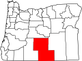
The unincorporated community of Valley Falls is located at the junction of U.S. Route 395 and Oregon Route 31 in the high desert country of Lake County in south-central Oregon. There are only five structures at the site. The main business is a combined gas station and store, located on the west side of the highway, south of the junction. There is also a recreational vehicle park and a guest ranch nearby. Valley Falls is 23 miles (37 km) north of Lakeview, Oregon, on Route 395; 23 miles (37 km) southeast of Paisley, Oregon, on Route 31; and 116 miles (187 km) southwest of Burns, Oregon, on Route 395. [8] [9] [10] [11]

Geology

Abert Rim seen from Valley Falls Abert Rim seen from Valley Falls, Oregon.JPG
Abert Rim seen from Valley Falls

Abert Rim is approximately one mile east of Valley Falls. The rim is one of the highest escarpments in the United States, rising 2,500 feet (760 m) above the valley floor. The top 800 feet (240 m) is a sheer-cliff. The rim cliff runs over 30 miles (48 km) from north to south, making it the longest exposed block fault scarp in North America. The rim is basalt, formed by large lava flows during the Miocene epoch. After the lava flows stopped, large blocks faults broke and tilted the land. Abert Rim is the result of one of those giant faults. [1] [9] [12] [13]

From Valley Falls, visitors have an unobstructed view of Abert Rim's cliff face. [10] Along the highway just south of the Valley Falls, there is an Outback Scenic Byway kiosk that explains how Abert Rim was formed. [1] There are also two geological information signs north of Valley Falls, one on Route 395 and the other on Route 31. [14]

Climate

The annual average high temperature in Valley Falls is 61.8 °F (17 °C). The warmest month is normally July, which averages over 86 °F (30 °C). The highest temperature ever recorded at the Valley Falls Weather Station was 105 °F (41 °C) in 1961. The annual average low temperature is 31.1 °F (−1 °C). January is normally the coldest month, averaging 22 °F (−6 °C). The lowest temperature ever recorded at the site was −34 °F (−37 °C) in 1962. [15] [16]

The area around Valley Falls is relatively dry, with average precipitation of about 13 inches (33 cm) per year. The area around Valley Falls is typical of Oregon's high desert country. The area's highest average precipitation comes between October and June, usually as the result of thunderstorms. From November to March most of the area's precipitation comes in the form of snow. [17] [18] [19]

Climate data for Valley Falls, Oregon
MonthJanFebMarAprMayJunJulAugSepOctNovDecYear
Average high °F (°C)41.3
(5.2)
44.9
(7.2)
51.9
(11.1)
57.1
(13.9)
67.3
(19.6)
77.2
(25.1)
86.2
(30.1)
84.7
(29.3)
75.4
(24.1)
63.3
(17.4)
50.1
(10.1)
41.3
(5.2)
61.8
(16.6)
Daily mean °F (°C)31.7
(−0.2)
33.9
(1.1)
38.7
(3.7)
42.9
(6.1)
50.8
(10.4)
58.5
(14.7)
66.1
(18.9)
64.2
(17.9)
55.7
(13.2)
46.5
(8.1)
37.6
(3.1)
30.4
(−0.9)
46.5
(8.1)
Average low °F (°C)22.1
(−5.5)
22.9
(−5.1)
25.4
(−3.7)
28.7
(−1.8)
34.3
(1.3)
39.9
(4.4)
46.0
(7.8)
43.8
(6.6)
36.1
(2.3)
29.7
(−1.3)
25.0
(−3.9)
19.4
(−7.0)
31.1
(−0.5)
Average precipitation inches (mm)1.5
(38)
1.4
(36)
1.0
(25)
1.0
(25)
1.5
(38)
1.2
(30)
0.4
(10)
0.3
(7.6)
0.6
(15)
1.0
(25)
1.2
(30)
1.4
(36)
12.5
(320)
Source: National Climatic Data Center (temperature) [15] and Western Regional Climate Center (precipitation) [17]

Demographics

The United States Geological Survey identifies Valley Falls as a "populated place". That is "a place or area with clustered or scattered buildings and a permanent human population. A populated place is usually not incorporated and by definition has no legal boundaries." [20] United States Census data are not available for Valley Falls. The Valley Falls area is part of the Summer Lake Census County Division , but specific census data for the community are not presented in 2010 census reports. [21]

Local points of interest

See also

Related Research Articles

<span class="mw-page-title-main">Lake County, Oregon</span> County in Oregon, United States

Lake County is one of the 36 counties in the U.S. state of Oregon. As of the 2020 census, the population was 8,160. Its county seat is Lakeview. The county is named after the many lakes found within its boundaries, including Lake Abert, Summer Lake, Hart Lake, and Goose Lake.

<span class="mw-page-title-main">Lakeview, Oregon</span> Town in Oregon, United States

Lakeview is a town in Lake County, Oregon, United States. The population was 2,418 at the 2020 census. It is the county seat of Lake County. The city bills itself as the "Tallest Town in Oregon" because of its elevation, 4,757 feet (1,450 m) above sea level. Lakeview is situated in the Goose Lake Valley at the foot of the Warner Mountains and at the edge of Oregon's high desert country. Its economy is based on agriculture, lumber production, and government activities. In addition, tourism is an increasingly important part of the city's economy. Oregon's Outback Scenic Byway passes through Lakeview.

<span class="mw-page-title-main">Oregon Route 140</span> Highway in Oregon

Oregon Route 140 is a state highway in southern Oregon, United States. It is the longest state highway in Oregon, running 237 miles (381 km) from the community of White City, Oregon, through Klamath Falls and on to Lakeview. It then continues east, eventually descending into the state of Nevada.

<span class="mw-page-title-main">Abert Rim</span>

Abert Rim in Lake County, Oregon is one of the highest fault scarps in the United States. It rises 2,490 feet (760 m) above the valley floor, finishing with an 820-foot (250 m) sheer-sided basalt cap. It was formed during the Miocene epoch. At that time basaltic flood lavas covered much of eastern Oregon. In subsequent faulting, great blocks were tilted and Abert Rim is at the western end of one of these blocks, while Lake Abert lies on top of another. Stretching more than 30 miles (48 km) from Lakeview north to Alkali Lake, Abert Rim is also the longest exposed fault scarp in North America.

<span class="mw-page-title-main">Lake Abert</span> A highly-saline lake in Oregon, United States

Lake Abert is a large, shallow, alkali lake in Lake County, Oregon, United States. It is approximately 15 mi (24 km) long and 7 mi (11 km) wide at its widest point. It is located 3 mi (4.8 km) northeast of the small, unincorporated community of Valley Falls, Oregon. The lake was named in honor of Colonel John James Abert by explorer John C. Fremont during his 1843 expedition into Central Oregon. No fish live in the alkaline waters of the lake; however, its dense population of brine shrimp supports a variety of shorebirds. The lake is an important stop on the bird migration route known as the Pacific flyway.

<span class="mw-page-title-main">Oregon Route 31</span> Highway in Oregon

Oregon Route 31 is a state highway in the U.S. state of Oregon that runs between the Central Oregon cities of La Pine and Lakeview. OR 31 traverses most of the Fremont Highway No. 19 of the Oregon state highway system, named after John C. Frémont. The entire length of OR 31 is part of the Outback Scenic Byway, though the byway extends further south beyond the end of OR 31, to the California border.

<span class="mw-page-title-main">Oregon Outback</span>

Oregon Outback is an unofficial term generally used to reference the high desert Basin and Range country of the central southern portion of the U.S. state of Oregon and covers most of Lake County, Klamath County, Malheur County, and Harney County

<span class="mw-page-title-main">Plush, Oregon</span> Unincorporated community in the state of Oregon, United States

Plush is an unincorporated rural community and census-designated place in the Warner Valley of Lake County, in the U.S. state of Oregon. As of the 2010 census it had a population of 57. The community is in an arid, sparsely populated part of the state 39 miles (63 km) by road northeast of Lakeview. The valley surrounding Plush contains many marshes and shallow lakes, most of them intermittent.

<span class="mw-page-title-main">Chandler State Wayside</span> State Park in lake County, Oregon

Chandler State Wayside is a state park in south-central Oregon in the United States. It is named in honor of Solomon and Hattie Chandler, who donated the land for the park. The park covers 85 acres (34 ha) of pine forest along a creek. The park provides restrooms and other basic facilities to accommodate the traveling public. Chandler State Wayside is administered by the Oregon Parks and Recreation Department.

<span class="mw-page-title-main">Summer Lake (Oregon)</span>

Summer Lake is a large, shallow, alkali lake in Lake County, Oregon, United States located 5 miles (8 km) south of the small, unincorporated community of Summer Lake, Oregon. At high water it is about 15 miles (24 km) long and 5 miles (8 km) wide, and supports a wide variety of birds and other wildlife in its marshes. The lake was named by explorer John C. Fremont on his expedition into Central Oregon in 1843.

<span class="mw-page-title-main">Chewaucan River</span> River in Oregon, United States

The Chewaucan River is part of the Great Basin drainage. It flows 53 miles (85 km) through the Fremont–Winema National Forests, Bureau of Land Management land, and private property in southern Oregon. Its watershed consists of 651 square miles (1,690 km2) of conifer forest, marsh, and rural pasture land. The river provides a habitat for many species of wildlife, including native Great Basin redband trout, a subspecies of rainbow trout.

<span class="mw-page-title-main">Warner Valley</span> Valley in south-central Oregon

The Warner Valley is a valley in south-central Oregon in the United States. It is a remote valley at the northwestern corner of North America's Basin and Range Province. The valley is home to a chain of lakes and wetlands known as the Warner Lakes. Native Americans were present in the Warner Valley for thousands of years before European explorers arrived in the 19th century. It is the site of Fort Warner, built by the United States Army in 1867. The fort was used as a supply depot and administrative headquarters during a protracted Army campaign against Northern Paiute bands in eastern Oregon and northern California. Today, livestock ranching is the main commercial activity in the valley. The Warner Valley offers a number of recreational opportunities including hunting, fishing, bird watching, and wildlife viewing.

<span class="mw-page-title-main">Warner Lakes</span> Endorheic lake in Oregon, United States

The Warner Lakes are a chain of shallow lakes and marshes in the Warner Valley of eastern Lake County, Oregon, United States. The lakes extend the length of the valley, covering approximately 90,000 acres (360 km2).

<span class="mw-page-title-main">Goose Lake Valley</span> Valley in south-central Oregon and northeastern California

The Goose Lake Valley is located in south-central Oregon and northeastern California in the United States. It is a high valley at the northwestern corner of North America's Great Basin. Much of the valley floor is covered by Goose Lake, a large endorheic lake that straddles the Oregon–California border. Native Americans inhabited the Goose Lake Valley for thousands of years before explorers arrived in the 19th century. The pioneer wagon route known as the Applegate Trail crossed the Goose Lake Valley on its way to southern Oregon. At the south end of Goose Lake, the Lassen Cutoff separated from the Applegate Trail and headed south toward the Sacramento Valley. Today, Lakeview, Oregon, is the largest settlement in the valley. Livestock ranching and lumber mills are the valley's main commercial activity. The Goose Lake Valley offers a number of recreational opportunities including hang-gliding, hunting, fishing, and birdwatching.

<span class="mw-page-title-main">Catlow Valley</span>

The Catlow Valley is a basin in Harney County, Oregon, United States. It is a remote valley at the northwestern corner of North America's Basin and Range Province. The valley is named after a pioneer rancher, John Catlow. The area was used by Native Americans for thousands of years before European explorers arrived in the 19th century. Today, cattle ranching is the main commercial activity in the valley. The public land in the Catlow Valley is administered by the Bureau of Land Management. This public land offers a number of recreational opportunities including hiking, hunting, fishing, bird watching, and wildlife viewing.

<span class="mw-page-title-main">High Desert Discovery Scenic Byway</span>

The High Desert Discovery Scenic Byway is a 127-mile-long (204 km) scenic highway in the southeastern part of the U.S. state of Oregon. It runs through the state's high desert country from the town of Burns to the unincorporated community of Fields. It was designated as an Oregon Scenic Byway in 2003. The highway is maintained by the Oregon Department of Transportation (ODOT). There are a number of points of interest along the route including several that are listed on the National Register of Historic Places.

Charles William Emanuel Jennings, known as Pop Jennings, was a businessman and Oregon state legislator. He was an early settler in the Chewaucan Valley in south-central Oregon, where he established the community of Valley Falls. Jennings was also a Democratic member of the Oregon House of Representatives for one term, serving from 1937 through 1938.

<span class="mw-page-title-main">East Lake Abert Archeological District</span> Historic district in Oregon, United States

The East Lake Abert Archeological District is an area in Lake County, Oregon, United States, that features numerous prehistoric camp sites and petroglyphs. It is located along the eastern shore of Lake Abert on land administered by the Bureau of Land Management and the Oregon Department of Transportation. The site includes stone-walled house pits and prehistoric rock art made by ancient Native Americans who occupied the site for approximately 11,000 years. Because of its unique archaeological and cultural significance, the East Lake Abert Archaeological District was listed on the National Register of Historic Places in 1978.

<span class="mw-page-title-main">Crump Lake (Oregon)</span> Natural lake in Oregon, US

Crump Lake is a shallow lake in the Warner Valley of eastern Lake County, Oregon, United States. The lake covers 7,680 acres (31.1 km2). It is the largest of the Warner Lakes system. The lake is named for pioneer rancher Thomas Crump. Crump Lake is owned by the Oregon Department of State Lands. Much of the land around the lake is administered by the Bureau of Land Management and the United States Fish and Wildlife Service. The lake and the surrounding wetlands support a wide variety of birds and other wildlife. Recreational opportunities on or near Crump Lake include fishing, bird watching, and camping.

<span class="mw-page-title-main">Summer Lake Hot Springs</span> Thermal springs in Oregon

Summer Lake Hot Springs are natural hot springs at the south end of Summer Lake in south-central Oregon. They are artesian mineral springs with four surface sources. The springs have complex water chemistry. The temperature of the main source is approximately 123 °F (51 °C) with a water flow of approximately 20 US gallons (76 L) per minute. Over the years, the site has been developed as a rustic family bathing and relaxation resort. The hot springs are 124 miles (200 km) southeast of Bend, Oregon, near the small town of Paisley, Oregon.

References

  1. 1 2 3 "Abert Rim", Oregon History Marker, Oregon Travel Information Council, Outback Scenic Byway, near Valley Falls, Oregon, 12 July 2014.
  2. 1 2 "Abert Lake Petroglyph Site", National Register of Historic Places Registration Form, Lakeview District, Bureau of Land Management, United States Department of the Interior, Lakeview, Oregon, 20 November 1974.
  3. McArthur, Lewis A. and Lewis L. McArthur, "Lake Abert", Oregon Geographic Names (Seventh Edition), Oregon Historical Society Press, Portland, Oregon, 2003 (1928), p. 552.
  4. Brogan, Phil F., "Fremont Given Western Assignment", East of the Cascades (Third Edition), Binford and Mort, Portland, Oregon, 1965, p. 38.
  5. McArthur, Lewis A. and Lewis L. McArthur, "Valley Falls", Oregon Geographic Names (Seventh Edition), Oregon Historical Society Press, Portland, Oregon, 2003 (1928), p. 988.
  6. "Valley Falls", The Oregon Outback National Scenic Byway, Lake County Chamber of Commerce, Lakeview, Oregon, 16 July 2014.
  7. Juillerat, Lee, "Store Stocks it All", The World, Coos Bay, Oregon, 4 March 1980, p. 19.(subscription required)
  8. Oregon topographic map, United States Geological Survey, United States Department of Interior, Reston, Virginia; displayed via ACME mapper, www.acme.com, 29 October 2013.
  9. 1 2 "Abert Rim" (PDF), The Oregon Outback Scenic Byway, National Scenic Byway Driving Guide, Oregon Department of Transportation, Salem, Oregon, 30 July 2014.
  10. 1 2 Lasater, Erika and Paul Denny, "Places to Visit in Oregon's Outback", www.oregonsoutback.com, Pendleton, Oregon, 16 July 2014.
  11. "Valley Falls, Lake County, 97636", www.smalltownoregon.com, 30 July 2014.
  12. "Lake Abert and Abert Rim", Lakeview District, Bureau of Land Management, United States Department of Interior, Lakeview, Oregon, 16 July 2014.
  13. Brogan, Phil F., "Escarpment Reach to Clouds", East of the Cascades (Third Edition), Binford and Mort, Portland, Oregon, 1965, p. 282.
  14. Longe, Erwin F., "Geology markers Along Oregon Highways" (PDF), Ore Bin (Volume 33, Number 10), Oregon Department of Geology and Mineral Industries, Portland, Oregon, October 1971, p. 188.
  15. 1 2 "Valley Falls, OR US", Data Tools: 1981-2010 Normals, National Climatic Data Center, National Oceanic and Atmospheric Administration, Asheville, North Carolina, 30 July 2014.
  16. "Valley Falls, Oregon: Period of Record General Climate Summary – Temperature", period 1948 to 2003, NOAA Weather Station Identification: 358812 (Valley Falls, OR), Valley Falls, Oregon, 30 July 2014.
  17. 1 2 "Valley Falls, Oregon: Period of Record General Climate Summary – Precipitation", period 1948 to 2003, NOAA Weather Station Identification: 358812 (Valley Falls, OR), Valley Falls, Oregon, 30 July 2014.
  18. Van Denburgh, A. S., "Climate" (PDF), Solute Balance at Abert and Summer Lakes, South-Central Oregon, Geological Survey Professional Paper 502-C, United States Geological Survey, United States department of Interior, United States Government Printing Office, Washington, District of Columbia, 1975, p. C4.
  19. "Oregon Topics: Weather/Climate", Oregon Blue Book, Oregon State Archives, Oregon Secretary of State, Salem, Oregon, January 2013.
  20. "Feature Detail Report for: Valley Falls", Geographic Names Information System, United States Geological Survey, United States Department of Interior, Reston, Virginia, 30 July 2014.
  21. "American Indian Areas, Counties, County Subdivisions, and Places - Section 5" (map of Klamath and Lake counties subdivisions) (PDF), Oregon: 2010 Summary Population and Housing Characteristics, United States Census 2010, Economics and Statistics Administration, United States Census Bureau, United States Department of Commerce, p. E-8 Oregon.