Christmas Valley, Oregon

Last updated

Christmas Valley, Oregon
Christmas Valley Building (Lake County, Oregon scenic images) (lakDA0060a).jpg
Old building in Christmas Valley
USA Oregon location map.svg
Red pog.svg
Christmas Valley
Usa edcp location map.svg
Red pog.svg
Christmas Valley
Coordinates: 43°14′15″N120°40′51″W / 43.23737°N 120.68077°W / 43.23737; -120.68077
Country United States
State Oregon
County Lake
Elevation
4,321 ft (1,317 m)
Population
 (2010)
  Total1,313 [1]
Time zone UTC-8 (Pacific)
  Summer (DST) UTC-7 (Pacific)
ZIP code
97641

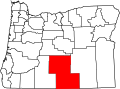
Christmas Valley is an unincorporated community in Lake County, Oregon, United States. The community was named after nearby Christmas Lake, usually dry, east of the present town and the site of the former Lake post office, which ran from 1906 until 1943. [2] [3] Real estate development around a planned community by M. Penn Phillips, called Christmas Valley, started after World War II. The Christmas Valley post office was established in 1963 as a rural station of Silver Lake. [2]

Contents

History

Christmas Lake, Christmas (Lake) Valley, and nearby Peter's Sink and Peter's Creek were named for pioneer stockman Peter Christman, who grazed his cattle there and had a house at Silver Lake, 18 miles (29 km) to the southwest. [4] These names were applied as early as September 29, 1877, when they were referred to by former Oregon Governor John Whiteaker in a letter to the editor of the Eugene City Guard . [4] Whiteaker himself had an interest in the fossil beds at nearby Fossil Lake, and ranching interests in the area as well. [4]

The name "Christmas" was an early corruption of the name Christman that became entrenched in the vernacular by 1900. The Christman family often spelled their name with a T although some family members would omit it and use the name Chrisman. Several examples of both spellings were found in print, some in government documents. Whiteaker himself referred to the lake as both "Christman Lake" and "Christmas Lake" in his letter to the editor, and unmistakably pinpointed the lake's location. [4] [5]

Penn Phillips era

In 1961, developer M. Penn Phillips laid out the townsite, including its fanciful holiday street names (such as Candy Lane, Mistletoe Road, Comet Street, Vixen Street, etc.), the Christmas Valley Airport, a water system, a golf course, a lodge, rodeo grounds, and an artificial lake originally named Christmas Valley Lake and now called Baert Lake. Phillips aggressively promoted the community in California to young, would-be farmers and retirees; often providing free bus tours and flights and marketing the potential of the land as green and readily farmed. The company quickly sold out the parcels, though despite Phillips' claims that the community would soon have more than 5,000 residents, few actually moved there. [4] In 1966, in an Oregon Tax Court decision about tax valuation of Christmas Lake property, Judge Edward Howell opined, "the land, at least in its present condition, is arid, dusty, windy, isolated, [and] subject to temperature extremes." [6] In the early 1970s, the Phillips company faced lawsuits about misrepresentation of the property and the Phillips era is usually considered a scam. [6]

Climate

This region experiences hot and dry summers, with yearly average temp of 71 °F (22 °C). Very hot summers and very cold nights and winters with snow, that skew average temps. Normal highs in summers are above 90 °F (32 °C) with nights dipping into the teens and winter record of low −40 °F (−40 °C). The average winter low is 19 °F (−7 °C) and high 37 °F (3 °C). According to the Köppen Climate Classification system, Christmas Valley has a warm-summer Mediterranean climate, abbreviated "Csb" on climate maps. [7]

Economy

Christmas Valley is largely an alfalfa farming community. The community has a number of commercial businesses including three grocery stores, two motels, four restaurants, and a gas station. Bakery and two car repairs, Credit Union, Medical clinic and a dental clinic building. An EV Charging Station at the hardware store. Airport and 9 hole golf course. [8]

A nine-hole golf course is maintained by Christmas Valley Park and Recreation District, as is the Christmas Valley Airport, Rodeo Grounds, Community Hall, Baert Lake and the community's twice monthly publication, Desert Whispers. [9]

Military

The Christmas Valley Air Force Station was an over-the-horizon radar station that was deactivated in 2002.

Tourism

Christmas Valley is near Fort Rock–Christmas Lake Valley basin, Fort Rock, Four Craters Lava Field, and Crack in the Ground.

The community is perhaps best known by off-road all-terrain vehicle enthusiasts worldwide who ride in the Christmas Valley Sand Dunes. [10] Near the Sand Dunes, Lost Forest, Thousands of Acres of Ponderosa Pines.

Education

Christmas Valley students are served by the North Lake School District.

Related Research Articles

<span class="mw-page-title-main">Dune</span> Hill of loose sand built by aeolian processes or the flow of water

A dune is a landform composed of wind- or water-driven sand. It typically takes the form of a mound, ridge, or hill. An area with dunes is called a dune system or a dune complex. A large dune complex is called a dune field, while broad, flat regions covered with wind-swept sand or dunes, with little or no vegetation, are called ergs or sand seas. Dunes occur in different shapes and sizes, but most kinds of dunes are longer on the stoss (upflow) side, where the sand is pushed up the dune, and have a shorter slip face in the lee side. The valley or trough between dunes is called a dune slack.

<span class="mw-page-title-main">Death Valley National Park</span> National park in California and Nevada, United States

Death Valley National Park is an American national park that straddles the California–Nevada border, east of the Sierra Nevada. The park boundaries include Death Valley, the northern section of Panamint Valley, the southern section of Eureka Valley and most of Saline Valley.

<span class="mw-page-title-main">Palm Desert, California</span> City in California, United States

Palm Desert is a city in Riverside County, California, United States, in the Coachella Valley, approximately 14 miles (23 km) east of Palm Springs, 121 miles (195 km) northeast of San Diego and 122 miles (196 km) east of Los Angeles. The population was 51,167 at the 2020 census. The city has been one of the state's fastest growing since 1980, when its population was 11,801.

<span class="mw-page-title-main">Stovepipe Wells, California</span> Unincorporated community in California, United States

Stovepipe Wells is a way-station in the northern part of Death Valley, in unincorporated Inyo County, California.

<span class="mw-page-title-main">Imperial Valley</span> Valley in California, United States

The Imperial Valley of Southern California lies in Imperial and Riverside counties, with an urban area centered on the city of El Centro. The Valley is bordered by the Colorado River to the east and, in part, the Salton Sea to the west. Farther west lies the San Diego and Imperial County border. To the north is the Coachella Valley region of Riverside County, which together with Imperial Valley form the Salton Trough, or the Cahuilla Basin, also the county line of Imperial and Riverside counties, and to the south the international boundary with Mexico.

<span class="mw-page-title-main">Great Sand Dunes National Park and Preserve</span> American national park in Colorado, United States

Great Sand Dunes National Park and Preserve is an American national park that conserves an area of large sand dunes up to 750 feet (230 m) tall on the eastern edge of the San Luis Valley, and an adjacent national preserve in the Sangre de Cristo Range, in south-central Colorado, United States. The park was originally designated Great Sand Dunes National Monument on March 17, 1932, by President Herbert Hoover. The original boundaries protected an area of 35,528 acres. A boundary change and redesignation as a national park and preserve was authorized on November 22, 2000, and then established on September 24, 2004. The park encompasses 107,342 acres while the preserve protects an additional 41,686 acres for a total of 149,028 acres. The recreational visitor total was 527,546 in 2019.

<span class="mw-page-title-main">Santa Clarita Valley</span> Valley in Los Angeles County, California, United States

The Santa Clarita Valley (SCV) is part of the upper watershed of the Santa Clara River in Southern California. The valley was part of the 48,612-acre (19,673 ha) Rancho San Francisco Mexican land grant. Located in Los Angeles County, its main population center is the city of Santa Clarita which includes the communities of Canyon Country, Newhall, Saugus, and Valencia. Adjacent unincorporated communities include Castaic, Stevenson Ranch, Val Verde, and the unincorporated parts of Valencia.

<span class="mw-page-title-main">Osoyoos</span> Town in British Columbia, Canada

Osoyoos is the southernmost town in the Okanagan Valley in British Columbia between Penticton and Omak. The town is 3.6 km (2.2 mi) north of the United States border with Washington state and is adjacent to the Osoyoos Indian reserve. The origin of the name Osoyoos was the word sw̓iw̓s meaning "narrowing of the waters" in the local Okanagan language (Syilx'tsn). The "O-" prefix is not indigenous in origin and was attached by settler-promoters wanting to harmonize the name with other place names beginning with O in the Okanagan region. There is one local newspaper, the Osoyoos Times.

<span class="mw-page-title-main">Kobuk Valley National Park</span> National park in Alaska, United States

Kobuk Valley National Park is an American national park in the Arctic region of northwestern Alaska, located about 25 miles (40 km) north of the Arctic Circle. The park was designated in 1980 by the Alaska National Interest Lands Conservation Act to preserve the 100 ft (30 m) high Great Kobuk Sand Dunes and the surrounding area which includes caribou migration routes. Park visitors must bring all their own gear for backcountry camping, hiking, backpacking, boating, and dog sledding. No designated trails or roads exist in the park, which at 1,750,716 acres, is slightly larger than the state of Delaware. Kobuk Valley is one of eight national parks in Alaska, the state with the second most national parks, surpassed only by California which has nine. The park is managed by the National Park Service.

<span class="mw-page-title-main">Eucla, Western Australia</span> Town in Western Australia

Eucla is the easternmost locality in Western Australia, located in the Goldfields-Esperance region of Western Australia along the Eyre Highway, approximately 11 kilometres (7 mi) west of the South Australian border. At the 2016 Australian census, Eucla had a population of 53.

<span class="mw-page-title-main">Algodones Dunes</span> Sand dune field in southeastern California

The Algodones Dunes is a large sand dune field, or erg, located in the southeastern portion of the U.S. state of California, near the border with Arizona and the Mexican state of Baja California. The field is approximately 45 miles (72 km) long by 6 miles (9.7 km) wide and extends along a northwest-southeast line that correlates to the prevailing northerly and westerly wind directions. The name "Algodones Dunes" refers to the entire geographic feature, while the administrative designation for that portion managed by the Bureau of Land Management is the Imperial Sand Dunes Recreation Area. In 1966, Imperial Sand Hills was designated as a National Natural Landmark by the National Park Service. The Algodones Dunes are split into many different sections. These sections include Glamis, Gordon's Well, Buttercup, Midway, and Patton's Valley. Although the Arabic-derived Spanish word algodones translates to "cotton plants", the origin of the toponym is unknown.

<span class="mw-page-title-main">Jessie M. Honeyman Memorial State Park</span> State park in Oregon, United States

Jessie M. Honeyman Memorial State Park, also known simply as Honeyman State Park, is in Lane County of the U.S. state of Oregon. It lies 3 miles (5 km) south of Florence along Highway 101, the coastal highway. The 27,212-acre (11,012 ha) Oregon Dunes National Recreation Area adjoins the park to the west. Many amenities are available, including over 200 campsites, all-terrain vehicle access, swimming, fishing and sandboarding.

<span class="mw-page-title-main">Silver Lake, Oregon</span> Unincorporated community in the state of Oregon, United States

Silver Lake is an unincorporated community and census-designated place in western Lake County, Oregon, United States, along Oregon Route 31. As of the 2010 census, it had a population of 149. Facilities include a gas station and a small store, a post office, and a public school, North Lake School, serving grades K-12.

<span class="mw-page-title-main">Ocotillo Wells, California</span> Unincorporated community in California, United States

Ocotillo Wells is an unincorporated community in San Diego County, California, United States. It is 3 miles (4.8 km) west of the Imperial County line on California State Route 78 at an elevation of 163 feet (50 m). The name became official in 1962 when it was adopted for federal use by the US Board on Geographic Names. A federally recognized variant name, Ocotillo, can cause confusion with the community of Ocotillo, California in Imperial County, 29 mi (47 km) to the south on Interstate 8.

<span class="mw-page-title-main">Geography of Oregon</span> Overview of the Geography of Oregon

Oregon is 295 miles (475 km) north to south at longest distance, and 395 miles (636 km) east to west. With an area of 98,381 square miles (254,810 km2), Oregon is slightly larger than the United Kingdom. It is the ninth largest state in the United States. Oregon's highest point is the summit of Mount Hood, at 11,249 feet (3,429 m), and its lowest point is the sea level of the Pacific Ocean along the Oregon Coast. Oregon's mean elevation is 3,300 feet (1,006 m). Crater Lake National Park, the state's only national park, is the site of the deepest lake in the United States at 1,943 feet (592 m). Oregon claims the D River as the shortest river in the world, though the state of Montana makes the same claim of its Roe River. Oregon is also home to Mill Ends Park, the smallest park in the world at 452 square inches (0.29 m2).

<span class="mw-page-title-main">Christmas Valley Sand Dunes</span> Natural sand dune complex in Lake County, Oregon, United States

The Christmas Valley Sand Dunes are a natural sand dune complex covering 11,000 acres (45 km2) of public lands east of Christmas Valley in Lake County, Oregon, United States, about 100 miles (160 km) southeast of Bend. The area is accessible via the Christmas Valley National Back Country Byway. The dunes are up to 60 feet (18 m) high. It is the largest inland shifting sand dune system in the Pacific Northwest. The dunes are composed mostly of ash and pumice from the eruption of Mount Mazama that formed Crater Lake 7,000 years ago. Approximately 8,900 acres (36 km2) of dunes are open to vehicles.

<span class="mw-page-title-main">Lost Forest Research Natural Area</span> Protected area in the United States

The Lost Forest Research Natural Area is a designated forest created by the Bureau of Land Management to protect an ancient stand of ponderosa pine in the remote high desert county of northern Lake County, in the south central area of the U.S. state of Oregon. Lost Forest is an isolated area of pine trees separated from the nearest contiguous forest land by forty miles of arid desert. There are no springs or surface water in Lost Forest, and much of the southwest portion of the natural area is covered by large shifting sand dunes that are slowly encroaching on the forest.

Knolls is an unincorporated community in north-central Tooele County, Utah, United States.

<span class="mw-page-title-main">Fossil Lake (Oregon)</span> Dry lakebed and fossil site in the U.S. state of Oregon

Fossil Lake is a dry lakebed in the remote high desert country of northern Lake County in the U.S. state of Oregon. During the Pleistocene epoch, Fossil Lake and the surrounding basin were covered by an ancient lake. Numerous animals used the lake's resources. Over time, the remains of many of these animals became fossilized in the lake sediments. As a result, Fossil Lake has been an important site for fossil collection and scientific study for well over a century. Over the years, paleontologists have found the fossil remains of numerous mammals as well as bird and fish species there. Some of these fossils are 2 million years old.

Baert Lake is a small artificial lake in the unincorporated community of Christmas Valley in the U.S. state of Oregon. Managed by the Christmas Valley Park and Recreation District, the lake is used for fishing, boating, and swimming from spring through autumn and for ice skating in winter if the ice is thick enough.

References

  1. Richard, Terry (December 24, 2006). "High Desert Holiday: Christmas Valley Gives a Welcome Respite from the Revelry". OregonLive.com.
  2. 1 2 McArthur, Lewis A.; McArthur, Lewis L. (2003) [1928]. Oregon Geographic Names (7th ed.). Portland, Oregon: Oregon Historical Society Press. pp. 201, 552. ISBN   978-0875952772.
  3. "Lake Post Office (historical)". Geographic Names Information System . United States Geological Survey, United States Department of the Interior. August 1, 1994. Retrieved February 26, 2011.
  4. 1 2 3 4 5 Tupper, Melany. High Desert Roses, Volume One, Significant Stories from Central Oregon.[ permanent dead link ]
  5. "A Trip to the Fossil Beds," Eugene City Guard, September 29, 1877.
  6. 1 2 "Christmas Valley Lodge, 1962". Oregon Historical Society. Retrieved February 15, 2008.
  7. But is actually more like Nevada in terms of weather. Climate Summary for Christmas Valley, Oregon
  8. P
  9. "Christmas Valley Park & Recreation District" . Retrieved November 6, 2019.
  10. Oregon Parks and Recreation Department: All-Terrain Vehicles, Christmas Valley Sand Dunes