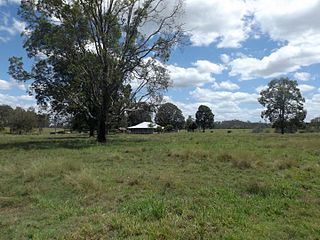
Richmond is a rural town and locality in the Shire of Richmond, Queensland, Australia. In the 2021 census, the locality of Richmond had a population of 578 people.
The Dawn is a rural residential locality in the Gympie Region, Queensland, Australia. In the 2021 census, The Dawn had a population of 604 people.

Cedar Vale is a rural locality in the City of Logan, Queensland, Australia. In the 2021 census, Cedar Vale had a population of 2,856 people.
Crystalbrook is a rural locality in the Shire of Mareeba, Queensland, Australia. In the 2021 census, Crystalbrook had "no people or a very low population".

Blackbull is a rural locality in the Shire of Croydon, Queensland, Australia. In the 2021 census, Blackbull had "no people or a very low population".
Dumpy Creek is a rural locality in the Shire of Banana, Queensland, Australia. In the 2021 census, Dumpy Creek had a population of 16 people.
Rookwood is a rural locality in the Shire of Mareeba, Queensland, Australia. In the 2021 census, Rookwood had a population of 9 people.
Fielding is a locality in the Shire of Carpentaria, Queensland, Australia. In the 2021 census, Fielding had "no people or a very low population".
Claraville is a locality in the Shire of Croydon, Queensland, Australia. In the 2021 census, Claraville had "no people or a very low population".
Savannah is a locality in the Shire of Carpentaria, Queensland, Australia. In the 2021 census, Savannah had "no people or a very low population".
Cambridge is a locality in the Shire of Richmond, Queensland, Australia. In the 2021 census, Cambridge had "no people or a very low population".
Burleigh is a rural locality in the Shire of Richmond, Queensland, Australia. In the 2021 census, Burleigh had a population of 52 people.
Saxby is a locality in the Shire of Richmond, Queensland, Australia. In the 2021 census, Saxby had a population of 35 people.
Lyndside is a rural locality in the Shire of Mareeba, Queensland, Australia. In the 2021 census, Lyndside had "no people or a very low population".
Highbury is a rural locality in the Shire of Mareeba, Queensland, Australia. In the 2021 census, Highbury had a population of 9 people.
Ravensworth is a rural locality in the Shire of Mareeba, Queensland, Australia. In the 2021 census, Ravensworth had "no people or a very low population".
Bulleringa is a rural locality in the Shire of Mareeba, Queensland, Australia. In the 2021 census, Bulleringa had "no people or a very low population".
Paddys Green is a rural locality in the Shire of Mareeba, Queensland, Australia. In the 2021 census, Paddys Green had a population of 405 people.

Springfield is a rural locality in the Shire of Mareeba, Queensland, Australia. In the 2021 census, Springfield had a population of 14 people.
Bellfield is a rural locality in the Shire of Croydon, Queensland, Australia. In the 2021 census, Bellfield had "no people or a very low population".


