Esmeralda, Queensland

Last updated

Esmeralda
Queensland
Australia Queensland location map.svg
Red pog.svg
Esmeralda
Coordinates 18°51′47″S142°39′43″E / 18.8630°S 142.6619°E / -18.8630; 142.6619 (Esmeralda (centre of locality))
Population0 (2021 census) [1]
 • Density0.00000/km2 (0.00000/sq mi)
Postcode(s) 4871
Area5,212.4 km2 (2,012.5 sq mi)
Time zone AEST (UTC+10:00)
Location
LGA(s) Shire of Croydon
State electorate(s) Traeger
Federal division(s) Kennedy
Suburbs around Esmeralda:
Croydon Croydon Gilbert River
Claraville Esmeralda Northhead
Savannah Victoria Vale Bellfield

Esmeralda is a rural locality in the Shire of Croydon, Queensland, Australia. [2] In the 2021 census, Esmeralda had "no people or a very low population". [1]

Contents

Geography

The Richmond–Croydon Road runs through from south to north. [3]

The land use is grazing on native vegetation. [4]

History

The locality takes its name from a local hill named on 30 September 1873 by explorer George Elphinstone Dalrymple. [2]

Demographics

In the 2016 census, Esmeralda had a population of 21 people. [5]

In the 2021 census, Esmeralda had "no people or a very low population". [1]

Education

There are no schools in Esmeralda nor nearby. The options are distance education and boarding school. [4]

Economy

There are a number of homesteads in the locality: [6]

Related Research Articles

<span class="mw-page-title-main">Hebel, Queensland</span> Town in Queensland, Australia

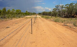
Hebel is a rural town and locality in the Shire of Balonne, Queensland, Australia. It is on the border of Queensland and New South Wales. In the 2016 census, Hebel had a population of 67 people.

<span class="mw-page-title-main">Cameron Corner, Queensland</span> Suburb of Bulloo Shire, Queensland, Australia

Cameron Corner is an outback locality in the Shire of Bulloo, Queensland, Australia. It is on the Queensland border with New South Wales to the south and South Australia to the west. In the 2021 census, Cameron Corner had a population of 19 people.

<span class="mw-page-title-main">Como, Queensland</span> Suburb of Sunshine Coast, Queensland, Australia

Como is a rural locality in the Shire of Noosa, Queensland, Australia. In the 2021 census, Como had a population of 54 people.

<span class="mw-page-title-main">Hungerford, Queensland</span> Town in Queensland, Australia

Hungerford is an outback town in the Shire of Bulloo and a locality in the Shire of Bulloo and Shire of Paroo, South West Queensland, Australia. The locality is on the Queensland border with New South Wales.

<span class="mw-page-title-main">Gregory, Queensland</span> Town in Queensland, Australia

Gregory is an outback town and locality in the Shire of Burke, Queensland, Australia. In the 2016 census, the locality of Gregory had a population of 72 people.

<span class="mw-page-title-main">Adavale</span> Town in Queensland, Australia

Adavale is a rural town and locality in the Shire of Quilpie, Queensland, Australia. In the 2021 census, the locality of Adavale had a population of 72 people.

Gilbert River is a rural locality in the Shire of Etheridge, Queensland, Australia. In the 2021 census, Gilbert River had a population of 32 people.

<span class="mw-page-title-main">Durham, Queensland</span> Suburb of Bulloo Shire, Queensland, Australia

Durham is a rural locality in the Shire of Bulloo, Queensland, Australia. It is on the Queensland border with South Australia. In the 2021 census, Durham had a population of 31 people.

<span class="mw-page-title-main">Josephville, Queensland</span> Town in Queensland, Australia

Josephville is a rural locality in the Scenic Rim Region, Queensland, Australia. In the 2016 census, Josephville had a population of 166 people.

Majors Creek is a locality split between the City of Townsville and the Shire of Burdekin, Queensland, Australia. In the 2021 census, Majors Creek had a population of 327 people.

<span class="mw-page-title-main">Waverley, Queensland</span> Suburb of Shire of Boulia, Queensland, Australia

Waverley is an outback locality in the Shire of Boulia, Queensland, Australia. In the 2021 census, Waverley had a population of 6 people.

<span class="mw-page-title-main">Ironpot, Queensland (South Burnett Region)</span> Town in Queensland, Australia

Ironpot is a rural locality in the South Burnett Region, Queensland, Australia. In the 2016 census Ironpot had a population of 45 people.

<span class="mw-page-title-main">Tanbar, Queensland</span> Suburb of Shire of Barcoo, Queensland, Australia

Tanbar is an outback locality in the Shire of Barcoo, Queensland, Australia. It is on the corner of Queensland's southern and western border with South Australia. In the 2016 census Tanbar had a population of 3 people.

Strathmore is a locality split between the Shire of Mareeba and the Shire of Etheridge, in Queensland, Australia. In the 2016 census Strathmore had a population of 12 people.

Desailly is a rural locality in the Shire of Mareeba, Queensland, Australia. In the 2021 census, Desailly had "no people or a very low population".

<span class="mw-page-title-main">Talaroo, Queensland</span> Suburb of Shire of Etheridge, Queensland, Australia

Talaroo is an outback locality in the Shire of Etheridge, Queensland, Australia. In the 2021 census, Talaroo had a population of 5 people.

Boatman is a locality in the Shire of Murweh, Queensland, Australia. In the 2021 census, Boatman had a population of 18 people.

Maramie is a locality in the Shire of Carpentaria, Queensland, Australia. In the 2021 census, Maramie had a population of 28 people.

Albinia is a rural locality in the Central Highlands Region, Queensland, Australia. In the 2021 census, Albinia had a population of 165 people.

Kinnoul is a rural locality in the Shire of Banana, Queensland, Australia. In the 2021 census, Kinnoul had a population of 80 people.

References

  1. 1 2 3 Australian Bureau of Statistics (28 June 2022). "Esmeralda (SAL)". 2021 Census QuickStats. Retrieved 28 February 2023. OOjs UI icon edit-ltr-progressive.svg
  2. 1 2 "Esmeralda – locality in Shire of Croydon (entry 43182)". Queensland Place Names. Queensland Government . Retrieved 2 November 2019.
  3. Esmeralda, Queensland (Map). OpenStreetMap. Retrieved 13 April 2022.
  4. 1 2 "Queensland Globe". State of Queensland . Retrieved 7 September 2023.
  5. Australian Bureau of Statistics (27 June 2017). "Esmeralda (SSC)". 2016 Census QuickStats. Retrieved 20 October 2018. OOjs UI icon edit-ltr-progressive.svg
  6. "Homesteads - Queensland". Queensland Open Data. Queensland Government. 18 November 2020. Archived from the original on 24 November 2020. Retrieved 24 November 2020.

Further reading